Brent Ward Profile picture
Dec 13, 2018 6 tweets 9 min read Read on X
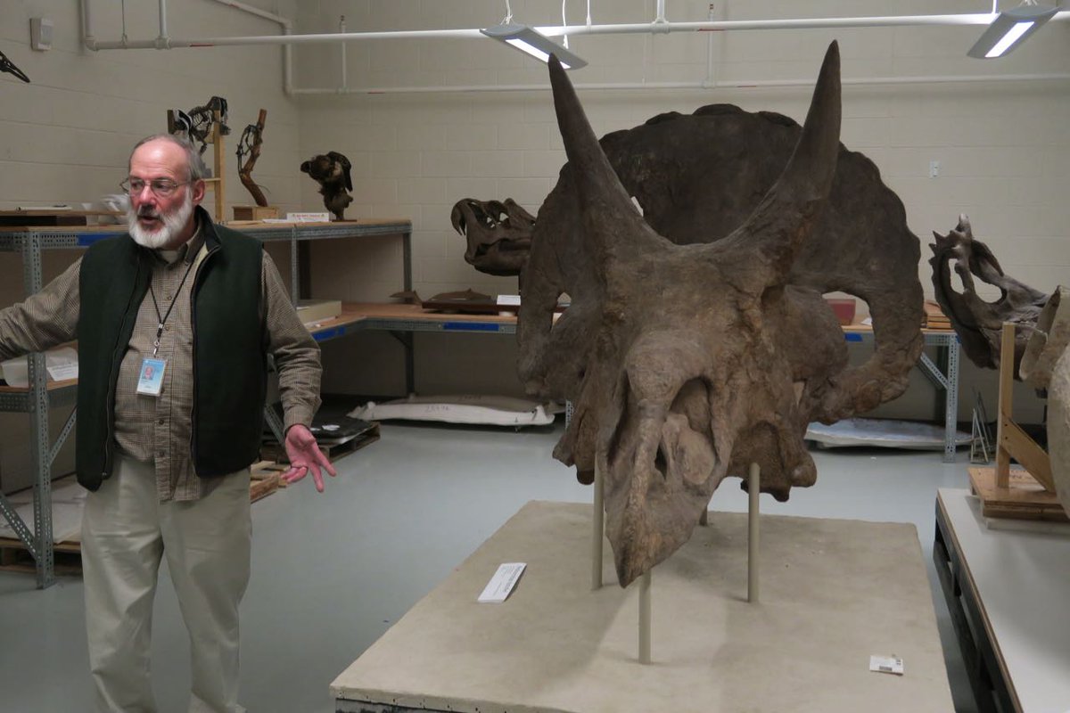
1/ Excellent behind the scenes tour of Smithsonian organized by Jen and Anita @BakingSodaVolc. Saw so many amazing things. Special thanks to our tour guides! #Smithsonian #AGU18 ImageImageImage
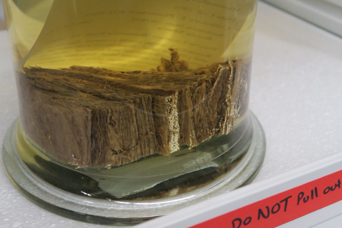
2/ Preserved flesh, skin and blood from a Siberian woolly mammoth found in 1901. Ya, totally cool! @BakingSodaVolc #Smithsonian #AGU18 ImageImageImageImage
3/ Plant fossils from 2.1 billion years to the Permian @BakingSodaVolc. #Smithsonian #AGU18 ImageImageImage
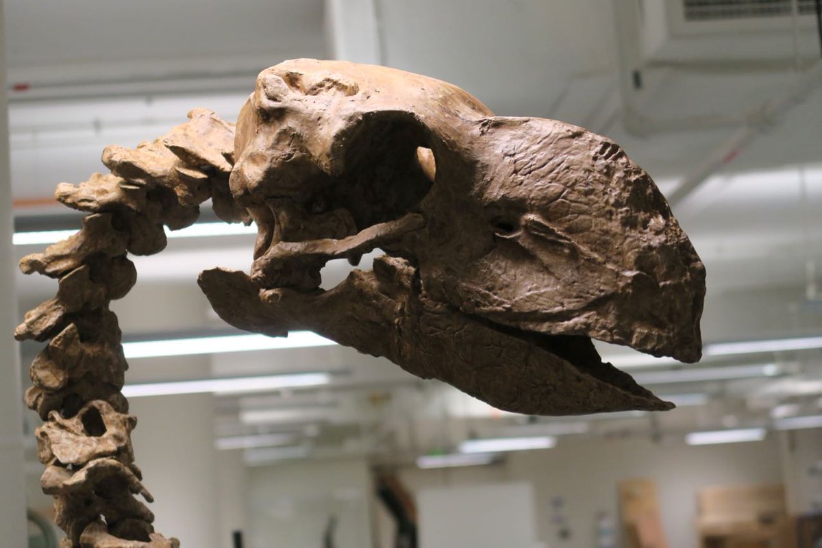
4/ So, so many amazing things. 10,000 year old Sloth dung from a cave, Gastornis skeleton taller than me!, Permafrost preserved Bison priscus.... @BakingSodaVolc #Smithsonian #AGU18 ImageImageImageImage
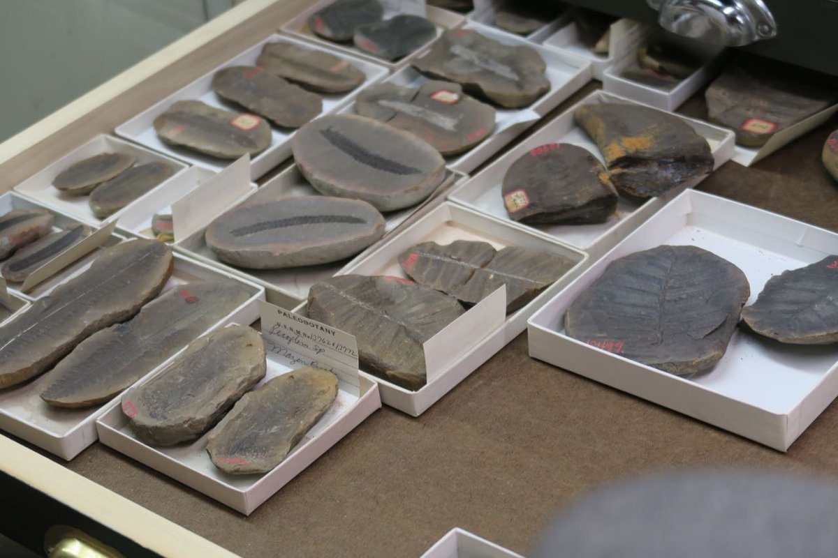
5/ Preserved dinosaur skin! Ground sloth collected by Thomas Jefferson, giant armadillo @BakingSodaVolc #Smithsonian #AGU18 ImageImageImage
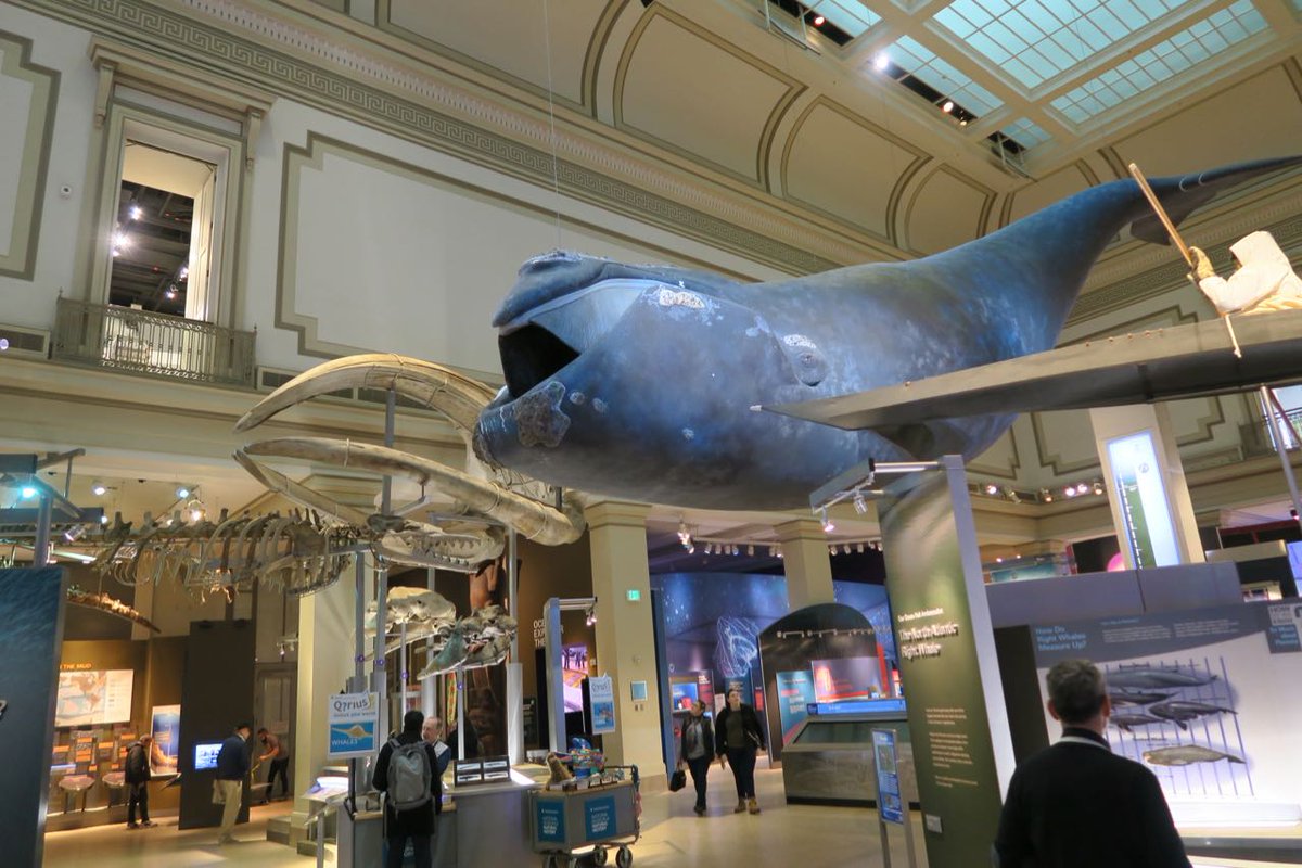
6/The regular exhibits are also excellent. Just did not have enough time to see it all, that is me transformed to a Neanderthal from one of the displays, plus Megalodon!. #Smithsonian #AGU18 ImageImageImageImage

• • •

Missing some Tweet in this thread? You can try to force a refresh
 

Keep Current with Brent Ward

Brent Ward Profile picture

Stay in touch and get notified when new unrolls are available from this author!

Read all threads

This Thread may be Removed Anytime!

PDF

Twitter may remove this content at anytime! Save it as PDF for later use!

Try unrolling a thread yourself!

how to unroll video
  1. Follow @ThreadReaderApp to mention us!

  2. From a Twitter thread mention us with a keyword "unroll"
@threadreaderapp unroll

Practice here first or read more on our help page!

More from @GeoBrentatlarge

Sep 15, 2020
On August 29 examined some active layer detachment slides Near Arch and Quill creeks, SW Yukon. Around 25-30 slides occured on August 17, the same time the Alaska Highway was blocked by debris flows. A thread of these. This is the slides near where we landed. 1/10 Image
Landed on the deposition zone of one of the landslides and flew the drone. Helicopter indicated for scale. 2/10 ImageImageImage
This is part of Crey Ackerson’s MSc thesis supported by Kristy Kennedy from the Yukon Geological Survey. 3/10 Image
Read 10 tweets
Sep 4, 2020
Finally some pictures of the Koidern Landslide. Start with some aerial pictures and then some more details. Some really interesting mollards, and some have remobilized! It is a long thread as it was a really cool landslide! 1/10
Looks like several phases. Initial failure crossed the small valley and then turned the corner. Then remobilization with a more fluid flow down the valley, blocking the larger stream. Then a smaller failure from the headscarp, where we first landed the helicopter. 2/10
Margin of the slide with lots of mollards. Nice streaking of the bedrock. 3/10
Read 10 tweets
Aug 12, 2020
Helicopter work, Covid style!

Great day in Crey Ackerson's field area with Kristy Kennedy Yukon Geological Survey. 1/ ImageImage
Love Helicopters! 2/
Spent the day in and around the Duke River area of Kluane National Park /3 Image
Read 7 tweets
May 16, 2020
It is my birthday eve and evil daughter #2 cooked me an awesome dinner and bought me a beautiful bottle of scotch! Maybe she is not so evil after all? ImageImageImage
Getting excited about the cake! The icing will be amazing!
The cake! Icing is a little thin but it tastes awesome! ImageImage
Read 4 tweets
Feb 19, 2020
Spent a beautiful Friday at Point Grey (aka Wreck Beach) looking at the stratigraphy. He we have two advance sub-units below the till. The lower is interstratified sand and silt with peats, with ages from 26-24 ka, the upper, cross stratified sand. 1/ Image
These advance sediments are called Quadra Sands and some diatoms in the lower sub-unit sediments indicate marine incursion. The upper sands show tidal influence. With eustatic sea level at this time, indicates >100 m of isostatic depression! 2/ Image
The accumulation of ~70 m of Quadra sands indicates significant accommodation space. The two sub-units are exposed all along the escarpment. 3/ Image
Read 8 tweets
Feb 11, 2020
Friday’s Seymour valley fieldtrip examined the stratigraphy of the thick valley fill. The base is 42-29 ka MIS 3 gravel, sand and peat, indicating warmest climate at the base and progressively cooler to the top. 1/9 Image
The MIS 2 Fraser Glaciation, has two advance stades. These are advance glaciolacustrine sediments of the older Coquitlam Stade, a mix of laminated to finely bedded silt and sand and diamicton. 2/9 Image
Indicates ice blocked the mouth of the Seymour valley, forming this lake. There is wood in these advance sediments, dating to around 21 ka. Implies there is a spruce-fir forest in the area as ice advanced. 3/9 ImageImage
Read 10 tweets

Did Thread Reader help you today?

Support us! We are indie developers!


This site is made by just two indie developers on a laptop doing marketing, support and development! Read more about the story.

Become a Premium Member ($3/month or $30/year) and get exclusive features!

Become Premium

Don't want to be a Premium member but still want to support us?

Make a small donation by buying us coffee ($5) or help with server cost ($10)

Donate via Paypal

Or Donate anonymously using crypto!

Ethereum

0xfe58350B80634f60Fa6Dc149a72b4DFbc17D341E copy

Bitcoin

3ATGMxNzCUFzxpMCHL5sWSt4DVtS8UqXpi copy

Thank you for your support!

Follow Us!

:(