
FOUL BURN AGITATION!
STATEMENT
EXPLAINING THE
NATURE AND HISTORY OF THE AGRICULTURAL IRRIGATION NEAR EDINBURGH
CONTAINING
A REFUTATION OF THE UNFOUNDED AND CALUMNIOUS MISREPRESENTATIONS ON THAT SUBJECT
IN
A PAMPHLET PUBLISHED IN THE NAME OF A COMMITTEE OF THE COMMISSIONERS...
STATEMENT
EXPLAINING THE
NATURE AND HISTORY OF THE AGRICULTURAL IRRIGATION NEAR EDINBURGH
CONTAINING
A REFUTATION OF THE UNFOUNDED AND CALUMNIOUS MISREPRESENTATIONS ON THAT SUBJECT
IN
A PAMPHLET PUBLISHED IN THE NAME OF A COMMITTEE OF THE COMMISSIONERS...

OF POLICE, IN WHICH THE
ANCIENT AND BEAUTIFUL CAPITAL OF
SCOTLAND IS FALSELY DESCRIBED
AS A RESIDENCE UNSAFE TO
THE HEALTH OF ITS
INHABITANTS
ANCIENT AND BEAUTIFUL CAPITAL OF
SCOTLAND IS FALSELY DESCRIBED
AS A RESIDENCE UNSAFE TO
THE HEALTH OF ITS
INHABITANTS
Which is quite the title, even by the standards of a Victorian pamphlet. I say pamphlet, the thing is actually 166 pages long and I've spent some time today reading it (skimming much of it) so that you don't have to.
It's Victorian local politics at its best and worst, and much of it is pure agitation, but it happens to contain a complete and detailed description of the East Foul Burn and the "Irrigated Meadow" systems, their history and operation of Craigentinny and Restalrig
Anyway, what is this East Foul Burn? Well it's the principal (in fact the only) watercourse that in olden times drained the Old Town, the Nor'loch and the south of the city into the sea, rainfall, sewage and all. This 1750 @natlibscotmaps James Dorrett map shows it roughly

@natlibscotmaps If you examine an old map of the Old Town, it's obvious that gravity will carry anything liquid downwards, if it's headed north it ends up in the Nor'loch, an artificially created body of water to protect the city, which itself drained to the east (Gordon of Rothiemay map, 1647)

@natlibscotmaps After irrigating the pleasant-looking Physic Garden of the Trinity College Kirk and hospital, it runs off down the South Back of Canongate, joined by any runoff from the Calton Hill and the streets and closes of the Canongate itself.
@natlibscotmaps On its way east and downhill, Gordon shows the stream (in reality an open sewer) passing a number of round structures. These are either freshwater cisterns or settling tanks for the sewage to fertilise all those gardens of the Canongate.


@natlibscotmaps There are springs in the area (which resulted in it being a hive of brewing activity for hundreds of years), so perhaps the former explanation is closer to the mark. Anyhoo, Edgar's map of 1765 shows that even 100 years later, there's still an open sewer down the South Back

@natlibscotmaps Ah, Stuart Harris refers to wells along the "Tummel Burn" (an alternative name for the East Foul Burn", so lets call them wells. It's worth noting too that the burn/sewer here forms the boundary between South Leith and Holyrood Abbey parishes
@natlibscotmaps Where were we? Ah yes, the Wateryett (Water Gate), which an area at the foot of the Canongate where there was a gate, not a defensive gate, but a customs barrier. By 1765, Edgar's map shows the burn/sewer must be culverted, but we can infer its route

@natlibscotmaps We're now off the maps until the 1804 Town Plan by John Ainslie, where we can pick up the burn again, re-emerging around Croftangry (Croft-an-Righ). One hope's Robert Younger's brewery (St. Ann's) wasn't extracting the water to brew with.

@natlibscotmaps Again the burn here is a property boundary. Comley Gardens (Green) and Clockmill (Lane) are ancient place names still recalled by modern street names. The burn here is draining everything running out the Hunter's Bog and off Arthur's Seat

@natlibscotmaps Comely Gardens were a "Tivoli Garden", a sort of Georgian amusement park, where for a fee one could stroll the gardens and admire the roses, could take tea or coffee or fruits and entertainment such as dances and musicians may be laid on.
@natlibscotmaps Comely Gardens is also to be remembered as the starting point of the "Great Edinburgh Fire Balloon", the first manned flight in the British Isles, when in August 1784, James Tytler rode a Montgolfier balloon all the way to a crash-landing in Restalrig

@natlibscotmaps (side note, James Tytler was a remarkable, if rather unsuccessful, man, who edited much of the 2nd edition of the Encyclopaedia Britannica amongst other things. He's not that well remembered but there are a couple of modern streets in this area named after him)


@natlibscotmaps Back to the matter in hand, we're at Clockmill, an ancient house named for (unsurprisingly) a mill driven by the burn. The name came from Clocksorrow, "clack" being Scots for a mill (an onomatopoeia) and Sorrow some form of hollow in various old tongues

@natlibscotmaps It's recorded as far back as 1569 as the "Clokiswrne Mylne", mentioned as the boundary of the "Girth", the Holyrood Abbey sanctuary. So now you know what those brass "S" embedded outside Holyrood Palace refer to. Not sure if the modern Polis would respect them though.

@natlibscotmaps Another theory is that Clockmill is the old Norse for "park like a bunch of arseholes"

@natlibscotmaps Until London Road was driven through c. 1815-20, the road here (now Spring Gardens / Royal Park Terrace), was the main road east out of Edinburgh if you were headed south. This road bridged the Foul Burn at the Clockmill Bridge, where the gate into the park now is.

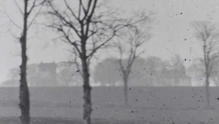
@natlibscotmaps Even though it was long culverted, you can see in this 1949 aerial photo that the road here rises and there's a noticable depression on either side, the footpath lying atop the culverted burn

@natlibscotmaps The old riverbank and the culvert below is also the reason why, until the last 20 years made it economically worthwhile, nobody ever bothered to built on that patch of open ground there.
@natlibscotmaps at Clockmill, another set of sewers drained into the East Foul Burn, Kincaid's Plan of 1784 records the "Common Sewer from the Pleasance" and "Common Sewer from Cowgate"


@natlibscotmaps These fed into this intriguing patch of land to the south of Holyroodhouse; "Common Sewer keept fragnate for Manure". I'm guessing "fragnate" is from "fragrare" in Latin, emitting a foul smell or reek. This would have been a settling pond for the "soil" (poop) of the city

@natlibscotmaps There was good money to be made in "soil" or "dung", before the advent of industrial fertilisers and before the Kelp Boom, it was one of the few sources of good fertiliser for fields and much in demand all you had to do was collect it!
@natlibscotmaps So by the time it reached the Clockmill, the burn was carrying the entire waste of the Old Town (apart from a small portion that drained west towards Dalry), off the Calton Hill, St Leonards Crags and Arthur's Seat. That's the sewage of about 60-80,000 people and their animals
@natlibscotmaps the Foul Burn Agitation! describes it as "a rapid and copious stream... to which [is] added the impure waters that proceed from the houses, streets and lanes of the city"
@natlibscotmaps From there it should have been a relatively straightforward journey down the broad, shallow natural valley in which Restalrig sits to the sea at Fillyside (roughly where Matalan now is), as the Roy Map of the early 1750s shows.

@natlibscotmaps Except it wasn't - that broad valley had been turned industriously into a series of "Irrigated Meadows", "irrigated by the waters from the City" at Restalrig, Craigentinny and Fillyside.


@natlibscotmaps There were further "irrigated meadows" at the foot of Salisbury Crags, about 14 acrease, the property of the Earl of Haddington and near Coltbridge to the west (fed by a much smaller Foul Burn that drained into the Water of Leith), some 40-50 acres owned by Russell of Roseburn

@natlibscotmaps The Restalrig meadows were the property of James Montgomery Bt. and extended to around 30 acres. The Craigentinny and Fillyside meadows were owned by William Miller (grandfather of "Christie" Miller) and were the largest at c. 120 acres.
@natlibscotmaps While the soil of the city had been collected since time immemorial, it's not clear when this industrial-scale meadow system evolved. The Foul Burn Agitation! recounts testimony of elderly farm workers of Restalrig that they had been in place since at least 1750.
@natlibscotmaps However a document from 1561 when the lands of Restalrig Kirk were confiscated during the Reformation records "of certain prebendaries yardis, in Restalrig and Chalmeris pertening to the saidis prebendaris, callit their Mansis and pece of suard Meadow"
@natlibscotmaps The Foul Burn Agitation! states the "practice existed from time immemorial of flooding the Meadow grounds by means of the Foul Burn"
@natlibscotmaps So we can say with some certainty that it was an ancient practice, and indeed the courts agreed with this when Alexander Duncan Esq. WS of Restalrig House tried to sue Miller and Montgomery on account of the smell.

@natlibscotmaps Indeed it kind of backfired on Duncan because in 1833, the Burgh Police Act protected the proprietors (Miller & Montgomery) from any act "to divert or alter any stream or watercourse, or diminish the ancient and accustomed quantity of rain or other water or soil flowing therein"
@natlibscotmaps (side note, this was included in a Police Act because at that time in Scotland the Police had the powers and responsibilities for cleansing the burgh, distributing water and preventing disease)
@natlibscotmaps The maps show the irrigated meadows as marshes, and indeed their detractors described them as such, but that was probably a cartographic shorthand. For starters, you can't grow crops in a marsh or stagnant water. So what were the meadows and how did they work?
@natlibscotmaps Basically, the Foul Burn was intersected by "principal feeders", ditches cut along the gradient. Water could be admitted to the feeders by means of a sluice (or simple damming). These feeders in turn fed side-ditches into individual plots.
@natlibscotmaps These plots would be flooded from April to November, the grass growing season. For 2 or 3 days, the plot would be flooded, then it was given 3-5 weeks for the grass to grow, which would then be cropped. After cropping, the process started again.
@natlibscotmaps The process of flooding and cropping was staggered so that there were always fields ready to crop, and there was always a good supply of water and soil with which to flood.
@natlibscotmaps Capital Collections has a number of images to help here. This watercolour by James Steuart from 1885 shows a feeder and sluice, a ditch, grass meadows and a sign (probably warning people to keep off the grass!) capitalcollections.org.uk/view-item?WINI…

@natlibscotmaps A David Sclater photo of 1895 is probably in winter due to the lack of leaves, but again shows ditches, an area of flooding, a dark smudge that may be a sluice.

@natlibscotmaps Zooming in on that photo (capitalcollections.org.uk/view-item?WINI…) we can see the Craigentinny Marbles, tomb of William Henry Miller and Wheatfield House.
@natlibscotmaps And this R. S. Reid Watercolour of 1860 (capitalcollections.org.uk/view-item?WINI…) show's the Miller pile at Craigentinny Castle, looking west back to the city. The pleasant enough looking Foul Burn flows through the foreground, labourers toil in the fields. The burn is obviously maintained

@natlibscotmaps The other aspect of the system was the settling ponds. These are clearly shown on Kirkwood's 1817 town plan. These were simply to allow the solids to be settled out of the burn, the liquids could then be drained off, the muck dug out and used (sold!) as fertiliser


@natlibscotmaps The pits are recorded as far back as 1738 when Mr Baird of Clockmill was irrigating his fields and "collecting dung", but by the late 18th century they were beginning to be infilled and have vanished by the 1820s.
@natlibscotmaps This was because there was 2 problems; firstly, there was too much sandy sediment washed off the city streets into the Foul Burn, and gardeners and farmer were loathe to pour sand onto their fields and borders.
@natlibscotmaps More importantly however, the sediment was found to be full of grass seeds. Without putrefaction (fermentation), these seeds could not be killed, and when the soil was spread it was an instant recipe for spreading invasive weeds.
@natlibscotmaps So the system settled around the production of grass for animal forage. And a very productive and profitable system it was. 400 labourers were employed by the system seasonally, and some 3,300 cattle in Edinburgh and 600 in Leith depended on it.
@natlibscotmaps These were largely pen-fed dairy cattle. At this time, dairy farming took place in and around the city as fresh milk could not be preserved. Dairies were small concerns, headed by a "cow feeder", with 20-40 milch cows each.
@natlibscotmaps The Meadows were estimated to turn a profit of £5,000 per annum, with Mr Miller estimating he made £30,000 over 2 years. Rents were 20-30/s per acre, or up to double for the better pasture or during times of food scarcity
@natlibscotmaps Preparing a meadow cost £20-25 per acre and was a sound investment. Mr Miller in 1821 spent £1,000 turning over 40 acres of "sandy wasteland" to meadow use.
@natlibscotmaps And each acre could provide up to 6 full crops per year. So all-in-all, this was a very productive and profitable concern. So much so that in 1834 the Police Commissioners tried to extend the burgh boundary to include the Irrigated Meadows and to give themselves rights over them
@natlibscotmaps They spent 4,000 of the city's pounds on the scheme, which the Foul Burn Agitation! describes as "Dung Speculation". They were unsuccessful though as Mr Miller and Mr Montgomery and by this time their one-time adversary Mr Duncan fought this off
@natlibscotmaps William Henry Miller of Craigentinny (a former MP by this point) was quick to defend his profitable scheme. In 1843, the North British Railway proposed running their line across his meadows. Miller had them shift it about 100 feet west so that it skirted his lands

@natlibscotmaps He then exchanged parcels of his land on the south of the line with his neighbours who had parcels trapped on the north, maintaining a large single field system. He also made it hard enough for the NBR that they never built their proposed shorter branch to Leith across his land

@natlibscotmaps The excellent thing about this map (maps.nls.uk/view/74400092) is that it shows the burn, the feeders, the side-ditches and also the directions of flow!

@natlibscotmaps But the whole system had a number of problems facing it. Firstly, the woeful sanitation of the Old Town needed resolving, and waste needed to be piped under the ground, not just diverted into an open river.
@natlibscotmaps And secondly, in 1817 the Edinburgh & Leith Gas Light Co. began building a gasworks at New Street (picture from Canmore, canmore.org.uk/collection/108…), the socking great chimney of which can be seen in this 1868 engraving "Edinburgh from the Calton Hill"

@natlibscotmaps You can guess where the gas works were dumping all the waste chemicals from the process of making town gas (most of which were not being recovered at this time for use as industrial feedstocks). flickr.com/photos/angelji…
@natlibscotmaps The gas works "give forth an abundant stream, the odour of which is no doubt extremely offensive, being the most nauseous of all compounds". "This flows into a principal feeder of the old foul burn at the South Back of the Canongate". The gasworks were poisoning the burn.
@natlibscotmaps This was not the first time that the "Foul Burns" had been polluted by industry. In 1791, Russell of Roseburn attempted to use the courts to stop the Haig's distillery at Lochrin from polluting his irrigated meadows at Coltbridge.
@natlibscotmaps The proprietors of the Irrigated Meadows managed to get fines applied to the gas works, £200 per instance of pollution and £20 per day. How successful this was is unclear, but the Meadows persisted. The 1888 OS 6 inch Survey shows they still occupy their main extent

@natlibscotmaps It wasn't until the 1930s that the whole area was rapidly built on, by suburban bungalows and semis around Marionville and the eastern part of Craigentinny, and by a council scheme to the western part of Craigentinny and up the hill towards the Lochend scheme.
@natlibscotmaps Much of the land was never built on and was set aside as Craigentinny Golf Couse. A railway yard, appropriately known as "Meadows Yard" was also built on the shore at Fillyside
@natlibscotmaps The Foul burn was simply built over and run in a culvert underneath all the new development, you can see its outlet in the sea wall here on the 1940s OS Town Plan, with a sewage pipe running to its right.

@natlibscotmaps By this time, you wouldn't have known that the Foul Burn had ever been there. But there are hints of it on the maps. This culvert under the East Coast Mainline for instance had been constructed to carry the burn under it. There are still hints of it in the undergrowth.


@natlibscotmaps The area name Meadowbank? Lifted directly off a house known as Meadow Bank, built on the bank of the Meadows. And Sunnyside Bank? The south-facing (therefore sunnier) bank.


@natlibscotmaps And what of that wedge of houses between Lower London Road and the Railway at Sunnybank? Cleared and demolished due to subsidence (follow the line of the window cills in the photo) flickr.com/photos/sixties…
@natlibscotmaps The 1929 tenement at No. 2 & 3 Sunnybank? No. 3 was pulled down in the 1960s due to subsidence, it's directly over the old course of the burn.


@natlibscotmaps The Meadowbank Hutments, sort of pre-fab houses-cum-allotments for ex-soldiers built after WW1 were pulled down during WW2 (about 1941) due to drainage issues. The rest of the area was never really developed and was left as sports fields.


@natlibscotmaps I don't know much else about the hutments, although they do sneak in to the corner of this 1929 aerial photo (top right)

@natlibscotmaps And if you're ever in Restalrig, near the old Kirk, somewhere underneath Marionville Fire Station and the roundabout infront of it runs the old Foul Burn, you can see the culvert under the road in this old photo on @Scranlife (scran.ac.uk/000-299-990-19…)

@natlibscotmaps @Scranlife Footnote. 🦶🗒️
Just came across this little reference in an Old Edinburgh Club book, which refers to a title deed of 1635 that describes the Foul Burn being in a culvert called "The Strand" at the Wateryett. This is backed up by Stuart Harris' book and Kincaid's map
Just came across this little reference in an Old Edinburgh Club book, which refers to a title deed of 1635 that describes the Foul Burn being in a culvert called "The Strand" at the Wateryett. This is backed up by Stuart Harris' book and Kincaid's map


@natlibscotmaps @Scranlife Harris also suggests that the "S" markers in the pavement mark the course of the stream, but I don't buy that. Gordon's map of 1647 shows the course of the drain around the north, not through the middle. The markers also form a line across the path of the river, not along it.

• • •
Missing some Tweet in this thread? You can try to
force a refresh


