Benjamin Strick Profile picture
Dec 20, 2019 13 tweets 12 min read Read on X
Italian arms have been sold to Russia, transported to Syria, & used by sanctioned Syrian Army militia breaching European trade & arms safeguards.

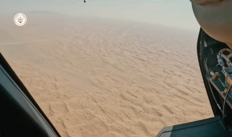
After 12 months of digging w/ @leone_hadavi, @Bashar24836440, we show how they got to places like this 👇👇
bellingcat.com/news/2019/12/2…
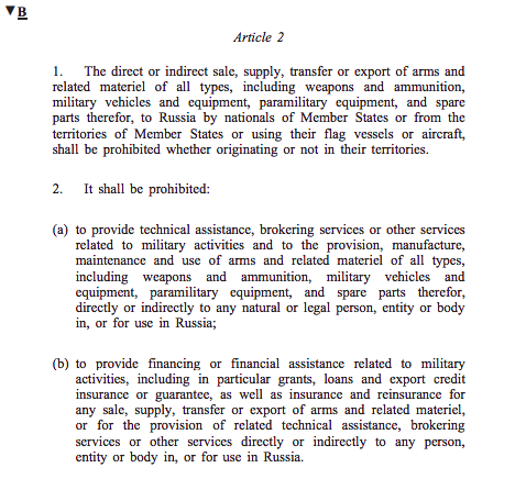
First, what about the rules on arms control in Europe? Italy must observe the Common Position (eur-lex.europa.eu/legal-content/…) & consider human rights when granting an export license. Plus there’s an arms embargo on dealing with Russia (europa.eu/newsroom/highl…) ImageImageImage
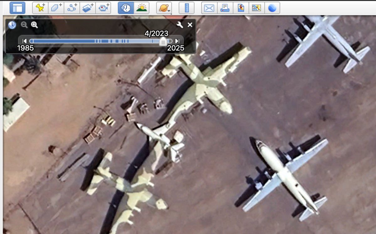
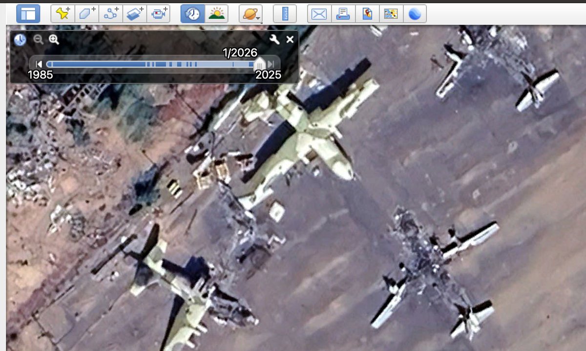
We cross-referenced Italian Govt records on export licences to reveal items granted for sale, transaction value & end-user country. For example we can see this 2011 lic. for sale of 10 Iveco M65E19WMs paid for & exported to Russia. Big H/T to @FrancescaCost2 for her skills here. ImageImageImage
Why have those safeguards? Well it's to stop things like this happening - people like Al-Hassan (سهيل الحسن), commander of Syrian Army's Tiger Forces, using EU arms. He’s also subject to EU-restrictive measures for "violent oppression against the population in Syria" ImageImage
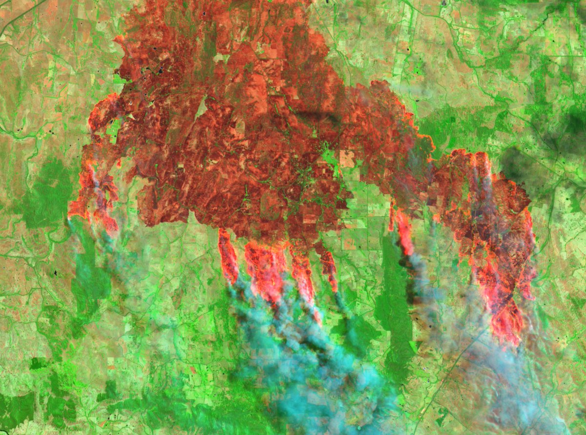
Through #geolocation, we can tell that the above footage (from here ) of Al-Hassan & the Iveco was filmed during the attack on Aleppo Power Station (محطة حلب الحرارية). The power station is located here: goo.gl/maps/5PqEPsqRr…. Image
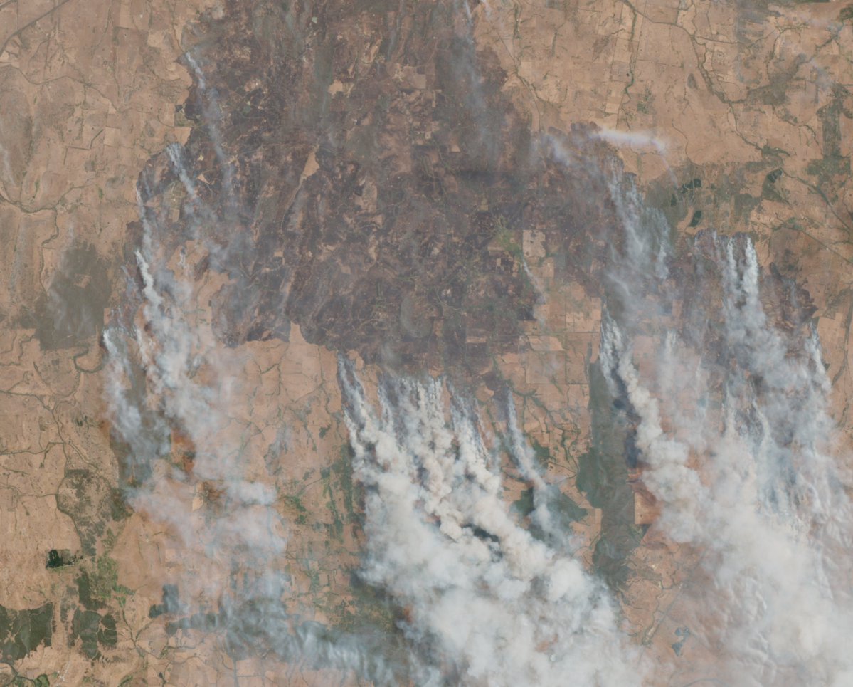
Through #chronolocation, we can tell when this video was filmed. Notice smoke coming from power station? It coincides with Sentinel-2 imagery from Feb 16, 2016 on @sentinel_hub (apps.sentinel-hub.com/sentinel-playg…). Sentinel imagery layered in @googleearth with @Pierre_Markuse fire script. Image
Images from after the attack on the Aleppo Thermal Power Plant also locate an Iveco LMV at the power plant. Image below was taken here: goo.gl/maps/eXMwTAccn…, as Syrian Army forces moved in. Original imagery of attack posted by @LinaArabii ✌️ Image
We’ve also geolocated the Iveco LMV used by Desert Hawks in Al-Rassafah (below) & by Desert Hawks/Hezbollah in Palmyra Offensive at Western Bayarat. You can read up on the full documentation of the geolocation and chronolocation in our @bellingcat post. bellingcat.com/news/2019/12/2… ImageImage
So we’ve located the LMV in Syria & we’ve found some of the people that use it. But how did it get to Syria? It was transported by air, and by sea. For instance: below we can see Iveco LMVs en route to Syria by sea (H/T to the legendary @YorukIsik ✌️) 👇
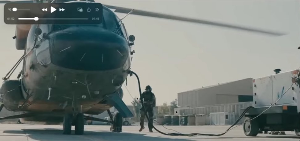
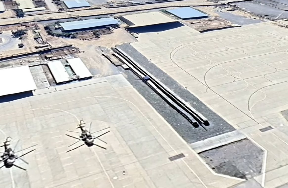
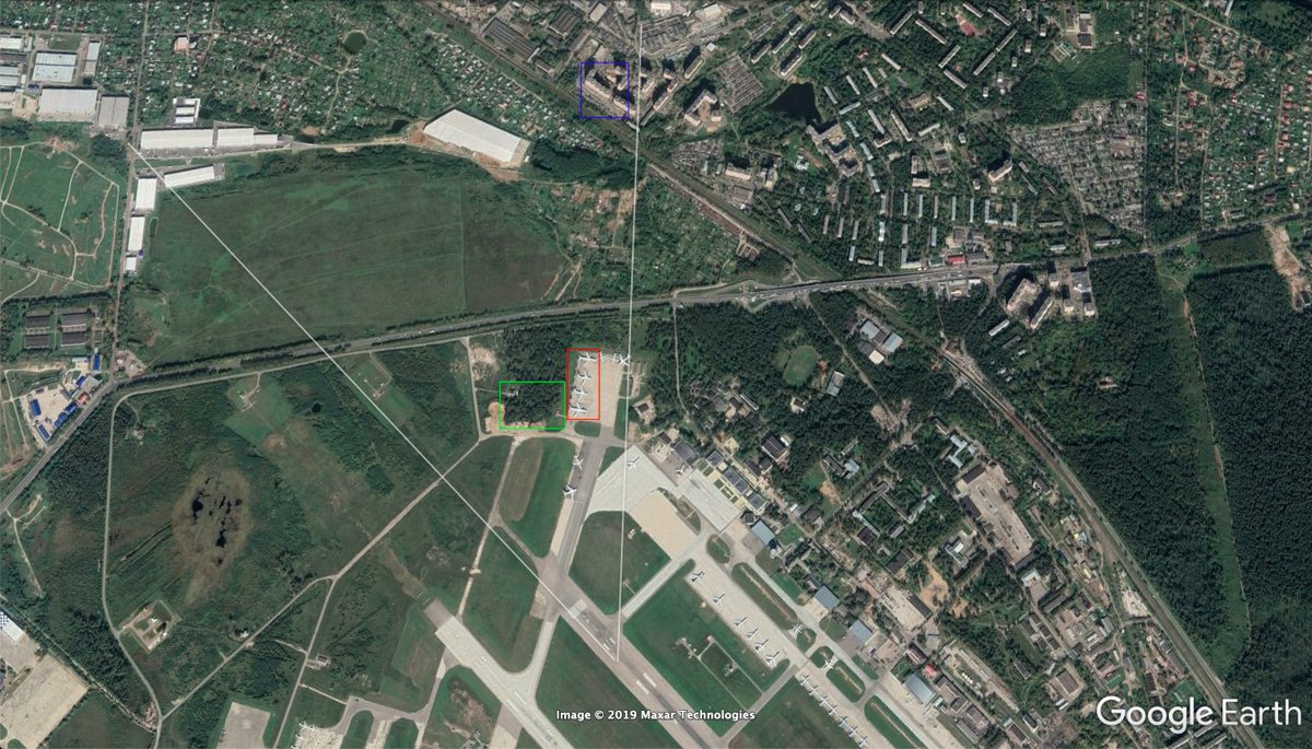
In this footage () we can see the Ivecos loading on a plane at Chkalovsiy Airport in Schyolkovo (Щёлково) and landing in Syria’s Hmeimim Air Base (قاعدة حميميم الجوية), here: goo.gl/maps/HXptj2QFn…. ImageImageImageImage
The continued sale of the Iveco LMV to Russia indicates a breach of safeguards. But Iveco is just one of many arms manufacturers identified in the @bellingcat & @LightouseReports #EUArms project that has breached these safeguards: bellingcat.com/news/uk-and-eu…
Through this methodology of arms tracing, over countless projects in Europe we have geo/chronolocated & dug paper trail of arms transfers that fall outside commitments of these rules. Through this work, we’ve been able to contribute to claims like this
A big part (& underplayed) is the work of investigators such as @leone_hadavi, @Bashar24836440 & @FrancescaCost2 who worked on this project from their laptops at home. These great investigators are up for hire - this work is a testament to their skills. H/T to you all ✊

• • •

Missing some Tweet in this thread? You can try to force a refresh
 

Keep Current with Benjamin Strick

Benjamin Strick Profile picture

Stay in touch and get notified when new unrolls are available from this author!

Read all threads

This Thread may be Removed Anytime!

PDF

Twitter may remove this content at anytime! Save it as PDF for later use!

Try unrolling a thread yourself!

how to unroll video
  1. Follow @ThreadReaderApp to mention us!

  2. From a Twitter thread mention us with a keyword "unroll"
@threadreaderapp unroll

Practice here first or read more on our help page!

More from @BenDoBrown

Jun 13
A new coordinated network of fake accounts pretending to be ‘Real Sikhs’ is targeting activists, stoking tensions and promoting Indian Govt narratives.

Who are they, what do they post, and how do they spread their campaign? Report:
Let's take a look 👇🧵 info-res.org/post/return-of…
Image
Before we start, it's important to note that this is not the first time we have exposed a network like this at @Cen4infoRes. In Nov 2021 we identified a similar network. But in the months after the accounts were removed, new accounts popped up.
In this new network, what we do know is the network of fake accounts posts content to undermine Sikh activists, stoke cultural tensions and promote Indian government narratives. But who are the accounts, and how are they posting so that we can catch future attempts?
Image
Image
Read 15 tweets
May 26
In April, CNN journalists were led to the 'home' of Haitian gang lord Vitel’homme Innocent and interviewed him. He is on @FBIMostWanted's Top 10, with a bounty of up to $2 million.

I mapped their drive and found his home here: 18.5278, -72.2314. Here's how👇🧵
First, I did this because knowing the location of where a gang lord responsible for horrible violence is helpful, even if he might not be there after CNN visited. Vitel is the leader of Kraze Barye and is on the @FBIMostWanted list for taking hostages, and sanctioned by UN.
Image
Image
This is the footage I used to geolocate Vitel'Homme Innocent's house, where the interview was conducted. I'll go through some of the scenes to provide proofs of how I made the geographical matches, using Google Earth.

Source:
Read 10 tweets
May 20
Google Earth has updated the whole of Sudan's El Geneina to reveal the disturbing scale of damage which happened during a reported ethnic cleansing campaign over the past year by the RSF and allied militias. Images shows #elgeneina from 2022 & 2024. More in the thread below 👇

Image
Image
Looking at the destruction visible on Google Earth, it's clear there were large areas targeted in El Geneina's west and east. It's worth noting that some of the shaded areas in the east had remainders of where there was previous destruction from clashes prior to 2023. Image
The destruction can be clearly seen in this area on Google Earth, just west of the centre of Darfur's El Geneina. The comparison is of Oct 2022 and April 2024. This satellite imagery is just a visualisation of the horrors that were committed by the RSF in its campaign.
Read 8 tweets
May 16
The situation in the Darfur city El Fasher (الفاشر) is extremely concerning. It's the last city not under control by the dangerous Rapid Support Forces and has been a safe haven for those fleeing attacks by the RSF.

It is now a city under siege and in a grave situation. /1
According to @MSF, a paediatric hospital in El Fasher was damaged due to the ongoing fighting. MSF ground staff reported a Sudanese Armed Forces air strike exploded nearby causing the damage. Two children died in the ICU. /2
An update on Sudan's El Fasher from @MSF on May 15 indicated that since fighting began on May 10, 454 casualties had arrived at South Hospital in El Fasher. It was reported that 56 died, but that the wounded and death toll would be higher. /3 msf.org/sudan-nowhere-…
Read 10 tweets
Apr 22
Google Earth has updated its satellite imagery of many parts of Sudan. Looking over West Darfur city of El Geneina, I am shocked at the level of destruction. In some parts, whole areas have been destroyed and cleared. Location: 13.4469, 22.4151 (dates: April 2023 & March 2024)
Image
Image
The burn damage around El Geneina's specialised hospital is incredible.
Image
Image
It's not just the widespread burning of structures that we see in El Geneina, as a result of the ongoing violence in Sudan, but there are also clear indications of structures that have been removed, like these warehouses, located at 13.43324, 22.41364
Image
Image
Read 5 tweets
Oct 7, 2023
This video, reportedly showing an Israeli woman kidnapped, beaten and taken into Gaza, was filmed from Al Shuja-iyyah St in Gaza at about 10am this morning.

Geolocation: 31.503462, 34.466569.
@Cen4infoRes @GeoConfirmed @bellingcat

Verification 👇 maps.app.goo.gl/ZF1Dx23w7jm5Dr…
Verification of the location can be confirmed through the location of the minaret in the background, white dome in the near ground, and then the angle of the orange roof in comparison to the street.

Location: 31.503462, 34.466569.
Image
Image
Shadows seen in the footage, indicate that the sun had to have been at a position to cast those shadows in line, or just off, the same angle as the street at 10am, or just before 10am.

Image
Image
Image
Read 7 tweets

Did Thread Reader help you today?

Support us! We are indie developers!


This site is made by just two indie developers on a laptop doing marketing, support and development! Read more about the story.

Become a Premium Member ($3/month or $30/year) and get exclusive features!

Become Premium

Don't want to be a Premium member but still want to support us?

Make a small donation by buying us coffee ($5) or help with server cost ($10)

Donate via Paypal

Or Donate anonymously using crypto!

Ethereum

0xfe58350B80634f60Fa6Dc149a72b4DFbc17D341E copy

Bitcoin

3ATGMxNzCUFzxpMCHL5sWSt4DVtS8UqXpi copy

Thank you for your support!

Follow Us!

:(