Good Morning – I’ll be your guide today on this tour. I have been an archaeologist for MOD on Salisbury Plain for over 15 years now. We’ll see some highlights but please do tweet your own photos, drawings, films, links and objects that this prompts #SPTAarchaeology
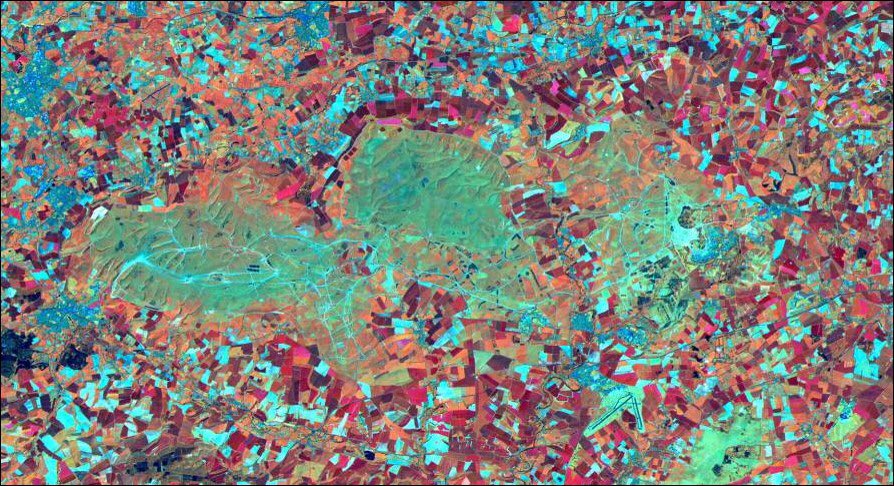
MOD has owned parts of the Plain since 1897 – and this is the reason for its preservation; no deep ploughing, fewer houses and road schemes. This satellite image demonstrates the case with the lack of fields and development #SPTAarchaeology 
Today we are on the WEST of the Plain – the most restricted access. This area was bought later than others so not appearing on the 1906 military map. Another restriction – metal detection is prohibited on military training land perhaps for obvious reasons (BANG) #SPTAarchaeology
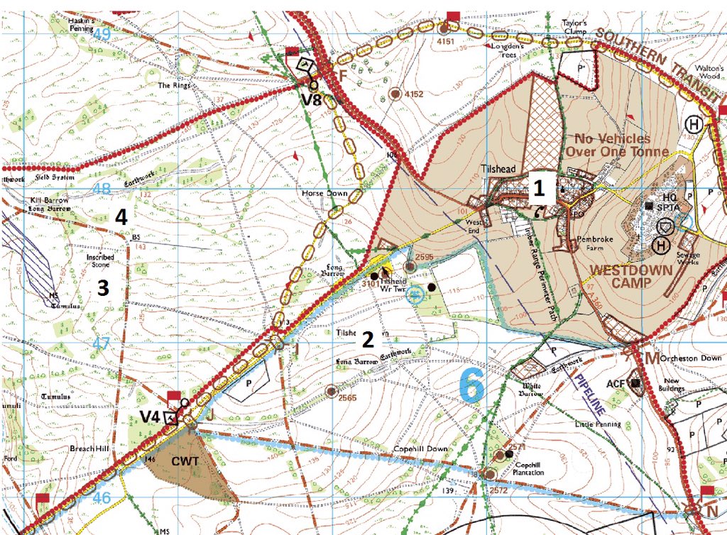
We start from Westdown Camp and will use the modern military map to guide us round. When you see a Number in brackets such as [1] this refers to a stop marked on the map. Lets go! #SPTAarchaeology
Driving through Tilshead and a first stop [1]. On our right, the village Hall – Canadian HQ for the area in WW1. A plaque on the Wall denotes the presence of the most famous visitor to the Plain. Perhaps ever! #SPTAarchaeology
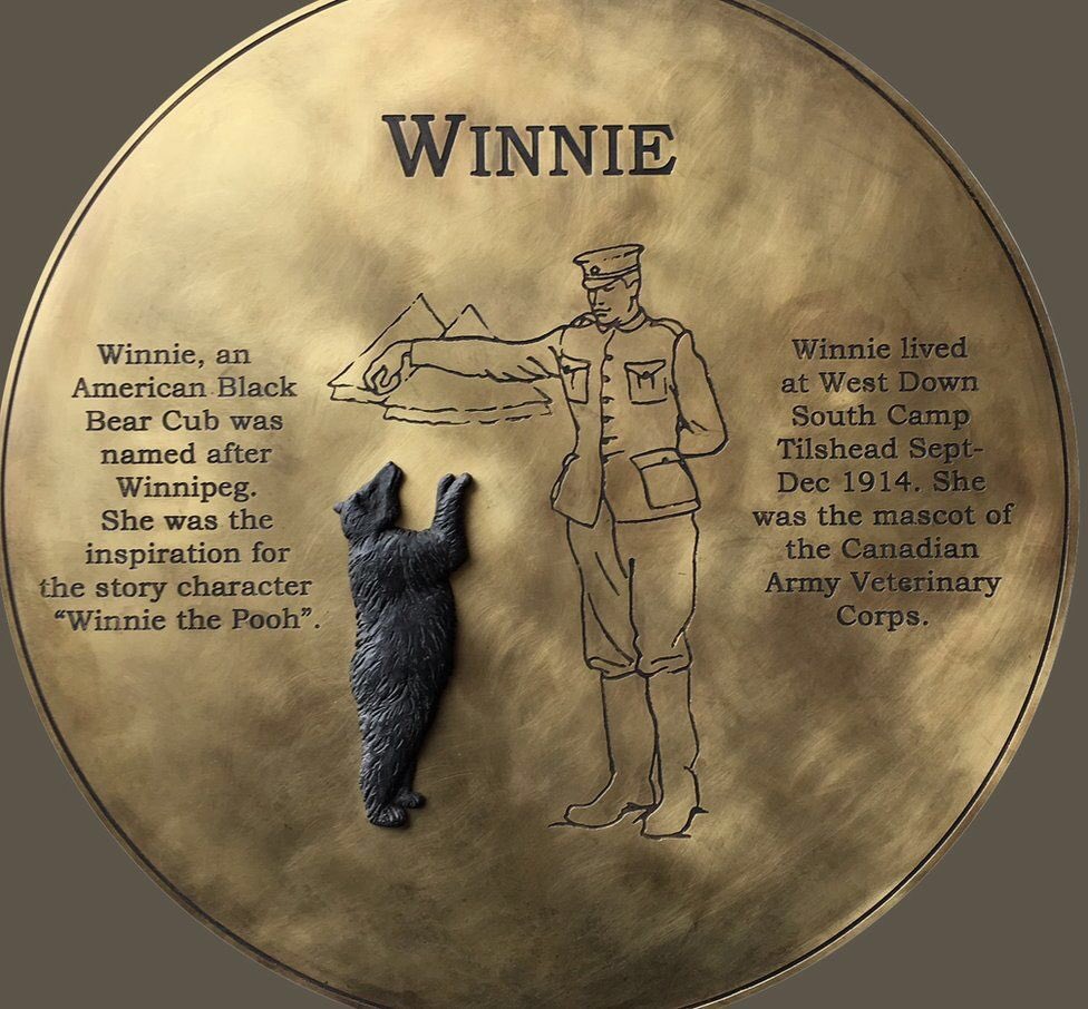
Winnipeg the bear was a Canadian mascot that was given to London Zoo as the prospect for facing the Germans was dangerous enough without heavily toothed/clawed bear. It became a favourite of Christopher Robin who named his Teddy after it…#SPTAarchaeology
#WinniethePooh
#WinniethePooh
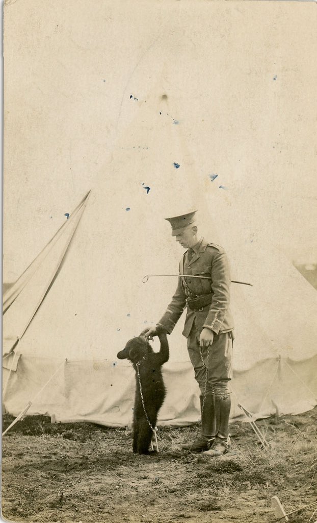
For more on Winnie the Pooh (the war years) - see cbc.ca/radio/thecurre…
Behind this is Tilshead Church which holds the remains of three of the earliest casualties of the Great War including Percy Sawyer, kicked to death by a horse, medical attention was given to him by one John Macrae. World famous for the poem ‘In Flanders Fields’ #SPTAarchaeology
Percy Sawyer and the other CWGC graves in Tilshead are noted here cwgc.org/find/find-war-…
And if you’ve forgotten the poem ‘in Flanders Fields - poetryfoundation.org/poems/47380/in… #SPTAarchaeology
So, up the hill and onto the training area. Curious trees around as this was the old arboretum of Tilshead Lodge. [2] The garden (and Parish) boundary is provided by a Late Bronze Age linear (the old ditch) which also sites upon an even earlier entity #SPTAarchaeology
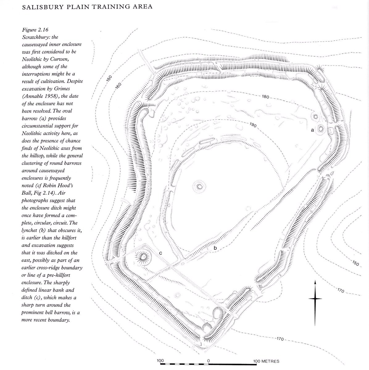
2] This is the Old Ditch longbarrow – one of 27 on the Plain. The BIGGEST in Britain at 120m long. These often had a platform with a number of individuals at one end and sometime as pit (or socket) for a standing stone. #SPTAarchaeology
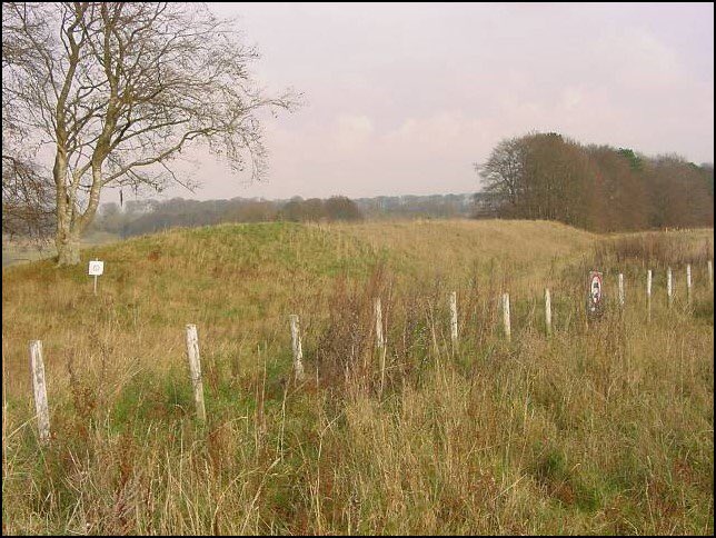
[2] These seem to stand at the tops of re-entrants and hence may be some sort of community marker. Best source is the brilliant book by Dave Field #SPTAarchaeology
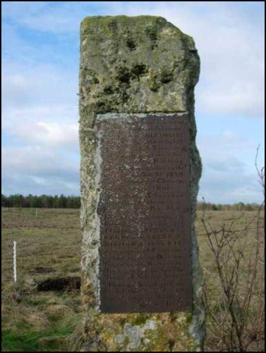
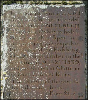
Back onto the main restricted area then and following a stone track to a monolith. [3] this is in fact Part 2 – the inscribed Stone. The first part at Gore Cross Farm is the Robbers stone where Mr Dean of Imber was subject to highway robbery by Benjamin Colclough #SPTAarchaeology
Here is the start of the robbery at Gore Cross #SPTAarchaeology
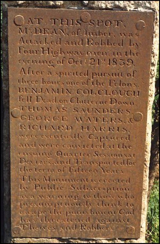
The stone is full of wonderful righteous language!! #SPTAarchaeology
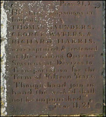
It refers to companions in iniquity!! This, to me acts like a gibbet & shows the hostile nature of the Plain - like Tess at Stonehenge as part of Hardy’s Wessex. Also marks the end of the non-military phase of the Plain.what was the fate of the other men #SPTAarchaeology
Well this tells us! drive.google.com/file/d/12ZRTL9… #SPTAarchaeology
The story has a lovely postscript with Australian troops visiting the Dean family (who still lived in Imber) in WW1 claiming to be the descendants of the former miscreants! #SPTAarchaeology
Directly across the track is proof that you can read the landscape as a text here. [4] A Late Bronze age linear cuts earlier Celtic Fields and then kinks round something before making for a Neolithic barrow (Kill Barrow) and continuing on. Allows phasing!. #SPTAarchaeology.
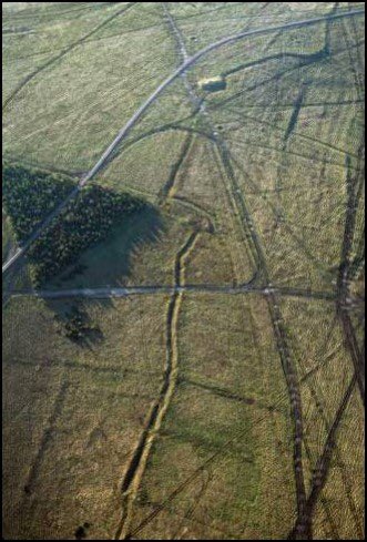
This also raises questions. LBA ditches are often very straight – if you put the surviving ones on the Plain end to end they would stretch 70km!! all dug without metal tools – wow, so why does this one kink? We need geophysics or similar to determine the feature #SPTAarchaeology
You may have noticed some elements on the military map being hachured blue. These are ‘important and fragile sites’ a keep out for the military even before the signing of the Hague Convention 1954 – our armed forces have been ahead of the game! #SPTAarchaeology

One of these is [5] the Roman village of Chapperton Down. A ribbon development on the old Roman Road. It is incorporated into military training as a minefield to make training more realistic. A ‘breach’ across was evaluated to enable passage across. #SPTAarchaeology
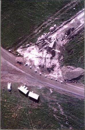
This showed houses of flint/cob/brick – still the vernacular today. #SPTAarchaeology
There were child burials in floor levels and evidence for agriculture – this was a rural settlement of the 3-4th C not with fancy villas. The deposits were recorded then buried under a geotextile & track to protect them. It works! We checked at Barrow Clump! #SPTAarchaeology
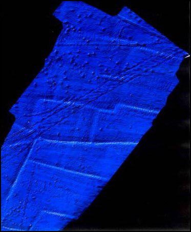
Driving past the village we see a series of lynchets on our right [6] these field terraces are ROMAN! Associated with the settlement. In places up to 2m high. Astonishing. We have to permit training here so monitor trends of disturbance with laser scans like this #SPTAarchaeology
You may notice pockmarks – these are shell crater left from an overseas artillery school of WW1 – they are no longer shelled ! In fact, they are placed out of bounds to training in any wet weather too. Lets drive on #SPTAarchaeology
As we reach the brow of the hill we get our first view of [7] Imber. The villagers were required to leave two weeks before Christmas in 1943 to provide the British and US Allies with realistic urban training prior to the Normandy Landings. #SPTAarchaeology
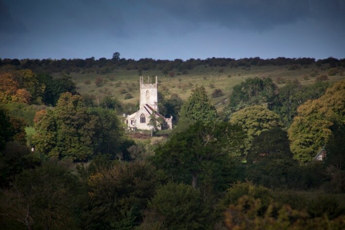
Horrible for the residents but vital to save lives. You can still see the Dean residence of Seagrams Farm #SPTAarchaeology
Access to Imber is incredibly restrictive (esp now) see link for updates openings - visitwiltshire.co.uk/whats-on/imber… #SPTAarchaeology
In the middle of the village we can get out and walk up the Grade 1 Listed Imber Church. It has set opening times in the year and is owned by the Churches Conservation Trust. They have lent us virtual keys let’s go inside! [7] #SPTAarchaeology
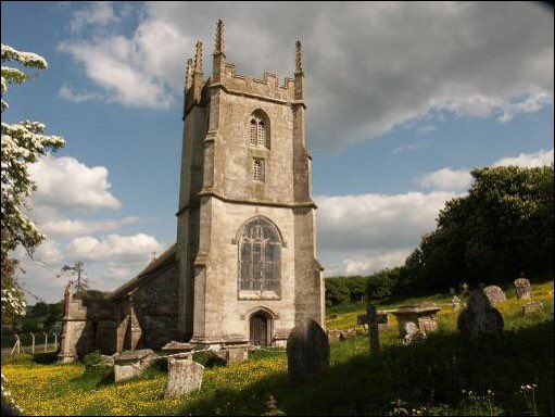
Whilst many of the fittings were moved to nearby Bratton and Edington churches – the lectern has returned and the Dean memorial remains. The Trust did magical work to reveal a series of very special wall paintings which set this church apart now.
In the tower is this offering – one of two in UK (the other Canterbury Cathedral). #SPTAarchaeology
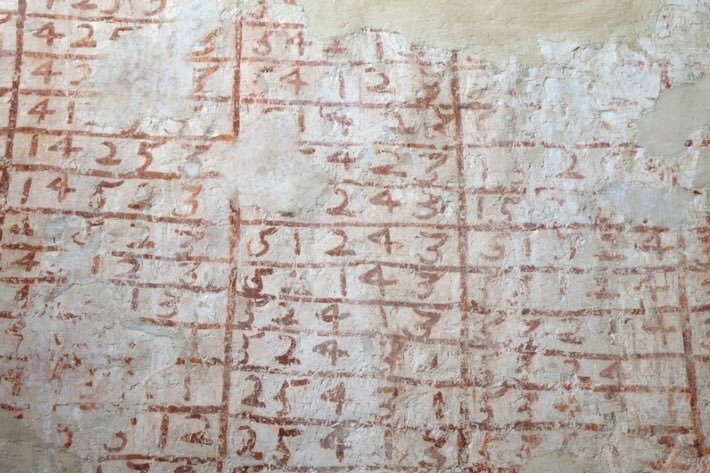
This is the bell peal roster for the campanologists telling them when to ring their particular bell; a sheet music drawn on the wall. A medieval musical Banksy #SPTAarchaeology
In the main church – one of the Seven Deadly sins was revealed (probably late 15 -early 16th C) – this is the sin of Avarice or greed. And the chap with bags of coins is being taken to hell by demons. #SPTAarchaeology
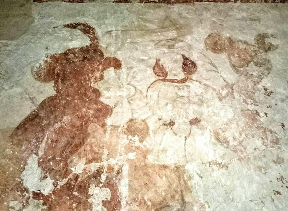
One of these demons looks suspiciously like Micky Mouse! IF you’ve seen endless Disney films with your child you’ll understand!! See also visitchurches.org.uk/visit/church-l… #SPTAarchaeology
I have worked with military veterans doing archaeology as recovery. JL Carr in ‘A month in the Country’ explored this theme as well as Medieval Church wall paintings. DO read it’s a beautifully linked work – a gentle and caring pulp fiction. #SPTAarchaeology
It was also a gorgeous film with no less a cast than Natasha Richardson, Kenneth Branagh and Colin Firth! #SPTAarchaeology

Lock the church doors , drive through the now training village and over to a copse called the ‘Fishhook’ – Here is a modern monument a military legacy and the top part of the heritage palimpsest. [8] this is a simulacrum of the Siegfried Line from WW2 #SPTAarchaeology
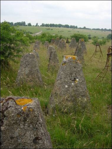
This is a legacy of military training from pivotal moments in this island’s history and hence important to note. Although when I requested anti-tank protection measures to protect these anti-tank features it went nowhere! #SPTAarchaeology
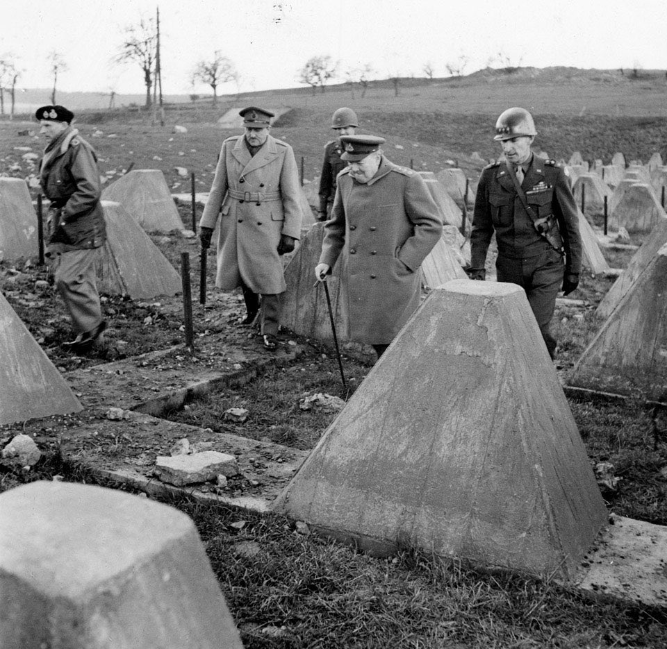
This shows the efforts the armed forces go to to make training realistic. This is a photo of the real thing – with Churchill, Montgomery, Eisenhower and others. #SPTAarchaeology
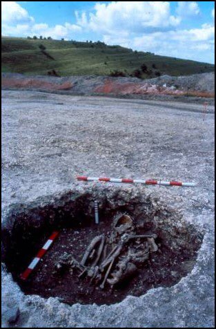
Along the Tinkers Track up to Boles Barrow [9] and its magnificent views to the south. A Neolithic barrow excavated by Dr Thurnam and with the finds in Wiltshire Museum. The collection was considered by Dr Martin Smith in his book with Megan Brickley #SPTAarchaeology
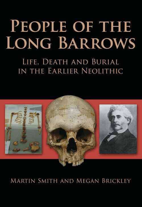
Martin believed that this barrow did INDEED hold remains of Neolithic victims of violence as Thurnam thought– the finding were published also in British Archaeology. This wasn’t post depositional damage but sensational evidence for violence over 5000 years ago. #SPTAarchaeology
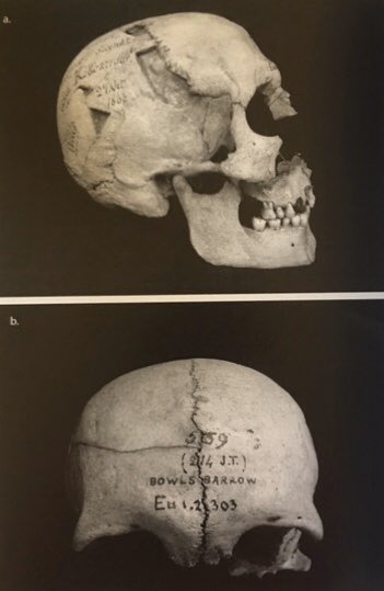
The barrow had secondary early medieval inhumations too (like Kill barrow mentioned earlier near Chapperton) #SPTAarchaeology reader.exacteditions.com/issues/53752/s…
The other sensation for this site was the discovery of a potential bluestone that now resides in @SalisburyMuseum
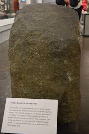
The only places you find these stones are Prescelli and Stonehenge. So why was this here? Well there has been much work on this by such luminaries as Mike Parker Pearson. #SPTAarchaeology eprints.gla.ac.uk/121403/1/12140…
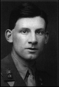
The Stone now resides at Salisbury Museum having been donated by the landowner of nearby Heytesbury House – a man called Siegfried Sassoon. #SPTAarchaeology
Now a detour via the stone track to the very northern edge of the Plain – looking out over Westbury and the Bratton hillfort and White Horse. #SPTAarchaeology
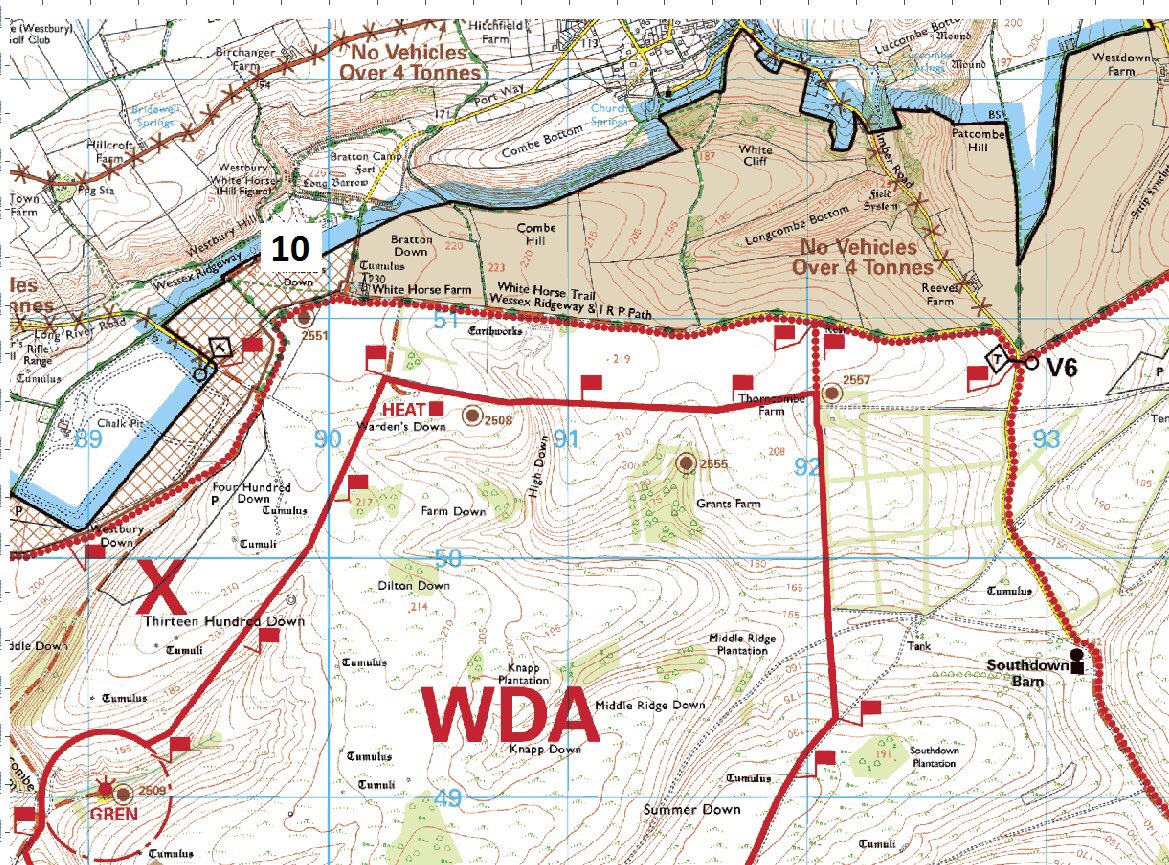
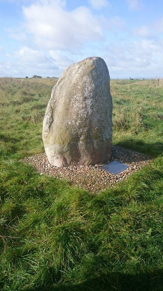
This is the supposed location [10] for the critical battle of Ethandun in 878. Here Alfred the Great defeated Guthrum the Viking. A different outcome may have seen a very different England #SPTAarchaeology
The site has been commemorated with this stone on the edges of the Training Area #SPTAarchaeology
And it gives me an excuse to link to this all time classic TV series – in Search of the Dark Ages with Michael Wood. I am tweeting from Winchester which might have been a Viking City more akin to York had the outcome gone the other way! #SPTAarchaeology
Back down to the Range road then – stopping off to check map references (& to show a tank range target) and then along the concrete Southern Transit Route past Battlesbury Hillfort. The road was built to minimise enviro impact of armour and has worked so well. #SPTAarchaeology

[11] The foothills of the hillfort revealed Middle Iron Age Settlement excavated by Wessex Archaeology. The usual IA weirdness of cattle skulls in ditches, human remains in pits etc was present. Alongside the posthles of a major roundhouse settlement. #SPTAarchaeology
You can download the complete excavation by @wessexarch report here. Wow! #SPTAarchaeology wessexarch.co.uk/our-work/battl…
On the 9 hectare hillfort which looks out over Warminster, another poignant memorial – to the Yorkshire Regiment. This bench was installed with permission from Historic England to remember lads from this Regiment killed in an event in Iraq #SPTAarchaeology
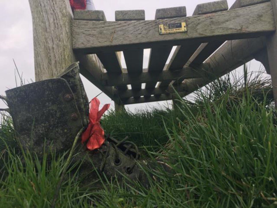
It has become a shrine – often holding (unopened) cans of beer, regimental wristbands, candles, cards to the men, and even army boots with ribbons. It is like the chambers of West Kennet with its current offerings and shows a military take on memorials #SPTAarchaeology
The hillfort itself is magnificent and one of the most photogenic monuments on SPTA as this image by @HistoricEngland shows
Next to the hillfort is Middle Hill [12] – with lynchets on several faces of the hill. These correspond with a set on the other side of the valley which yielded late Medieval pottery when disturbed, and the hill also has a Bronze Age barrow on the summit. #SPTAarchaeology
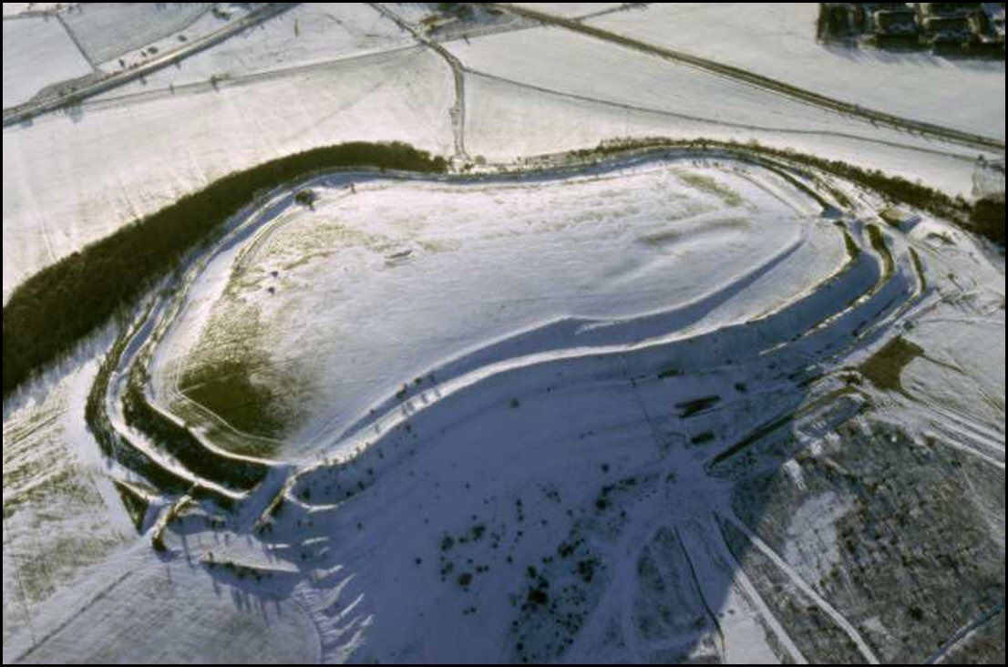
The next, and third, hill is Scratchbury [13]. It too has a hillfort – one which would be almost impossible to ‘defend’. Is it the same (c300BCE) date as Battlesbury and contemporary? Two adjacent forts like Hod and Hambledon hills in Dorset are not common. #SPTAarchaeology
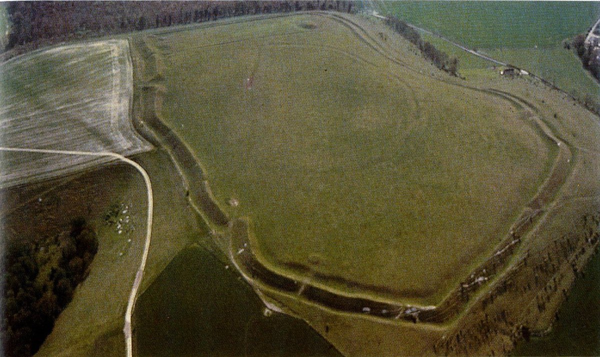
There are BA barrows here too, and something thought to be a causewayed enclosure like Robin Hoods’ Ball (see tomorrow!) – but perhaps not in fact this type of monument according to Al Oswald of @HistoricEngland #SPTAarchaeology
It too has a link to the poet Sassoon as he wrote about it in this beautiful work. #SPTAarchaeology poetryfoundation.org/poems/43174/on…


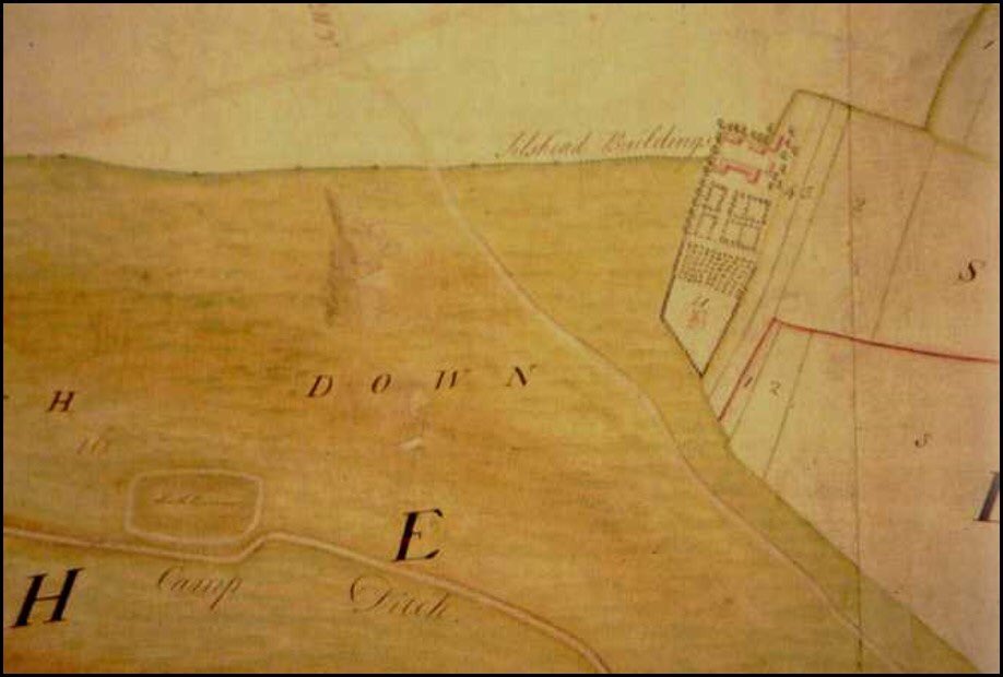
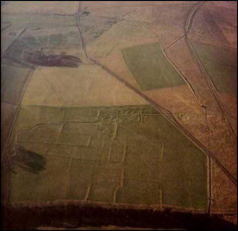
Along the concrete road and past Knook. One of the best sites on the Plain (again out of bounds to military). Must start with this wonderful Royal Commission plan [14]. #SPTAarchaeology
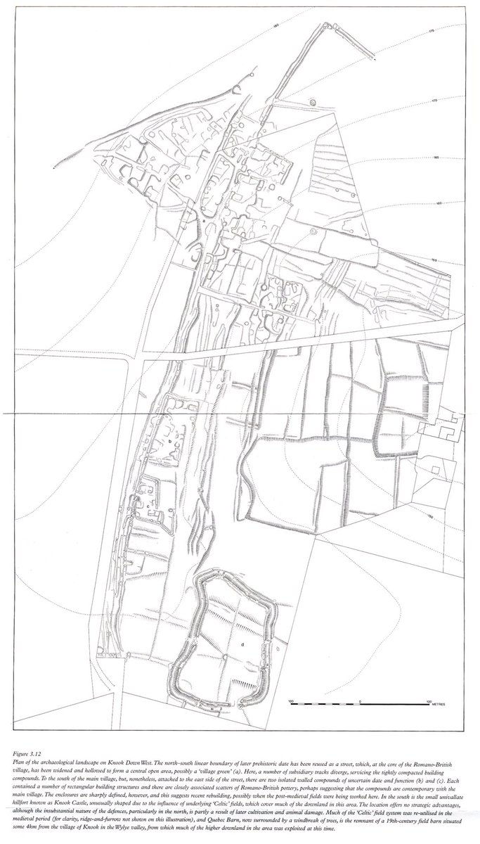
This and the @HistoricEngland photo demonstrates a Late Bronze Age Linear to the left, then an Iron Age enclosure on the right sitting atop, and therefore later than) ‘Celtic Fields’ #SPTAarchaeology
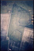
This then is turned into a Roman village of small house plots in enclosures in similar construction style to Chapperton. The LBA linear is converted to Roman streets which then widens to incorporate the Roman ‘village green’. Quite astonishing. #SPTAarchaeology
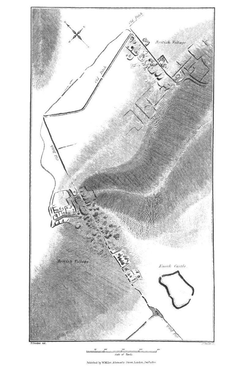
The measured plan does actually show the good work of Colt Hoare in his early plan #SPTAarchaeology
Many of the finds from this area are in the wonderful @WiltshireMuseum - do visit when we are able to get our again #SPTAarchaeology
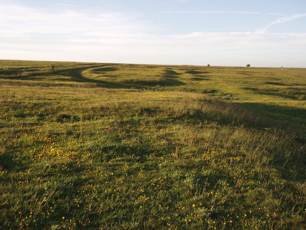
Colt Hoare’s work on Ancient Wiltshire is a valuable resource and the first considered work of Archaeology on the Plain, Adjacent to Knook West is the imaginatively named Knook East – connected by a hollow way. #SPTAarchaeology
This site has a series of Roman fields and house enclosures that the surveyors could even determine platforms for hay ricks in the enclosure corners an a Roman well at the southern edge, now surrounded by trees. The Plain is a multi-period joy. #SPTAarchaeology
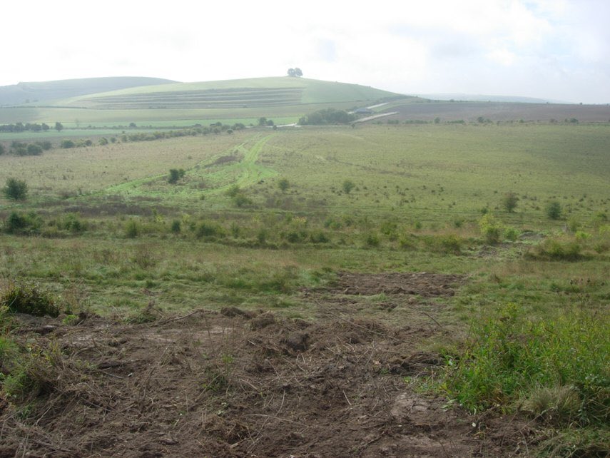
Continuing along the road to Westdown it is hard to believe this is southern England – so unspoilt.You can hear skylarks everywhere, & experience glories of nature and orchids. It is the biggest expanse of chalk grassland west of the Steppe in Russia. #SPTAarchaeology
And hence [15] it sometimes substitutes for Russia in film sets. Those that saw the Keira Knightley version of Anna Karenina may remember the peasants scything away? Well this was here – Breakheart bottom. #SPTAarchaeology
It is not only the military that want to recreate realistic landscapes; film directors and production companies do too. #SPTAarchaeology
And that leads us to the end of day one and back to Westdown. Tomorrow we will see the site of ANOTHER film – Oscar-winning ‘1917’ and much more as we go onto the Centre of the Plain. Join me! #SPTAarchaeology