My Authors
Read all threads
Let's talk maps. 🗺️

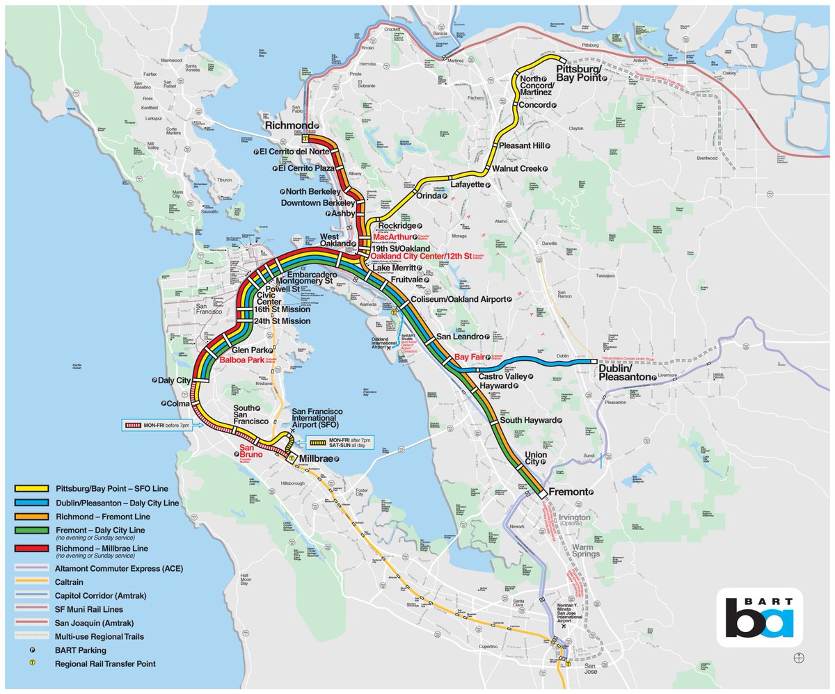
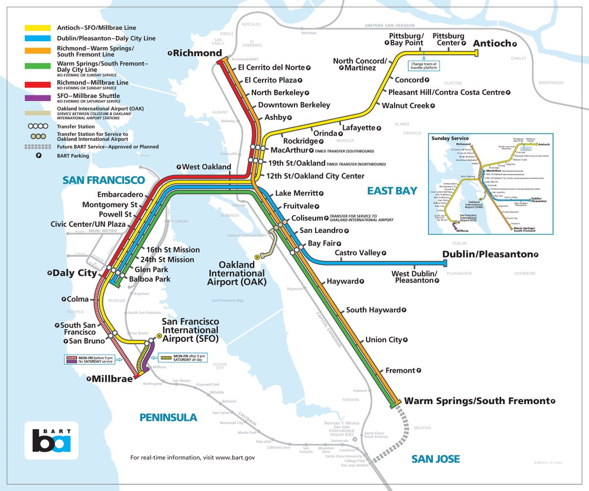
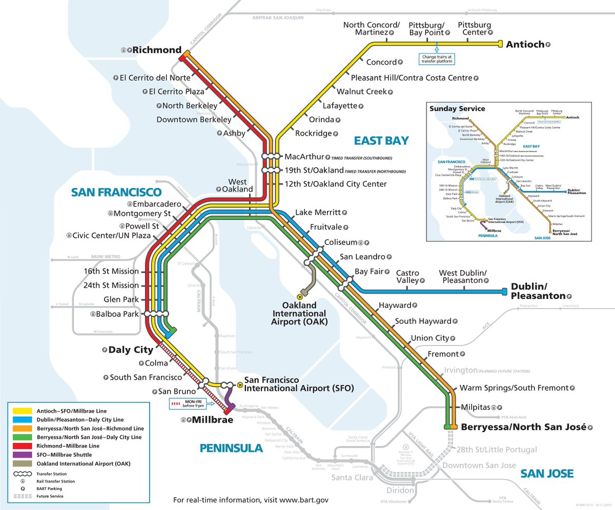
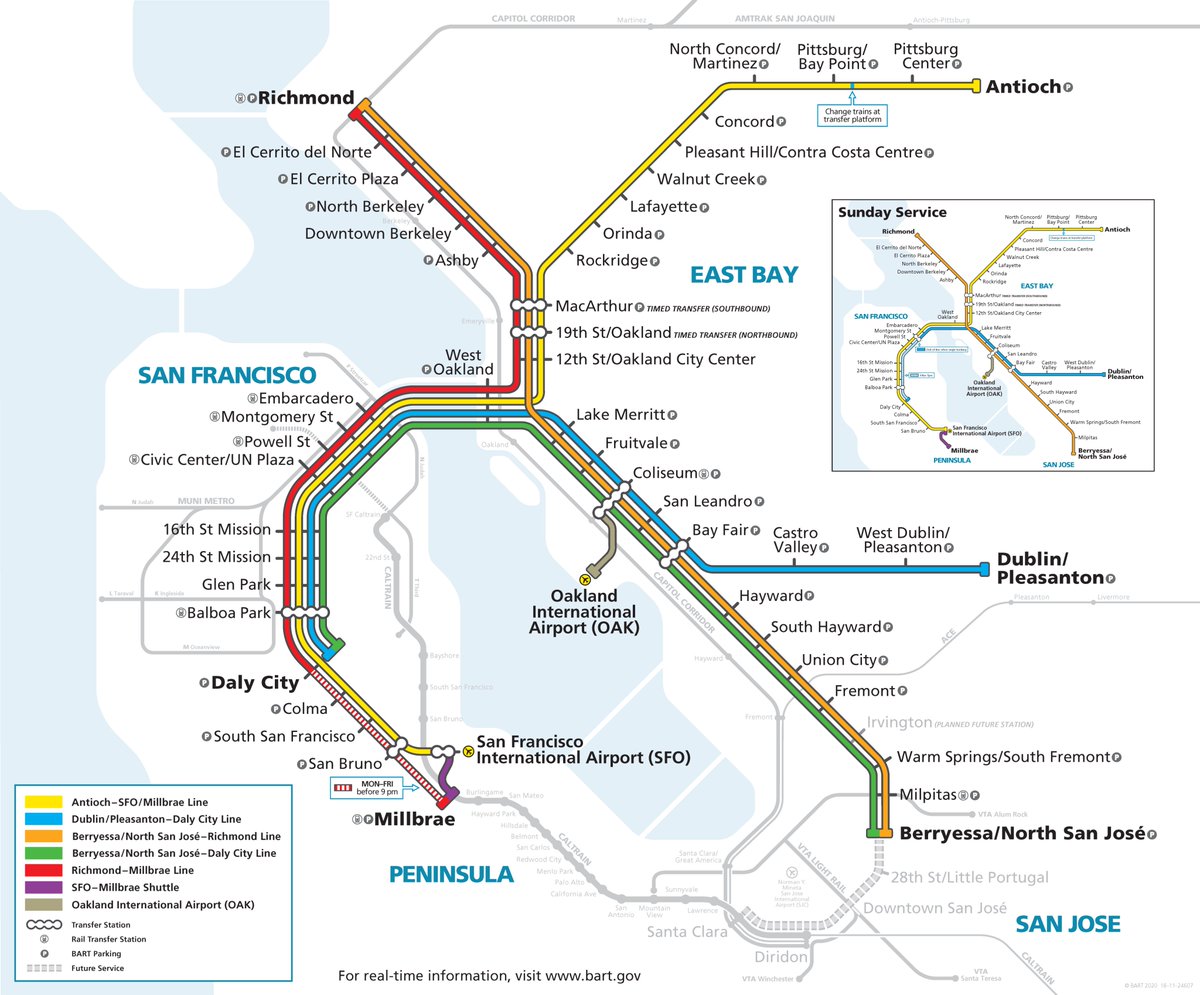
BART staff finalized its new system map in preparation for the future Milpitas and Berryessa station opening and will present it to the Board of Directors next week.

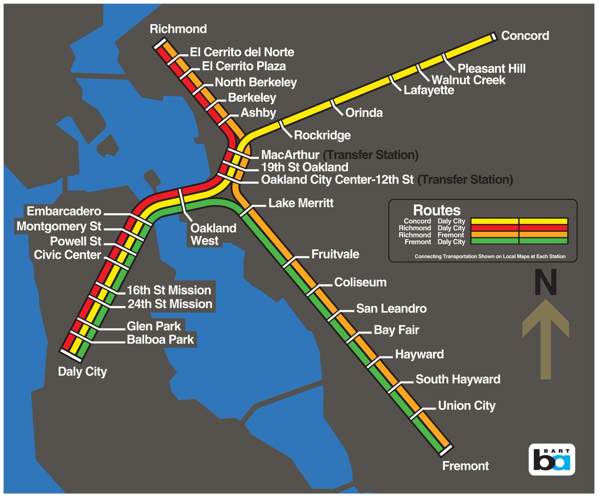
Left: current map
Right: finalized new map once Milpitas & Berryessa opens Current BART system mapFinalized new BART system map for when Milpitas and Berryessa stations open
With BART's Silicon Valley extension into San Jose, BART needed to rescale the system map to add more South Bay details.

Multiple improvements were made to the design to make it easier to read and to better highlight regional transit connectivity points.
The new system map underwent some cleaning to help ease of reading and comprehension.

The Yellow Line in Contra Costa County is smoothed out, and more spacing has been given between the Oakland stations to make the map easier to read and follow.
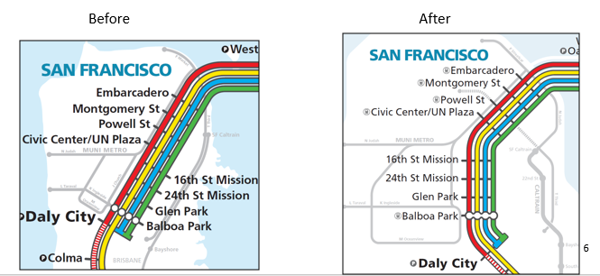
The new map gives more space and legibility to @sfmta_muni Metro -- including adding the Central Subway -- and @Caltrain in San Francisco to better highlight alternative transit options in The City.
In the peninsula, we interlined the Yellow Line with the Purple Line (SFO-Millbrae) to eliminate some annotations that currently cause confusion.
In the southern East Bay, ACE service has been added to the new system map to better promote partner transit service.

The new map also added Irvington Station between Fremont and Warm Springs as a future planned station.
A new transfer bubble has replaced the old transfer icon to emphasize transfer stations and the ease of changing trains at transfer stations.

The new transfer bubble is also present for transfer to Oakland Int'l Airport. Transfer is now consistent with others on the map.
The new map includes a "Rail Transfer Station" icon and is listed in front of station names to better promote connectivity with the various transit agencies which serve the Bay Area.
Lastly -- and mostly an aesthetic touch -- the San Francisco Bay's water lines has been smoothed out.

While we love the San Francisco Bay, the new map prioritizes ease of understanding the map over the geographic accuracy of a body of water.
This new finalized map will be the fourth iteration of the BART system map.

The BART system map reflects not only BART's expansion but also its place within the greater Bay Area and the priorities we make as the region evolves.

bart.gov/news/articles/…
We made some tweaks over the weekend to the version of the BART system map we showed you on Friday.
Full details about our process of updating the map are detailed here: bart.gov/news/articles/…
Missing some Tweet in this thread? You can try to force a refresh.

Enjoying this thread?

Keep Current with SFBART

Profile picture

Stay in touch and get notified when new unrolls are available from this author!

Read all threads

This Thread may be Removed Anytime!

Twitter may remove this content at anytime, convert it as a PDF, save and print for later use!

Try unrolling a thread yourself!

how to unroll video

1) Follow Thread Reader App on Twitter so you can easily mention us!

2) Go to a Twitter thread (series of Tweets by the same owner) and mention us with a keyword "unroll" @threadreaderapp unroll

You can practice here first or read more on our help page!

Follow Us on Twitter!

Did Thread Reader help you today?

Support us! We are indie developers!


This site is made by just two indie developers on a laptop doing marketing, support and development! Read more about the story.

Become a Premium Member ($3.00/month or $30.00/year) and get exclusive features!

Become Premium

Too expensive? Make a small donation by buying us coffee ($5) or help with server cost ($10)

Donate via Paypal Become our Patreon

Thank you for your support!