🅰ntiquity Journal Profile picture
Sep 29, 2020 9 tweets 4 min read Read on X
This 📷 is the ruins of Hattusa, capital of the Hittite Empire in the #BronzeAge. Tax collectors there amassed a fortune in grain, hundreds of tonnes of which are still inside!

Here's an #AntiquityThread on what the largest find of its kind tells us about ancient politics 🧵 1/ Image
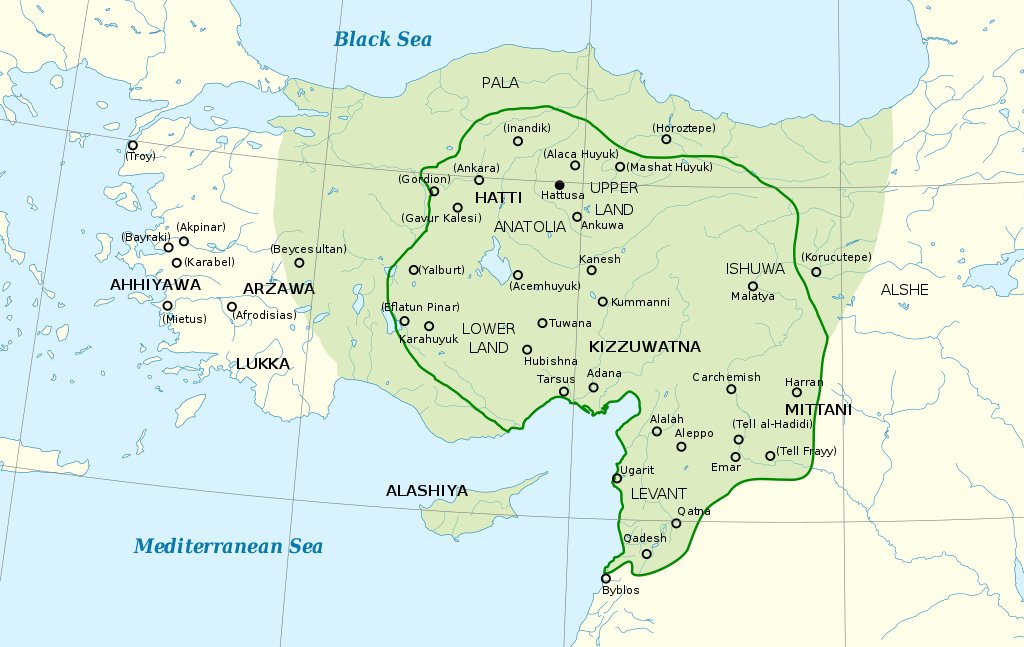
Hattusa was established as by Hattusili I ~1650BC. The Hittite Empire would go on to rule most of Anatolia within a few centuries, coming into conflict with Assyrians and the New Kingdom of Egypt. 2/

📷: Map of the Hittite Empire at its greatest extent by Ikonact / CC BY-SA 3.0 Image
A big empire needs a big granary and archaeologists uncovered one at Hattusa in 1999. It's over 100 metres long and could hold ~6,0000 tonnes of grain - enough to feed a population of 20 000–30 000 for one year! 3/

📷: Plan of the grannery. Image
What makes this find especially incredible is hundreds of tonnes of this grain was still in place, preserved as a charred mass >1 metre thick 4/

📷: A mass of carbonised cereals above the stone floor of the granary Image
This charring was the result of a fire that appears to have taken place shortly after the silo was built and the structure was abandoned.

But whilst this was bad news for the Hittites it's great for archaeologists, as it preserved the grain for study 5/
The rulers of Hattusa likely filled this giant granary with taxation. People would have to give a portion of their produce, calculated from their agricultural output and
labour force.

Except for the elites, they were exempt. 6/
Thanks to this granary, we can see how the regular folk under Hittite rule fulfilled their demands.

The secret? Focusing on low-effort cereals that produced reasonable returns, even under marginal conditions. 7/

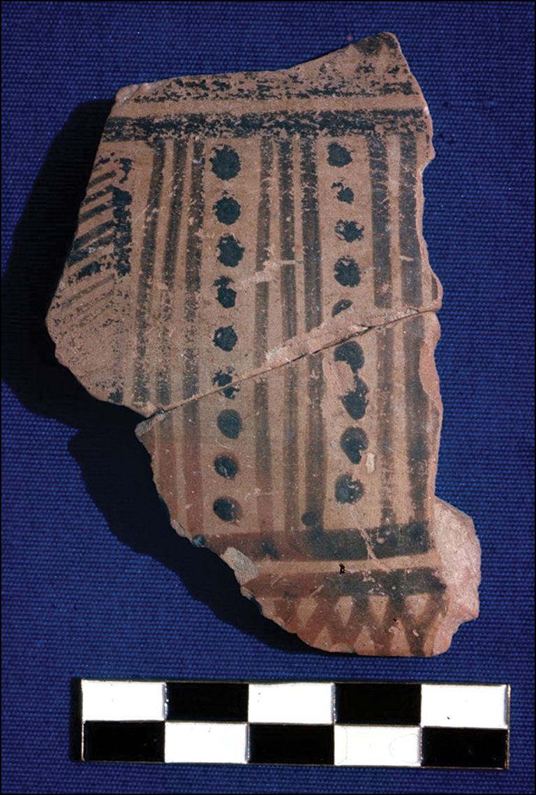
📷: Wheat & barley recovered from the silo. Image
But there was some variation in this strategy, likely dictated by the land farmers had access too.

The ability of the royal administration to tax such a range of people across a wide area suggests the tax collector had a long reach even back then. 8/8
Read more about the analysis of the largest archaeobotanical assemblage in the world in the original research in Antiquity 👇

Diffey, Neef, Seeher & Bogaard. The agroecology of an early state: New results from Hattusha (£) doi.org/10.15184/aqy.2… Image

• • •

Missing some Tweet in this thread? You can try to force a refresh
 

Keep Current with 🅰ntiquity Journal

🅰ntiquity Journal Profile picture

Stay in touch and get notified when new unrolls are available from this author!

Read all threads

This Thread may be Removed Anytime!

PDF

Twitter may remove this content at anytime! Save it as PDF for later use!

Try unrolling a thread yourself!

how to unroll video
  1. Follow @ThreadReaderApp to mention us!

  2. From a Twitter thread mention us with a keyword "unroll"
@threadreaderapp unroll

Practice here first or read more on our help page!

More from @AntiquityJ

Sep 23
NEW Analysis of Bronze Age arrowheads from the Tollense Valley 🇩🇪 reveals some were not produced locally, uncovering the earliest evidence for large-scale interregional conflict in Europe and suggesting a southern army fought at ‘Europe's oldest battle’.

#AntiquityThread 1/15 🧵 Leif Inselmann examining one of the foreign-type arrowheads in the find archive of Mecklenburg-Western Pomerania, Schwerin (credit: Leif Inselmann).
Warning: this thread contains images of human remains 2/16
The Tollense Valley in Mecklenburg-Western Pomerania is well-known as the site of a large conflict dating to c.1250 BC. The quantity of human remains found (more than 150 individuals) suggests over 2000 people were involved, an amount unprecedented for the Nordic Bronze Age. 3/16 Map of Mecklenburg-Western Pomerania, Germany, highlighting the location of the Tollense Valley in relation to the city of Strasburg. Insert: map of Central and Eastern Europe, indicating the location of Mecklenburg-Western Pomerania.
Read 16 tweets
Mar 5
NEW Greek colonisation of the Mediterranean and the development of the Greek alphabet took place earlier than previously thought, radiocarbon dates from the Geometric period site of Zagora on the island of Andros find.

An #AntiquityThread 1/9 🧵 Fragment of a Late Geometric period krater, decorated with painted geometric patterns.
The Greek Geometric period is named after the ceramics of the time, which were painted with geometric patterns. It took place towards the end of the Early Iron Age in Greece and witnessed the beginning of Greek colonisation in the central Mediterranean. 2/9 Fragment of a Middle Geometric period pot, decorated with geometric patterns.
Key cultural developments, such as the introduction of the Greek alphabet, and a population boom took place during the Late Geometric period, which was thought to date from 760–700 BC. However, absolute dates are scarce and dating has been done using ceramic typologies. 3/9 Fragment of the base of a Sub-Protogeometric period skyphos.
Read 9 tweets
Feb 8
NEW Painkiller or pleasure? Black henbane seeds discovered in a hollowed bone provide the first conclusive evidence for the intentional use of the poisonous plant in the Roman world.

Strap in for a hallucinogenic #AntiquityThread 🧵 1/13

📷 BIAX Consult Hollowed sheep or goat bone next to many black seeds and a stopper made from black birch tar.
Archaeologists have discovered hundreds of black henbane seeds in a hollowed bone at the rural Roman-period settlement of Houten-Castellum in the Netherlands, providing the first firm evidence for the poisonous plant’s intentional use in the Roman world. 2/13 Many black henbane seeds.
Black henbane is a plant, known from ancient and historical sources both for its medical properties and for its hallucinogenic effects. Before now, however, no conclusive evidence of its use in the Roman world had been found. 3/13

📷 K.G. Simoglou / CC BY-SA 4.0 Two pale yellow black henbane flowers with black centres.
Read 13 tweets
Jan 23
NEW Pottery analysis uncovers the complex flavours of Roman wine!

Archaeologists have compared Roman clay jars for winemaking with modern Georgian examples, revealing how Roman wine looked, smelled, and tasted. 🍷

A dry and full-bodied #AntiquityThread 1/12 🧵 Buried Roman fermentation jars (dolia) from Villa Regina, Boscoreale. Credit: E. Dodd, courtesy of the Ministero della Cultura – Parco Archaeologico di Pompei.
The Romans are well-known for their love of wine. In the Roman world, large clay pots called dolia were manufactured for fermenting, storing and ageing wines. 2/12 Roman wine cellar at Tortoreto Muracche (Abruzzo). Credit: Francesco Pizzimenti, courtesy of Soprintendenza Archeologia, Belle Arti e Paesaggio per le province di L’Aquila e Teramo.
"No study has yet scrutinised the role of these earthenware vessels in Roman winemaking and their impact on the look, smell and taste of ancient wines”, state the authors. 3/12
Read 12 tweets
Jan 15
NEW DNA analysis has revealed that regional cuisines persisted as new staple crops spread across the prehistoric world, showing how even the first cooks retained strong cooking traditions.

Strap in for a tasty #AntiquityThread 1/12 🧵 The Yanghai cemeteries. A desert containing many pits. Credit: Hongen Jiang.
Broomcorn millet was first domesticated in China before spreading west into Central Asia and beyond. In China it was cooked through boiling and steaming, producing a wet and sticky end product. 2/12 Harvested millet gathered into bundles in a field, with a mountain in the background.
In Central Asia, however, grains were typically ground and baked into bread. When millet was introduced, people simply applied their pre-existing cooking techniques to the new grain. 3/12 Loaves of bread.
Read 12 tweets
Dec 15, 2023
NEW Deep in the remote, boreal landscape of the Siberian taiga, a promontory fort has been found to be 8000 years old, making it the oldest in the world! It is a rare example of hunter-gatherers building fortified sites.

A wintery Antiquity Thread ❄️ 1/10 🧵 Above: a bank and ditch (highlighted red) marking the remains of a pit house. Below: a visible depression (highlighted red) marking the edge of the fortification.
Archaeologists have typically associated the rise of social and political 'complexity' in Eurasia with the development of agriculture. However, hunter-gatherers in Siberia built fortified settlements centuries before similar sites developed in Europe. 2/10 Map of Eurasia, showing hunter-gatherer (green) fortifications and agricultural (orange) enclosed sites.
To find out why, researchers performed fieldwork at a promontory fort (Amnya I), thought to be the oldest Stone Age fortification in Eurasia, and its associated settlement (Amnya II), providing the first direct radiocarbon dates for Amnya II. 3/10

📷 N. Golovanov Aerial photograph of the Amnya river and promontory.
Read 10 tweets

Did Thread Reader help you today?

Support us! We are indie developers!


This site is made by just two indie developers on a laptop doing marketing, support and development! Read more about the story.

Become a Premium Member ($3/month or $30/year) and get exclusive features!

Become Premium

Don't want to be a Premium member but still want to support us?

Make a small donation by buying us coffee ($5) or help with server cost ($10)

Donate via Paypal

Or Donate anonymously using crypto!

Ethereum

0xfe58350B80634f60Fa6Dc149a72b4DFbc17D341E copy

Bitcoin

3ATGMxNzCUFzxpMCHL5sWSt4DVtS8UqXpi copy

Thank you for your support!

Follow Us!

:(