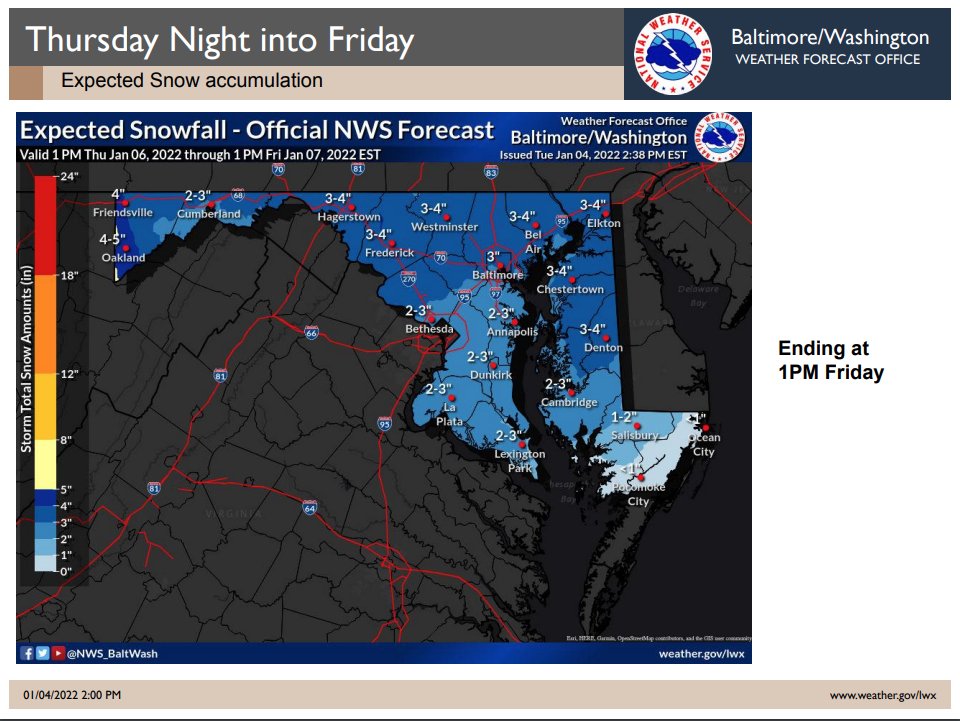
(1/3) Here is the latest update for the next weather system affecting the State:
● Most of the State will have accumulating snow tonight->tomorrow.
● Snow will begin afternoon->evening from west to east in Md.
● Most of the State will have accumulating snow tonight->tomorrow.
● Snow will begin afternoon->evening from west to east in Md.

(2/3)
● Heavier snow corridor of 3-4” from I-95 to NE/east-central MD. 1” per hour rates possible for 1-2 hours. Heaviest likely from 10pm - 4am.
● Winds will pick up & power outages are likely.
● Wind chill factors in the teens and single digits Friday morning.
● Heavier snow corridor of 3-4” from I-95 to NE/east-central MD. 1” per hour rates possible for 1-2 hours. Heaviest likely from 10pm - 4am.
● Winds will pick up & power outages are likely.
● Wind chill factors in the teens and single digits Friday morning.
(3/3)
Charge all communications devices in case of any power outages. Traveling may be hazardous during the worse of the storm. If you must venture out make sure your vehicle is winter ready and you have an emergency supply kit with you.
Please be safe.
#MdWx #WeCare!
Charge all communications devices in case of any power outages. Traveling may be hazardous during the worse of the storm. If you must venture out make sure your vehicle is winter ready and you have an emergency supply kit with you.
Please be safe.
#MdWx #WeCare!
• • •
Missing some Tweet in this thread? You can try to
force a refresh


