In 1928, when the Tamiami Trail was completed, people could finally travel easily by car from Tampa to Miami, hence the name "Tamiami." Also known as U.S. Highway 41, the road was considered a feat of engineering at the time.

NPS photo

#EvergladesNationalPark #Everglades An aerial image shows construction of the bridge alongside t
It took over 11 years, $7 million and more than 3 million sticks of dynamite to complete the 264-mile roadway and adjacent canal.

The road was great for the economy of Southwest Florida and enabled this part of Florida to become a center for real estate, business, and tourism.
But it was disastrous for the Everglades ecosystem, cutting off the natural flow of water into what is today Everglades National Park.
Now there’s a happy ending to this story -- engineers have returned to fix this mistake.

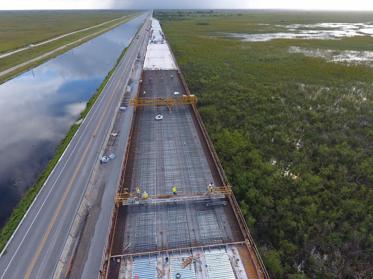
By 2019, approximately 3.5-miles of elevated bridging replaced the roadway and increased the flow of water into the park by 80%.

NPS Figure by Amy Renshaw

#EngineersWeek A figure of a map including the northeastern part of the par
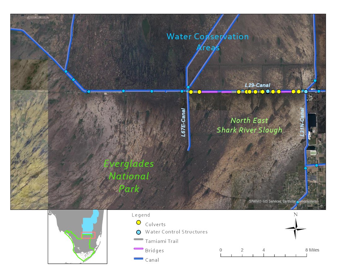
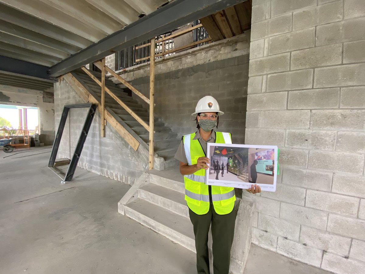
Current projects to raise the road and build more culverts will better distribute more water into the park.

We are already seeing some promising results now that the water can flow more freely.

NPS photo

#FindYourPark #EncuentraTuParque
Read more about the intertwined past, present and future of the park with Tamiami Trail in "Removing the cork in the bottle: Reconstructing Tamiami Trail to restore water flow to Everglades National Park." Follow the link in today's story.
nps.gov/articles/000/r…

• • •

Missing some Tweet in this thread? You can try to force a refresh
 

Keep Current with Everglades National Park

Everglades National Park Profile picture

Stay in touch and get notified when new unrolls are available from this author!

Read all threads

This Thread may be Removed Anytime!

PDF

Twitter may remove this content at anytime! Save it as PDF for later use!

Try unrolling a thread yourself!

how to unroll video
  1. Follow @ThreadReaderApp to mention us!

  2. From a Twitter thread mention us with a keyword "unroll"
@threadreaderapp unroll

Practice here first or read more on our help page!

More from @EvergladesNPS

Feb 26
We wanted to remind everyone that the Environmental Assessment (EA) for the Shark Valley Site Plan is available for review and comment through March 11 at parkplanning.nps.gov/sharkvalley.

Learn more and submit comments directly on the project website.
The Park proposes to enhance visitor experience, safety and park operations at Shark Valley by providing on-site overflow parking, installing shade structures along the Shark Valley Tram Road, and reducing flooding at the Entrance Road, Tram Road and the Administration Complex.
The Environmental Assessment evaluates two action alternatives, describes the environment that would be affected by the alternatives, and assesses the environmental consequences of implementing the alternatives.

NPS Photo

#EvergladesNationalPark #Everglades Image
Read 5 tweets
Feb 24
Did you know an Underground Railroad route ran through what is today Everglades National Park? Here's the story of how abolitionist Jonathan Walker smuggled 7 enslaved people from Pensacola to the Bahamas, a British colony at the time, and thus free.
In 1844, the group departed in a small sailing vessel, following the Florida coast south toward Cape Sable in present day Everglades National Park.
They eventually rounded the cape on the southwestern tip of the Florida peninsula, and moved past Sandy Key, Clive Key and Eagle Key in Florida Bay. Along the way, Walker fell ill and they ran low on water.
Read 11 tweets
Mar 29, 2021
Active shooter incident happening at Everglades NP. Main park road (SR 9336) closed for public safety. Visitors/residents in Flamingo should shelter in place. Suspect is a 33 y.o. white male. Federal, state, and local law enforcement agencies are coordinating the response.
There are no injuries to report as of now. Suspect fired at park rangers unprovoked. Suspect is still at large.
Read 6 tweets
Mar 28, 2021
Spring has sprung, and it's wading bird nesting season!

We just closed access to Paurotis Pond in the park, but for good reason: wading birds, including Wood Storks like the ones pictured here, are doing what they're supposed to do and are raising babies.

Pic: Anthony Sleiman Two large, white birds with grey heads and long, slightly cu
This closure will help limit human disturbance to these threatened birds as they nest.

Two of the larger bird colonies we watch in the park are Broad River and Cabbage Bay colonies, both located in western Everglades National Park. Signage reads "BIRD NESTING AREA DO NOT APPROACH BEYOND
Wood Storks started nesting in both colonies in mid-January, and their numbers have increased since then with around 500 nests in Broad River and 300 nests in Cabbage Bay. They also recently began nesting, although late, in Paurotis Pond.
Read 5 tweets
Mar 26, 2021
Let's take a peek into the future... that is the Flamingo Visitor Center's future!

Swipe to see the "before and after" of the main entrance and one of the exhibits. The "afters" are renderings, as the center is in construction.

NPS Images Deputy Superintendent Sabri...This "after" rend...Ranger Alan stands in a con...This "after" rend...
This historic visitor center is undergoing a complete rehabilitation and is expected to reopen to visitors later this year.
So what else is changing? Some of the renovations include replacing the entire roof, adding structural improvements to help withstand hurricane-force winds and storm surges, and creating a completely new interior.
Read 4 tweets
Feb 28, 2021
Wherever there were enslaved African Americans, there were people eager to escape. One such attempt in 1844 brought 7 freedom seekers in a sailing vessel through, what is today, Everglades National Park. Photo 1 by NPS: Color map of the United States with arrows sPhoto 2 Daguerreotype by Southworth & Hawes, 1845: A hand wi
Abolitionist Jonathan Walker smuggled 7 enslaved people from Pensacola to the Bahamas, a British colony at the time, where slavery had been abolished since 1834.

Following the coast southward, they rounded Cape Sable on the southwestern tip of the Florida peninsula.
They moved past Sandy Key, Clive Key and Eagle Key in Florida Bay. Along the way, Walker fell ill & they ran low on water.

Walker intended to head NE thru today's Biscayne NP (@biscaynenps) to Cape Florida. From there, it would have been a relatively short trip to the Bahamas.
Read 7 tweets

Did Thread Reader help you today?

Support us! We are indie developers!


This site is made by just two indie developers on a laptop doing marketing, support and development! Read more about the story.

Become a Premium Member ($3/month or $30/year) and get exclusive features!

Become Premium

Don't want to be a Premium member but still want to support us?

Make a small donation by buying us coffee ($5) or help with server cost ($10)

Donate via Paypal

Or Donate anonymously using crypto!

Ethereum

0xfe58350B80634f60Fa6Dc149a72b4DFbc17D341E copy

Bitcoin

3ATGMxNzCUFzxpMCHL5sWSt4DVtS8UqXpi copy

Thank you for your support!

Follow Us on Twitter!

:(