It's that time of the year again... We're referring to National Hurricane Preparedness Week.
How does this monument in Islamorada relate to the Everglades?
NPS Photo by Rachel DiPietro
Both locations were devastated by the great Labor Day hurricane of 1935.
Before hurricanes and tropical storms started receiving names to aid in tracking, and before the age of radar, only rudimentary tools like barometers and hand-written observations or calculations were available to prepare for impact.
The 1935 Labor Day hurricane was so powerful in its intensity that hundreds of people in the Florida Keys were washed away, with some bodies turning up as far away as Flamingo and Cape Sable in the Everglades.
The hurricane was also the final blow to Henry Flagler's Florida East Coast Railway, which would have served as the first complete line of connection on land between the Florida mainland and Key West.
This hurricane, with storm surge of up to 20 ft, sustained winds of 185 mph, and a barometer reading of 892 mb (26.35 inches), remains the worst recorded hurricane to make landfall in the United States.
The majority of the hurricane victims were World War I veterans brought in from other areas of the country to work on roads and bridges as part of a New Deal program during the Great Depression.
The remains of most of the victims are interred at the Hurricane Memorial, dedicated in 1937, and located at mile marker 82 on the Overseas Highway in the Florida Keys.
Like some locations in the Everglades, this memorial is included on the National Register of Historic Places. It is open to the public with limited parking.
Stay tuned for the rest of Hurricane Preparedness Week as we share some of the ways Everglades National Park works to protect people and resources from these powerful forces of nature.
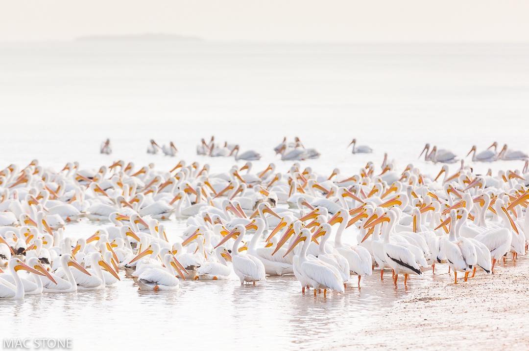
White Pelicans have one of the largest wingspans of any bird in North America, measuring approximately 9-9.5 feet. Those long wings are needed to support their body which can weigh between 10-13 pounds.
White Pelicans can often be found in the Everglades from late fall through the spring. They spend their time here mainly on coastal waters, bays, and estuaries where they can forage in the shallow water and rest on exposed areas such as sandbars.
Like all natural areas on our planet, the Everglades and @HaleakalaNPS were born from Earth’s changing climate over vast periods of time. Earth's climate is always fluctuating between glacial cycles that both alter the terrain and influence sea level over thousands of years.
Over the last 150 years however, scientists have observed an increase in global temperature and consequentially, a rise in global sea level.
The accelerated rates at which the temperature and seas are rising threaten to outpace the ability of plants, animals, and natural processes to adapt.
We wanted to remind everyone that the Environmental Assessment (EA) for the Shark Valley Site Plan is available for review and comment through March 11 at parkplanning.nps.gov/sharkvalley.
Learn more and submit comments directly on the project website.
The Park proposes to enhance visitor experience, safety and park operations at Shark Valley by providing on-site overflow parking, installing shade structures along the Shark Valley Tram Road, and reducing flooding at the Entrance Road, Tram Road and the Administration Complex.
The Environmental Assessment evaluates two action alternatives, describes the environment that would be affected by the alternatives, and assesses the environmental consequences of implementing the alternatives.
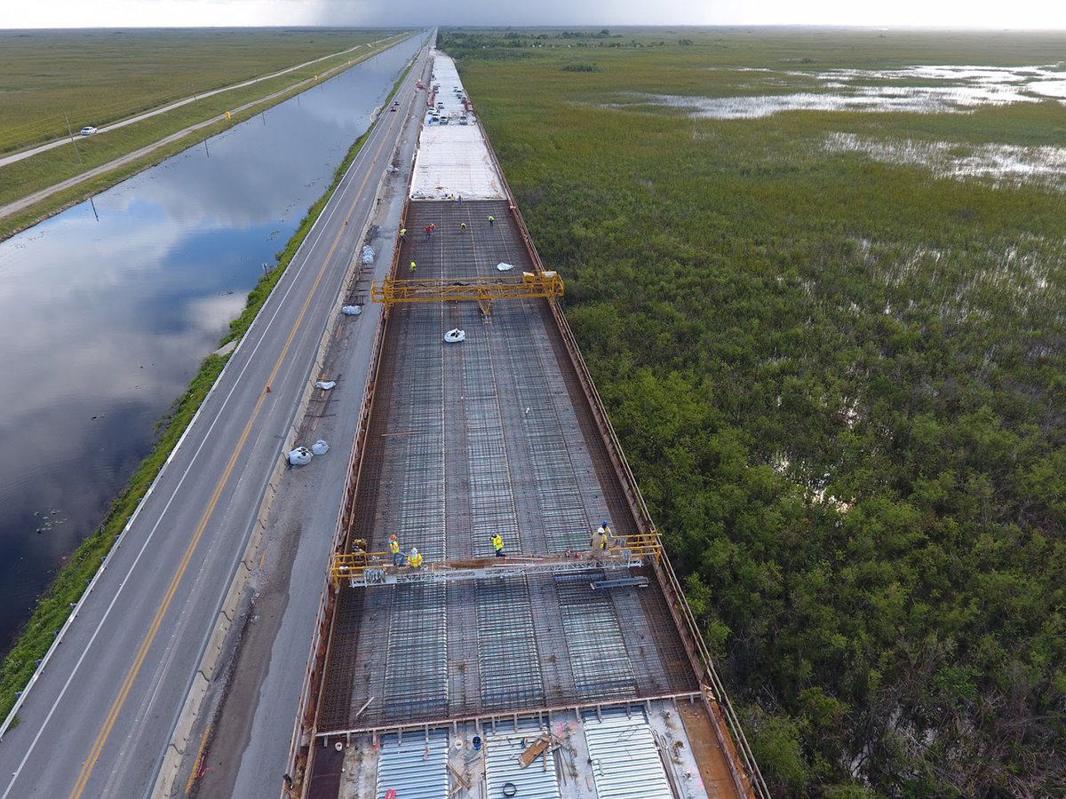
In 1928, when the Tamiami Trail was completed, people could finally travel easily by car from Tampa to Miami, hence the name "Tamiami." Also known as U.S. Highway 41, the road was considered a feat of engineering at the time.
Did you know an Underground Railroad route ran through what is today Everglades National Park? Here's the story of how abolitionist Jonathan Walker smuggled 7 enslaved people from Pensacola to the Bahamas, a British colony at the time, and thus free.
In 1844, the group departed in a small sailing vessel, following the Florida coast south toward Cape Sable in present day Everglades National Park.
They eventually rounded the cape on the southwestern tip of the Florida peninsula, and moved past Sandy Key, Clive Key and Eagle Key in Florida Bay. Along the way, Walker fell ill and they ran low on water.
Active shooter incident happening at Everglades NP. Main park road (SR 9336) closed for public safety. Visitors/residents in Flamingo should shelter in place. Suspect is a 33 y.o. white male. Federal, state, and local law enforcement agencies are coordinating the response.