Our new paper in @ScienceAdvances takes the first global view of location hiding in commercial fisheries. We find strong ties between location hiding and illegal activities #IUU, proving a new tool to police the wild west of our open oceans. 1/6
shorturl.at/jprDQ
shorturl.at/jprDQ

Our team analyzed nearly 4 billion AIS messages from 2017-19 to isolate intentional disabling (instances when a vessel purposely turned its AIS off) from gaps caused by technical issues like poor satellite reception. Access the dataset here: shorturl.at/dfjW8 2/6
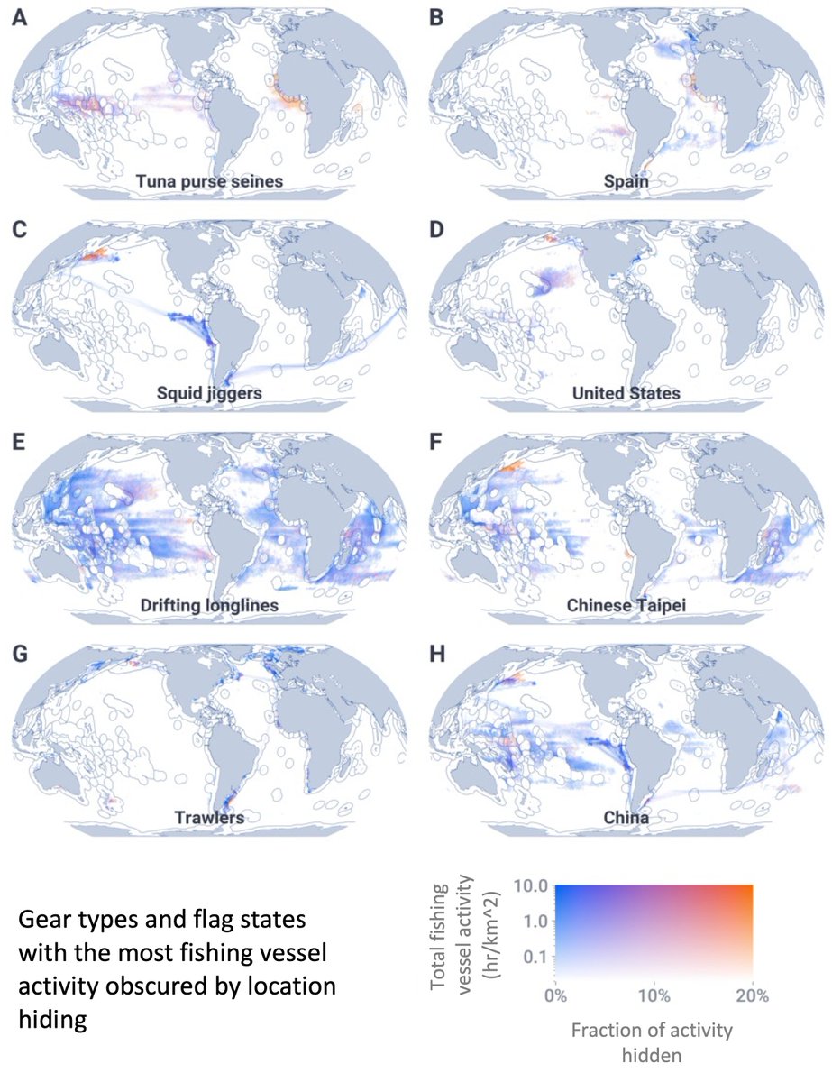
We found that nearly 6% of global fishing vessel activity is obscured by location hiding – over 4.9 million hours! We broke location hiding out by gear type and flag state to understand who location hides the most, and where they do it. 3/6 

Then we used #machinelearning to understand why vessel hide their locations. We found two nefarious reasons: obscuring unauthorized boundary crossings and transshipments. Location hiding was most likely adjacent to foreign and contested EEZs, and in transshipment hotspots. 4/6
A. shows a vessel turning off its AIS near Argentina’s EEZ and then steaming to port under coast guard escort. It was later charged with illegal fishing. B. shows a vessel turning off its shipboard AIS but leaving its gear-mounted AIS on during a transshipment event. 5/6 

But location hiding could also be for legal reasons: to hide from competitors, and to hide from pirates in dangerous waters. The act of location hiding itself does not indicate illegal activity, but it can help us focus the fight against #IUU fishing on the riskiest vessels. 6/6
Huge shout to the stellar team from @NOAAFisheries, @UCSC_Fisheries, and @GlobalFishWatch who put so many hours into this work: @tclavL, @timD_white, @MeganCimino, Jenn Van Osdel, @TimHochberg, @davidkroodsma, and @elhazen
• • •
Missing some Tweet in this thread? You can try to
force a refresh


