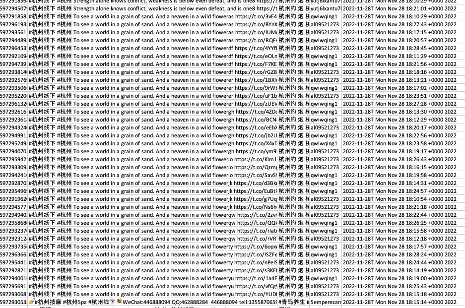
Over the past 20 minutes, almost 2000 tweets have been uploaded using the hashtags of major Chinese cities (such as #杭州), all with the text "I'm single, can I get a husband on Twitter".
All of the accounts have been made in the past two months, and have zero or few followers.
This is happening during a very interesting period.
Namely, while content about the protests in China is being posted on Twitter, using the hashtags of the cities as place markers.
I've downloaded a full csv of the past 2000 tweets using #杭州线下 (Hangzhou offline).
The phrases appear to be quite odd. Some mentioning Pokemon...
Hit me up if you want the csv.
The timeline of posts is fairly linear - at least of the 2000 tweets I collected under the #杭州线下 hashtag. But there is barely any engagement on any of the tweets, no retweets, comments or likes, showing that these posts, while there, are not gaining any traction at all.
There is no clear evidence that this spammy behaviour is linked to the protests in China, but it does show that while there are important topics posted on Twitter, they are being blocked by spammy behaviour that uses the same location based hashtags, obscuring important content.
• • •
Missing some Tweet in this thread? You can try to
force a refresh
In a few hours I pulled 3000+ tweets using China location tags #北京, #杭州 & #重庆. These tags are dens of spam.
Red lines indicate interactions between accounts (generally normal activity). Orange nodes are lone accounts, almost all of which spam the tags with dating ads.
A quick summary on the accounts created seen in the network graph above.
- 555 of the accounts were made in Nov
- 463 made in Oct
- many have zero or few followers
- many mention "high end silk" ads in different ways.
That's just out of the 3000 I collected. But so many more
Here is what that spammy content looks like, over and over again.
For journalists or researchers looking up what's happening in China at specific locations. This is what they're wading through.
Happy to share the data with legitimate researchers online activity.
Hi. Our team at @MyanmarWitness has just published extremely insightful resources detailing the locations of Myanmar military air force bases, detailed guides on air assets, and a comprehensive guide on the small arms used by the Myanmar army. #WhatsHappeningInMyanmar
One of our biggest resources is the Myanmar Small Arms Guide, the result of a huge effort by @leone_hadavi and others to document domestically manufactured small arms systems used by the military.
We have documented some of the air assets responsible for directly/indirectly destroying communities in Myanmar. The guide goes in-depth to show supply chains, armaments and identification points. Read it here: myanmarwitness.org/aircraft
Surprised to see recent reporting and govt announcements about 'illegal Chinese police stations', even though the information has been publicly available for some time.
Let me take you on a walk through the open source information 👇
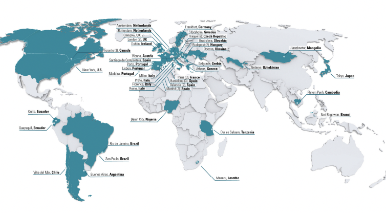
It indicates a map of locations of where these police stations are located.
In that report, addresses of the stations can be easily found by digging through the footnotes. For example, here are three addresses based in the UK where there are reportedly 'illegal police stations' operated by China.
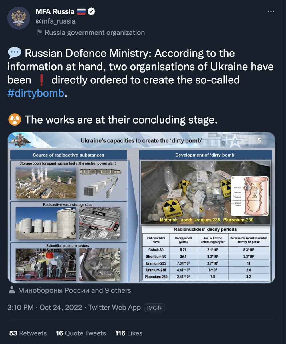
The 'evidence' presented by the Russian MoD claiming Ukraine is creating dirty bombs is completely unreliable. Image on the right if from as far back as 2016, if not more.
This one is my favourite. MoD claims this is some sort of proof of "Scientific research reactor".
Image on the left is from the Beloyarsk NPP in Russia and image on the right is a flipped version of an old clip about the Novosibirsk Scientific and Industrial Complex
The 'evidence' pack on dirty bombs isn't just a collage of random images pulled from historical archives of the internet, it's also an expose on just how bad Kremlin propaganda can be.
For example, using past propaganda in the same claim of evidence 👇
Pakistan's floods are an 'unprecedented climate catastrophe' with 1100+ people killed as a result.
Visualising flood damage is challenging, but satellite imagery tells an important story. I'm going to cover some of the worst hit areas in this thread 👇🧵
This GIF I've made from @Planet imagery shows Hala, which sits next to the Indus River, not far from Hyderabad.
The imagery you are seeing is two satellite images in a GIF visualisation. The images are from August 2 and August 28.
This visualisation shows the flooding in Mianwali in Pakistan's Punjab province.
The imagery you are seeing is two satellite images which I blended together in a GIF. They are @Planet images from August 22 and 28.
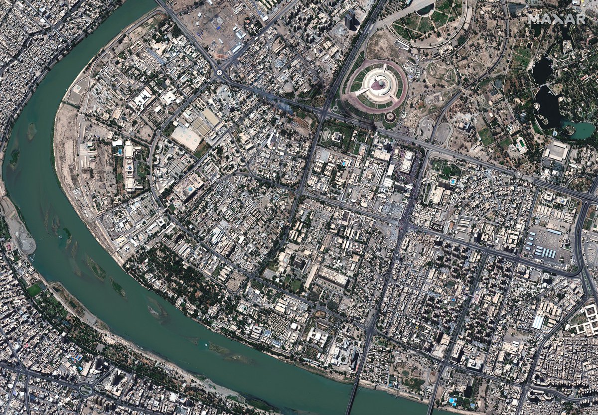
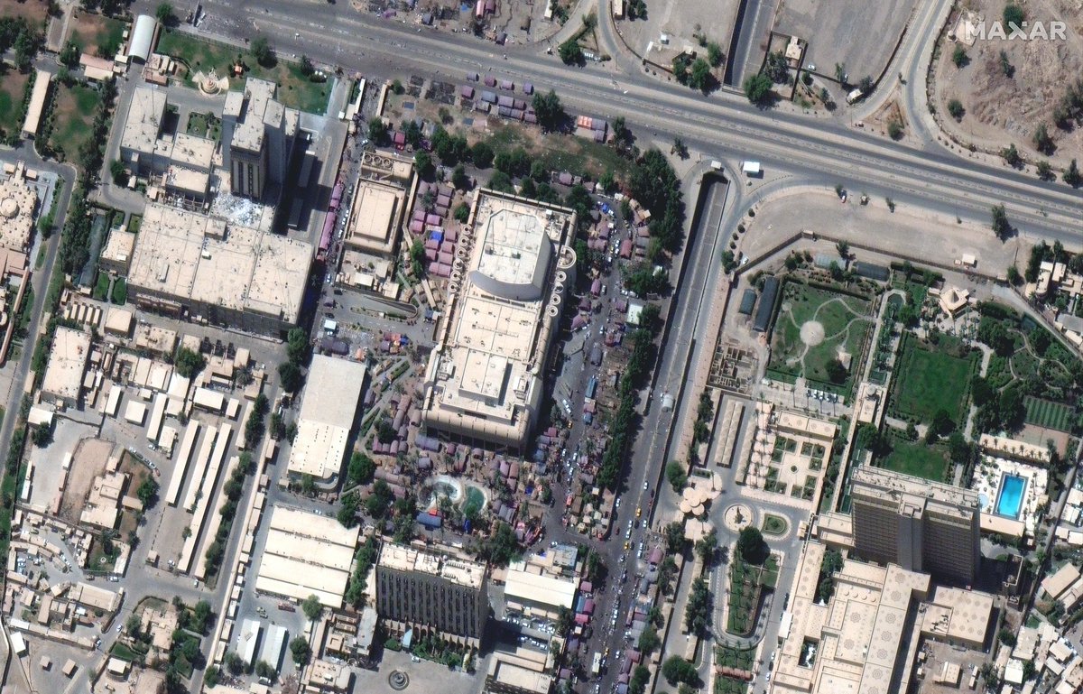
Satellite imagery taken yesterday (August 30) over Baghdad shows fires, shelters and security forces around the Green Zone as violent protests erupted following the resignation of Muqtada al-Sadr.