We wanted to remind everyone that the Environmental Assessment (EA) for the Gulf Coast site of Everglades National Park is available for review and comment through Feb. 26 at parkplanning.nps.gov/document.cfm?p…
Learn more and submit comments directly on the project website. Select “Open For Comment” from the left column.
The EA analyzes the proposal to redevelop site facilities and supporting infrastructure at the Gulf Coast site of Everglades National Park, located in Everglades City.
The proposed improvements will address the damages resulting from Hurricane Irma and focus on improving visitor experience while protecting cultural and natural resources and making the site resilient to climate change for the next 50 years.
The EA evaluates the impacts of a no-action alternative and one action alternative. It describes the environment that would be affected by and assesses the environmental consequences of implementing each alternative.
Under the no-action alternative, the NPS would maintain the existing conditions at the Gulf Coast site.
Comments must be posted through the project website for consideration in the planning process. Although we will read them, please know that comments submitted through social media will not be considered as part of the project review.
To be added to the Everglades National Park mailing list and receive notifications and updates related to ongoing planning efforts, please email Daniel Noon, Chief of Planning and Compliance, at daniel_noon@nps.gov
• • •
Missing some Tweet in this thread? You can try to
force a refresh
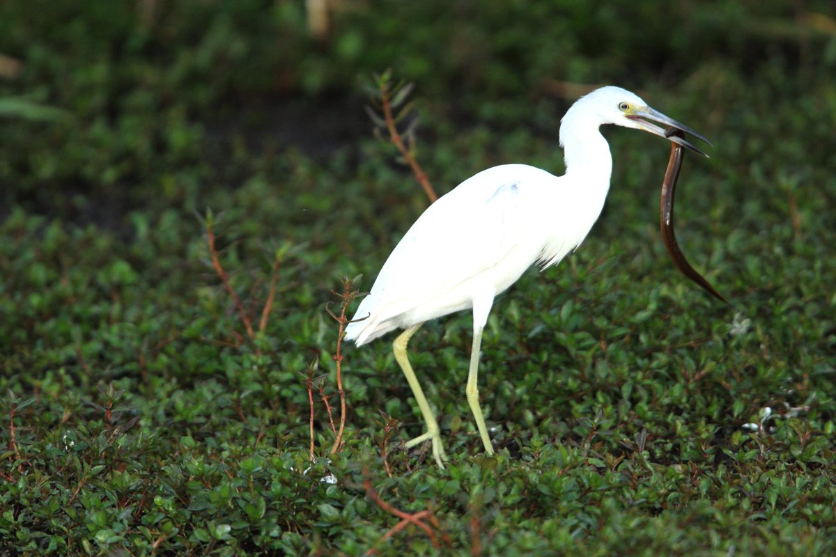
It’s National Invasive Species Awareness Week and today we're highlighting one invasive species in the Everglades that some people might not be too familiar with.
Photo by Kevin Sunderland
The Asian swamp eel (Monopterus spp.) is a drought-resistant fish which was first found in Florida in 1997 and a population found in a canal in Homestead Florida in 1999.
By 2007, the species had spread from the canal system into the southern Taylor Slough area of the park.
White Pelicans have one of the largest wingspans of any bird in North America, measuring approximately 9-9.5 feet. Those long wings are needed to support their body which can weigh between 10-13 pounds.
White Pelicans can often be found in the Everglades from late fall through the spring. They spend their time here mainly on coastal waters, bays, and estuaries where they can forage in the shallow water and rest on exposed areas such as sandbars.
It's that time of the year again... We're referring to National Hurricane Preparedness Week.
How does this monument in Islamorada relate to the Everglades?
NPS Photo by Rachel DiPietro
Both locations were devastated by the great Labor Day hurricane of 1935.
Before hurricanes and tropical storms started receiving names to aid in tracking, and before the age of radar, only rudimentary tools like barometers and hand-written observations or calculations were available to prepare for impact.
Like all natural areas on our planet, the Everglades and @HaleakalaNPS were born from Earth’s changing climate over vast periods of time. Earth's climate is always fluctuating between glacial cycles that both alter the terrain and influence sea level over thousands of years.
Over the last 150 years however, scientists have observed an increase in global temperature and consequentially, a rise in global sea level.
The accelerated rates at which the temperature and seas are rising threaten to outpace the ability of plants, animals, and natural processes to adapt.
We wanted to remind everyone that the Environmental Assessment (EA) for the Shark Valley Site Plan is available for review and comment through March 11 at parkplanning.nps.gov/sharkvalley.
Learn more and submit comments directly on the project website.
The Park proposes to enhance visitor experience, safety and park operations at Shark Valley by providing on-site overflow parking, installing shade structures along the Shark Valley Tram Road, and reducing flooding at the Entrance Road, Tram Road and the Administration Complex.
The Environmental Assessment evaluates two action alternatives, describes the environment that would be affected by the alternatives, and assesses the environmental consequences of implementing the alternatives.
In 1928, when the Tamiami Trail was completed, people could finally travel easily by car from Tampa to Miami, hence the name "Tamiami." Also known as U.S. Highway 41, the road was considered a feat of engineering at the time.