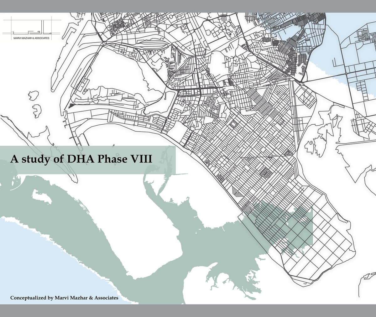
I am back on my favourite topic: contested decisions of DHA’s Phase 8, the most ‘planned’ upper class neighbourhood of Karachi. Where real estate is highly valued. But this time I discuss development of religious versus public spaces. @DHAKarachiOfc @SindhCMHouse @DCKhiCentral 

In its October 2021 order against the DHA’s land reclamations, the Sindh High Court that the housing authority “had occupied 117 acres of land in Phase 8 illegally, it had reclaimed over 300 acres”. So technically the edge is contested at the moment but construction continues.
Prologue: real estate zones which is an amalgamation of residential, corporate and commercial plots and is approximately 4320 acres of vast land. The area is surrounded on 1/3 sides by water which has been highly commercialized. 

From Arabian Sea to multiple creeks Chinna Creek, Gizri Creek, Phitti Creek and Korangi Creek and Bundal Island. Ever-growing development around the area causes drastic changes in the natural ecological cycle day to day, from cutting sea backwards to destruction of mangroves.
The Defence Housing Authority (DHA), Karachi which was formerly developed by armed forces in the mid-1950s as a cooperative housing society. The area of focus in our study is Phase 8 established in 2007 when its construction work started sprawls around a rough estimate of 20 km 

The Defence Housing Authority (DHA), Karachi which was formerly developed by armed forces in the mid-1950s as a cooperative housing society. The area of focus in our study is Phase 8 established in 2007 when its construction work started sprawls around a rough estimate of 20 km
In this sqft area I am trying to understand including or designing public spaces at an average radius versus recent phenomena of rapid construction of massive footprint of mosques 

I spoke to residents who claimed that its surprising how these spaces are emerging without any notifications as per blueprint which keeps changing according to @DHAKarachiOfc . Amenity plots ideology is a huge question and the amount of money being invested 

My query here is that since the land is contested, development of mosques in zones which are not fully inhabited become gateway to marking territory? Why so many mosques are being developed rapidly in areas especially E8 which is the most contested strip of Phase 8. 

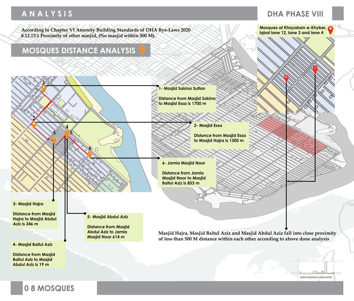
This also leads to another question, where this zone being the most planned urban infrastructure is the least pedestrian friendly. Here this map shows: massive under construction mosques, some are also vertical in status. 

Some already constructed mosques. Its is important to analyze the area of Phase VIII roughly estimate of 20 km of widespread land. Approximate area of 4320 acres with an approx length of 16’,588’ and width of 12, 603’ needs what kind of amenities if equally distributed. 

In this research I am not touching upon missing factors at how the plan is flawed since it does not include an urban plan which includes social housing, children zone, pedestrian friendly walkways, green belts, and nature reserves since the contested land is adjacent to ecology
Available parks for public are only 3 and rest are clubs and private membership based commercial spaces. Historically, mosque designs came with courtyards, which played the role of communal spaces for the emergent community during that particular time.
Development of new cultural landscapes: Its interesting to witness that a planned area focuses on structures which open 5 times a day with limitations and huge structures are being built. These generated spaces that are more exclusive spaces rather than inclusive
In phase 8 one does not witness : public amenities like community center / town hall or any congregational spaces which are for free and generate platform to encourage social and cultural interactions. Infact it continues to build high real estate commercial zones. #karachi
I spoke to residents who claimed that its surprising how these spaces are emerging without any notifications as per blueprint which keeps changing according to @DHAKarachiOfc . Amenity plots ideology is a huge question and the amount of money being invested
My query here is that since the land is contested, development of mosques in zones which are not fully inhabited become gateway to marking territory? Why so many mosques are being developed rapidly in areas especially E8 which is the most contested strip of Phase 8.
This also leads to another question, where this zone being the most planned urban infrastructure is the least pedestrian friendly. Here this map shows: massive under construction mosques, some are also vertical in status.
Some already constructed mosques. Its is important to analyze the area of Phase VIII roughly estimate of 20 km of widespread land. Approximate area of 4320 acres with an approx length of 16’,588’ and width of 12, 603’ needs what kind of amenities if equally distributed. 

In this research I am not touching upon missing factors at how the plan is flawed since it does not include an urban plan which includes social housing, children zone, pedestrian friendly walkways, green belts, and nature reserves since the contested land is adjacent to ecology 

Available parks for public are only 3 and rest are clubs and private membership based commercial spaces. Historically, mosque designs came with courtyards, which played the role of communal spaces for the emergent community during that particular time. 

Development of new cultural landscapes: Its interesting to witness that a planned area focuses on structures which open 5 times a day with limitations and huge structures are being built. These generated spaces that are more exclusive spaces rather than inclusive 

In phase 8 one does not witness : public amenities like community center / town hall or any congregational spaces which are for free and generate platform to encourage social and cultural interactions. Infact it continues to build high real estate commercial zones. #karachi
Amazing to see estimate of 20 km of widespread land- the amount of mosques which versus non commercial spaces for health, mindfulness, children, women and elderly citizens. 

• • •
Missing some Tweet in this thread? You can try to
force a refresh


