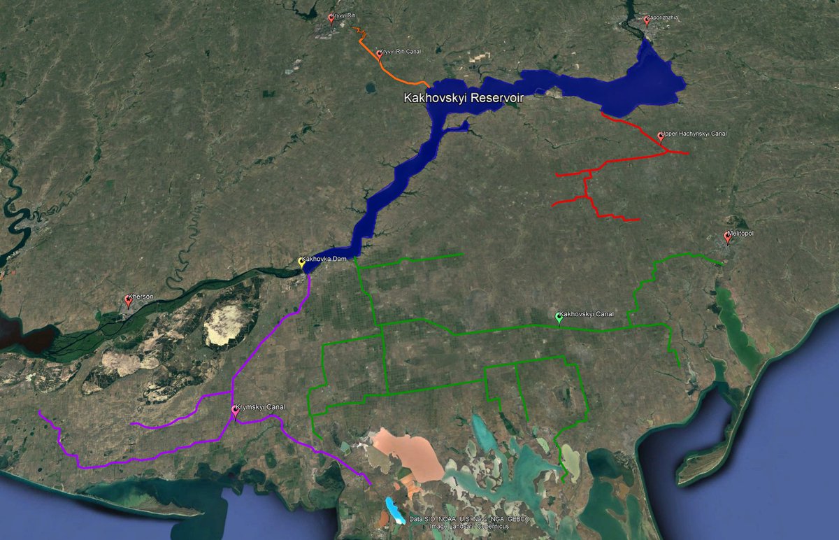
While the focus is rightly on the flooding downstream of the Kakhovka Dam, the long-term damage to Southern Ukraine's huge agricultural sector is particularly worrying.
These farms and people rely on 4 canals that flow from the (soon to be former) Kakhovskyi Reservoir. A short🧵
These farms and people rely on 4 canals that flow from the (soon to be former) Kakhovskyi Reservoir. A short🧵

I am not an expert and I don't know at what depth the pumps that feed these canals operate, but the dam was built specifically to feed these canals. Here's a soviet commemorative stamp celebrating the achievement. You can see the South Ukraine and North Crimean canals on the map. 

Even using satellite, it's obvious how important these canals are. I traced their largest components using Google Earth: you can see the fields are literally greener where the canals flow. 

Kryvyi Rih's "Southern Reservoir" is fed from the artificially high waters of the Kakhovskyi Reservoir and provides water for domestic, industrial and agricultural purposes. The lake itself is used for the breeding of commercial fish species. 

The Upper Hachynskyi Canal provides drinking water and irrigation to the towns and fields in the north of Zaporizhzhia Oblast. 

The South Ukraine (Kakhovskyi) Canal irrigates most of Kherson Oblast's seemingly endless agricultural fields, as well as supplies drinking water to the people living in the hundreds of towns and cities along the way. 

Lastly, the famous North Crimean Canal supplies water to western Kherson, as well as (obviously) Crimea. 

I was fortunate to visit much of this stunning and quintessentially Ukrainian region in 2018 and 2019. Here's a photo I took of a cute bus stop next to a gorgeous field surrounded by endless fields in the Kherson region. It's about 2km from one of the canals. 

Addendum: @ChrisO_wiki has put together an excellent thread which adds the historical context and devastating forward outlook I didn't have time to include yesterday.
https://twitter.com/ChrisO_wiki/status/1666352735132995584
• • •
Missing some Tweet in this thread? You can try to
force a refresh

 Read on Twitter


