More and more confident the Northeast could experience the worst flooding since Ida over the coming 48 hours. For some locations, this could be the most severe hydrological event since Irene. A thread on the setup, the hazard, and why I'm so concerned.

Flooding is a complicated, ingredients- and storm- based thing to forecast. But it all comes down to: will it rain enough to overwhelm natural and manmade water-removal infrastructure? Enough to send streams from banks, swamp urban drains, bust culverts and roads, sink hillsides?
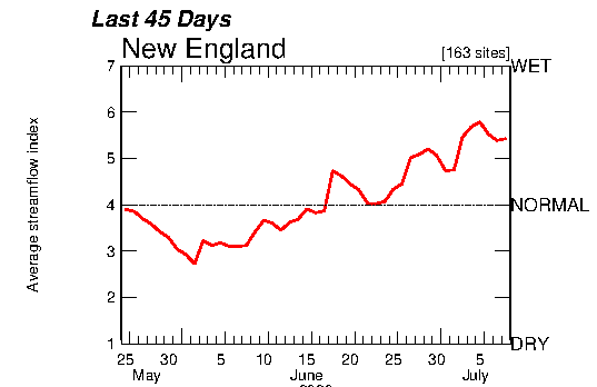
The first consideration: how much more water can these systems support? What can soils absorb? How much can rivers whisk away sans flood?
At every time interval, across mode, this answer has been reduced for much of the Northeast by substantial saturation over the last month.
At every time interval, across mode, this answer has been reduced for much of the Northeast by substantial saturation over the last month.

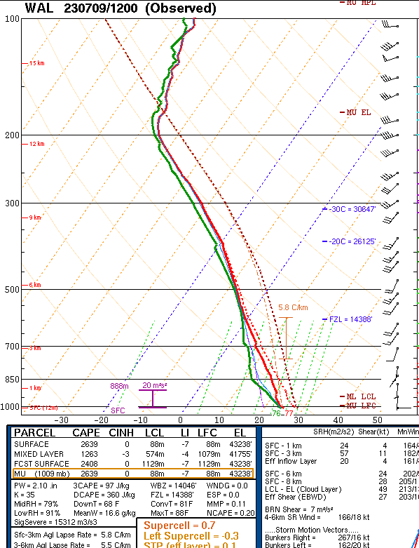
Now to the rain itself: how much water ends up at the surface is a function of how heavy and prolonged rain is. This requires understanding the atmospheric ingredients at play, as well as the expected behavior of the storms that end up developing.
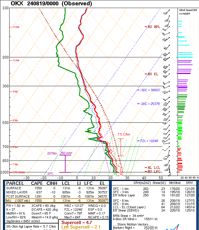
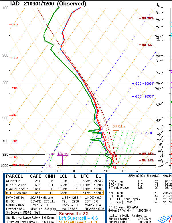
The advecting ingredients are absolutely loaded for heavy, efficient, tropical rain. Deep tropospheric saturation, widespread moderate instability, PWATs approaching 2", and impressive midlevel warmth: The atmosphere could almost not be more favorable for extreme rain rates.
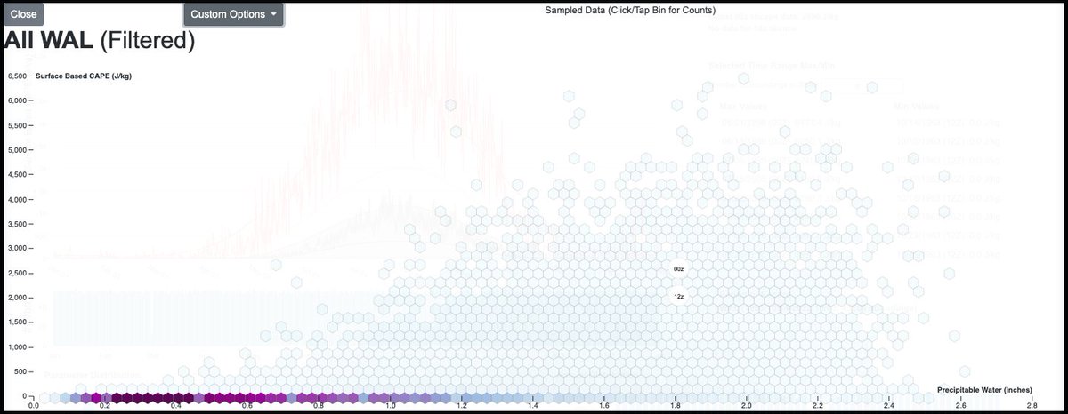
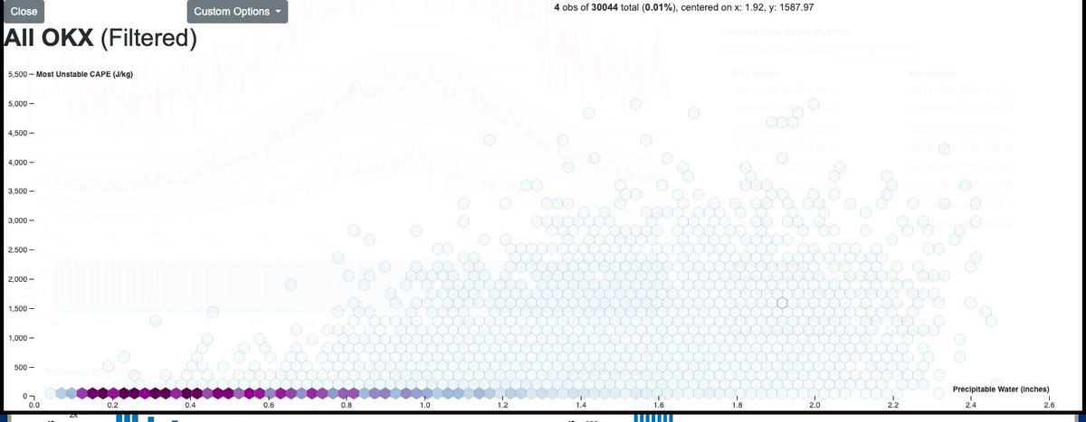
For comparison's sake:
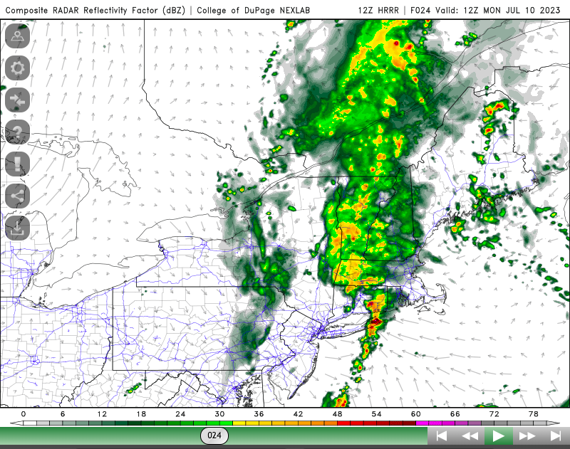
Per convective models, storms will initiate rapidly and widely from Virginia to Canada E of a SSE->NNW oriented cold front. They will backbuild, root to topography, and synoptically train through dark. Some places will see extreme rain.
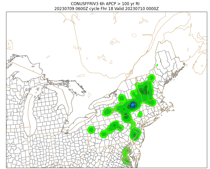
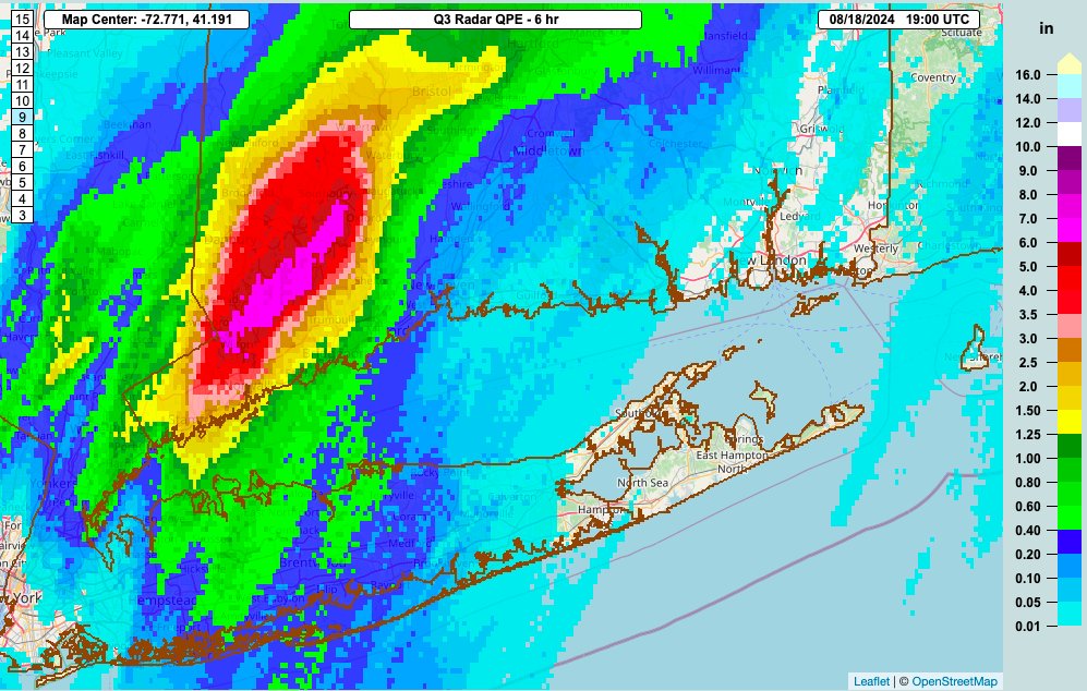
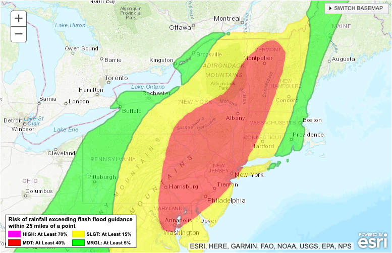
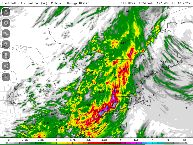
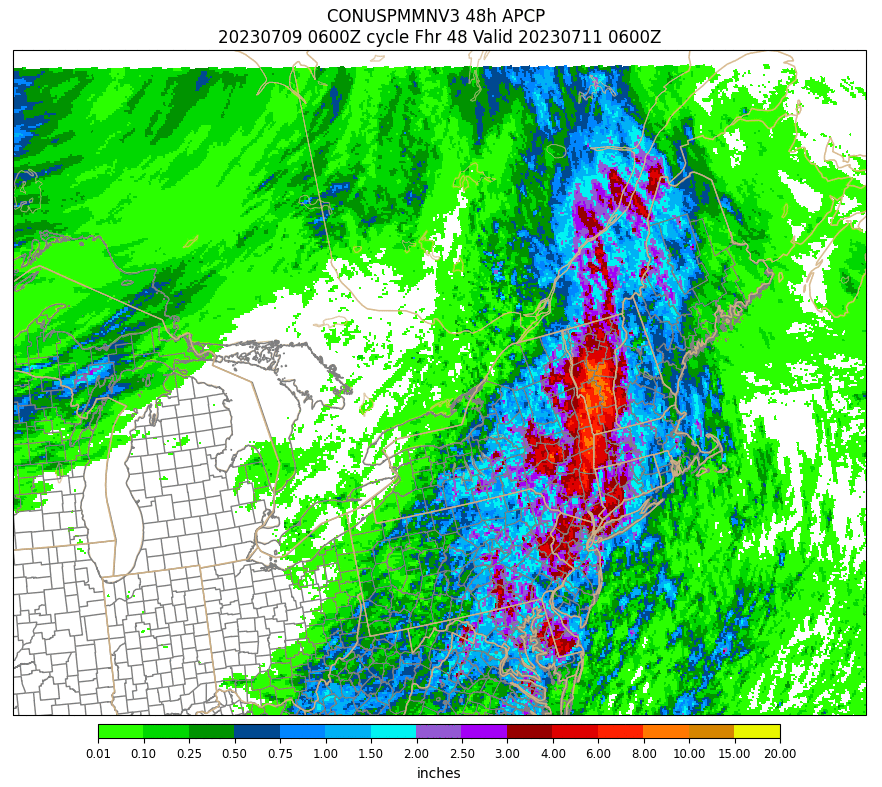
By 12z Mon, many instances of significant flash flooding will likely be ongoing. A couple events may be catastrophic. HRRR has several separate zones of 6-10+" rain/24 hr developing in SNE by morning. The locations likely aren't representative of reality, but the amounts may be.
Where this exceptional convective rain event develops remains uncertain, but models are honing in on a corridor generally from the NE Mid-Atl to the topography of the Catskills through central Vermont and adjacent New Hampshire.
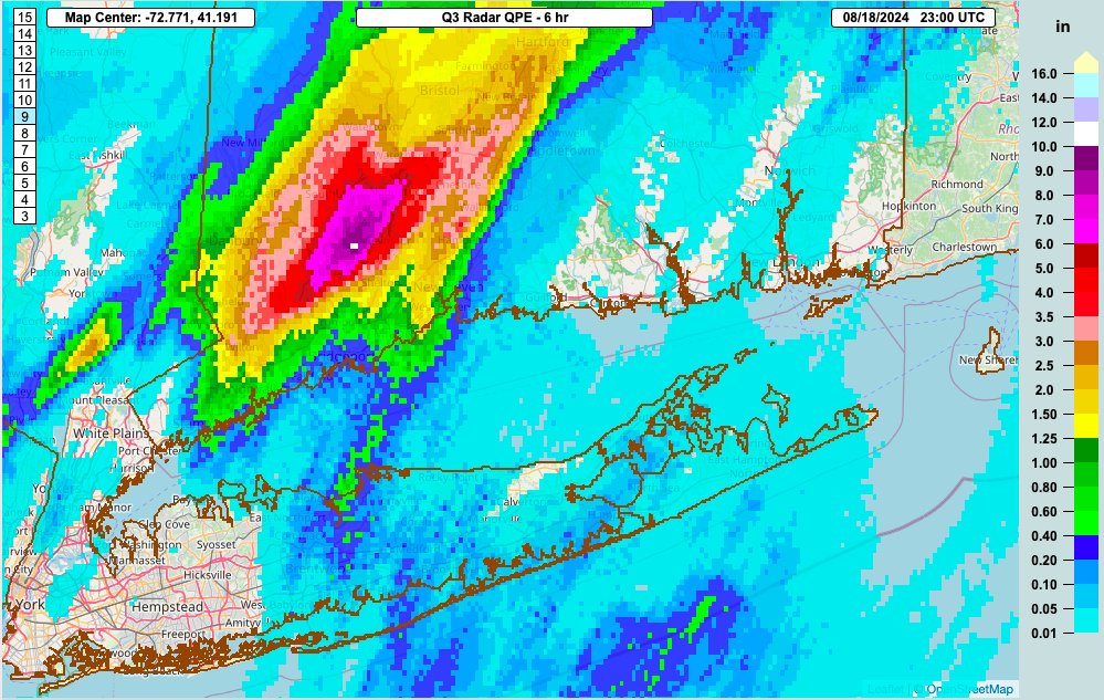
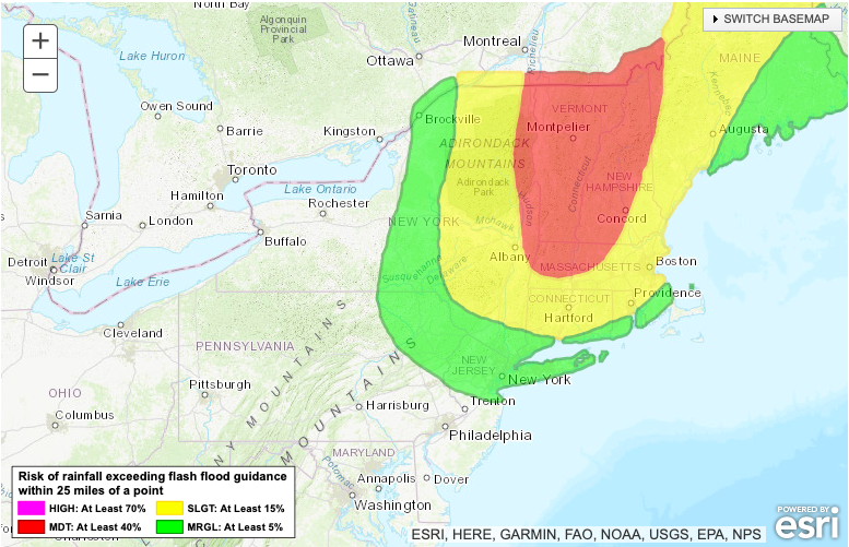
Round one will barely have ended tomorrow morning when round two gets going. As a surface low slides north along the front, very prolific stratiform rain a-la-tropical cyclone rain shield, with embedded convection, will likely overspread the north-central Northeast.
As another slug of substantial rain- 2 to 6 inches- falls on Monday, across areas already impacted by Sunday's convective flash flooding, a significant, potentially catastrophic flood event will develop. This will probably be focused in Vermont, along with adjacent NH/NY/MA.
If you live anywhere in the moderate risk areas posted by the WPC (slide 1), make sure your WEA alerts are on. Normal flash flood warnings don't typically trigger these alerts, but the higher-end warnings reserved for significant events will. Make sure to sleep with your phone.
If you live somewhere exceptionally vulnerable- think basement apartment, streambank, mountainside- make sure you have an evacuation plan, bag, and route. Hopefully you won't need it, but somebody somewhere over the next 48 hours probably will
And remember- TURN AROUND DON’T DROWN. Crossing moving water- even if you think you can make it- is never worth a potential tragedy.
• • •
Missing some Tweet in this thread? You can try to
force a refresh