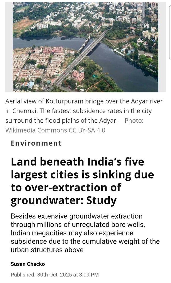
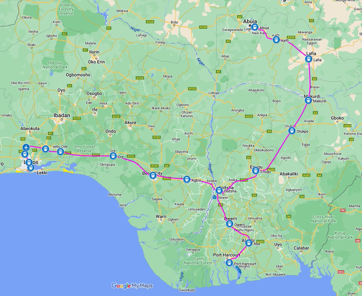
With the Lagos blue line seeing strong patronage, I'd like to turn some attention to the ill-fated Abuja metro.
I had proposed short term solutions to make the line more useful once its restarted, but here, I'll look at some necessary capital investment for network expansion.
I had proposed short term solutions to make the line more useful once its restarted, but here, I'll look at some necessary capital investment for network expansion.

Quick recap, the metro opened in 2018 with a multitude of bad planning decisions that led to it being shut down only 2yrs later in 2020.
https://twitter.com/TonamiPlayman/status/1574663803861487618?s=20
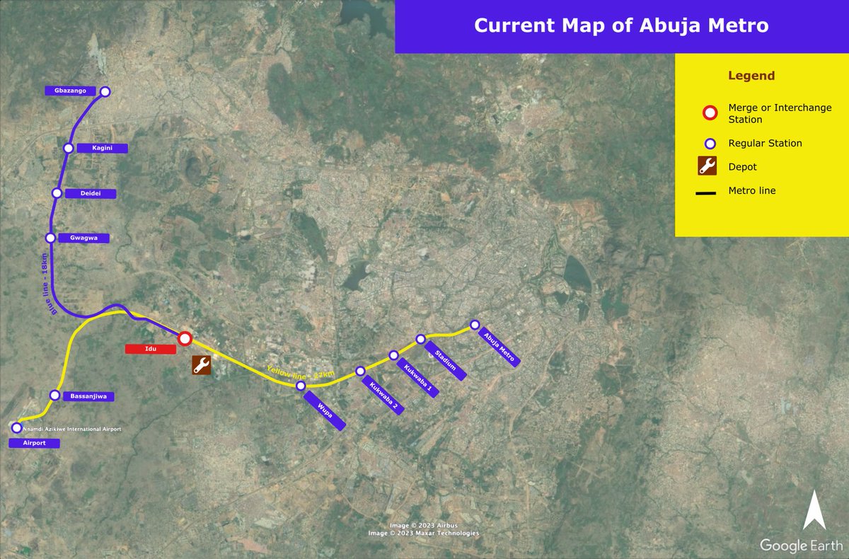
This is the current map of the Abuja metro. Operations started in 2018 serving only 3 stations, Airport, Idu, & Abuja metro on the Yellow line.
The other 4 stations on the Yellow line were skipped and none of the stations on the Blue line were served.
The other 4 stations on the Yellow line were skipped and none of the stations on the Blue line were served.
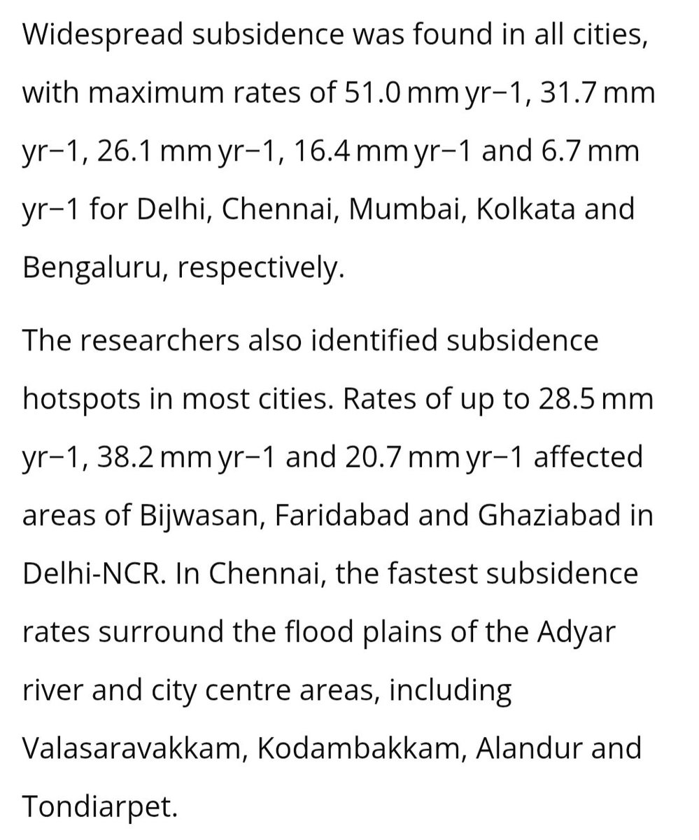
My proposal for restarting the line involves reprioritization of the branches & bringing all 12 stations into service.
The Gbazango branch gets higher priority with 15min service, while the Airport branch gets 30min service.
The Gbazango branch gets higher priority with 15min service, while the Airport branch gets 30min service.
https://twitter.com/TonamiPlayman/status/1677606619725840384?s=20
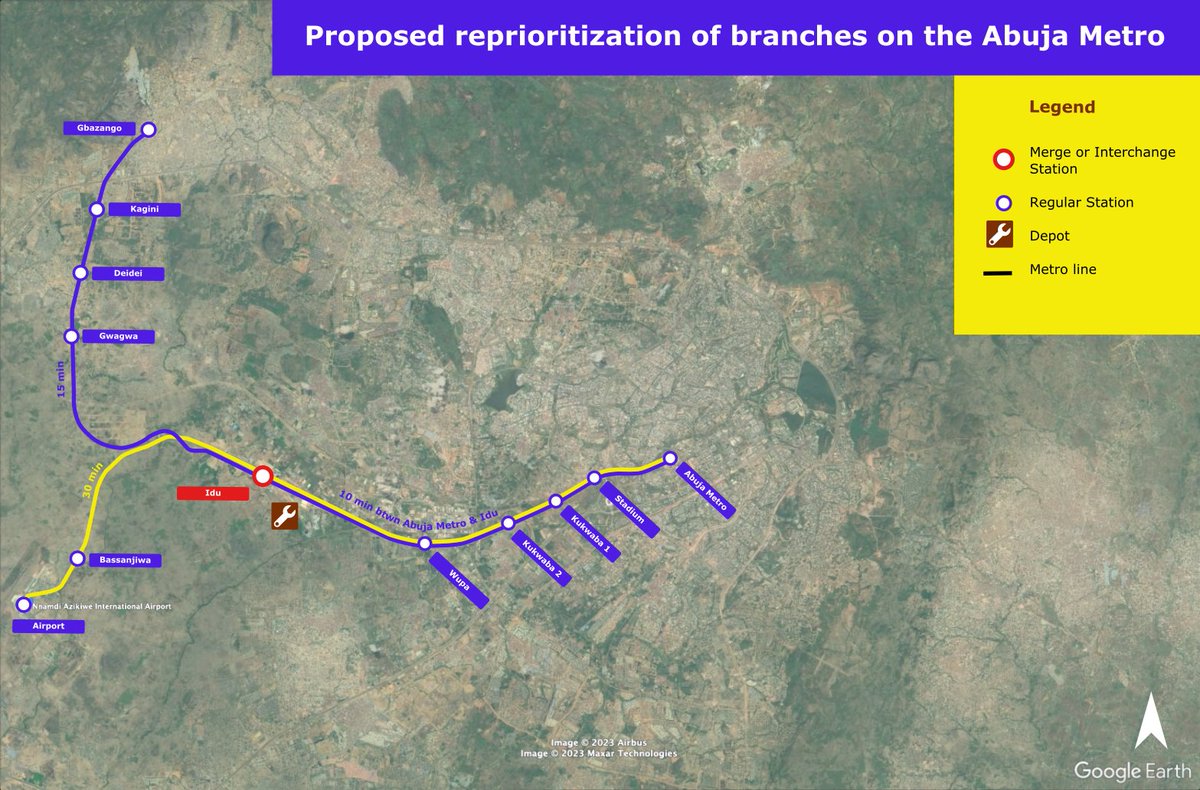
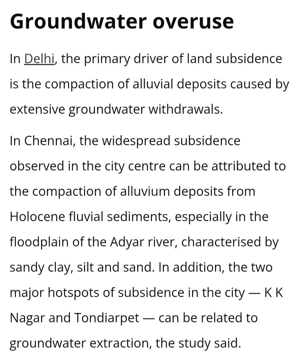
Both branches will combine for 10 min service (6tph) in the core between Abuja Metro & Idu.
https://twitter.com/TonamiPlayman/status/1677607142059286529?s=20
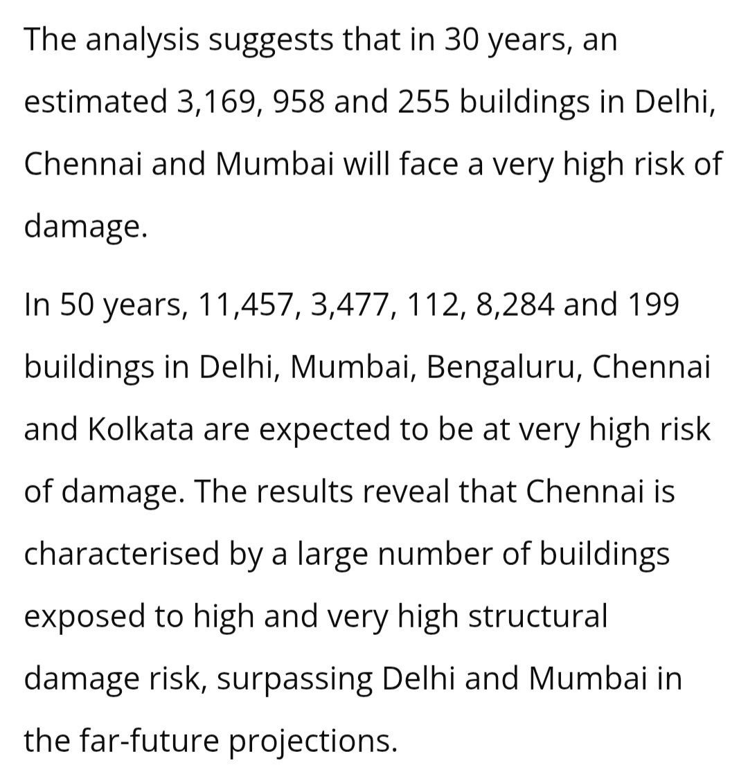
Now back to the expansion plan.
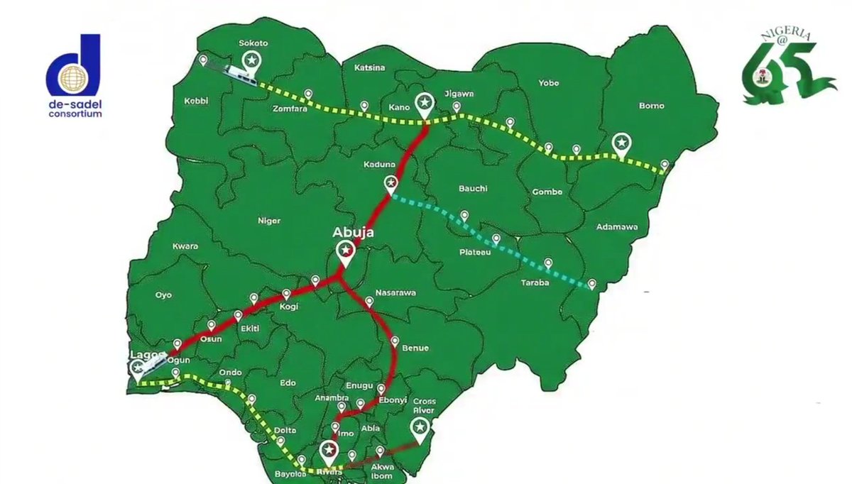
I propose 3 new lines in order of build priority.
1. Yellow - Kubwa extension - 1.9km
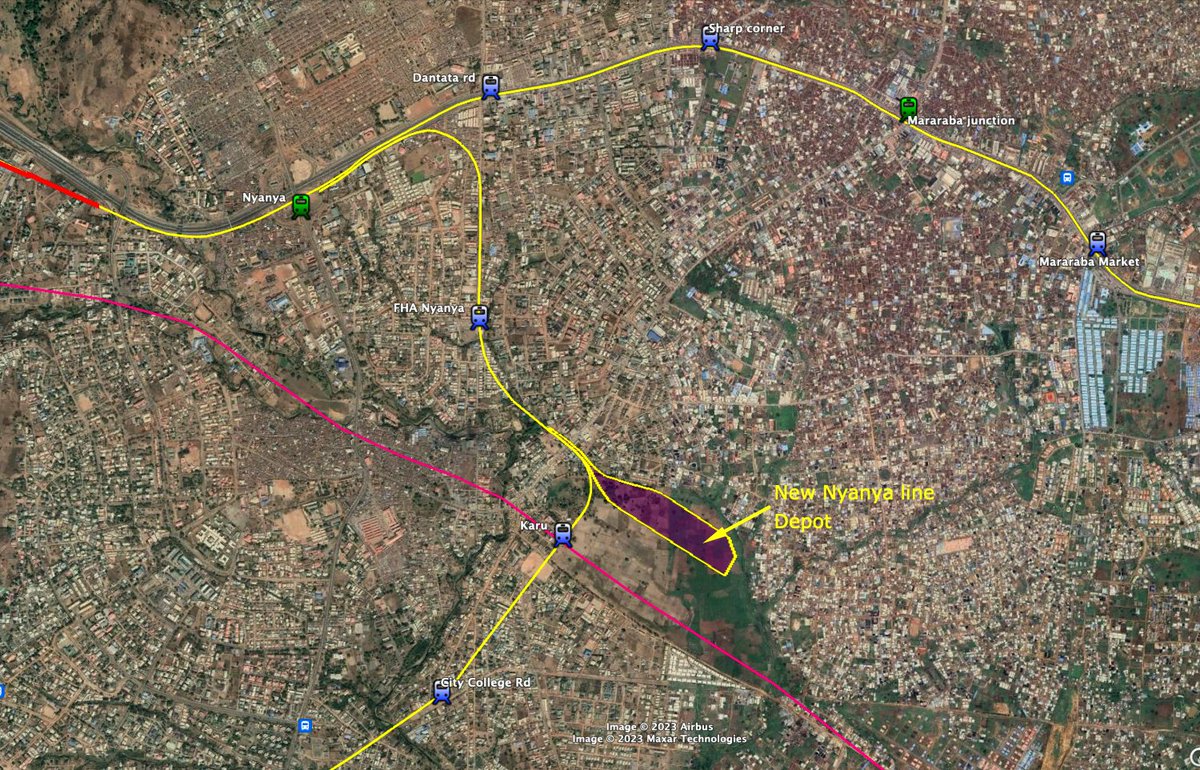
2. Yellow - Abuja Central to New Nyanya 22km+ a 6km Karshi branch.
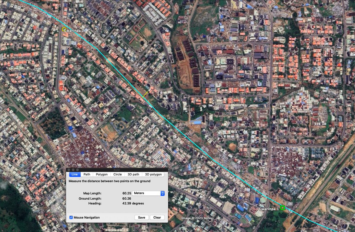
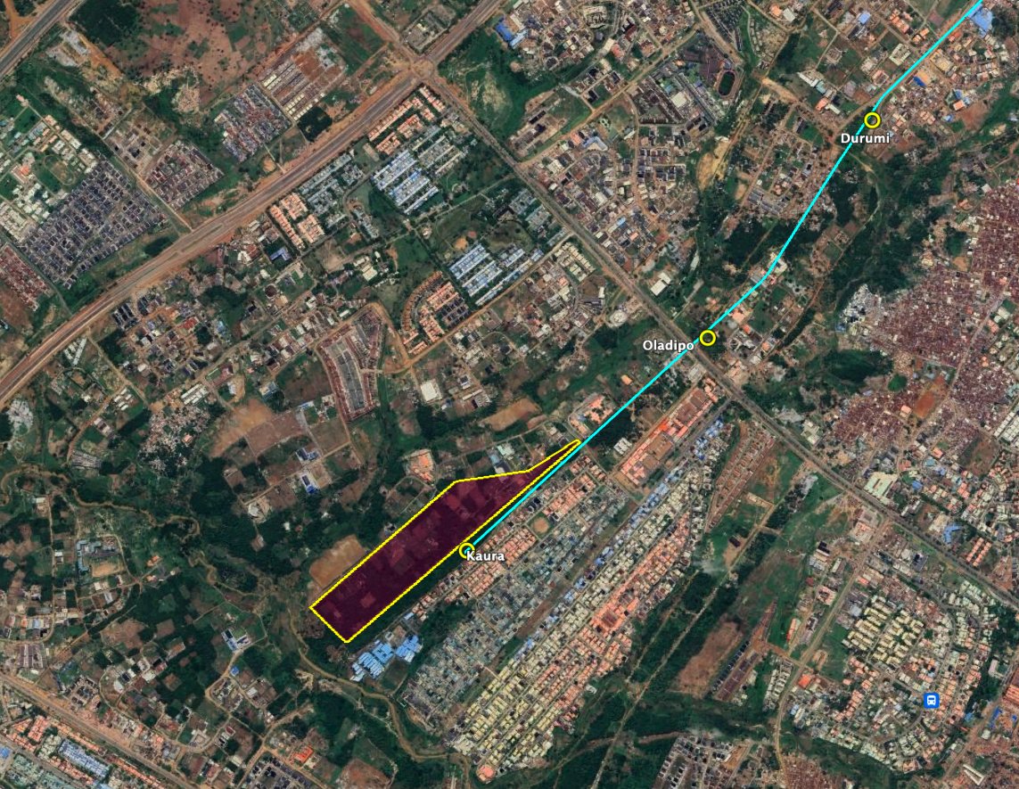
3. Teal - Gwarinpa to Kaura - 24km
4. Red - Karmo to Lokogoma - 24km
I propose 3 new lines in order of build priority.
1. Yellow - Kubwa extension - 1.9km
2. Yellow - Abuja Central to New Nyanya 22km+ a 6km Karshi branch.
3. Teal - Gwarinpa to Kaura - 24km
4. Red - Karmo to Lokogoma - 24km
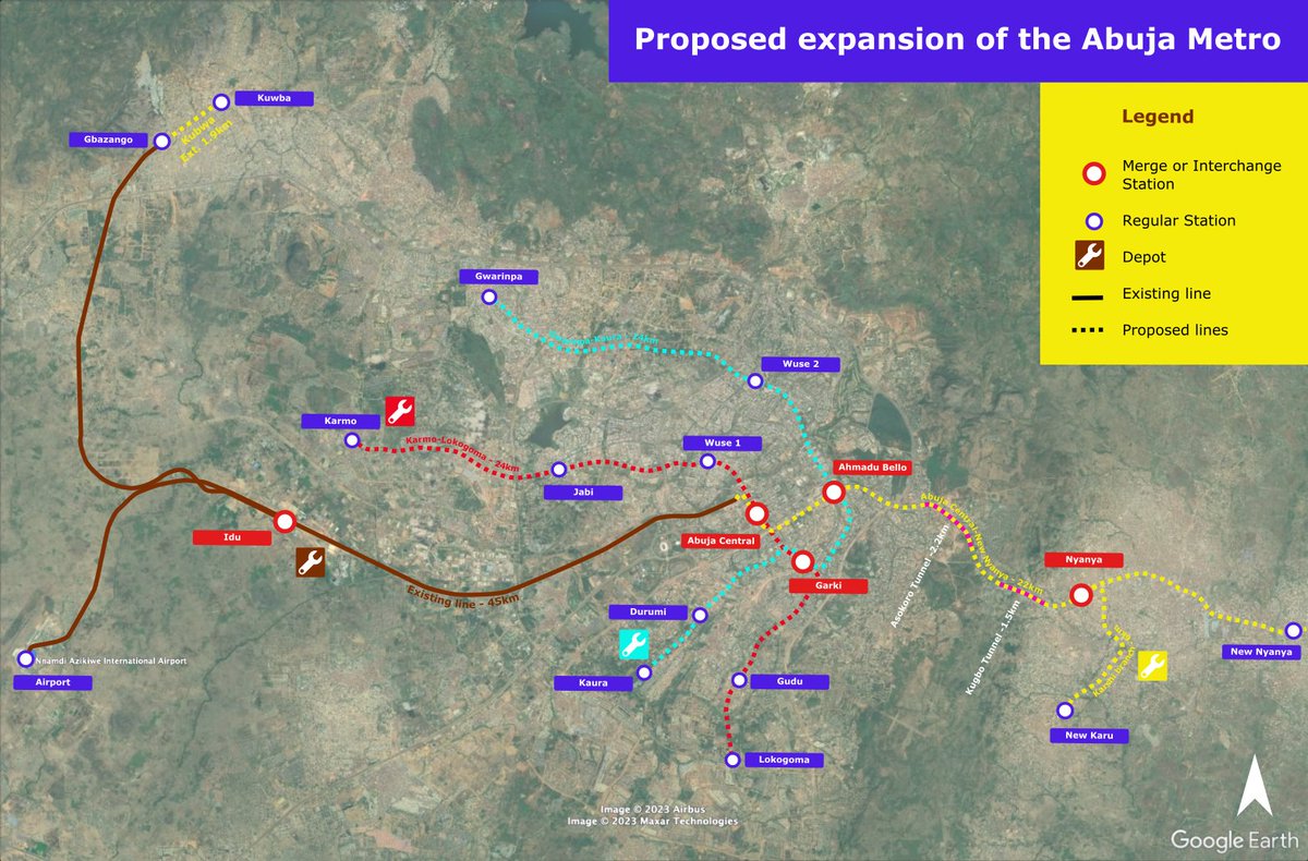
The new Yellow line to Nyanya will be an extension of the existing network.
The New Nyanya branch will be paired with the Kubwa branch and serve the densely populated suburbs of Nyanya & Mararaba.
The Karshi Branch will be paired with the Airport branch.
The New Nyanya branch will be paired with the Kubwa branch and serve the densely populated suburbs of Nyanya & Mararaba.
The Karshi Branch will be paired with the Airport branch.
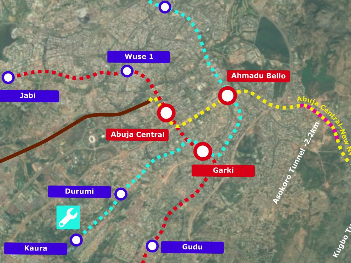
The New Nyanya line will be mostly elevated, but will require 2 tunnels to traverse the Asokoro escarpment at acceptable 4% grades.
Asokoro Tunnel - 2.2km
Kugbo Tunnel 1.5km
Both Tunnels can be built Cut & Cover along with the stations.
Asokoro Tunnel - 2.2km
Kugbo Tunnel 1.5km
Both Tunnels can be built Cut & Cover along with the stations.
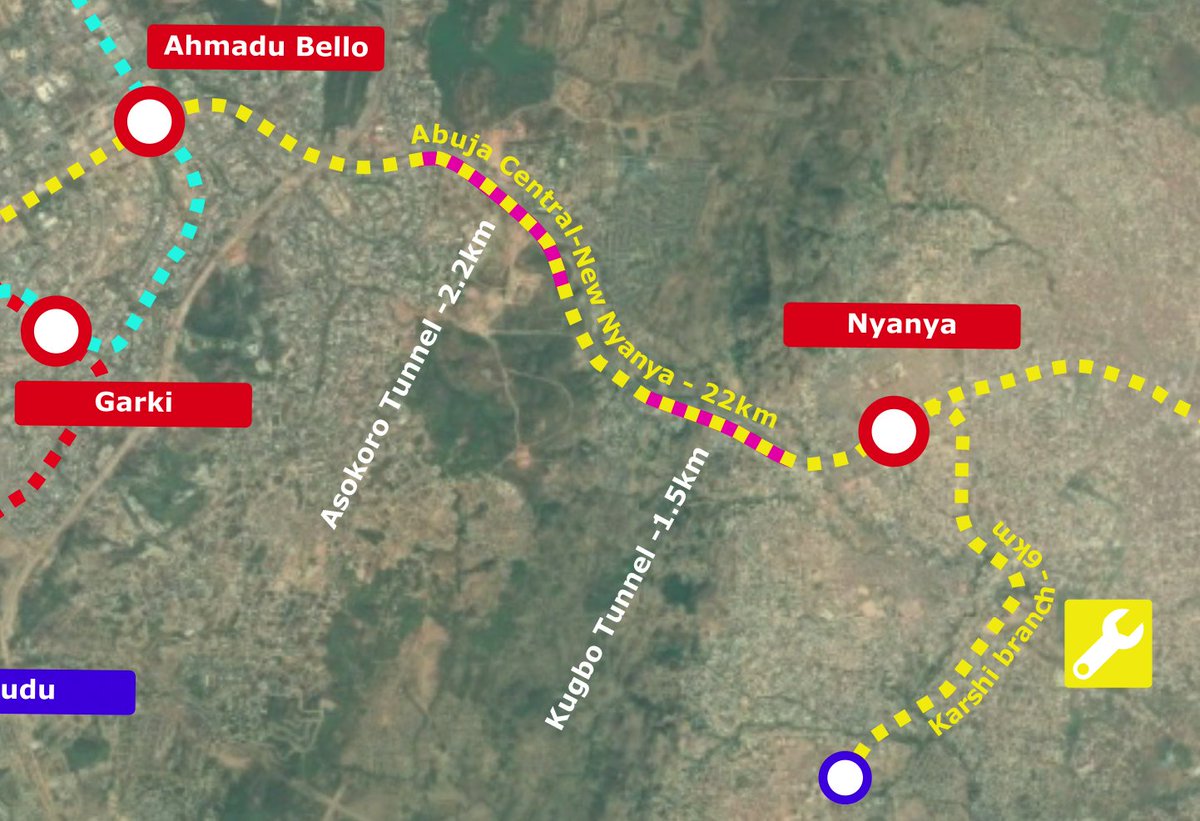
Those 2 stations will be the only underground stations in the system at Mogadishu & Kugbo.
The Depot of the New Nyanya line can be located next to the Karu station.
The #3 priority line is the Gwarinpa line (Teal) runs through the existing 60m wide reserved right of way and can be built on an embankment with concrete retaining walls.
The Depot for the Gwarinpa line can be located in Kaura next to the Kaura station. The site would have to be acquired from its existing owners with compensation.
The #4 priority line is the Red line going through Wuse. It also has a reserved right of way that reaches 70m width in some spots.
Just like the Gwarinpa line, it be built on embankments.
Just like the Gwarinpa line, it be built on embankments.
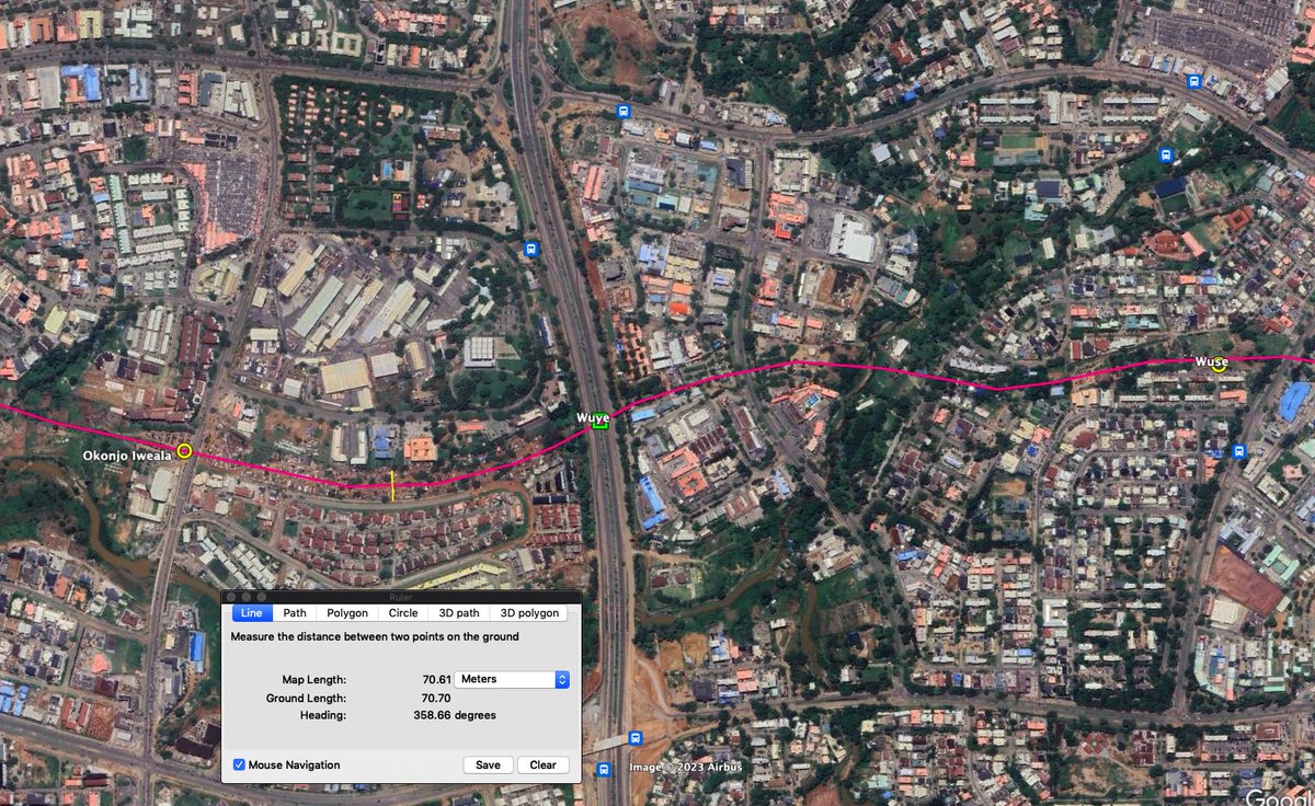
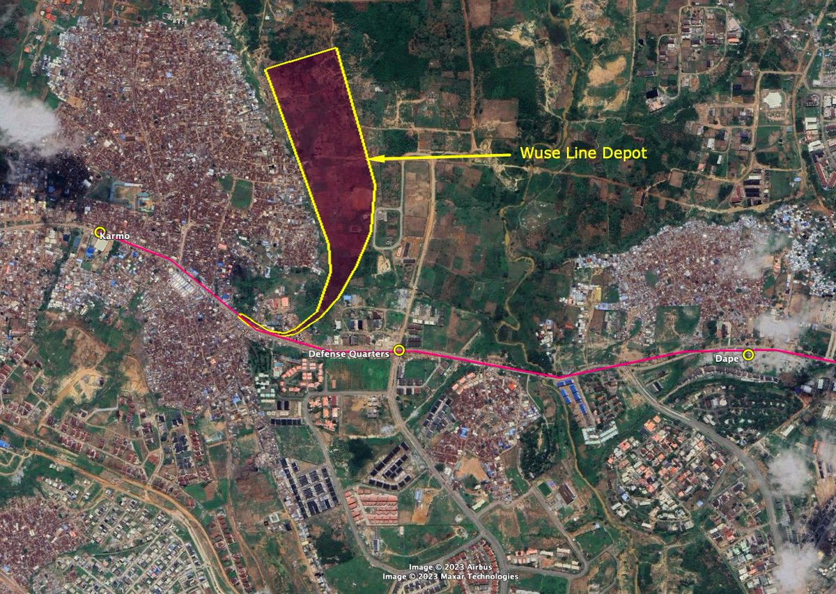
The depot for the Wuse line (Red line) can be located between Karmo station & Defense Quarters station.
The 3 lines will all meet at a triangle of stations with 2 line interchanges at
Abuja Central between the Red & Yellow line,
Garki Station between the Red & Teal line,
And Ahmadu Bello Station between the Yellow & Teal line.
Abuja Central between the Red & Yellow line,
Garki Station between the Red & Teal line,
And Ahmadu Bello Station between the Yellow & Teal line.
Both the Red & Teal lines with wide reserved ROWs should be built quad track to enable express & local services, with the expresses becoming very useful in future outer extensions.
The express stations can use a similar layout to the Van der Madeweg staion in Amsterdam.
The express stations can use a similar layout to the Van der Madeweg staion in Amsterdam.
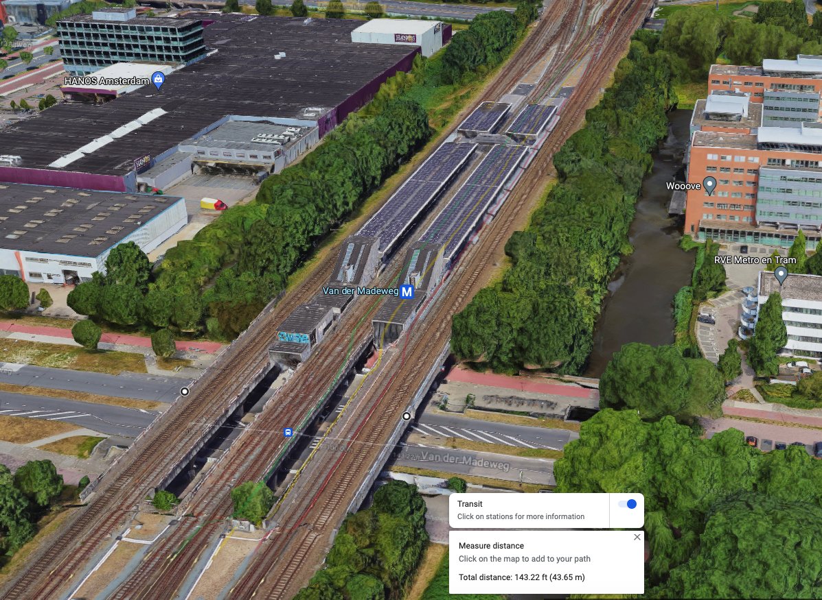
Running 2 central local tracks & 2 outer express tracks. The 2 local tracks can be built first, but the embankment should be wide enough to accommodate the 2 express tracks at a later date.
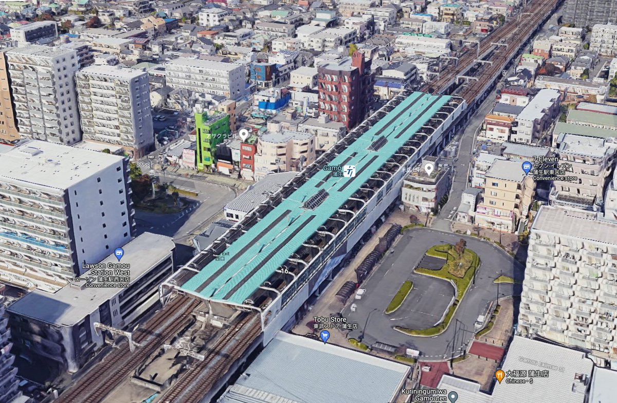
The local stations can use a similar layout to the Gamo Staion on the Tobu Skytree line with a single island platform and 2 tracks on either side.
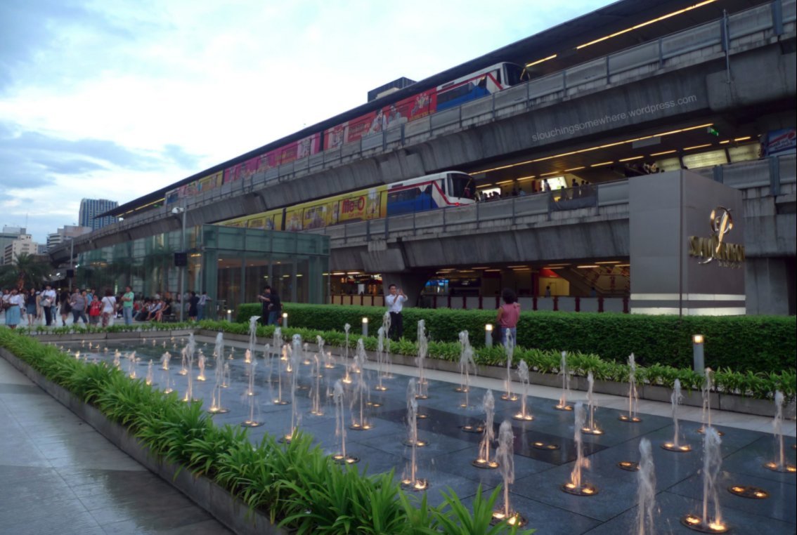
The Yellow line would be a double deck layout. The elevated sections would be similar to the double deck section of the Bangkok metro around Siam station, while the underground section would be stacked track layout built cut & cover.
For the Abuja metro, the Teal & Red lines would be much easier to build since they have a reserved ROW and would need less complex elevated or underground structures.
The system just has to be prioritized right & built accordingly.
The system just has to be prioritized right & built accordingly.
• • •
Missing some Tweet in this thread? You can try to
force a refresh