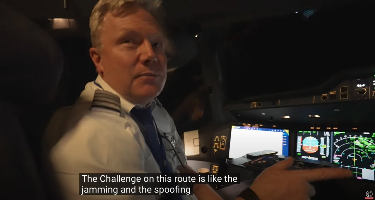
Interesting video from the cockpit of an A350 flying from Copenhagen to Bangkok. "The challenge on this route is like the jamming and the spoofing. But we know how to deal with that now. You'll see later on when we come close to Ukraine a lot of our systems will fall out"
"The worst thing about this is the spoofing so uh because of the jamming the airplane may think it's it's a different place than where it is right so and then it'll it could give us some failures that we have to handle."
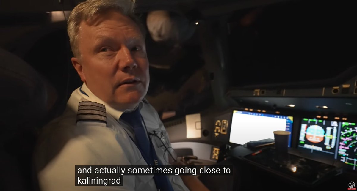
"That also happens in the northern part of uh Norway and actually sometimes going close to Kaliningrad."
[They start to lose GPS.] "It's only a problem if you are going to land somewhere." "For en route navigation is not a problem we use this system. The IRS, the inertial reference system, that's super reliable."
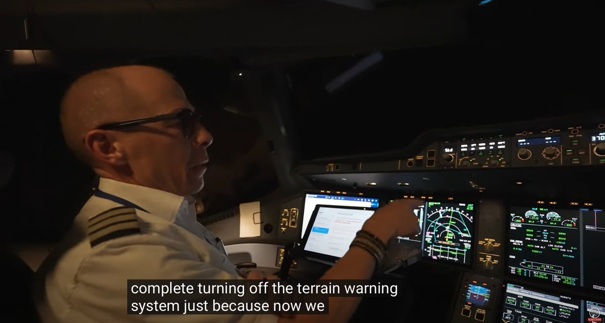
"Turning off the terrain warning system, just because now we get so many of these jamming problems that we want to make sure that we don't get these terrain warnings on the screen in the middle of the night."
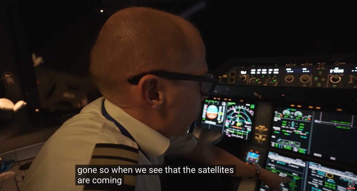
"Right now we have no satellites at all, all the satellites are gone so when we see that the satellites are coming back then we can turn it back on again."
Video:
Systems listed in orange are inoperative. RNP AR, GNSS 1, ADS-B TRAFFIC 1+2, APU, GLS AUTOLAND, GLS 1, SLS 1.
"I was sitting here one day, and I saw the clock going backwards."
Watching these pilots deal with systems they can no longer use or trust, I'm reminded of a quote from a major airline's Chief Operations Officer about GPS interference: "Navigation is not my problem. My problem is normalization of deviance."
I think this is the flight: SAS973 on 2024-03-19 (thanks, @giammaiot2). The bad GPS jamming happened over the Black Sea, about 10 minutes before entering Turkey.
• • •
Missing some Tweet in this thread? You can try to
force a refresh
It's been a long time since I worked with ArduPilot Mission Planner, but I think this screenshot suggests this drone navigated to the airfield autonomously and then was hand-flown into the target. "PosHold", "0m>6" and the map in the upper left are the clues. 1/
The map shows pre-planned waypoints, and 0m>6 means the drone is 0 meters from the 6th waypoint. During the video the drone is in PosHold mode, in which the drone keeps its position unless the pilot gives stick inputs.
In PosHold, if the pilot releases the sticks the drone will come to a stop. Perfect for hand-flying over a high-latency cellular link. It could have been completely autonomous, but that would have increased complexity and likely decreased reliability.
It's illustrative to compare the DHL flight that crashed, BCS18D, to another 737, THY9JS, that did an ILS approach to the same runway. I'm not a pilot, but the DHL flight looks high, fast, and missed the initial ILS capture. They were behind the plane for most of the approach.
Both planes came from the same direction for the approach into Vilnius rwy 19 via ILS. The DHL flight was higher and faster for most of the approach, which may be why they missed the initial ILS capture and went through the extended runway centerline before lining up for final.
The ADS-B data shows that the DHL flight had a higher altitude, with a higher ground speed and descent rate for much of the approach, until about the last 60 seconds when they got on track.
Video demo of an AI-powered global aviation situational awareness and analysis tool. It's accessing a live, real-time data feed, to answer questions like "What are the 3 aircraft closest to Area 51?" and "How many military aircraft are flying over Germany?"
Some notes on this demo: It uses the OpenAI realtime API, which is a new low-latency audio-to-audio model. It's fast, but it's not the smartest model. I gave it access to two tools: one plots markers on the map, the other does SQL queries.
It makes several mistakes. One reason it (usually) shows its queries, displays things on a map and shows a results table is to make errors and wrong assumptions more obvious and make results verifiable. Maybe a fun little second video would be to catalog its mistakes.
Short thread on how I made this map, which shows areas where aircraft are being affected by GPS spoofing, and the locations they're being spoofed to (not the location of the spoofing transmitter):
Wired retracted the op-ed claiming Google alters search results to make more ad money. The story fed into existing beliefs about Google and tech and spread super fast. But the stories we want to believe are the ones we should scrutinize most. wired.com/story/google-a…
First I was skeptical because it fit so well into those existing beliefs. Then I realized the story had one source–I couldn't find any other reporters at the Google antitrust trial who mentioned what was clearly a bombshell. That's when I figured it was a misunderstanding.
Thinking through how ads would get matched to search queries, I realized I could easily imagine query rewriting being part of that, just as described, except not affecting the search results. That seemed to make a misunderstanding even more likely.