Here is a thread of my favourite maps of Africa. Let me know which you like most and give me your best theories for how thel all fit together.
Starting with population. 1/10
Starting with population. 1/10

Forests. 2/10

Livestock. 3/10

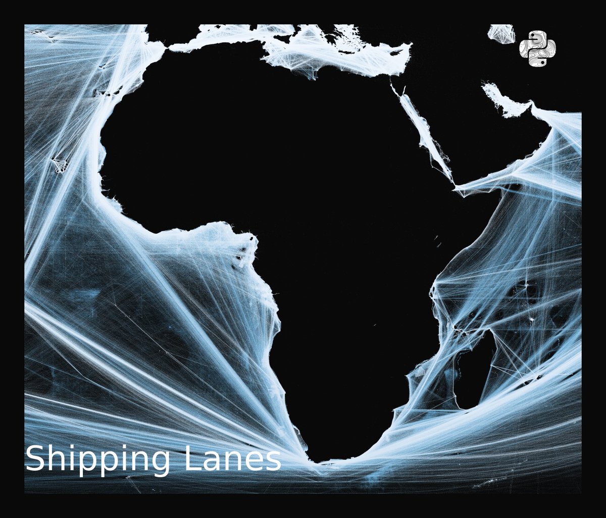
Shipping Lanes. 4/10
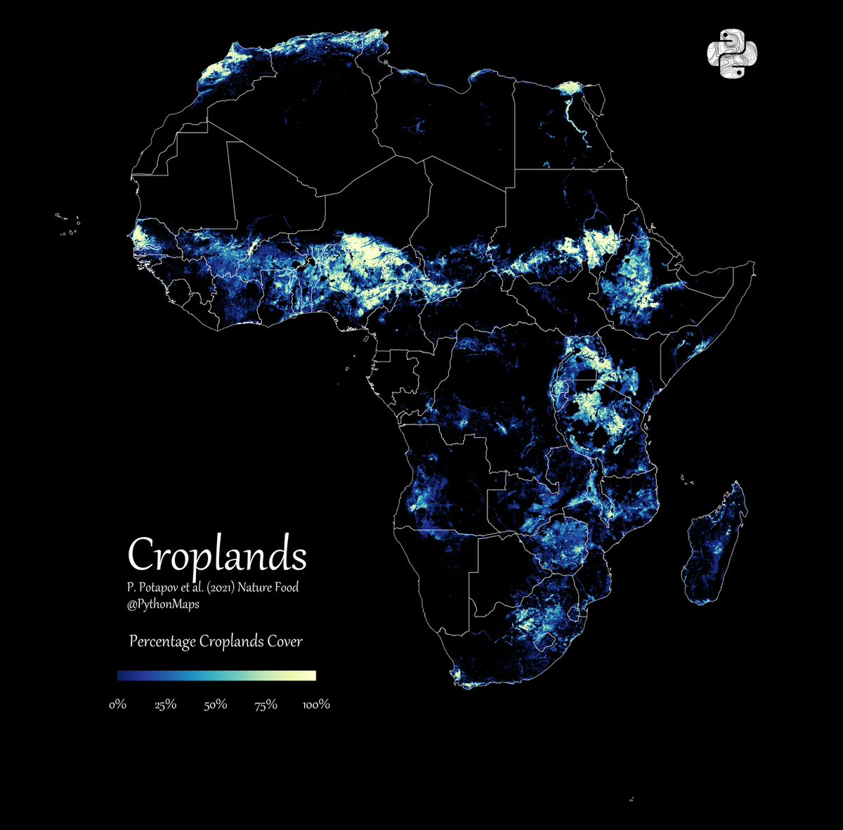
Croplands. 5/10
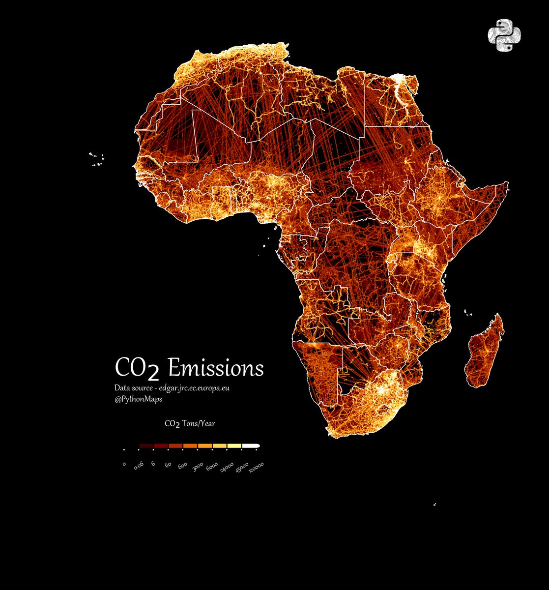
Emissions. 6/10
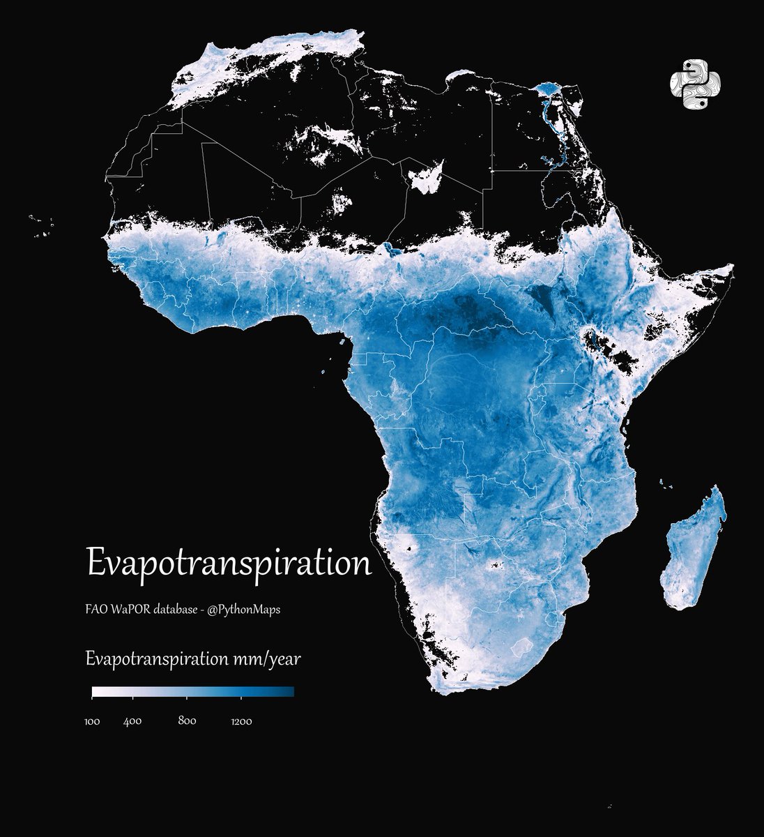
Evapotranspiration. 7/10
Roads. 8/10

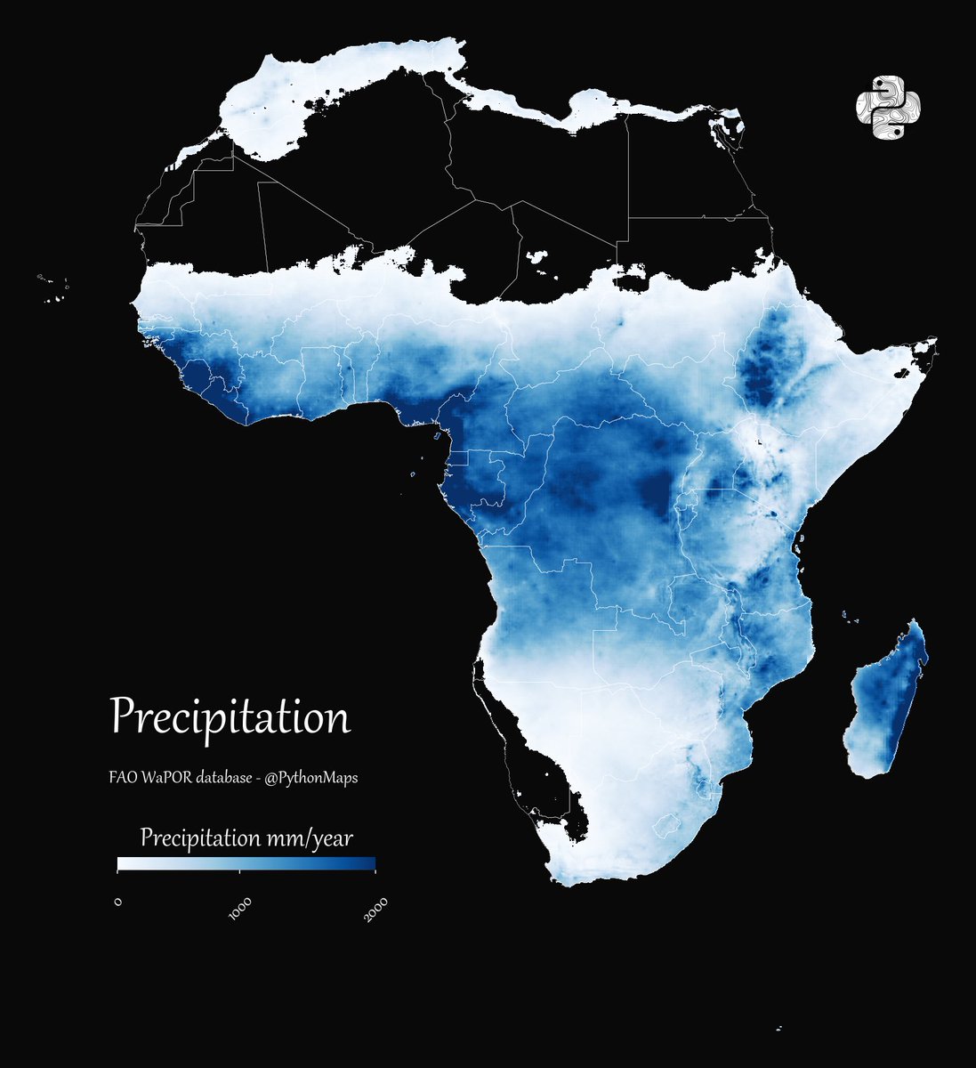
Rainfall. 9/10
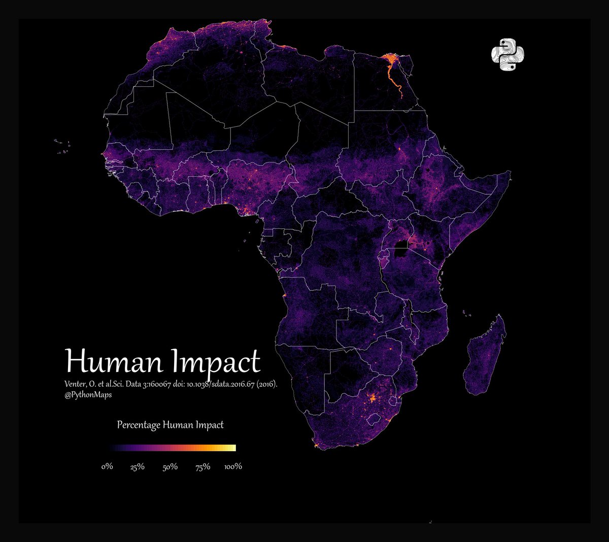
Human Impact. 10/10
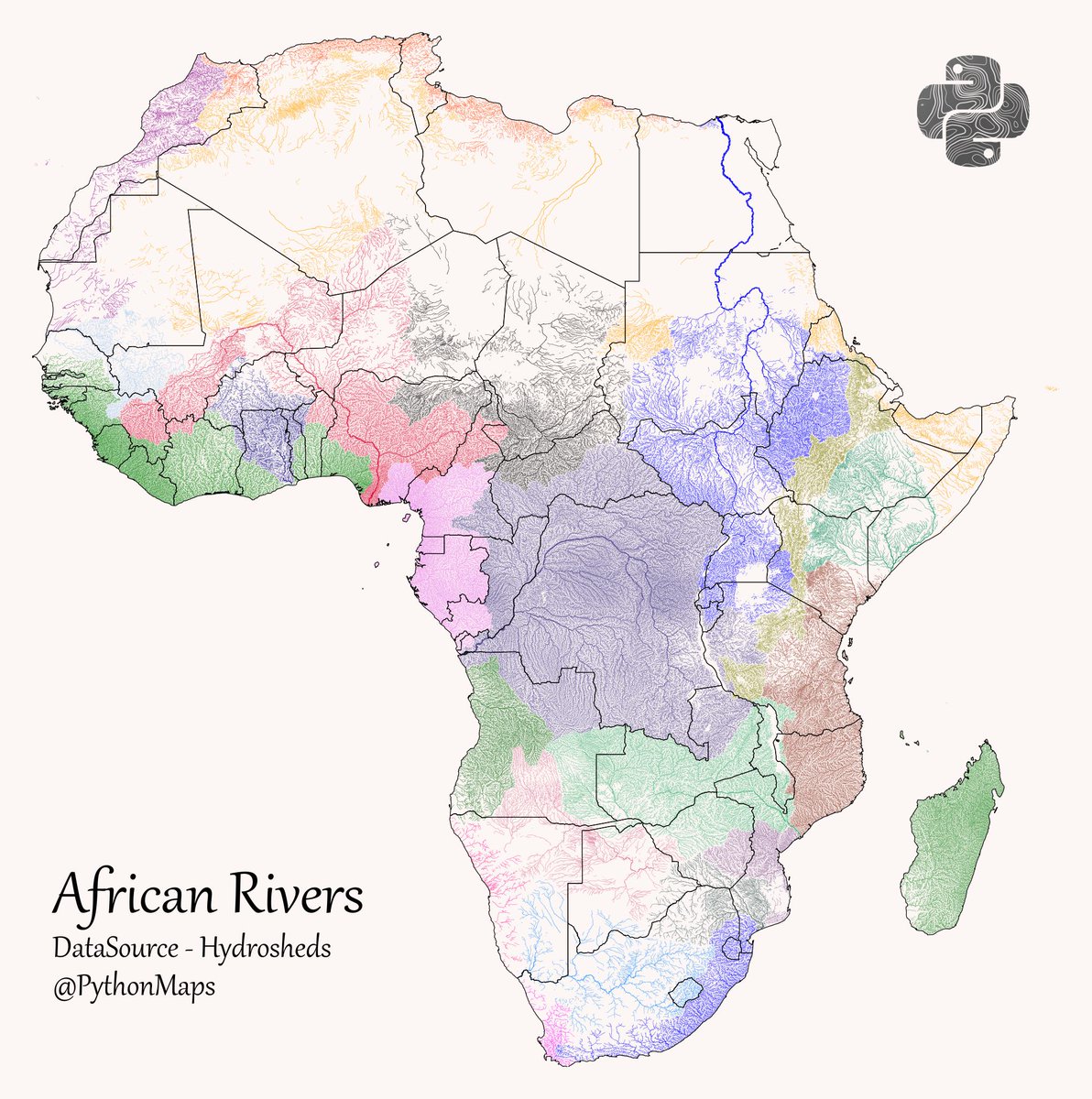
How can I forget. Rivers. 11/10
• • •
Missing some Tweet in this thread? You can try to
force a refresh