
Another thread of maps I like. This time we are looking loosely at the Indian sub continent. Included are India, Pakistan, Afghanistan, Nepal, Bhutan, Bangladesh, Sri Lanka and Myanmar.
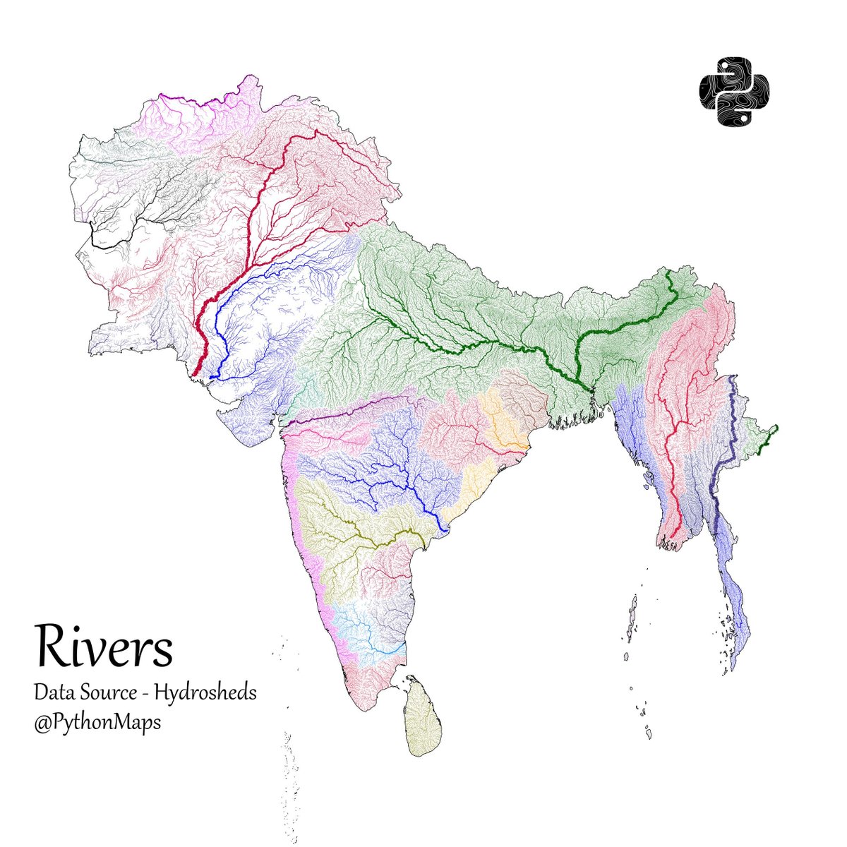
First up, Rivers! 1/13
First up, Rivers! 1/13
Population - using data from @KonturInc 2/13

Forests - using everyones favourite colourmap. 😉3/13

Grasslands. Data comes from Global Land Cover-SHARE (GLC-SHARE) database. 4/13

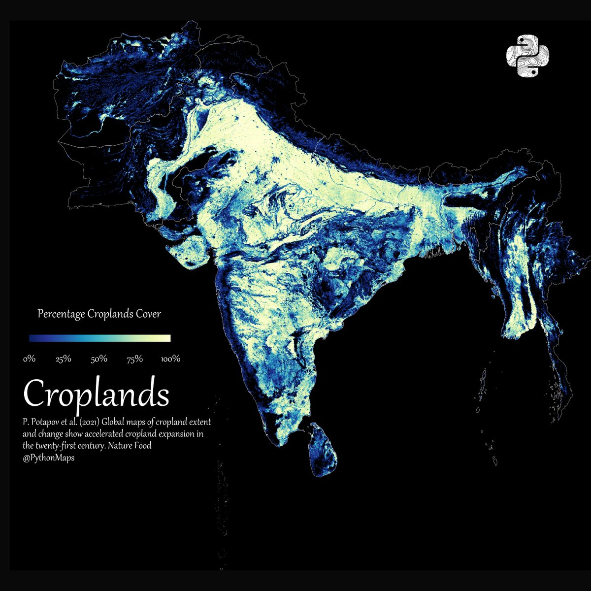
Croplands 5/13
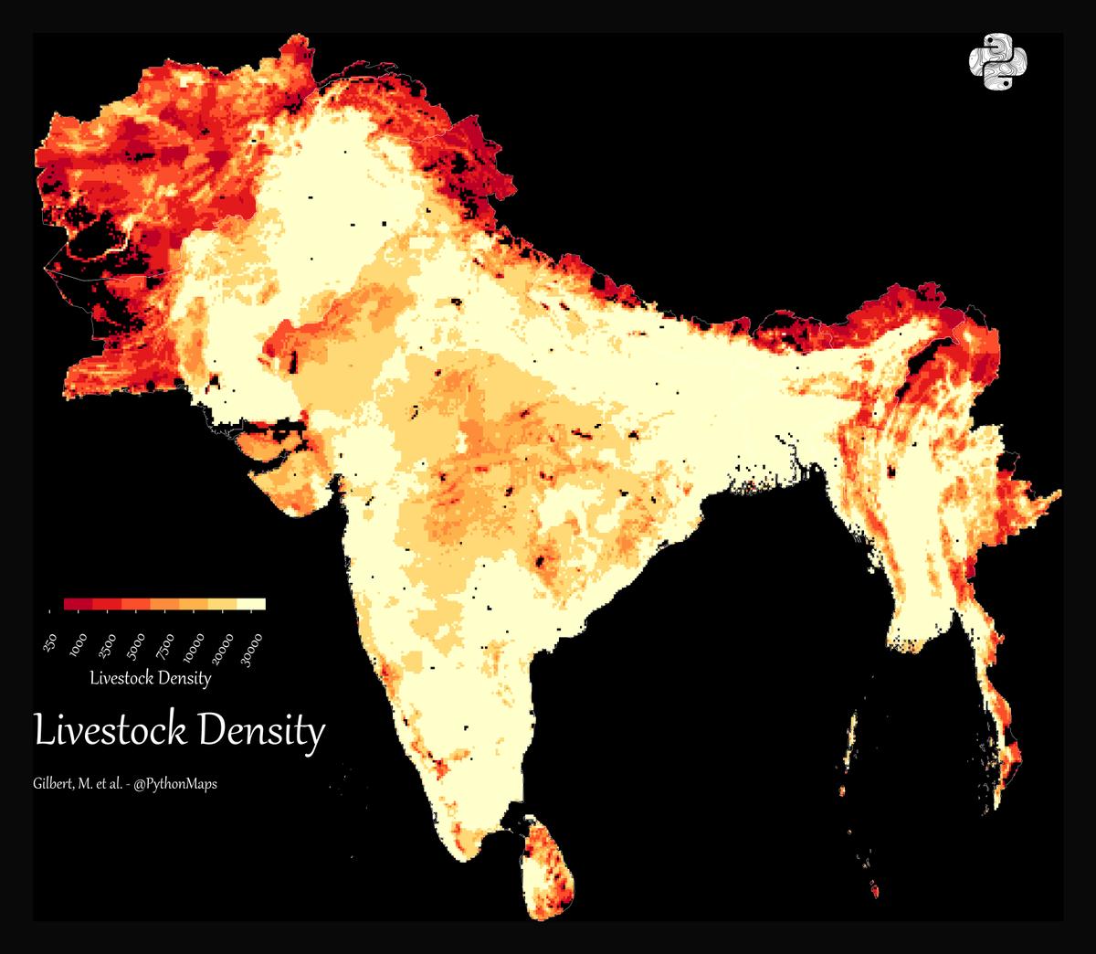
Cattle density 6/13
Pig density. 7/13

Shipping lanes 8/13

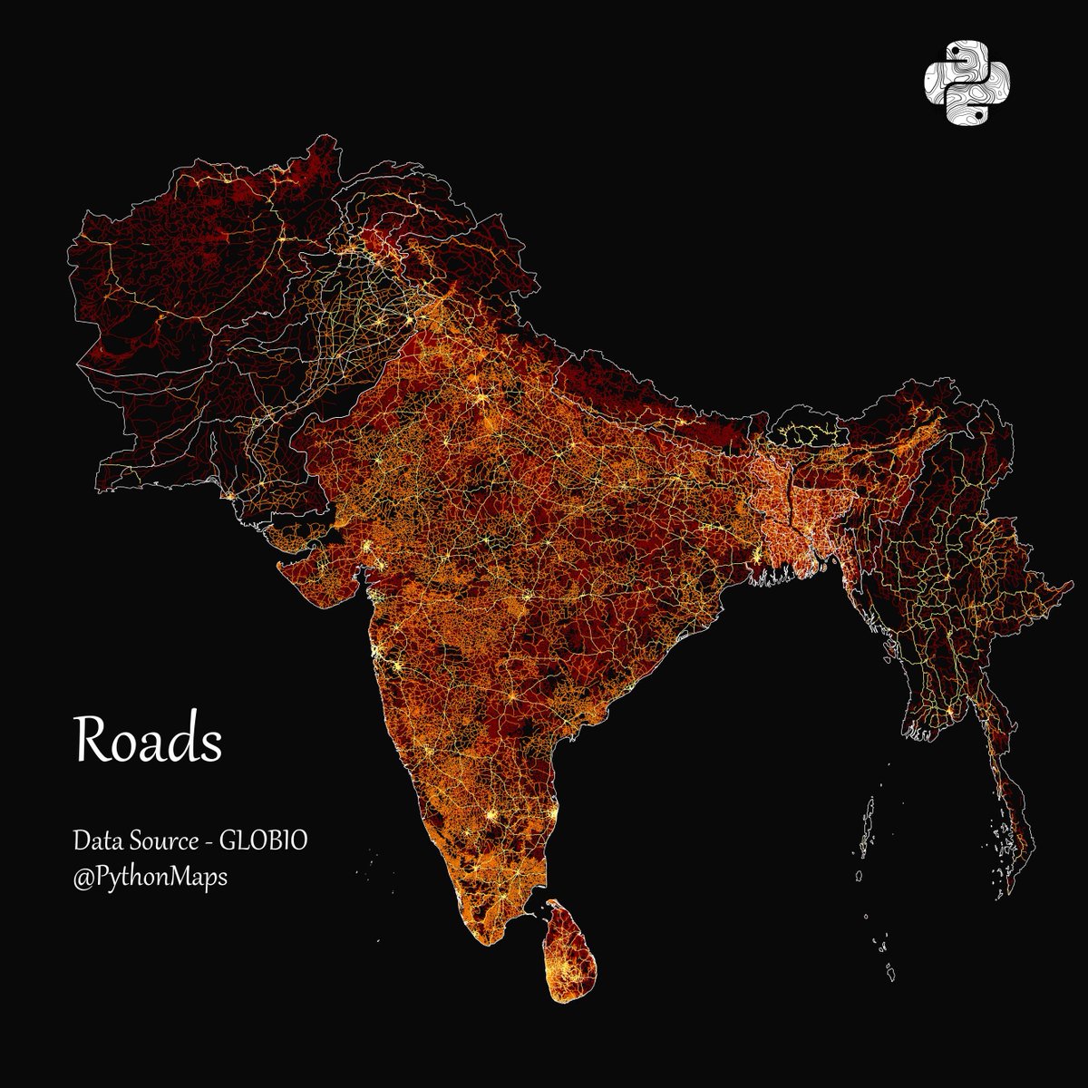
Roads 9/n
Topography as contour lines. 9/13

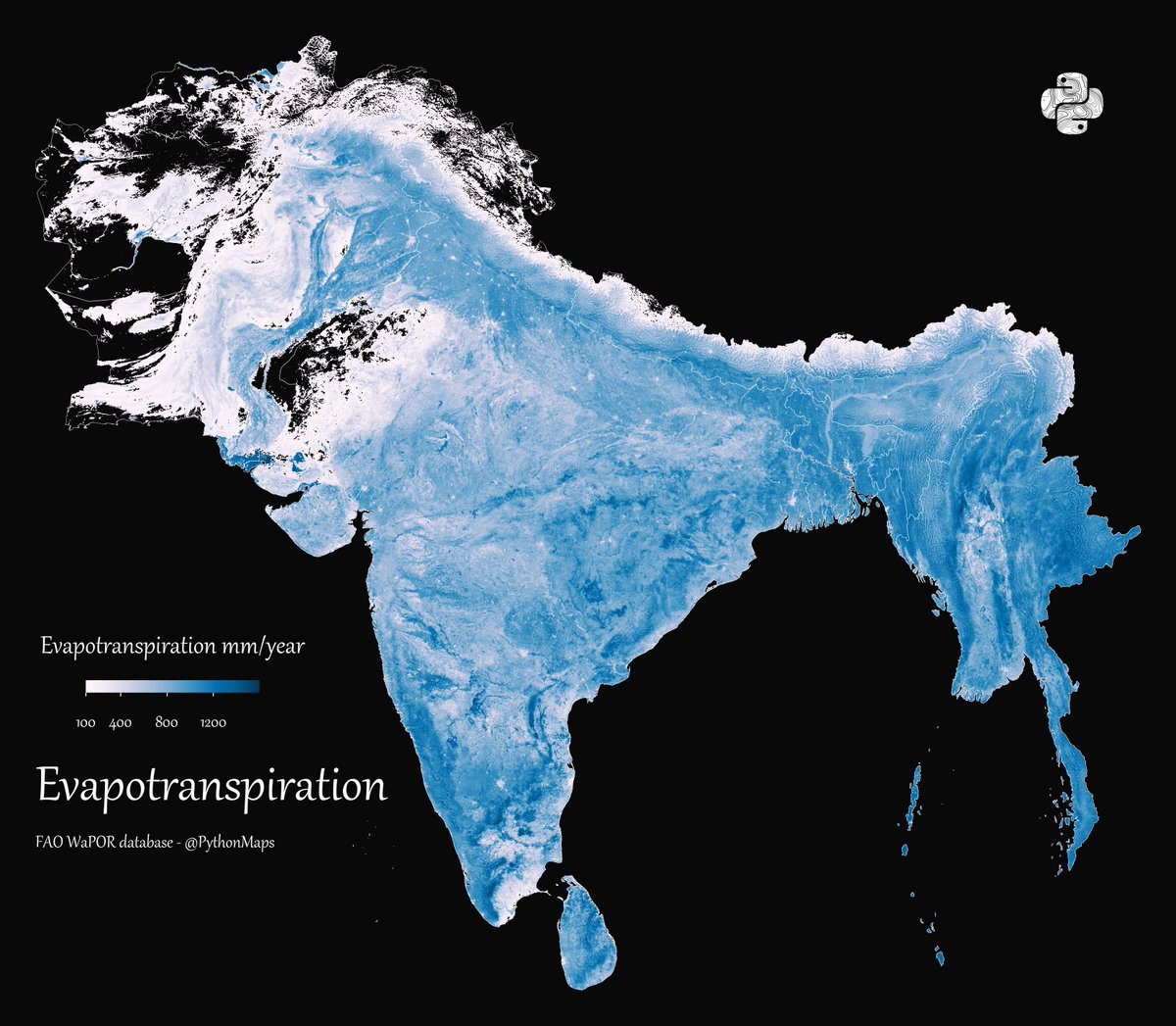
Evapotranspiration 10/13
Emissions 11/13

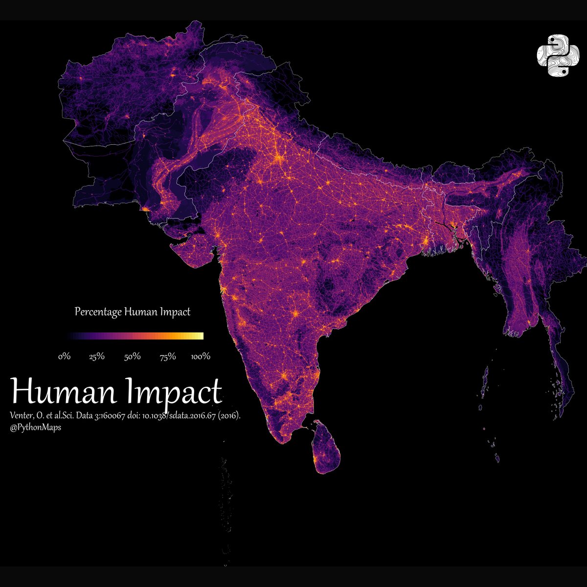
Human Impact 12/13
Rainfall 13/13

Actually, one more. Why are there no ducks in the Northwest of India?

You know what. Why not, one more. Power Lines.

• • •
Missing some Tweet in this thread? You can try to
force a refresh


