An extremely long thread on visiting Paris by me: someone interested in cycle infrastructure and making public spaces better.
The last decade’s change is so positive and has been huge: what have they done and how have they done it?

The last decade’s change is so positive and has been huge: what have they done and how have they done it?

Things they’ve done:
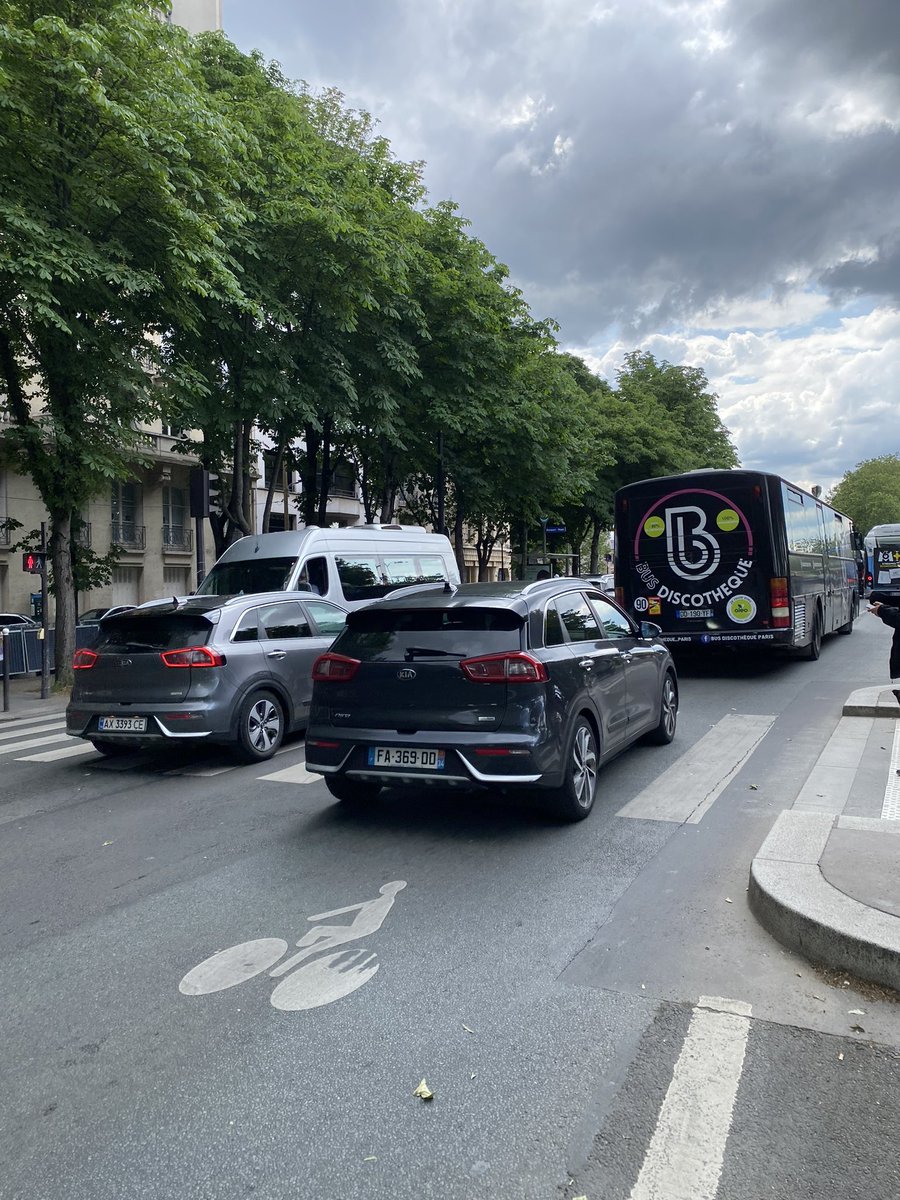
1. Reallocated space to people. Classic Paris boulevard now: generous two way cycle lane, one way lane for private cars, one way lane for buses & taxis.
1. Reallocated space to people. Classic Paris boulevard now: generous two way cycle lane, one way lane for private cars, one way lane for buses & taxis.


2. Really greened it up: urban forests! SUDS! New trees! Beautiful pedestrianisation.


3. Tackled the really big flagship emblematic projects. Rue de Rivoli! The Seine! Place de La Concorde! All now hugely skewed for pedestrians and cyclists. Contraflow cyling on ALL 30kph roads. (!).


4. Got a lot of the smaller things right: great bike parking everywhere. Hire / Lime bikes, but none littering the pavement cos of great bike parking. Lots of car sharing. Bike size traffic lights at all intersections. Car-free days.


And what’s it like? Well I used to live there and the transformation is epic. It is so quiet! So peaceful. You can hear the birds as you cycle along - listen! No one is hooting any longer. Streets are one way. Things are calm.
There’s huge variation across Paris. And it’s really complicated politically, the police have veto powers on certain main roads. And what’s done locally depends on the political will of the 20 mayors, one for each arrondissement. The main roads are Anne Hidalgo and they’re great
Fascinatingly, the 16th arrondissement, Paris’ most wealthy - like Kensington & Chelsea - now feels poor and rubbish. They’ve not got on board as want to protect their right to drive everywhere and as a consequence it’s noisy, dirty, and ugly public space. And drivers hooted!
They like a bollard in Paris - chonky ones to stop cars entering the banks of the Siene, skinny elegant ones elsewhere, and plastic ones which can only be temporary otherwise the prefects in charge of keeping Paris nice can veto them. Stuff is therefore well built and beautiful


Lots of bike traffic lights and tons of pedestrian crossings. Which are largely adhered to, but there’s definitely an anarchic element among both car drivers and cyclists.


These are good! Fully pedestrianised smaller roads. The one below carried 6,000 cars until a couple of months ago (!£ and was used as a rat run to the ring road.


This is Paris’ newest cycle lane. @christianwolmar went to bed on Thu night with roadworks outside and woke up to this on Fri morning. It is being heavily used already. As I say, pace of change is immense.


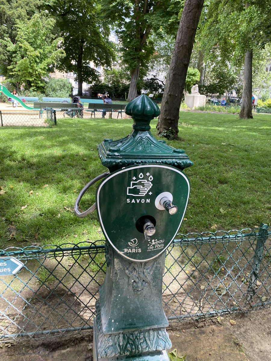
There’s loads of water around to fill your water bottle. As this one says “water. It’s a public service”

The U shaped roundabout is a classic. Acres of tarmac converted into a forested pedestrian area and a u shape for cars and bikes to drive in. Below a complete, in progess, and not yet addressed one (in the 16th, obvs).

I was v. impressed with the Ecology (Green) politicians I met too. They’re in coalition leadership and in charge of transport in Paris as a whole and often in the forward-looking arrondissements: we met @VincentGOULIN (20th) and @Guill_Durand (12th)
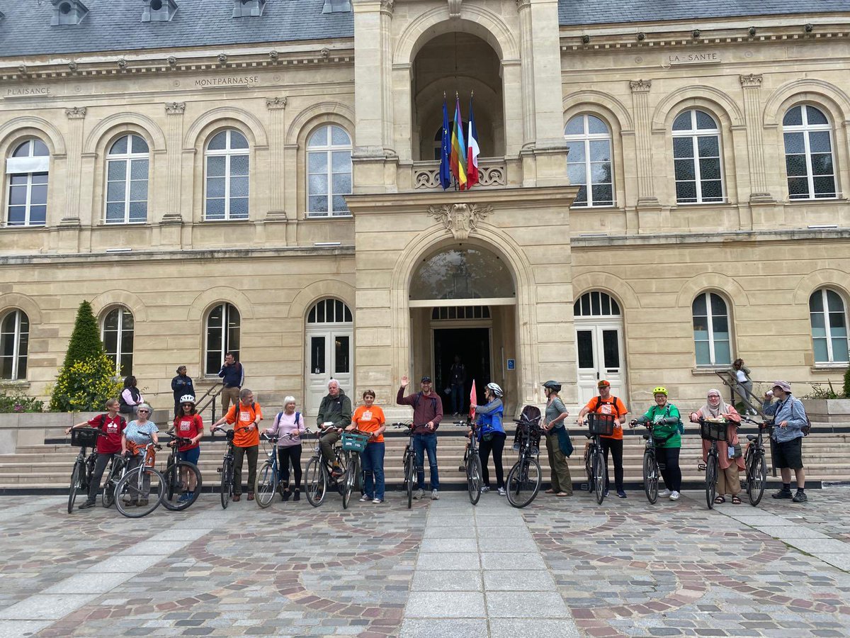
It was a truly epic trip. Massive thanks to @eilidhmurray3 and @London_Cycling for letting me come along and @ParisEnSelle for an insightful & incredible tour.
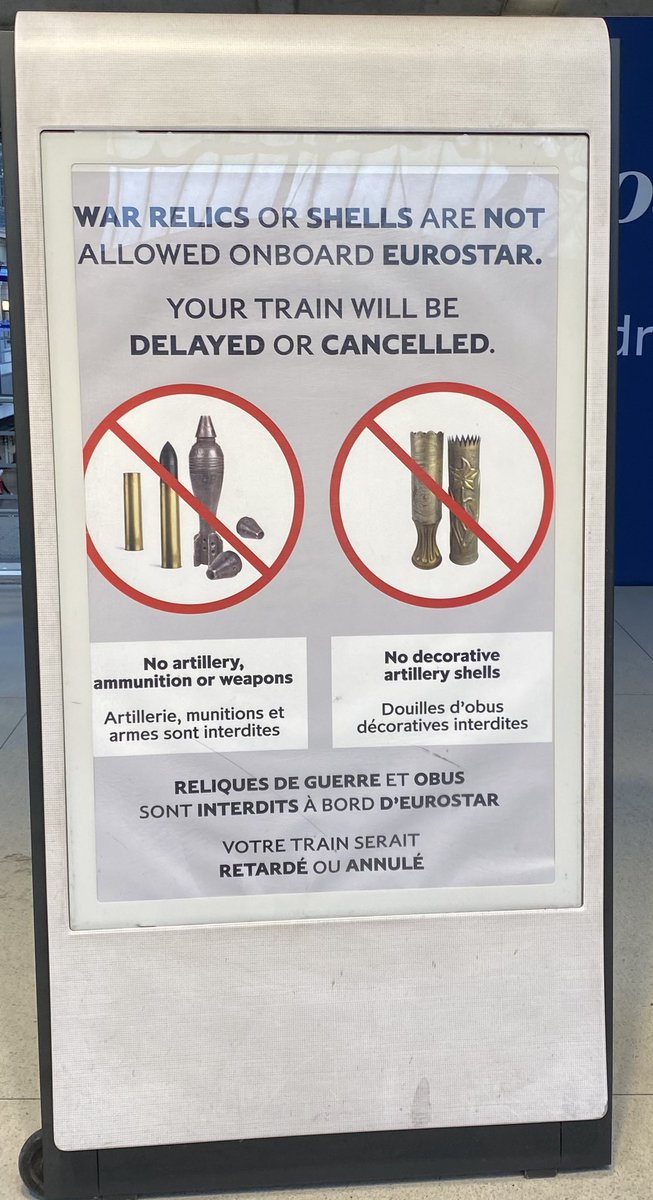
Only problem was I couldn’t bring any of my unexploded WW2 weaponry on the Eurostar. Oh well, next time. 🇫🇷💖
Only problem was I couldn’t bring any of my unexploded WW2 weaponry on the Eurostar. Oh well, next time. 🇫🇷💖
Here’s some literature from one of the Arondissements on planned changes. Clear benefits listed. Then a high level plan of what’s happening and when. Then detail of two of the initiatives: school streets and pedestrianising one side of a roundabout and making it into a park.


If you go to Paris you can hire a bike for a couple of days from many hostels or Holland Bikes. Or sign up for Velib, or Lime Bikes which are pay by hour. This is the 25km route that Paris en Selle cycled us today: all the sights AND the infra sights.
komoot.fr/tour/157794427…
komoot.fr/tour/157794427…
Also, banks of the river Seine. I drove it when it was a motorway. It is now a glorious public space. These pics show 1. The slip road entrance, 2. Where it joins the carriageway, 3. The carriageway itself.
It needs more trees etc on this bit (has elsewhere) but is amazing.
It needs more trees etc on this bit (has elsewhere) but is amazing.


Two interesting stats: we heard that emergency service response times are now below 7min for the first time in decades, due to traffic changes.
And Rue de Rivoli has seen increased revenue post removal of motor traffic. @rivovasta I don’t suppose you can easily give source?
And Rue de Rivoli has seen increased revenue post removal of motor traffic. @rivovasta I don’t suppose you can easily give source?
Outside central Paris and moving into the suburbs is really a core focus now. The road pictured has decent infra but dumps cyclists into a 4 lane highway beyond the Paris borders. The solution is coming tho! A network of cycle tracks following a public transport map philosophy…


… each “line” will be different types of cycling infra but will have clear and easy signs to read and will be safe. Connecting up the towns outside Paris with the City itself. We are looking at this in Oxfordshire but I absolutely love the way Paris has designed the map
Paris is incredible. But there’s still a way to go before I’d let my 7 year old hire a bike and go out as a tourist in the city. We did this in Utrecht cos I KNEW that everything would be safe and connected. It isn’t in Paris. But it’s getting there, in just 5-10 years. WOW.
On the Eurostar I met these 4 young women who had gone to Paris for the day and hired @limebike for the day. Made me so happy that this is now possible - it wasn’t before! They said it was so fun but priority v. confusing.
Lime, could you have a pop up for foreigners like this?
Lime, could you have a pop up for foreigners like this?


Here’s the 16th attempt at a pop up bike lane for the Olympics btw. Dangerous, potentially lethal, granite block blocking entire bike lane.
https://twitter.com/phsanse/status/1791973548367466747
To be clear, a key part of the public space reallocation is removing parking. Aim is to remove half of on-street parking, ie around 70k of the 140k spaces. Car ownership is dropping in Paris (!) even private underground parking now being rented for other business use as no cars!
And car ownership decline is crucial to freeing up public space. In 1990 half of Parisians owned a car, now less than 30% do. They have great car-sharing options, via Getaround & others - my guides showed me on the app and there were c.50 cars to borrow within a 5 min walk.
• • •
Missing some Tweet in this thread? You can try to
force a refresh