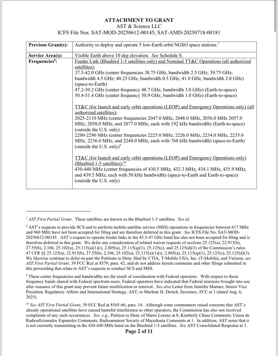
There are different portions of lowband spectrum that BlueBirds block 1 and BlueWalker 3 can use.
The range has public safety and commercial cellular spectrum in it.
🧶🐈⬛
1/n
The range has public safety and commercial cellular spectrum in it.
🧶🐈⬛
1/n
https://twitter.com/Steved24661/status/1796842949453533473
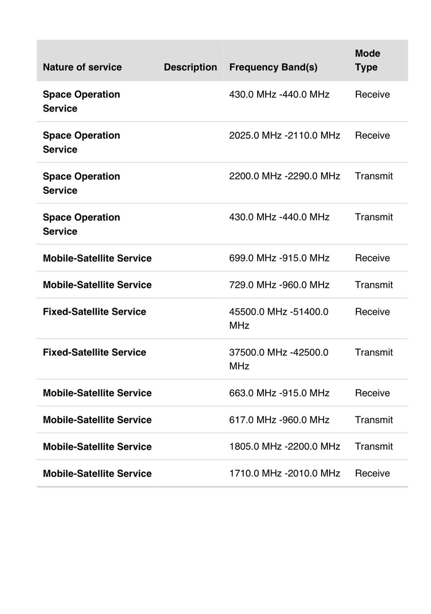
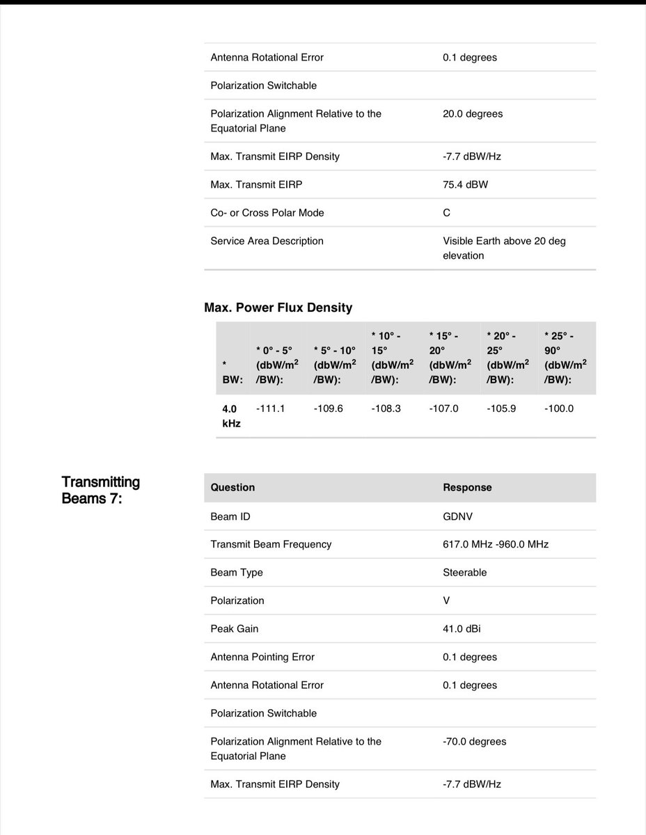
Back in 2020 plan was 617-960 range. In 2024 the plan is 617-960 MHz range. Same.
Micron antenna elements are c-c 161 mm. That is optimized for ~930 MHz if You space the phased array at 1/2 wavelength.
Consistent with that range.
2/n
Micron antenna elements are c-c 161 mm. That is optimized for ~930 MHz if You space the phased array at 1/2 wavelength.
Consistent with that range.
2/n
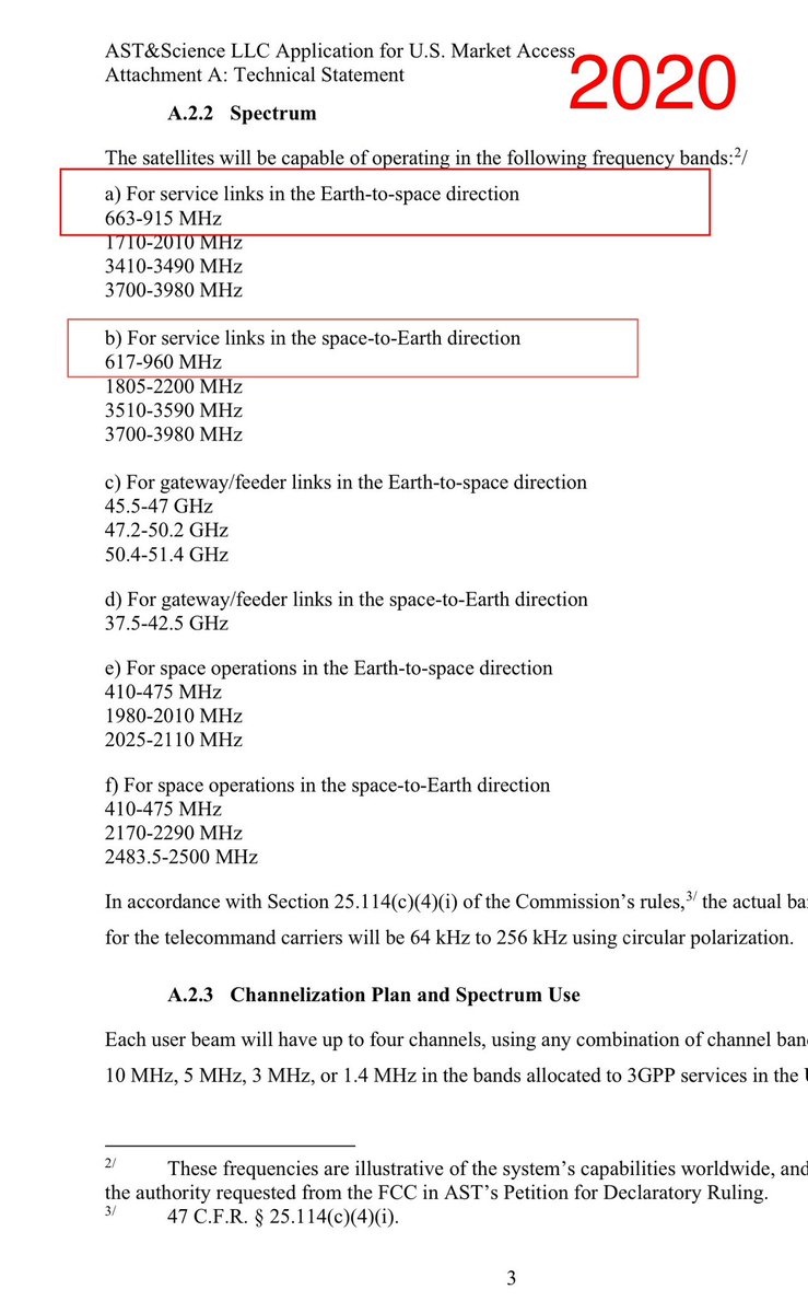
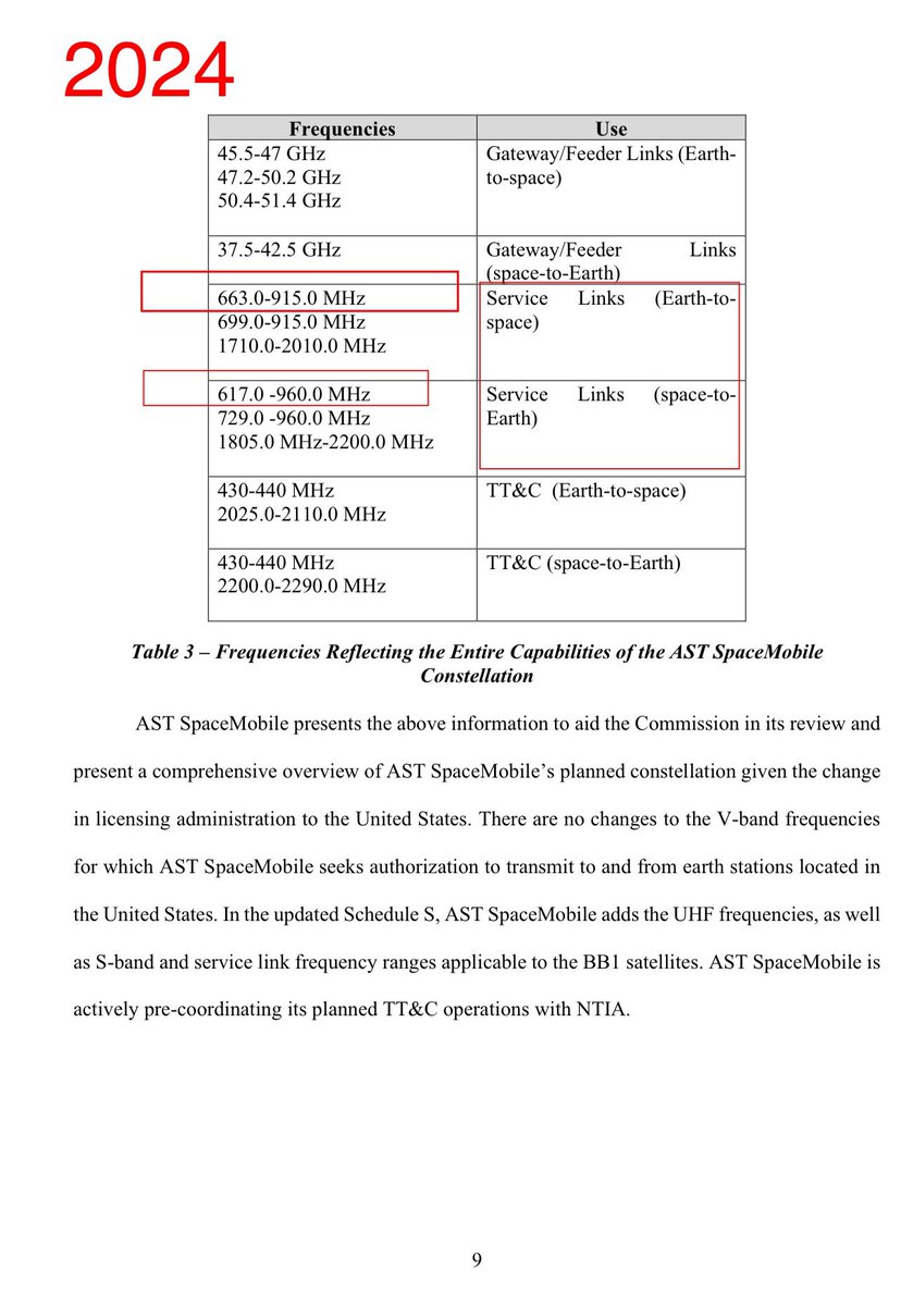
In the schedule S from March 2024
the range is the same. 617–960.
3/n
the range is the same. 617–960.
3/n
How they go about operating in that range, (and others like c-band and midband), is piece by piece.
They start with some but aim for more.
They will try to find large chunks of spectrum - a big continous bandwidth - and spectrum that covers large swaths of land and sea.
4/n
They start with some but aim for more.
They will try to find large chunks of spectrum - a big continous bandwidth - and spectrum that covers large swaths of land and sea.
4/n
The reason they want large blocks of spectrum is that cell phones can not currently aggregate one sliver of lowband with another sliver of lowband.
They can however aggregate lowband with midband.
5/n
They can however aggregate lowband with midband.
5/n
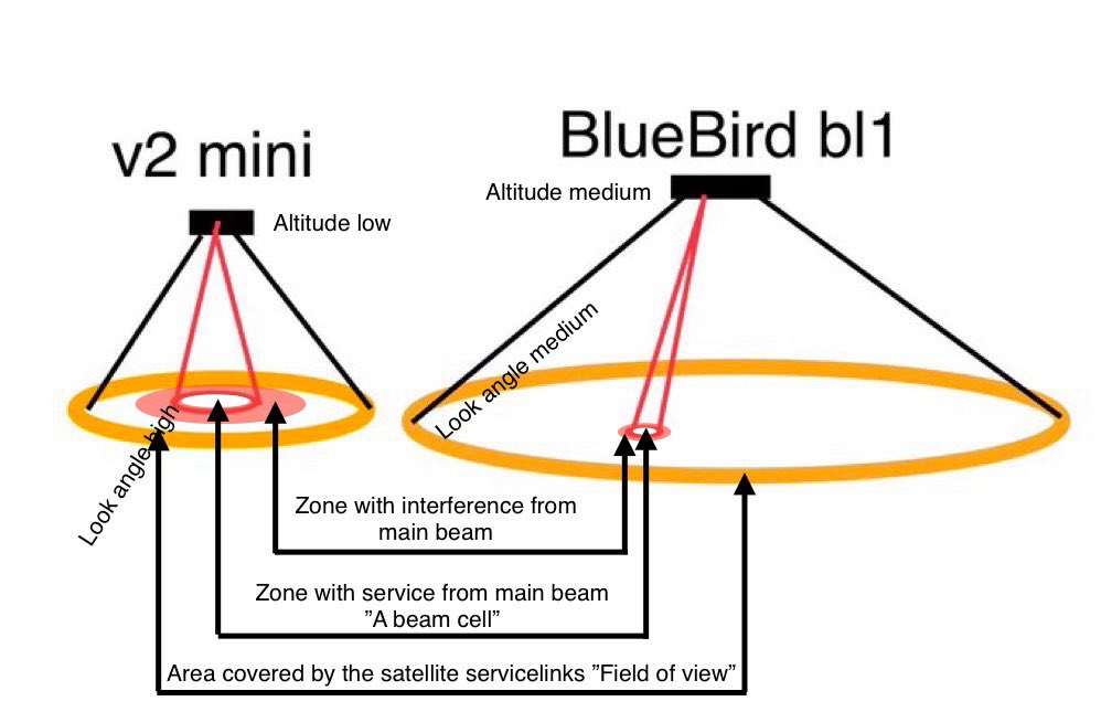
They also want to cover a large swath of land not just pieces of a mosaic.
For two reasons.
To offer coverage everywhere and to not have the fuzz of protecting the neighbouring towers from interference.
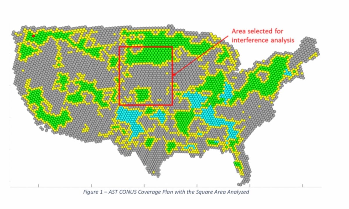
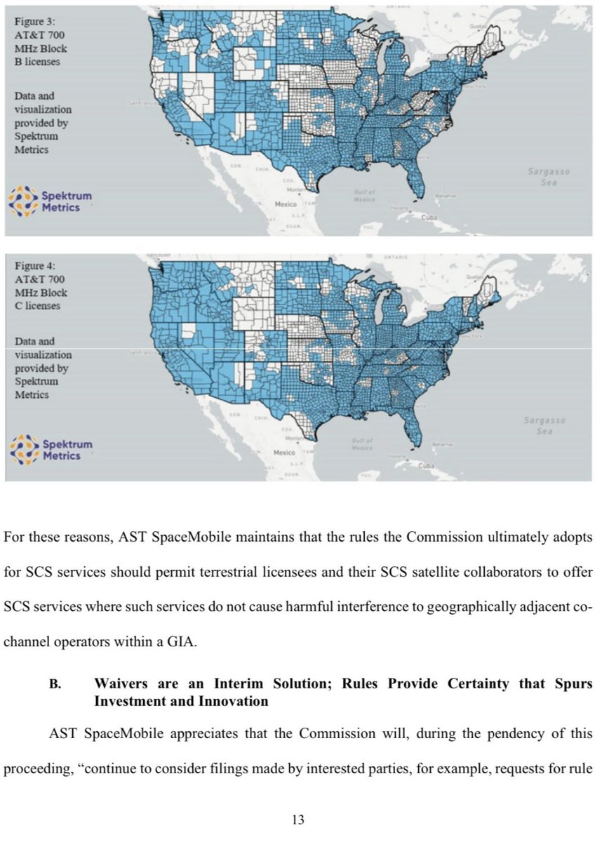
This is AT&T 850 MHz alone.
And the total coverage adding Verizon.
6/n
For two reasons.
To offer coverage everywhere and to not have the fuzz of protecting the neighbouring towers from interference.
This is AT&T 850 MHz alone.
And the total coverage adding Verizon.
6/n
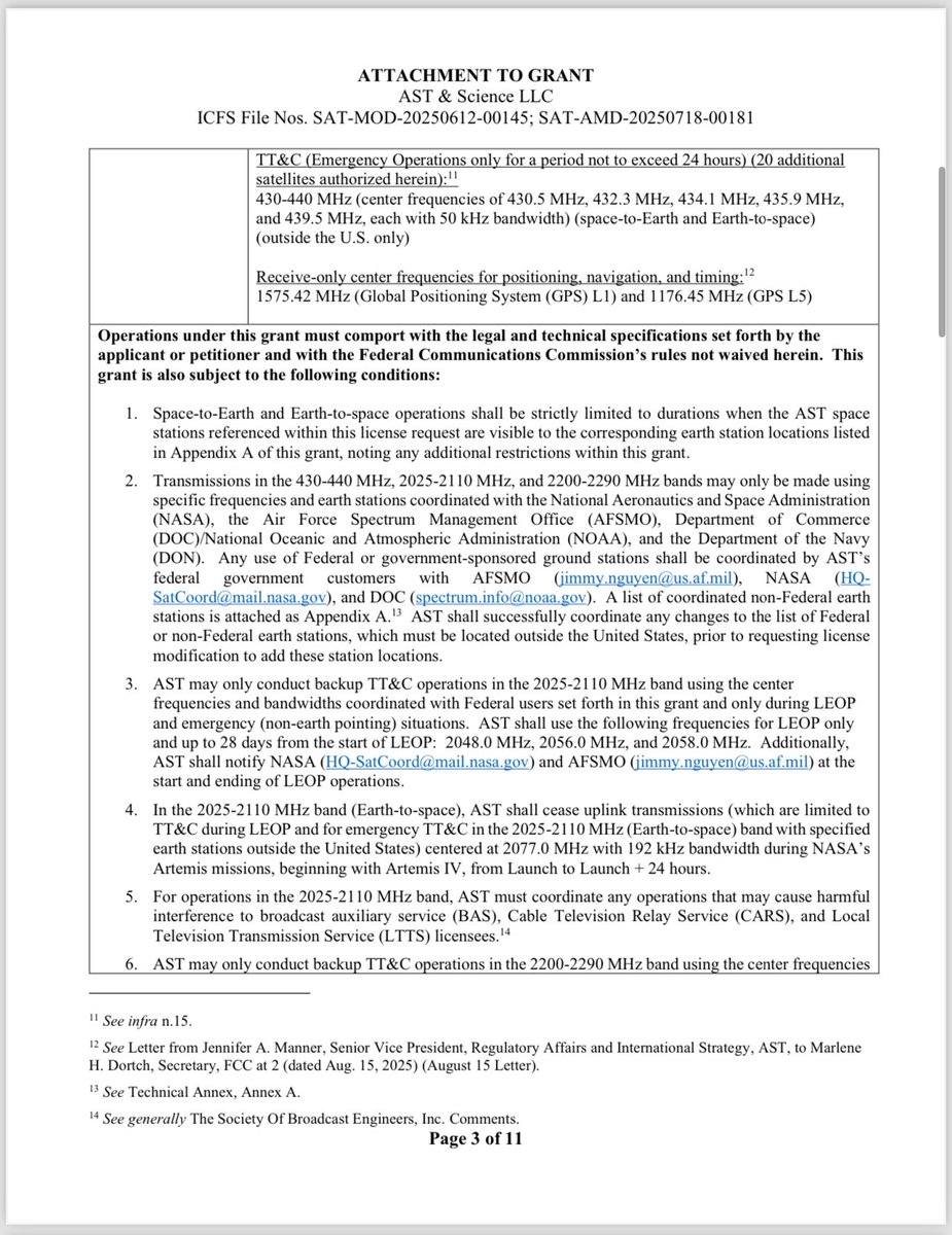
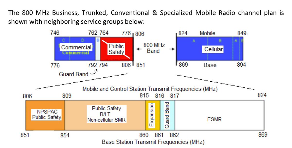
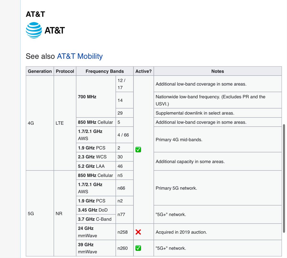
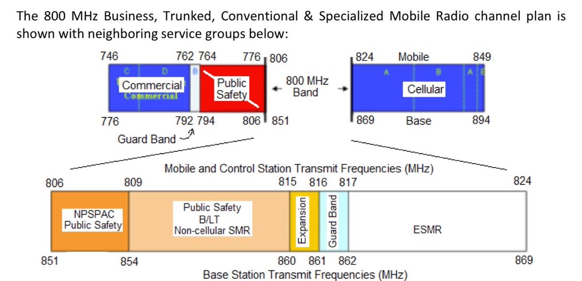
In a 2023 amendment AST points out the commercial lowband service links in that frequenzy range they want to start operating in first, on top of other gov use cases.
”700 MHz and 850 MHz”
Specifically:
704-746 and 824-894
On top of this FirstNet is known:
758-768+788-798
7/n
”700 MHz and 850 MHz”
Specifically:
704-746 and 824-894
On top of this FirstNet is known:
758-768+788-798
7/n


Verizon lowband spectrum fits neatly with FirstNet spectrum to allow a massive block for DoD/gov/First responder use cases.
This is the large block part. They aren’t very public about this opportunity. Yet.
Nice to make Extended Reality work everywhere and overlay AI intel
8/n
This is the large block part. They aren’t very public about this opportunity. Yet.
Nice to make Extended Reality work everywhere and overlay AI intel
8/n
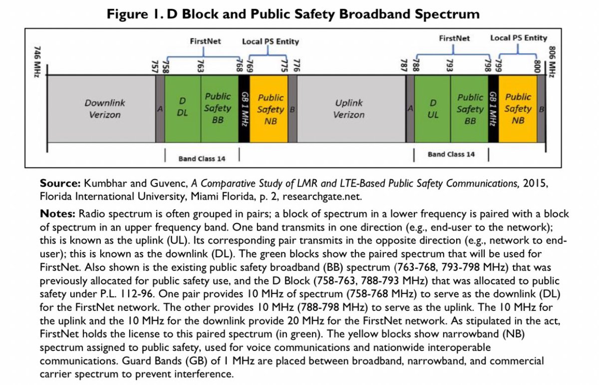
In the 824-894 range ”850 MHz” there is band 5.
Here AT&T holds what Verizon does not and together they hold all of it.
And by pooling spectrum not only do they create wider bands for the gov use case.
They also create a total blanket coverage for the commercial use case.
9/
Here AT&T holds what Verizon does not and together they hold all of it.
And by pooling spectrum not only do they create wider bands for the gov use case.
They also create a total blanket coverage for the commercial use case.
9/

The wider story is about prime lowband spectrum being the scarce resource and how more of it will migrate from analouge / narrowband Land Mobile Radio type applications to digital 5G/6G use once the latter assures coverage.
There is more to this further down the track.
10/10
There is more to this further down the track.
10/10
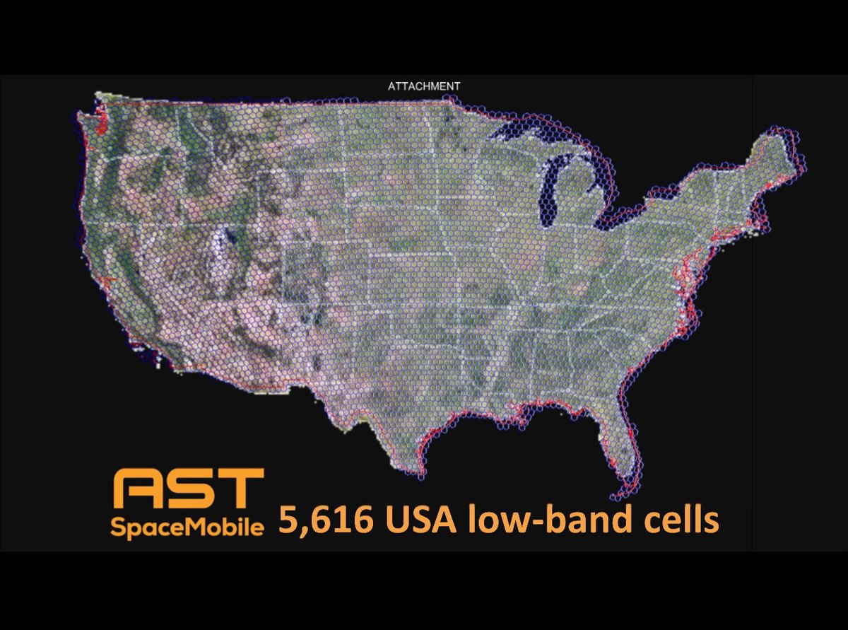
Live view ^ from FCC ULS system of fronthaul / service links in cellular lowband spectrum being leased to $ASTSwireless2.fcc.gov/UlsApp/Applica…
• • •
Missing some Tweet in this thread? You can try to
force a refresh