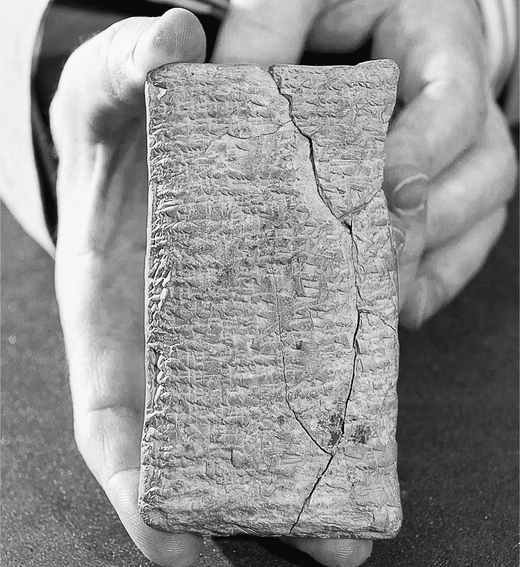
This 2,700-year-old tablet is the oldest map of the world.
It reveals just how differently the ancients understood the world — but one detail is particularly strange.
It sheds light on a VERY ancient story… (thread) 🧵
It reveals just how differently the ancients understood the world — but one detail is particularly strange.
It sheds light on a VERY ancient story… (thread) 🧵
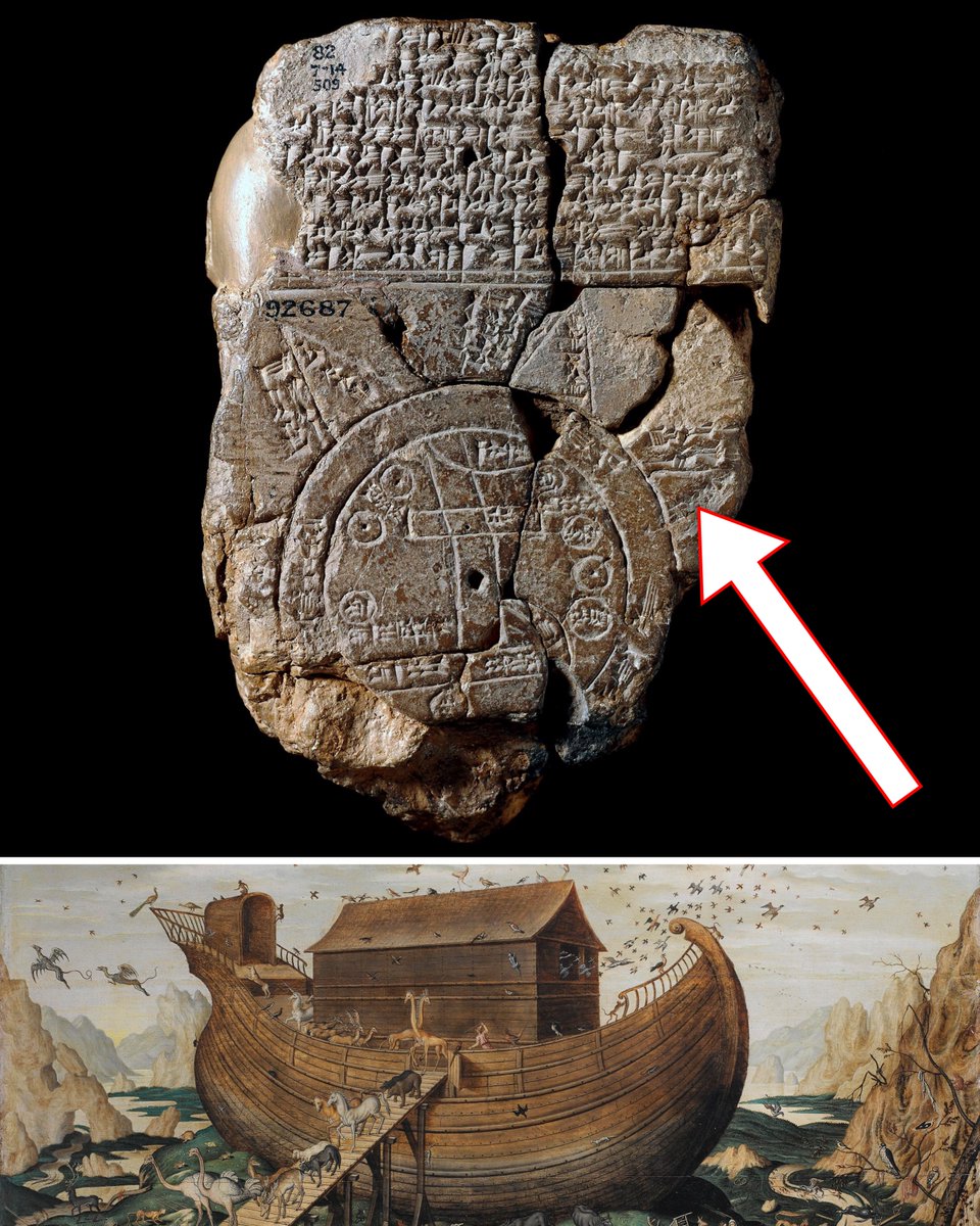
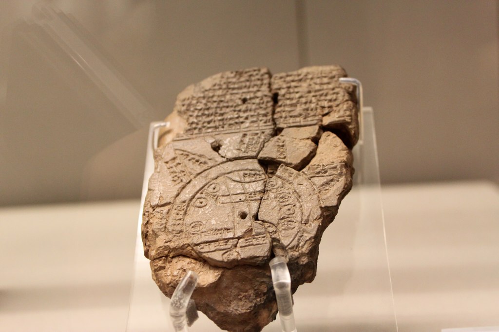
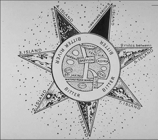
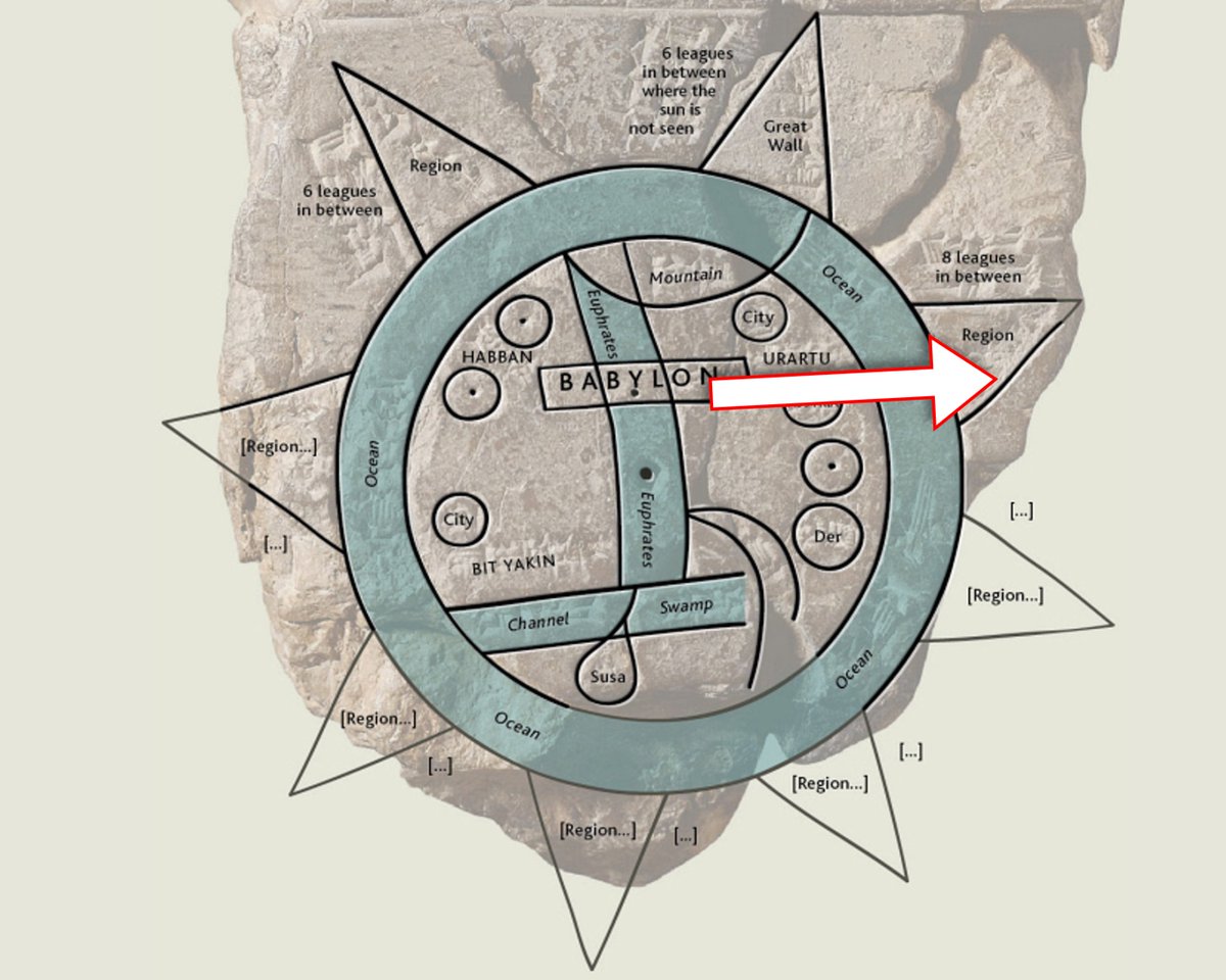
The "Imago Mundi" is the oldest map of the world — as it was known to the Babylonians around 700 BC.
It's carved into a small piece of clay, with annotations explaining it, and the creation myth of the world.
It's carved into a small piece of clay, with annotations explaining it, and the creation myth of the world.
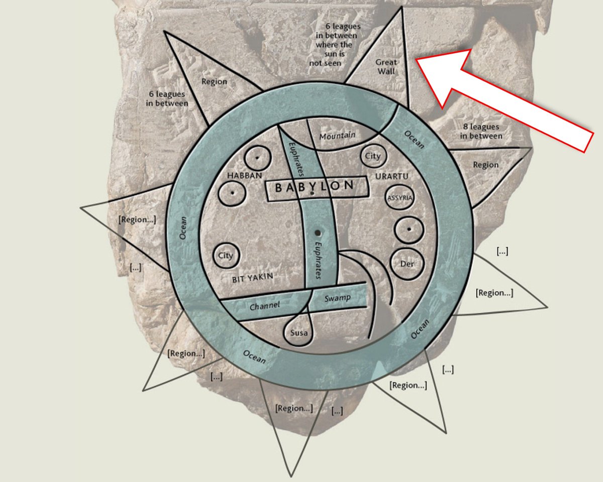
The central parts of the map are easy to read:
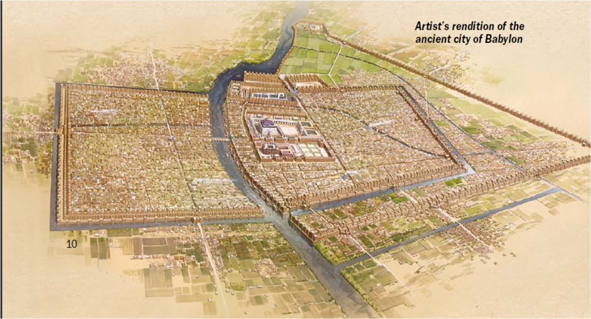
The Euphrates river runs north to south, straddled by the city of Babylon (modern-day Iraq), and surrounded by cities and regions marked by small circles.
The Euphrates river runs north to south, straddled by the city of Babylon (modern-day Iraq), and surrounded by cities and regions marked by small circles.
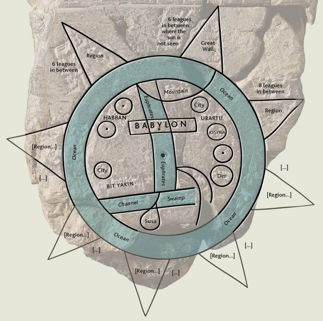
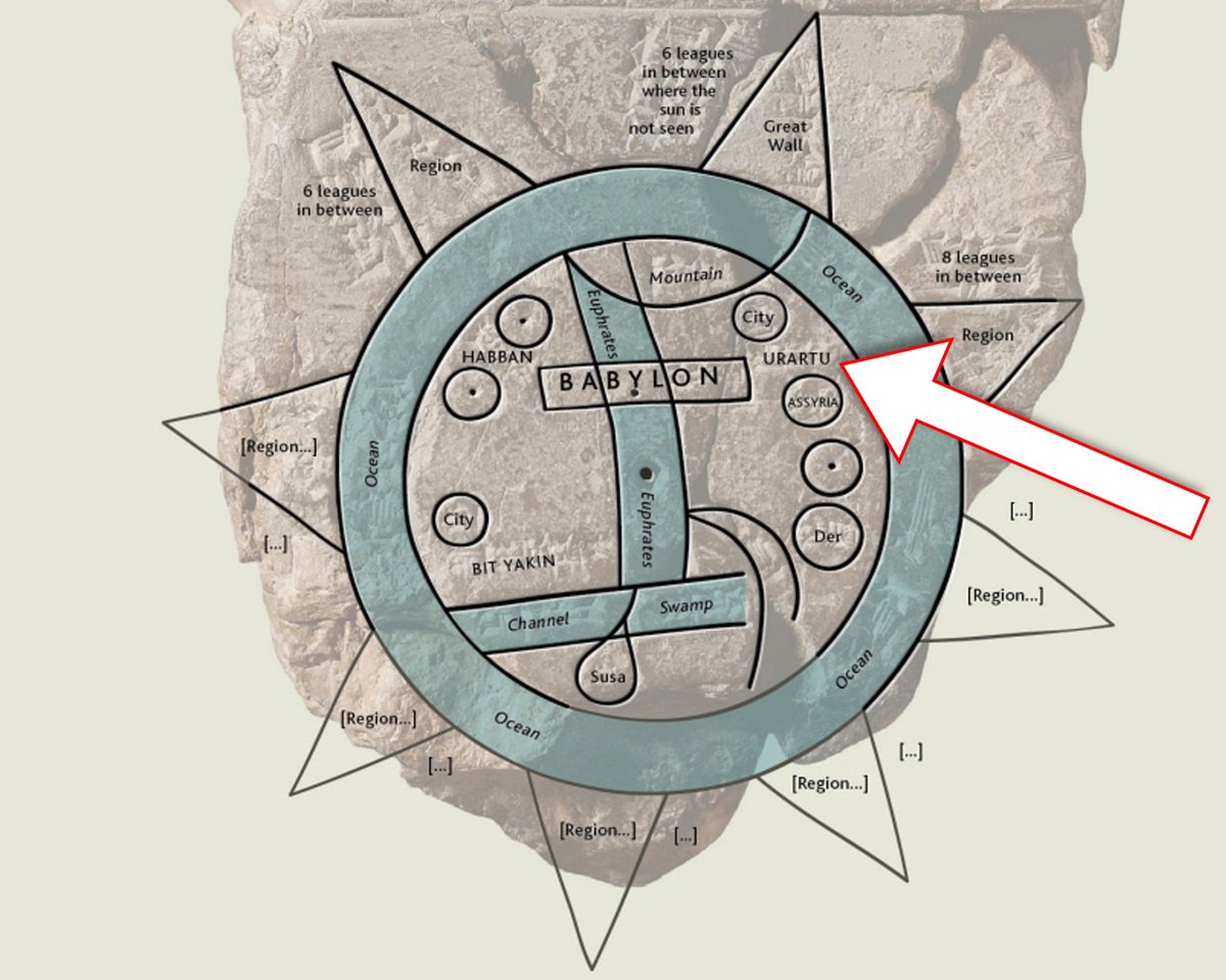
A point of interest is the place marked "Urartu" — this is the ancient name for what we now call Armenia.
Encircling these points on the map is the "Bitter River" (meaning salt water).
Encircling these points on the map is the "Bitter River" (meaning salt water).
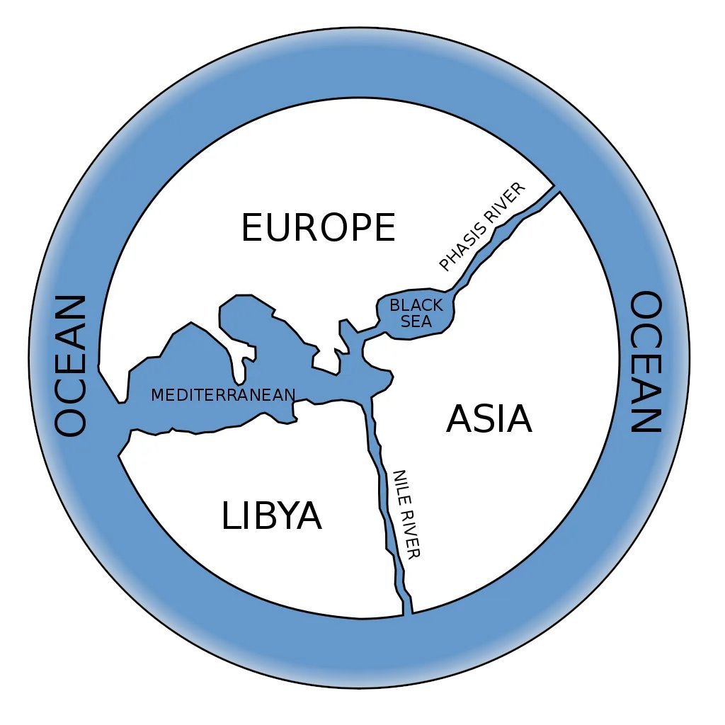
Like other ancient maps, the known world is encircled by water across which man wasn't known to have ventured.
What lies across the water is where it gets interesting...
What lies across the water is where it gets interesting...
On the other side lie 7 triangular regions — and this is where the mythological is introduced.
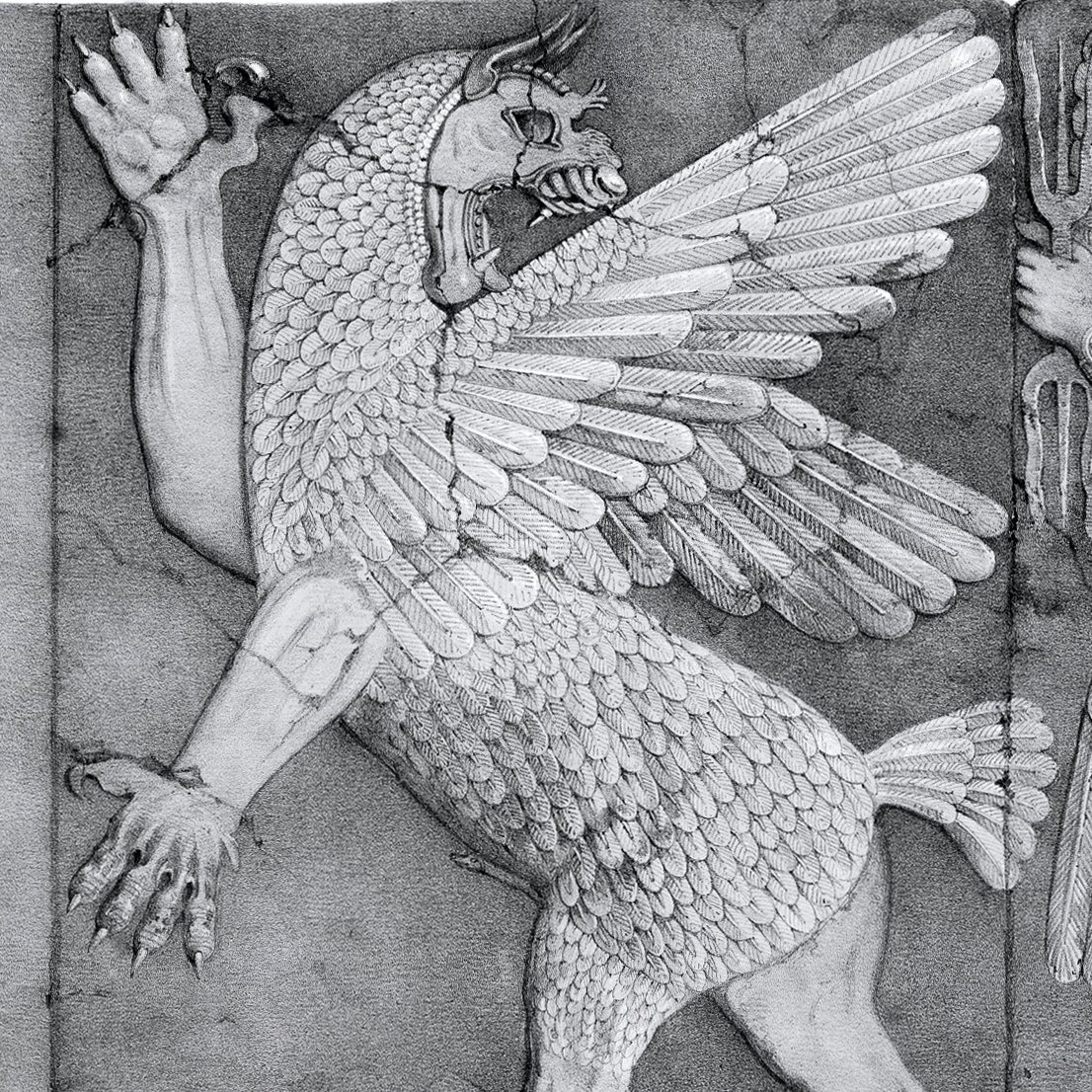
These regions are where legendary beasts are said to roam, and the text on the back of the tablet tells us what we can find at each one...
These regions are where legendary beasts are said to roam, and the text on the back of the tablet tells us what we can find at each one...
One area is marked: "where the sun is not seen."
This likely refers to the legendary journey of Gilgamesh to lands of perpetual darkness, as in Sumerian myth.
This likely refers to the legendary journey of Gilgamesh to lands of perpetual darkness, as in Sumerian myth.
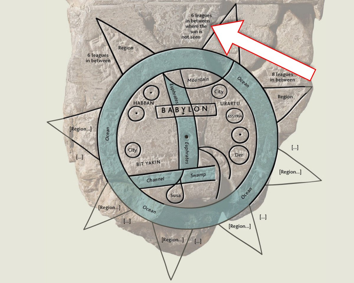
Next, a "great wall" occupies one region (likely the home of a demon from Sumerian myth). To reach it, "you must travel seven leagues".
The Babylonian worldview was steeped in mystery and myth — with the mythological firmly entangled with the physical world...
The Babylonian worldview was steeped in mystery and myth — with the mythological firmly entangled with the physical world...
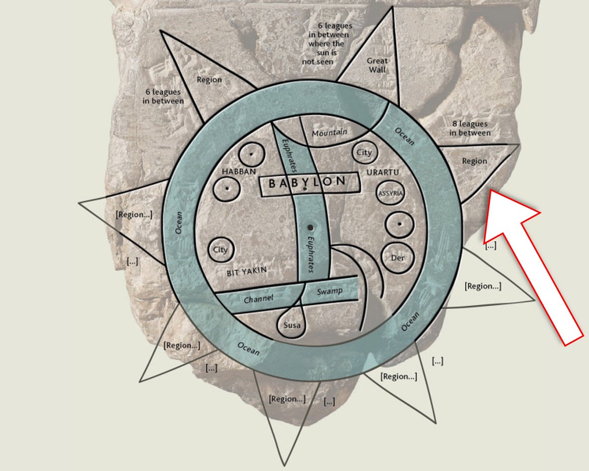
But most interesting of all are the (fragmented) inscriptions relating to the next triangle:
"To the fourth, to which you must travel seven leagues…. Are as thick as a parsiktu-vessel..."
"To the fourth, to which you must travel seven leagues…. Are as thick as a parsiktu-vessel..."
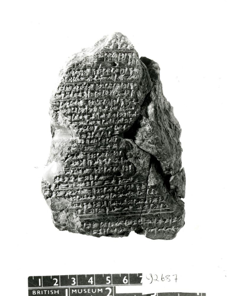
There's only one other cuneiform tablet known to exist that uses that language: "thick as a parsiktu-vessel".
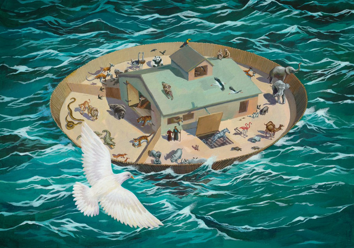
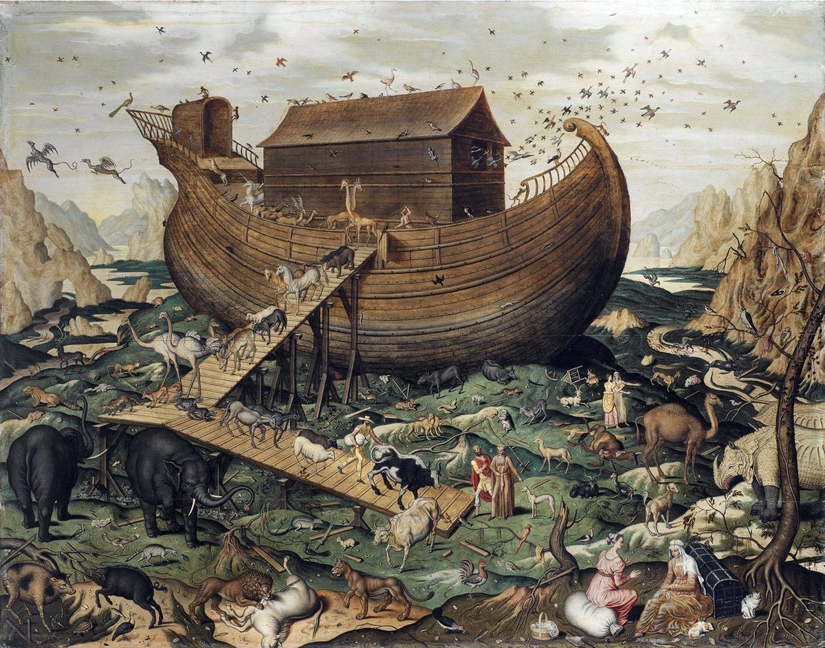
It's the "Ark Tablet" — 1,000 years older than the map, it provides instructions for the building of a great Ark...
It's the "Ark Tablet" — 1,000 years older than the map, it provides instructions for the building of a great Ark...
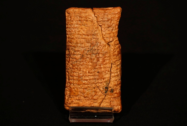
This tablet describes the boat built by Atraḥasis to carry humanity through the Flood at God's instruction. That ancient measuring unit relates to its giant ribs:
"I set in place in thirty ribs, that were one parsiktu-vessel thick."
"I set in place in thirty ribs, that were one parsiktu-vessel thick."
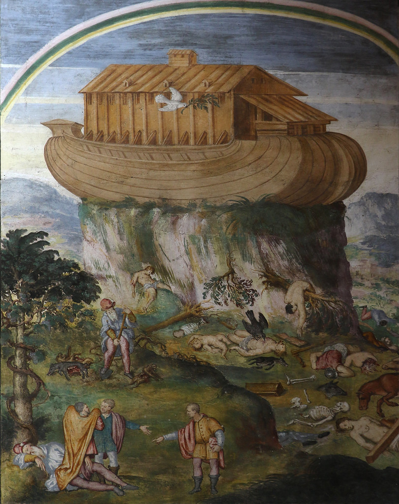
So, the map seems to imply a rough location of where the Ark came to ground according to Babylonian myth.
If an intrepid explorer went from Babylon, through Urartu and across the Bitter River, they'd find the Ark's wooden ribs upon the mountainside...
If an intrepid explorer went from Babylon, through Urartu and across the Bitter River, they'd find the Ark's wooden ribs upon the mountainside...
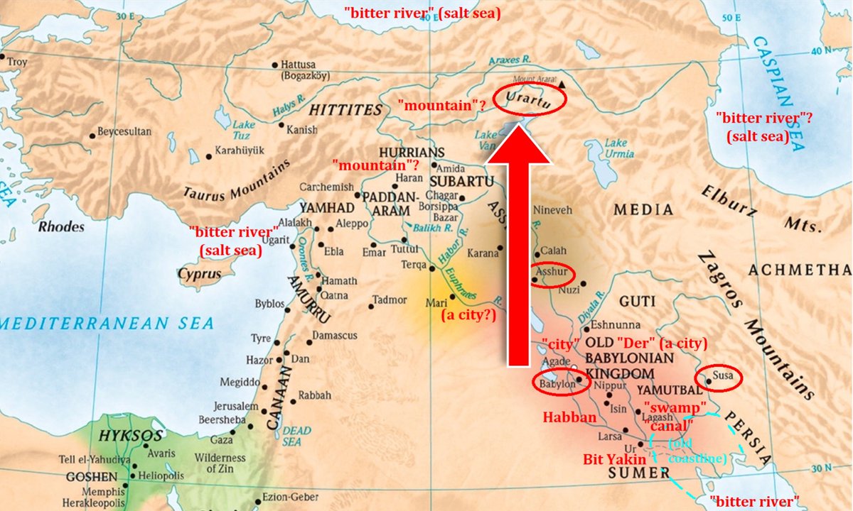
Intriguingly, that's in the direction of the Ararat mountains — where Biblical tradition states Noah's Ark landed.
Albeit, the map implies you must keep going, and cross the water (unclear which) before you'll find it.
Albeit, the map implies you must keep going, and cross the water (unclear which) before you'll find it.
To modern archeologists, the location of Noah's Ark lies firmly in the realm of myth.
But that wasn't true of first-century historians. Josephus said it lay "in Armenia, at the mountain of the Cordyaeans" — now thought to be Turkey's Mount Ararat.
But that wasn't true of first-century historians. Josephus said it lay "in Armenia, at the mountain of the Cordyaeans" — now thought to be Turkey's Mount Ararat.
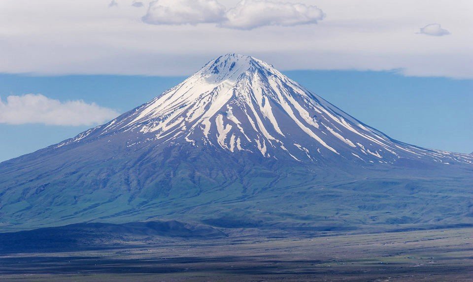
For the Babylonians, the Ark lay at the very edge of their world — unaccessible, but a tangible distance (7 leagues) away.
That is, perhaps, until someone would just be bold enough to venture there...
That is, perhaps, until someone would just be bold enough to venture there...
If topics like this interest you, I go deeper every week in my FREE newsletter!
92,000+ people read it: history, art and culture 👇
culture-critic.com/welcome
92,000+ people read it: history, art and culture 👇
culture-critic.com/welcome
The very last paragraph on the back of the tablet reads quite poetically:
"In all eight regions of the four shores of the earth …, their interior no-one knows."
"In all eight regions of the four shores of the earth …, their interior no-one knows."
If you enjoy these breakdowns, please give the original post a retweet! 🙏
And I'll keep doing more like this...
And I'll keep doing more like this...
https://x.com/Culture_Crit/status/1850600478058467783
• • •
Missing some Tweet in this thread? You can try to
force a refresh