Africa First Profile picture
Dec 14, 2024 27 tweets 7 min read Read on X
Thread of interesting African maps you've (likely) never seen before 🧵

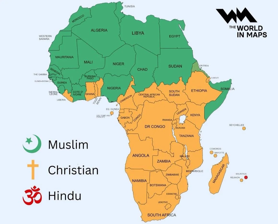
1. Map of the largest religious group in each African country. Image
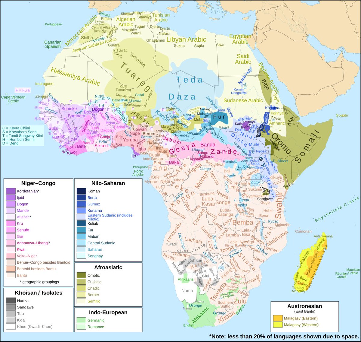
2. Extensive map of African languages. Image
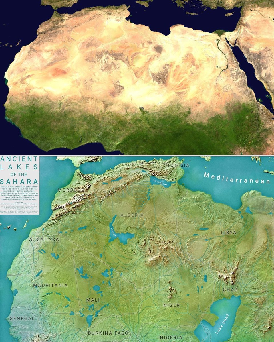
3. The Sahara desert was green 6000 years ago Image
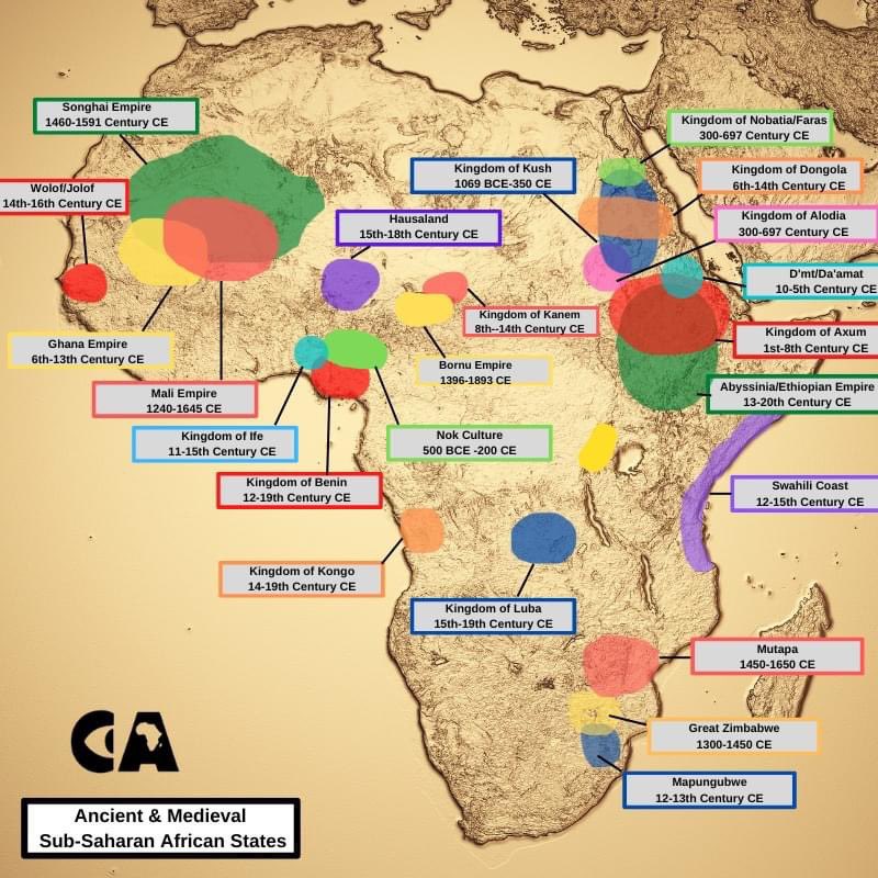
4. Major ancient and medieval states in Africa. Image
5. A map showing the expansion of Arabic culture across Africa. Image
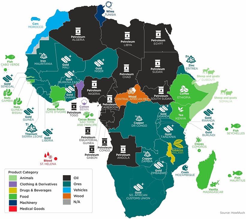
6. The top exported product in every African country. Image
7. Map showing railway lines in Africa. Image
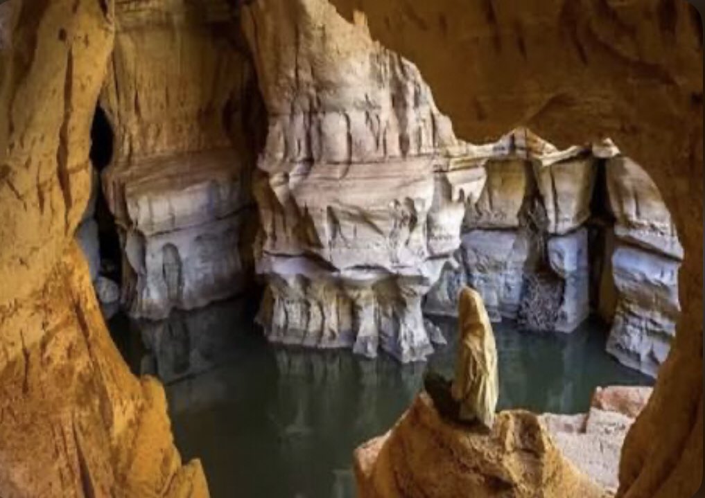
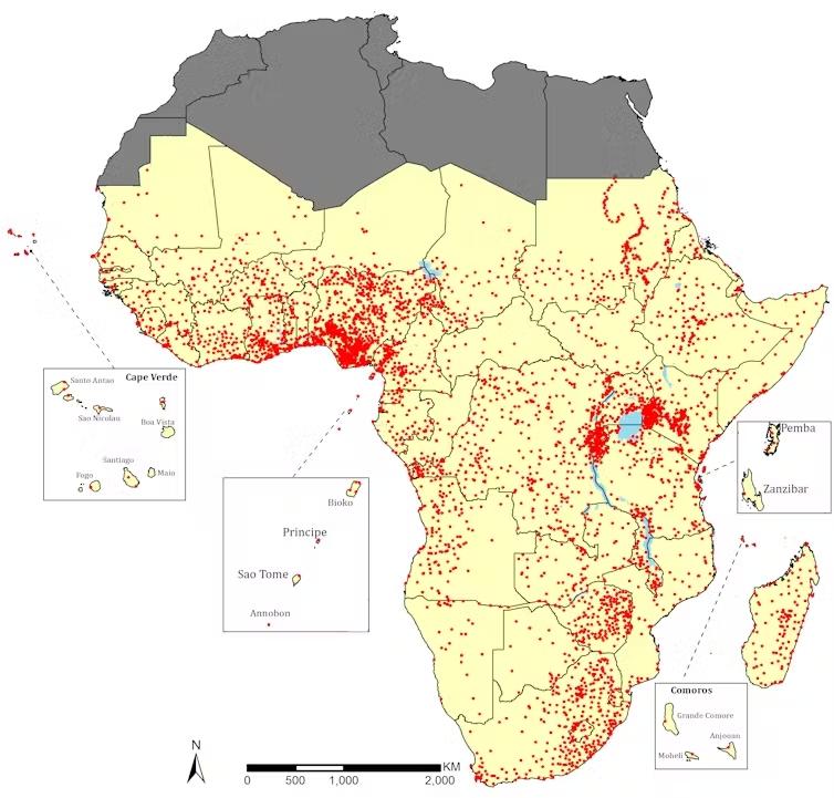
8. Map showing All the Rock art Sites in Africa Image
9. A map of all reported UFO sightings in Africa, 1906-2014. 📸ESRI
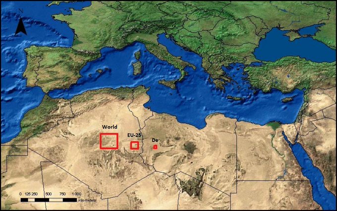
10. A map showing the theoretical areas of thermal solar power panels required on the Sahara Desert to meet the electricity demand of the world, the European Union (EU), and Germany. Image
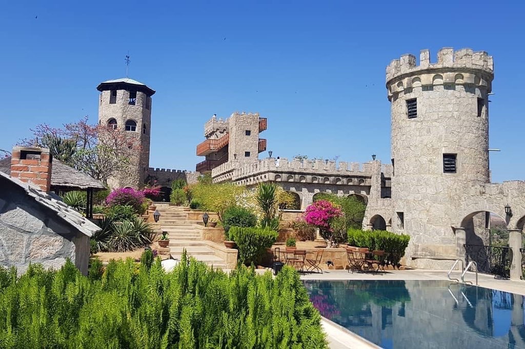
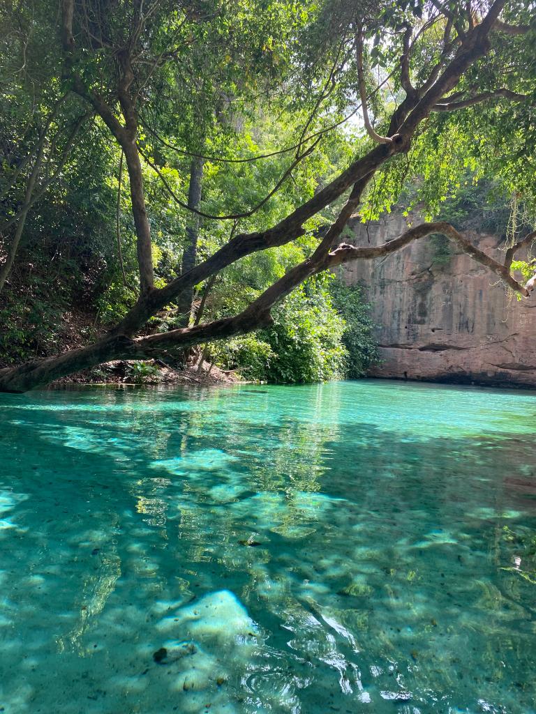
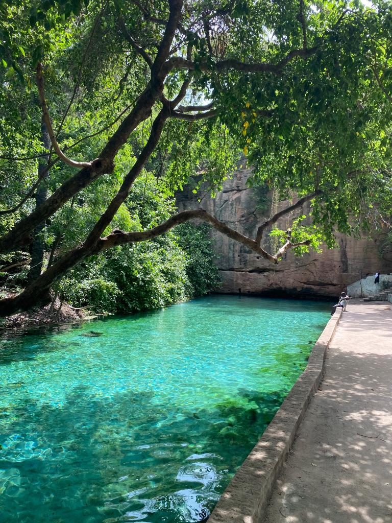
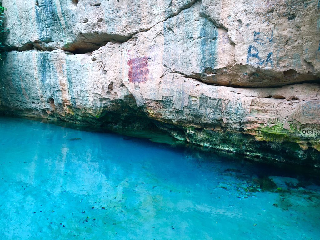
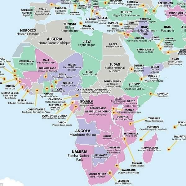
11. Map highlighting top tourist spots in Africa

Green = historic

Gray = Religious

Pink = Natural

Purple = tourist Image
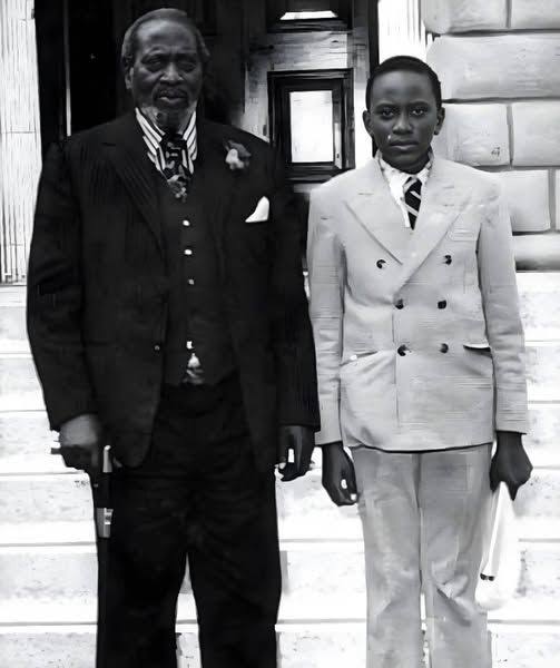
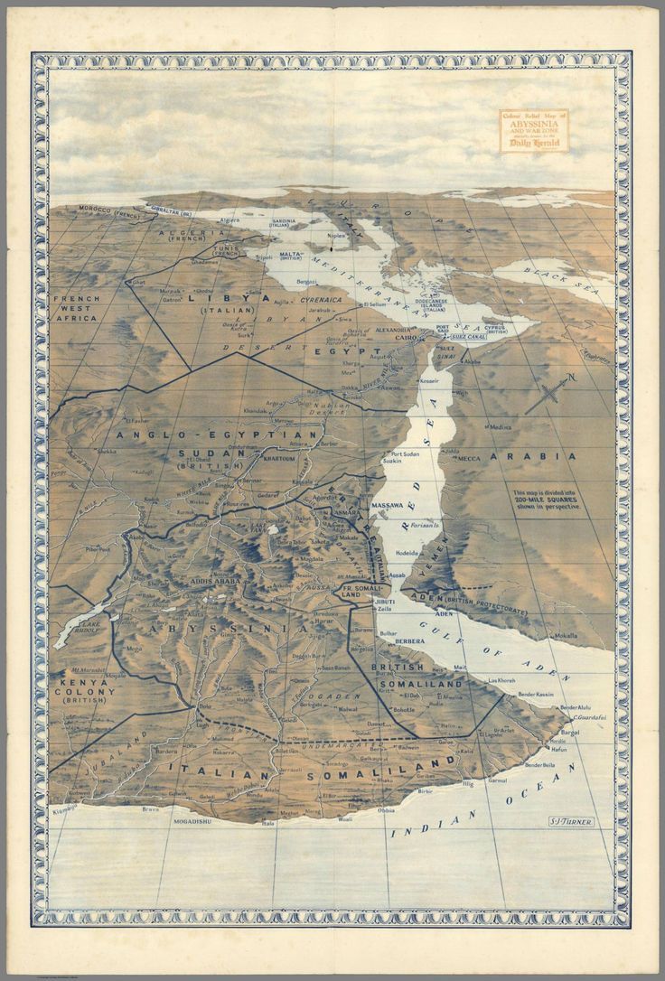
12. Gazing towards Europe, from the Horn of Africa, 1938. Image
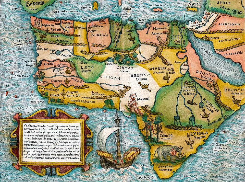
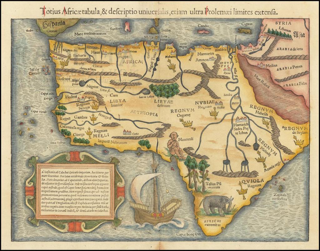
13. ‘The entirety of Africa, & universal description, extending even beyond the limits of Ptolemy’ by Sebastian Munster, 1554. Image
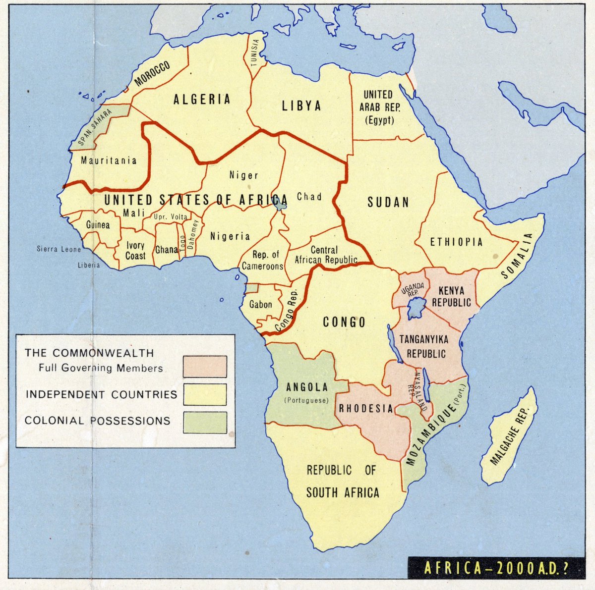
14. A 1963 prediction of Africa at the beginning of the 21st century. Image
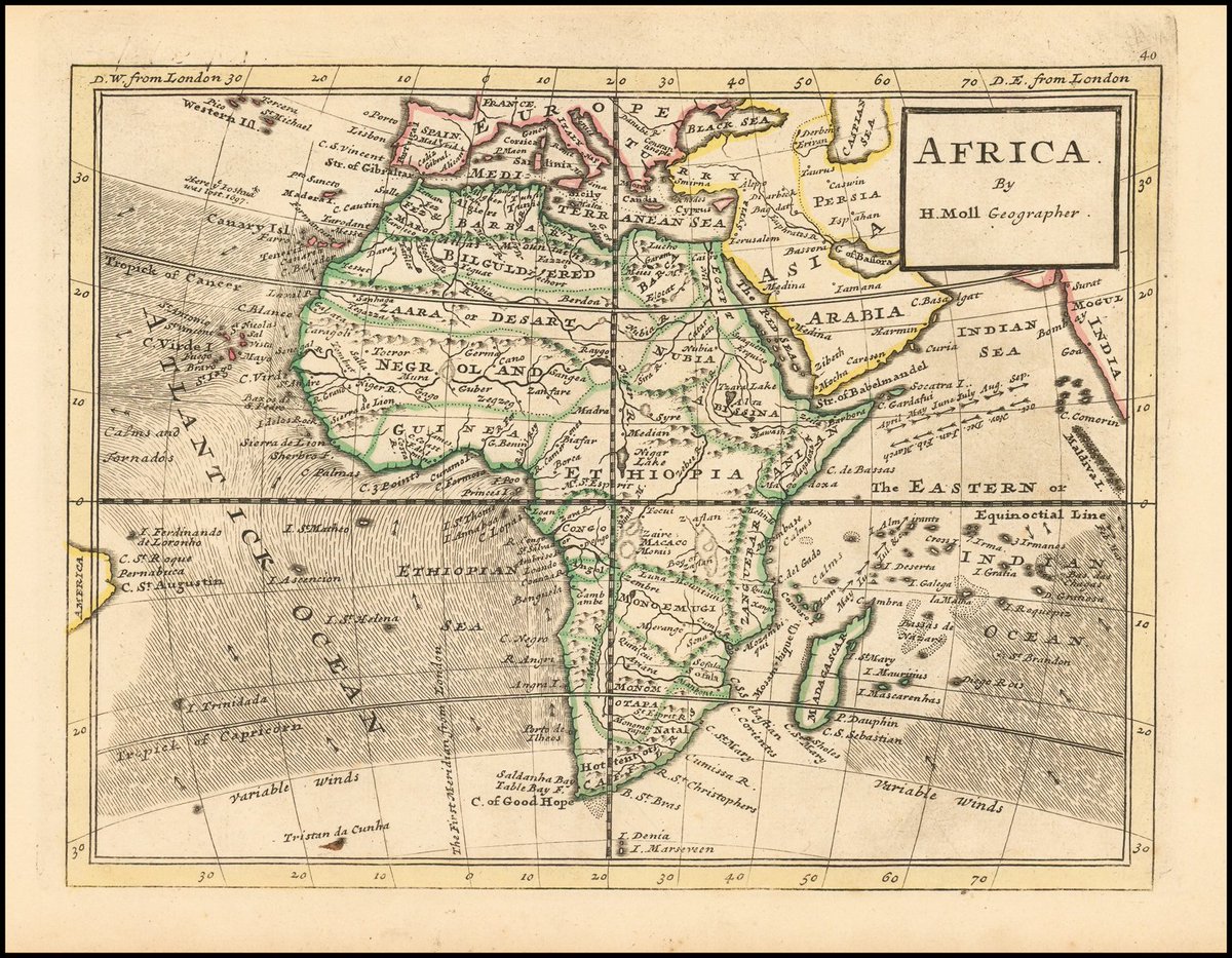
15. "Africa" by Herman Moll (1729).

Most of Niger River watershed is termed "Negroland". Image
16. Physical map of Africa from a geography textbook (1916). Image
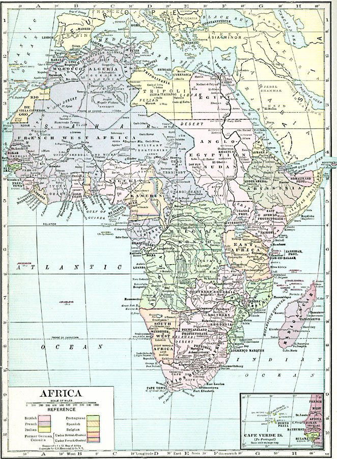
17. Post-WWI Africa - Hammond's Modern Atlas of the World (1920).

The map shows major cities, rivers, and landforms, and an inset map of the Cape Verde Islands under Portuguese control. Image
18. Afrika - German geography book (1940)

Shows Africa and its German colonies. Image
19. First published in 1544 by Sebastian Münster, this is the first map of Africa as a continent.

There are earlier world maps that show the continent but none focusing on it alone since Bartolomeo Dias had only rounded the Cape of Good Hope in 1488. Image
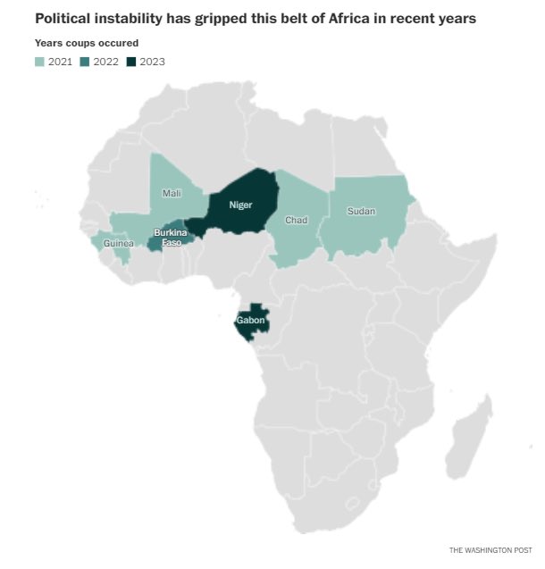
20. Africa’s 7 military coups over past 2 to 3 years. Image
21. A map of hospitals and clinics in sub-Saharan Africa. Image
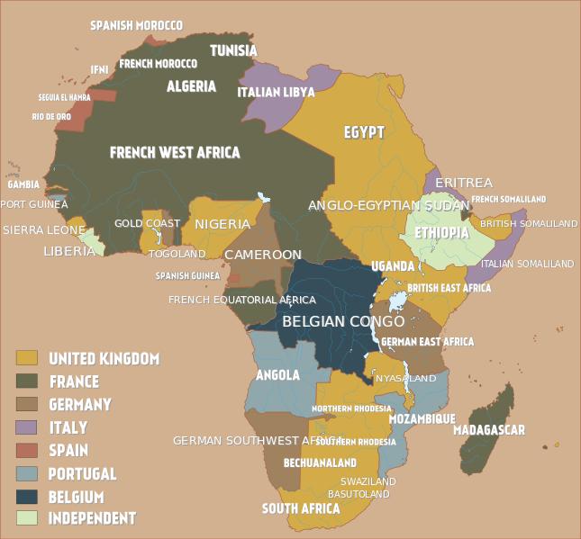
22. Map of how the African continent was divided in 1914 just before the outbreak of WWI. Image
23. This watercolour map of Africa was created by artist H T Hawes and was the original artwork for an item in Odham’s Atlas of 1957. Image
24. How Africa voted on the UN Ukraine declaration. Image
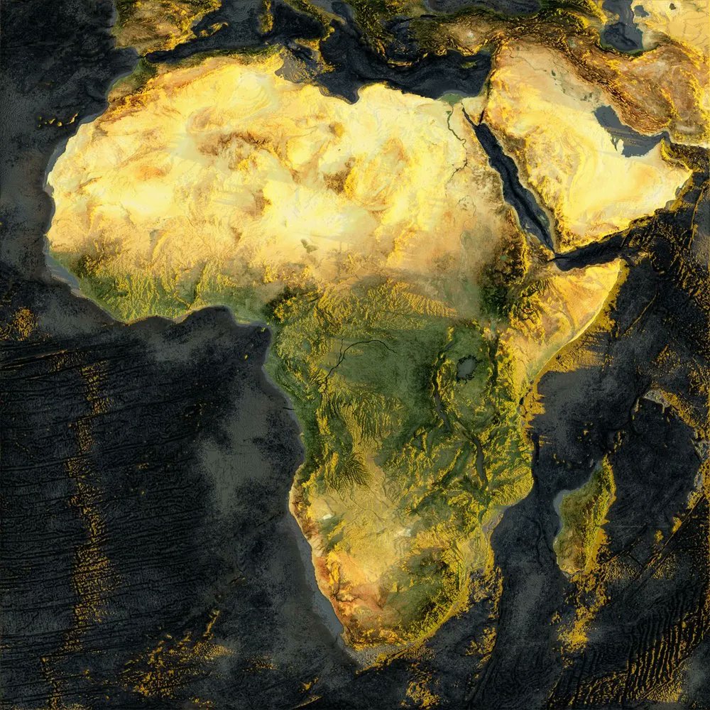
25. This map of Africa uses Sentinel-2 satellite imagery and adds elevation data. 📸 Topi Tjukanov
Thanks for reading! If you like this thread, kindly share the first post and foIIow 👉🏿 @AfricaFirsts for more interesting and informative African content.

• • •

Missing some Tweet in this thread? You can try to force a refresh
 

Keep Current with Africa First

Africa First Profile picture

Stay in touch and get notified when new unrolls are available from this author!

Read all threads

This Thread may be Removed Anytime!

PDF

Twitter may remove this content at anytime! Save it as PDF for later use!

Try unrolling a thread yourself!

how to unroll video
  1. Follow @ThreadReaderApp to mention us!

  2. From a Twitter thread mention us with a keyword "unroll"
@threadreaderapp unroll

Practice here first or read more on our help page!

More from @AfricaFirsts

May 1
African countries ruled by both fathers and sons you’ve probably never heard of.

Thread 🧵

1. Kenya 🇰🇪

Jomo Kenyatta, the country’s first president, served from 1964 to 1978

His son, Uhuru Kenyatta, later became president, serving two terms from 2013 to 2022. Image
2. Ghana 🇬🇭:

In Ghana, Edward Akufo-Addo served as president from 1970 to 1972.

His son, Nana Akufo-Addo, became president in 2017 and served two terms until 2025. Image
Image
3. Togo 🇹🇬:

In Togo, Gnassingbé Eyadéma ruled as president from 1967 until his death in 2005.

He was succeeded by his son, Faure Gnassingbé, who has been in power since 2005. Image
Image
Read 15 tweets
Sep 11, 2025
The Utopia of Ethiopia 🇪🇹

A country that was never coIonized, the birthplace of coffee and home to mighty #GERD.

The most populous landlocked country in the world runs on a unique calendar, and today marks the first day of its 2018 New Year.

An interesting thread🧵on Ethiopia. Image
Image
Image
Image
1. The beautiful city of Addis Ababa.

Addis Ababa is the highest capital city in Africa and serves as the diplomatic capital of the continent.

It is the third most attractive city in East Africa and the only East African city with a Light Rail system. Image
Image
Image
Image
2. Ethiopia has the largest hydropower/hydroelectric dam in Africa and the 18th in the world.

The Grand Ethiopian Renaissance Dam (GERD)

A US$5 billion dollar project owned by Ethiopian Electric Power, generates 5.15 GW.

It is a symbol of Ethiopia’s 🇪🇹 progress. #GERD Image
Image
Image
Image
Read 31 tweets
Sep 10, 2025
Thread on the Largest Hydropower/Hydroelectric Dams in Africa 🧵

1. The Grand Ethiopian Renaissance Dam (GERD):

A US$5 billion project owned by Ethiopian Electric Power, generates 5.15 GW, making it Africa’s largest hydropower plant and a symbol of Ethiopia’s 🇪🇹 progress. #GERD Image
Image
Image
Image
2. The Koysha Dam in Ethiopia 🇪🇹, under construction with an expected cost of about US$2.5 billion, will have an installed capacity of 2,160 MW.

It is part of Ethiopia’s strategy to expand renewable hydropower. Image
Image
3. The Julius Nyerere Hydropower Station in Tanzania 🇹🇿, a US$2.9 billion project with an installed capacity of 2,115 MW (2.1 GW), is Africa’s second largest dams, powering national growth and development. Image
Image
Read 12 tweets
Aug 20, 2025
Mind-Blowing Things You Won't Believe Are Made in Africa! ~ A Thread 🧵

1. Hyper-realistic hand, leg, and ear prosthetics, made for black people by John Amanam from Nigeria 🇳🇬 Image
2. The iconic double-decker London buses are made in Egypt 🇪🇬, Africa by MCV and exported to England. Image
3. Sports cars made by Laraki Automobiles in Morocco 🇲🇦, Africa, that could give Lamborghini and Bugatti a run for their money. Image
Read 25 tweets
Jul 5, 2025
A Sojourn to the Acclaimed Giant of Africa: 9ja 🇳🇬

Welcome to Nigeria, Africa’s most populous nation and the undisputed Giant of Africa!

A land blessed with abundant mineral wealth and warm people.

A thread🧵on the breathtaking beauty of Nigeria that captivates all who visit. Image
Image
Image
Image
1. Wikki Warm Spring, located within the Yankari Game Reserve in Bauchi, Nigeria, features natural, crystal-clear warm water surrounded by lush greenery.

It's a popular destination for relaxation, swimming, and experiencing nature’s therapeutic beauty. Image
Image
Image
Image
2. Almat Farm, located in Kuje, Abuja in North Central Nigeria 🇳🇬, is a serene agro-tourism destination offering organic produce, animal farming, and a peaceful retreat experience.

Visitors can enjoy farm tours, picnics, and a range of eco-friendly activities. Image
Image
Image
Image
Read 27 tweets
Jun 10, 2025
An Interesting Thread on Africa’s National Traditional Fabrics and Their Fabric Maps You’ve Never Seen Before🧵

Every country's fabric map was designed by @MapsAfrican

1. Aṣọ Òkè - Nigeria 🇳🇬 Image
Image
2. Shweshwe - South Africa 🇿🇦 Image
Image
3. Kente - Ghana 🇬🇭 Image
Image
Read 24 tweets

Did Thread Reader help you today?

Support us! We are indie developers!


This site is made by just two indie developers on a laptop doing marketing, support and development! Read more about the story.

Become a Premium Member ($3/month or $30/year) and get exclusive features!

Become Premium

Don't want to be a Premium member but still want to support us?

Make a small donation by buying us coffee ($5) or help with server cost ($10)

Donate via Paypal

Or Donate anonymously using crypto!

Ethereum

0xfe58350B80634f60Fa6Dc149a72b4DFbc17D341E copy

Bitcoin

3ATGMxNzCUFzxpMCHL5sWSt4DVtS8UqXpi copy

Thank you for your support!

Follow Us!

:(