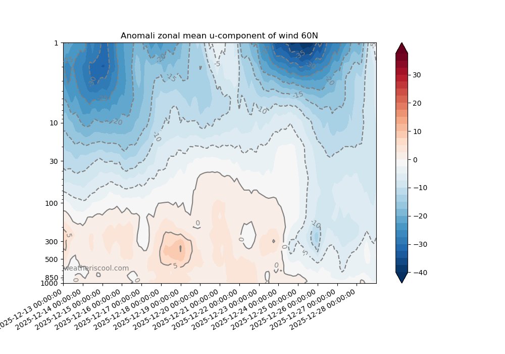
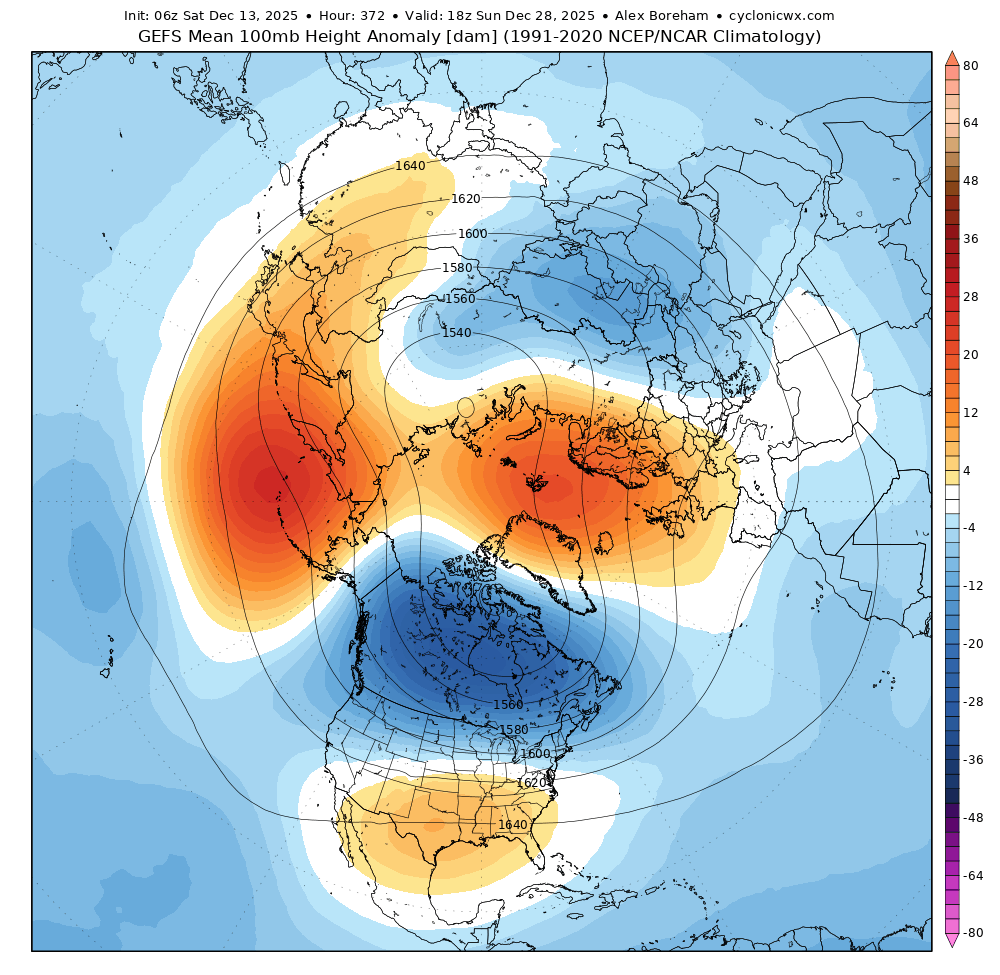
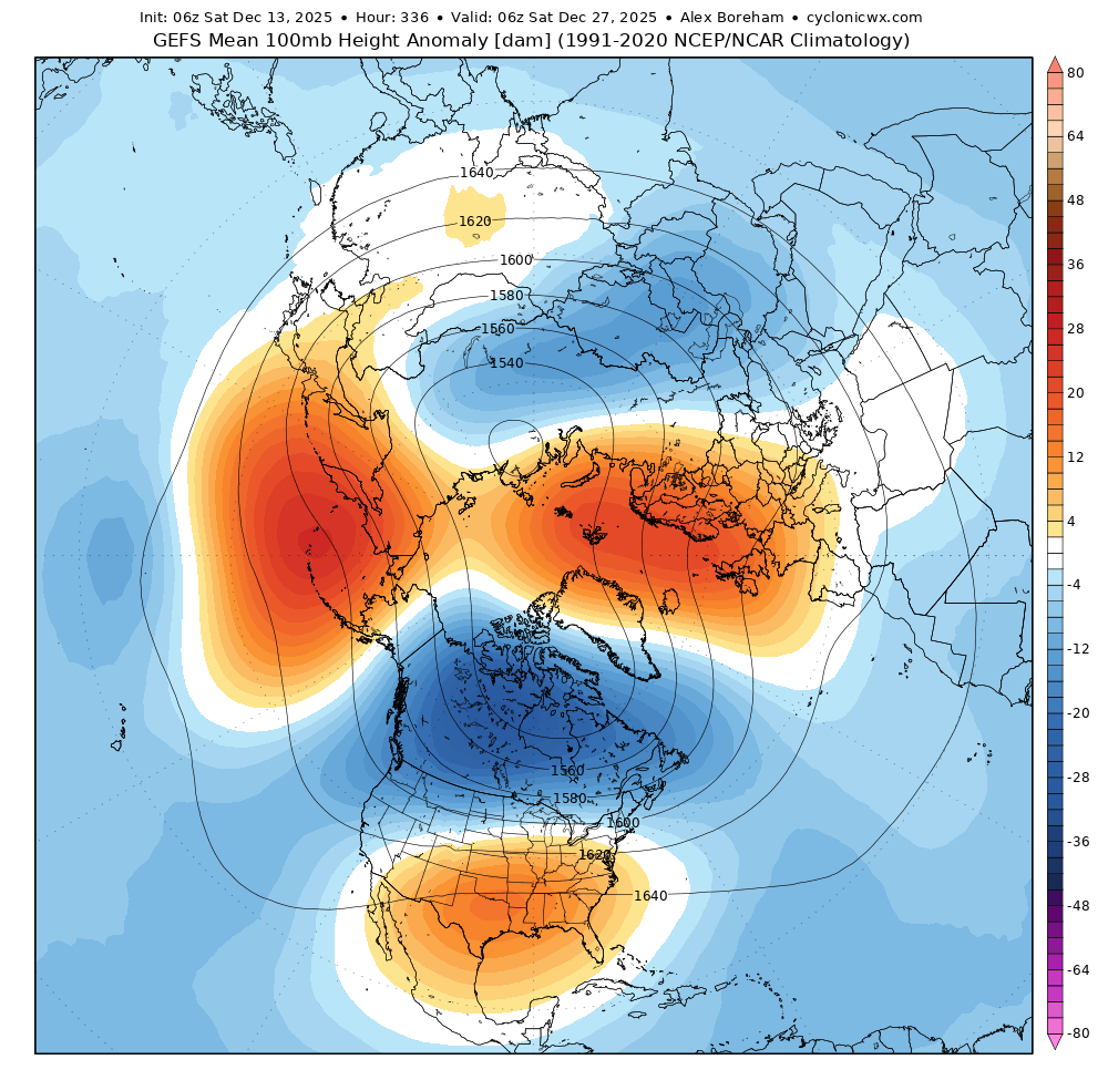
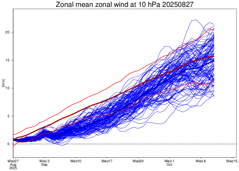
🔧Record weak #SPV, weak MJO propagation, deeply negative AAM & emergent La Niña will be the main subseasonal drivers of the upcoming month, prompting wet conditions across Europe & near-normal temperatures throughout September. 🧵
📉🌧️It is now well-acknowledged that the coming month will likely be thermally near-normal to below-normal across Europe & wetter than average, especially in the first half of the month, thanks to an active rail of low pressure transiting throughout the continent (+NAO/SCAND) ⤵️
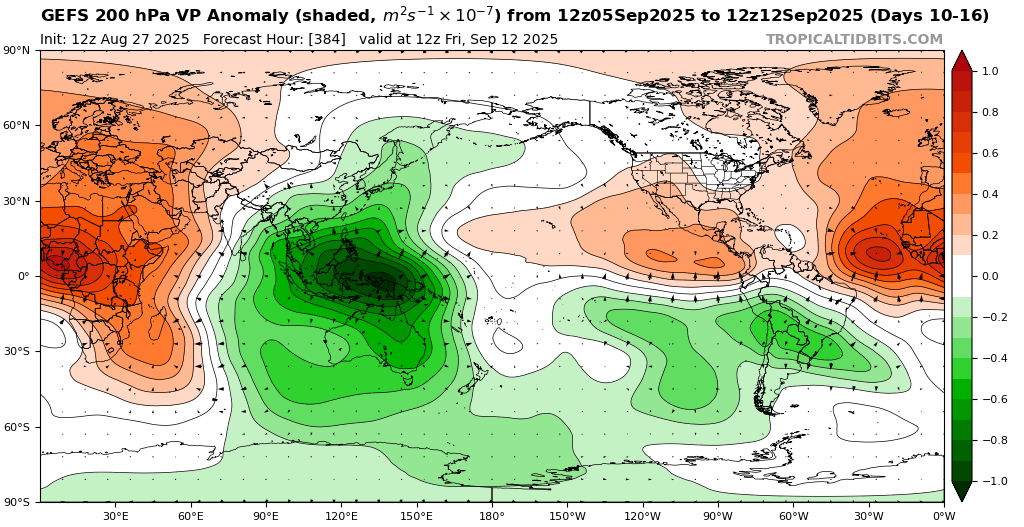
Without any sign of strong heat ahead, September could be a relatively "normal" month, climatologically speaking, without this preventing the occurrence of milder epiphenomena. Behind this dynamic, a deeply negative AAM & weak MJO activity works to maintain disturbed conditions⤵️
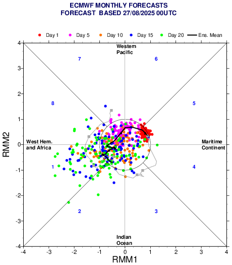
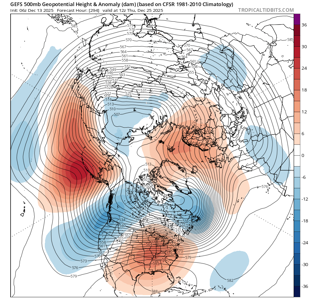
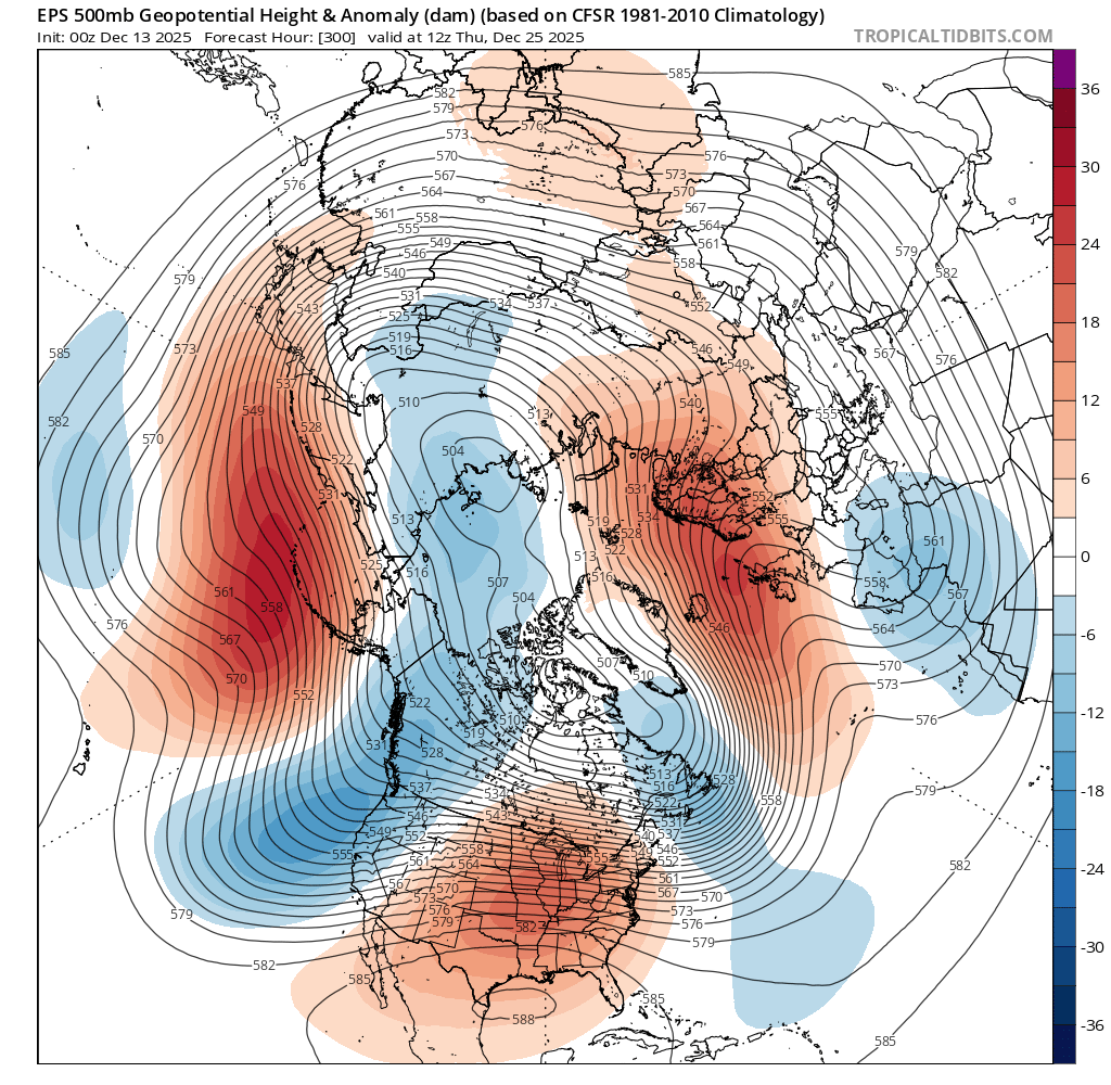
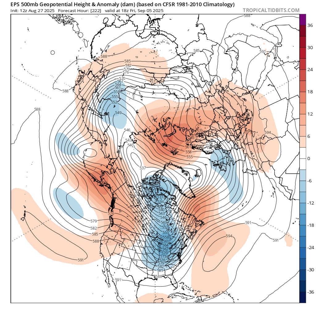
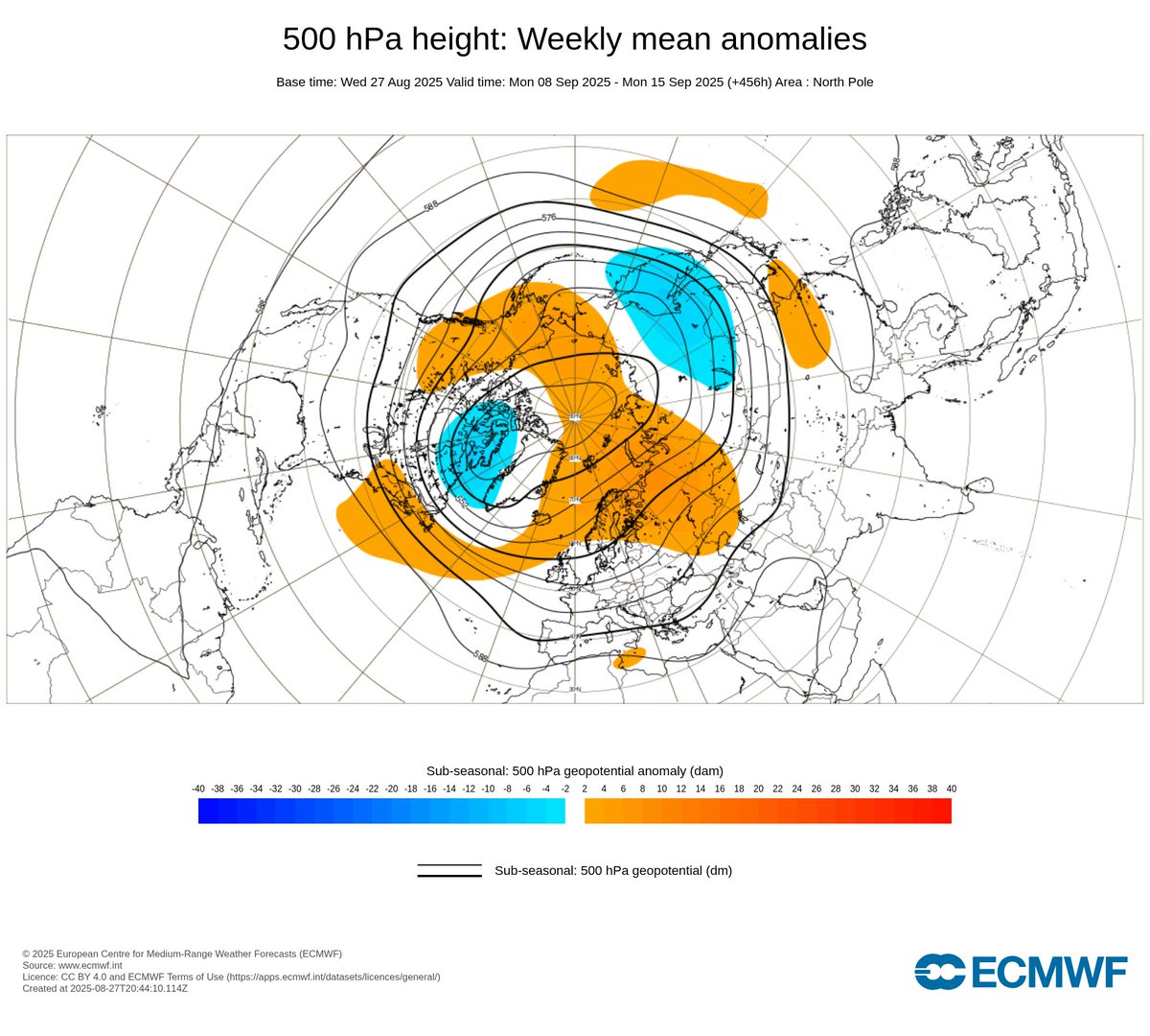
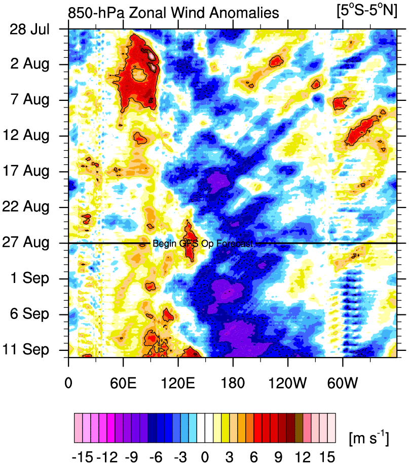
🌊A transition into a very weak MJO phase 6-7 and a rapid return to phase 1 under Niña-like AAM is very likely to contribute to the upcoming unstable pattern, maintaining Greenland-Scandinavian High Lat. blocks, as currently shown in extended-range forecasts ⤵️
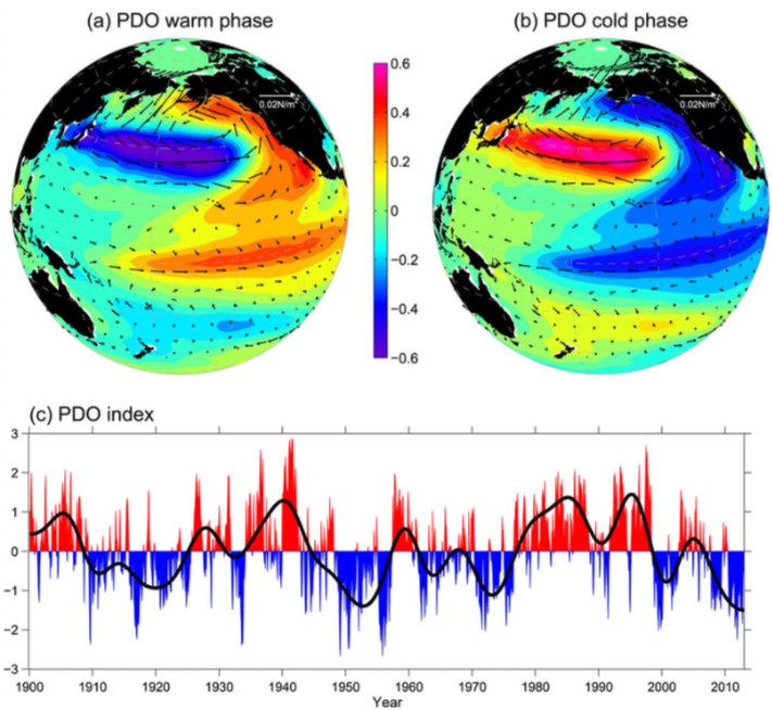
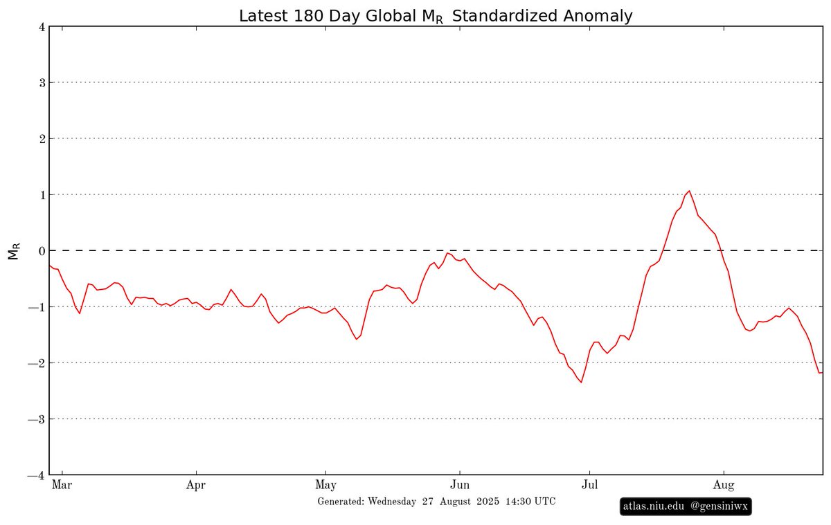
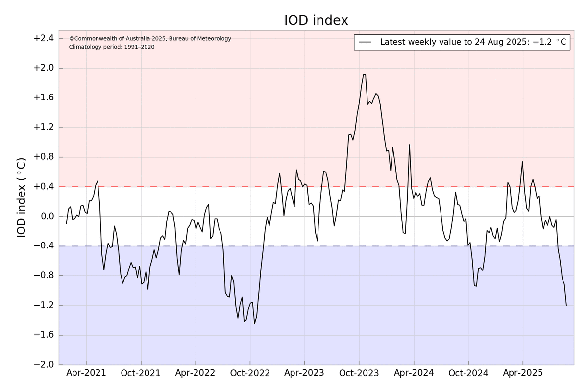
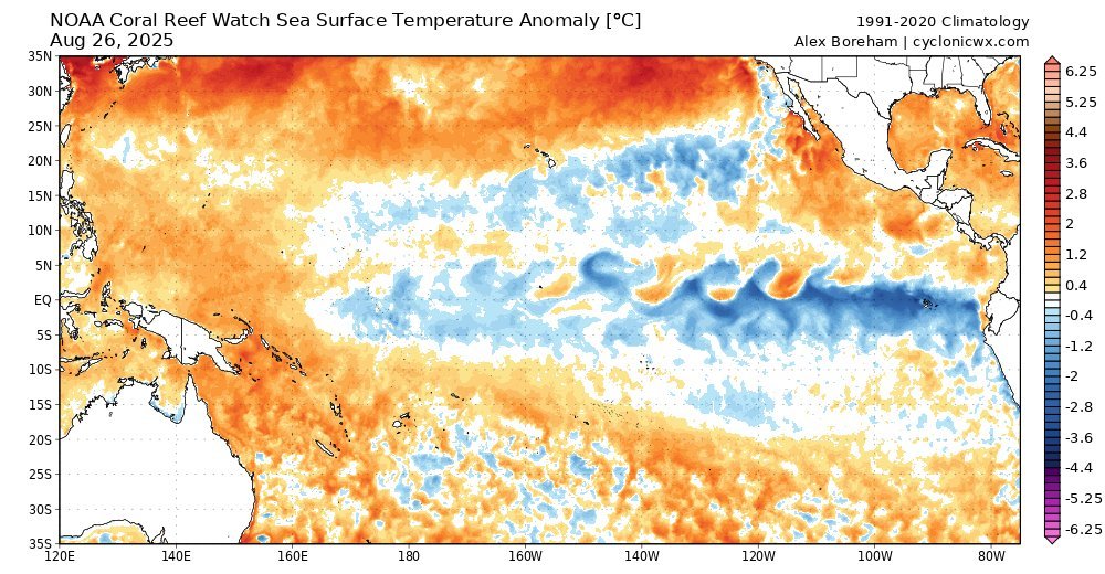
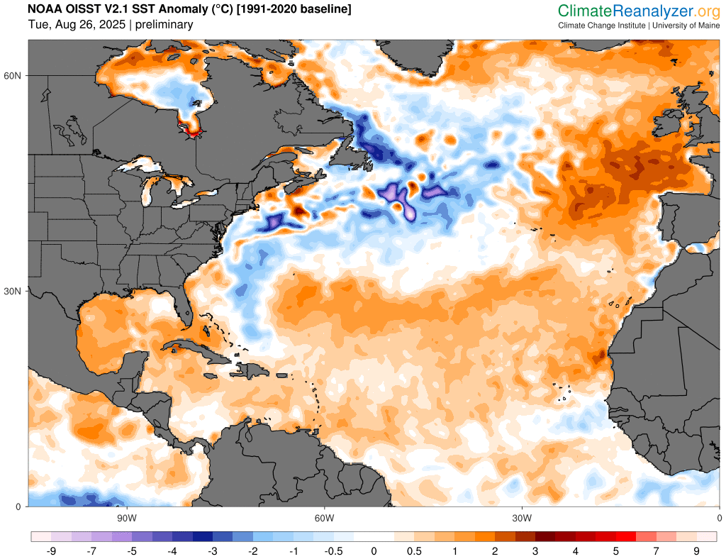
📉 Deeply La Niña-like negative AAM seems to be mainly fueled by a strong negative IOD event underway, sticking convection over the Maritime Continent, strengthening La Niña and in turn contributing to making the AAM negative through a prolonged action-reaction cycle. ⤵️
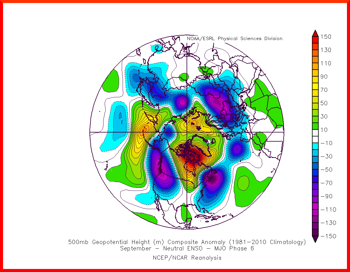
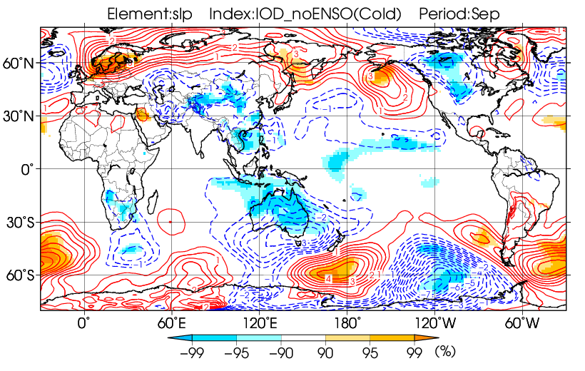
❓ Such conditions is very likely to continue throughout September, making a generally wet & standard or cool September very likely in Europe. JMA composite for -IOD in September match very well with what is currently forecasted in NWP. ⤵️
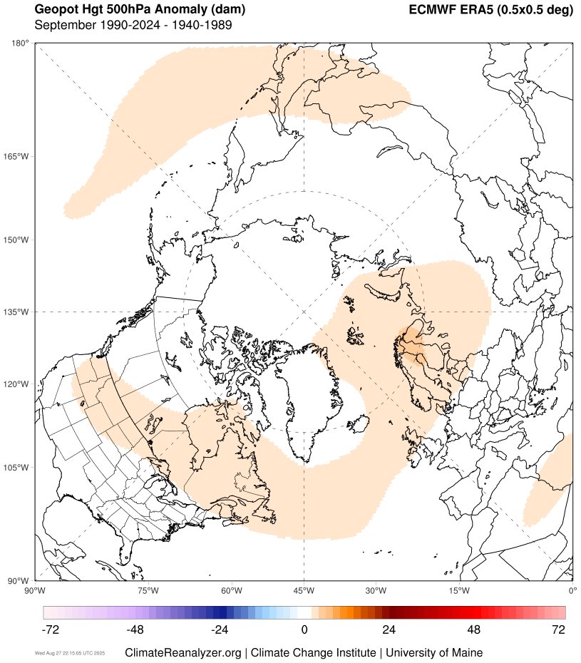
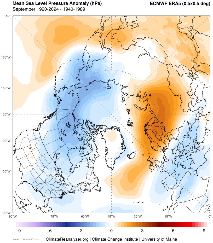
⚒️ These conditions are also close to the trend observed in the past three decades, compared to the period 1940-1989, which was more zonal & likely enhanced by a combination of both record weak #SPV & cooler Atlantic SST pattern prompting such a synoptic. ⤵️
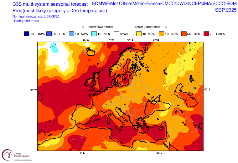
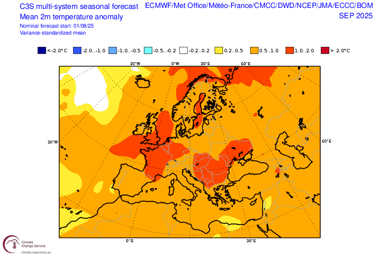
🍂 Overall, I would expect a continuation of disturbed & cool conditions in 🇪🇺 over the next few weeks, w/o excluding the possibility of a possibly significant mild spell, given the persistent strong background warming. A near-normal September would be a blow to the C3S forecast.
@threadreaderapp unroll
• • •
Missing some Tweet in this thread? You can try to
force a refresh
We are nearing a cross-model agreement for a North Atlantic/Scandinavian block towards the Christmas period.
Such a pattern could be motivated by a downwelling of the current +GPH/-ve U-winds anomalies, stuck to 200 hPa due to the wave reflection, towards the troposphere. 1/
Nearly three weeks after the initial SSW, models are hinting towards a proper downwelling into the lower troposphere near ~20/12, a typical delayed response which tends to occur after a wave reflection wane (e.g. 1958 & 1968), with a lot of uncertainties. 2/
The 10 & 100 hPa profile looks conducive to;
1. Sustained cold pattern in Canada & U.S. later in the winter
In what is said to be "one of the most significant" advances in recent years about subseasonal predictability, researchers from the Institute of Science and Technology Austria discovered a previously unknown cyclic climate pattern, TWISO🧵
❓WHAT IS TWISO ?
Called Tropics-Wide Intraseasonal Oscillation (TWISO), the oscillation, previously undetected, influences rainfall, winds, temperatures, and convective activity among other things in the tropics.
The oscillation follow a 30-60 days period 🗓️
📊Shorter than seasonal-scale El Niño Southern Oscillation (ENSO) and longer than daily climate variability, TWISO is said to be a fundamental property of the tropical system, not merely a byproduct of existing modes like the MJO or ENSO.
🔎 Aperçu à moyen et long terme – quel temps ces prochaines semaines ? [Bulletin N°1 du 9 octobre 2025]
🍂 Après une entrée d'automne fraîche et peu dynamique, ces conditions vont-elles durer en octobre ? Premiers éléments de réponse dans ce premier bulletin hebdomadaire🧵
🅰️ Vers un puissant anticyclone ces prochains jours
➡️ Une puissante cloche anticyclonique concernera l'🇪🇺 Occidentale ces prochains jours, avant de se recentrer vers les Îles Féroés dans une forme de blocage dit "omega".
➡️L'anticyclone est attendu pour être inhabituellement fort pour la période de l'année et la région, avec une pression maximale pouvant atteindre jusqu'à 1037 hPa en mer du Nord en début de semaine prochaine – un nouveau record mensuel potentiel de haute pression.
1/ THREAD | LA PDO EST-ELLE UNE OSCILLATION « ARTIFICIELLE » ?
Longtemps considéré comme une oscillation naturelle, la PDO, connu pour ses impacts climatiques mondiaux, pourrait en réalité être influencé par les activités humaines.
DÉCRYPTAGE 🧵
2/ QU’EST-CE QUE LA “PDO” ?
La PDO a été découverte en 1996 par Steven R. Hare dans sa thèse de doctorat portant sur l’étude de l’évolution des stocks de saumon dans le Pacifique Nord, avant d’être formalisée en 1997 dans une étude publiée par Steven & ses collègues⤵️
Acronyme de “Pacific Decadal Oscillation”, la PDO est une oscillation multidécennale des températures océaniques du Pacifique N, alternant historiquement entre une phase négative & positive tous les 20-30 ans adoptant une structure en « fer à cheval », à l’image de l’Atl. Nord⤵️
🌡️Après la plus longue période au-dessus de 1.5°C [par rapport à l'ère préindustrielle] jamais enregistrée, les anomalies de températures mondiales ont chutées ces 3 derniers mois pour retourner aux niveaux de réchauffement proche des conditions post-Nino 2023-2024.
@CopernicusECMWF 📌 En juillet 2025, la température mondiale était supérieure de 1,25°C à la moyenne estimée entre 1850-1900. Ce n'était que le quatrième mois sur les 25 derniers mois où la température mondiale était inférieure de 1,5 °C au-dessus du niveau préindustriel.
@CopernicusECMWF 📌Cela ne signifie pas que le réchauffement climatique s'est arrêté. « Si nous ne stabilisons pas rapidement les concentrations de GES dans l’atmosphère, nous devons nous attendre non seulement à de nouveaux records de température, mais aussi à une aggravation de ces impacts »
ℹ️La chaleur est désormais confirmée. Quelles sont les causes de ce changement de régime? 1/ L'AAM a entamé sa chute, générant une modification des flux atmosphériques, 2/ la MJO passe en phase 8-1, 3/ en conséquence, la NAO va redevenir positive. Décryptons cela dans ce thread⤵️
1/ l'AAM, indicateur du moment atmosphérique terrestre, a entamé sa chute, faisant suite à une forte hausse depuis mi-juillet. Cela a commencé à redistribuer les vents zonaux dans l'HN, propageant vers le sud les anomalies - & +, signature d'un retour imminent de la NAO+
C'est la deuxième fois de l'été que cela se produit, après la chute de fin Juin ayant provoqué une poussée de NAO+ durant la 1ere décade de Juillet. La tendance négative est associée à une propagation vers le sud des anomalies, alors qu'une tendance positive produit l'inverse