1/Spent last Saturday with Kelly Russel, UBC, exploring Mt. Meager, a volcano north of Pemberton. It last erupted 2360 years ago, and also produces numerous landslides, shown me me here is the 2010 landslide. #SFUNaturalHazards#MtMeagerHazards
2/ Extensively hydrothermally altered rocks make this Canada’s most dangerous mountain and the 2010 landslide (pictured before) was the largest in Canadian history. Gio Roberti, my PhD student, explains the dynamics of this failure. #SFUNaturalHazards. #MtMeager
3/ There was a complex rheology and hummocky landslide debris. The river has cut a nice section through one of the hummocks. This one has uniform lithology so likely a large block that became fractured. #SFUNaturalHazards#MtMeager
4/ The landslide sheared off trees. More distal trees killed by being inundated by more fluid rich sediments. #SFUNaturalHazards#MtMeager
5/ Now onto the last eruption! This welded block and ash deposit at keyhole falls is one of the primary products from the eruption. This dammed the river and formed an extensive lake. When it drained, that is what formed the impressive falls.#SFUNaturalHazards#MtMeager
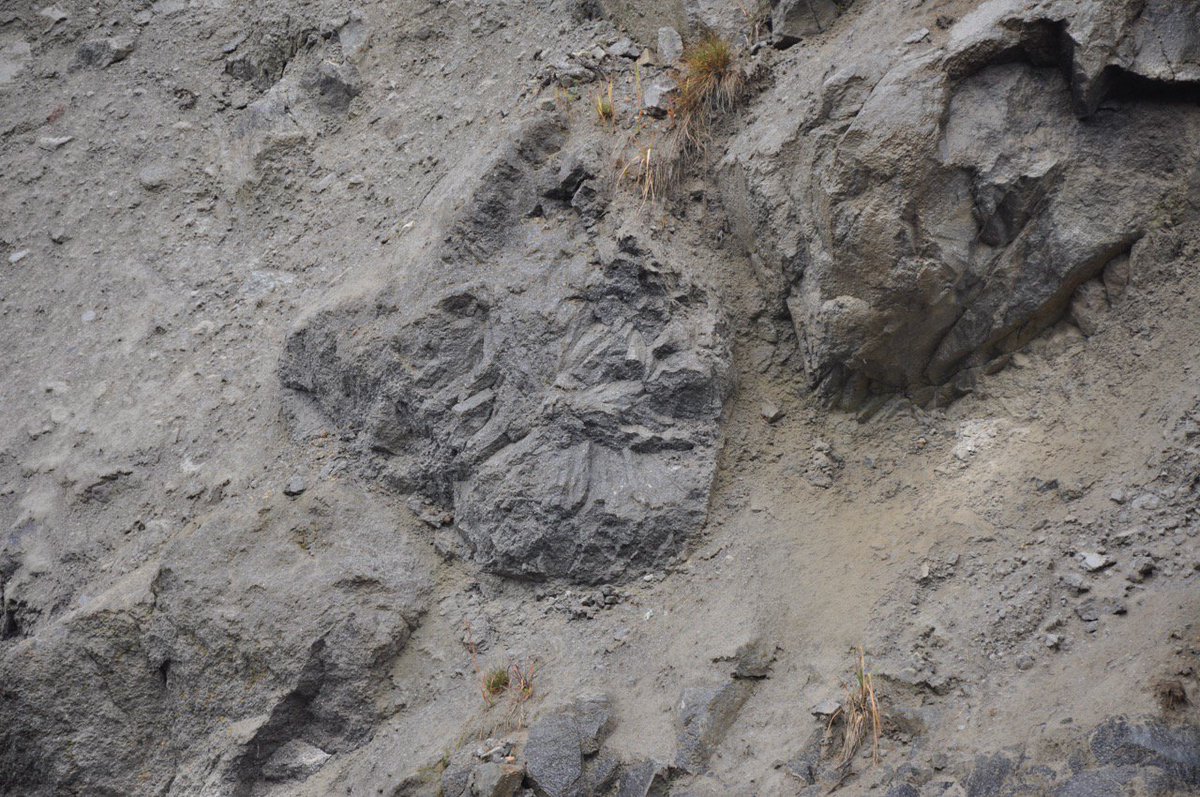
6/ Catastrophically drainage of the lake ripped out still warm parts of the block and ash flow. This is actually 3 large blocks in a coarse gravel. Radial pattern means cooled after erosion. Now that’s a flood! #SFUNaturalHazards#MtMeager
7/ There were extensive pyroclastic pumiceous rich deposits which are mined as an aggregate. The rounded granitic clasts of deep basement formed by milling during the eruption. #SFUNaturalHazards#MtMeager
8/ Last stop was looking at Crazy columnar jointed basalts that erupted up under a glacier. And it didn’t seem at all weird to be discussing this in the pouring rain while it was getting dark!
9/ The measure of a good fieldtrip is commonly how many good garden stones were acquired. This one was pretty good! . #gardenstones!
• • •
Missing some Tweet in this thread? You can try to
force a refresh
On August 29 examined some active layer detachment slides Near Arch and Quill creeks, SW Yukon. Around 25-30 slides occured on August 17, the same time the Alaska Highway was blocked by debris flows. A thread of these. This is the slides near where we landed. 1/10
Landed on the deposition zone of one of the landslides and flew the drone. Helicopter indicated for scale. 2/10
This is part of Crey Ackerson’s MSc thesis supported by Kristy Kennedy from the Yukon Geological Survey. 3/10
Finally some pictures of the Koidern Landslide. Start with some aerial pictures and then some more details. Some really interesting mollards, and some have remobilized! It is a long thread as it was a really cool landslide! 1/10
Looks like several phases. Initial failure crossed the small valley and then turned the corner. Then remobilization with a more fluid flow down the valley, blocking the larger stream. Then a smaller failure from the headscarp, where we first landed the helicopter. 2/10
Margin of the slide with lots of mollards. Nice streaking of the bedrock. 3/10
Spent a beautiful Friday at Point Grey (aka Wreck Beach) looking at the stratigraphy. He we have two advance sub-units below the till. The lower is interstratified sand and silt with peats, with ages from 26-24 ka, the upper, cross stratified sand. 1/
These advance sediments are called Quadra Sands and some diatoms in the lower sub-unit sediments indicate marine incursion. The upper sands show tidal influence. With eustatic sea level at this time, indicates >100 m of isostatic depression! 2/
The accumulation of ~70 m of Quadra sands indicates significant accommodation space. The two sub-units are exposed all along the escarpment. 3/
Friday’s Seymour valley fieldtrip examined the stratigraphy of the thick valley fill. The base is 42-29 ka MIS 3 gravel, sand and peat, indicating warmest climate at the base and progressively cooler to the top. 1/9
The MIS 2 Fraser Glaciation, has two advance stades. These are advance glaciolacustrine sediments of the older Coquitlam Stade, a mix of laminated to finely bedded silt and sand and diamicton. 2/9
Indicates ice blocked the mouth of the Seymour valley, forming this lake. There is wood in these advance sediments, dating to around 21 ka. Implies there is a spruce-fir forest in the area as ice advanced. 3/9