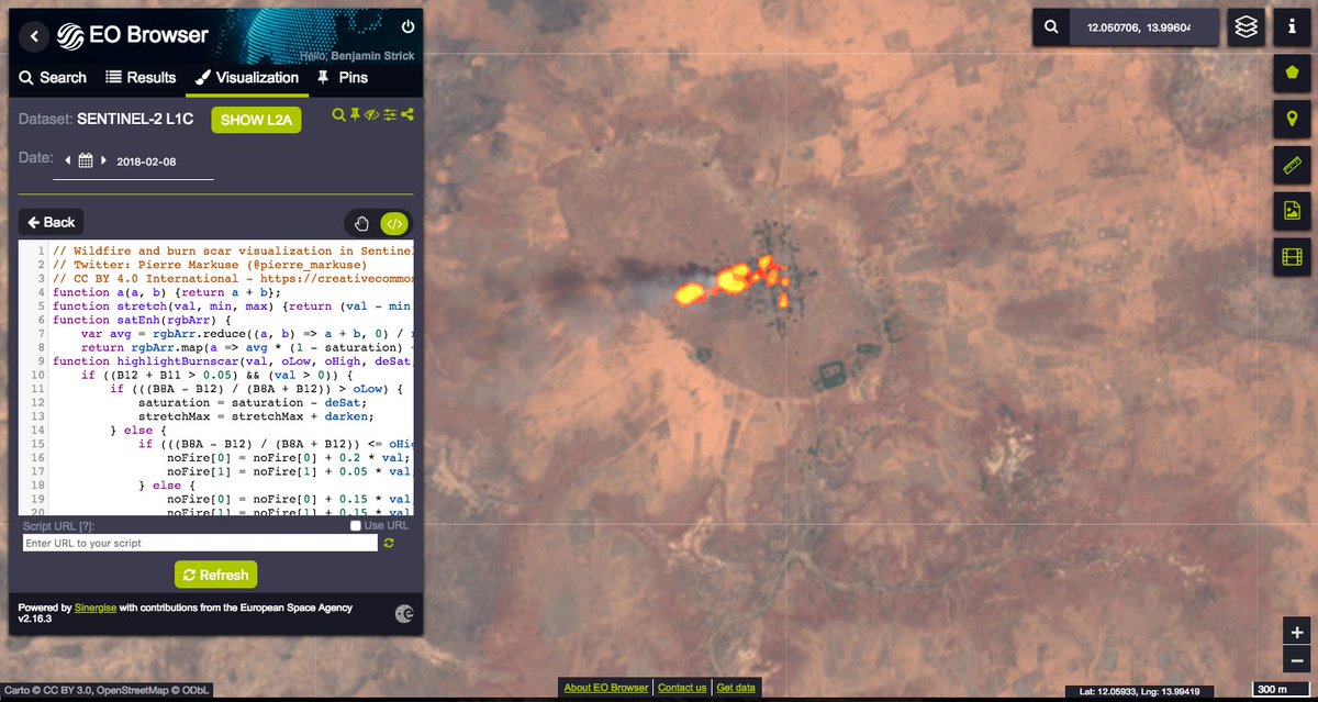
If you are using satellite imagery in your coverage of conflict areas, I encourage you to use @sentinel_hub imagery with custom scripts (available on @github - github.com/sentinel-hub/c…). For example, take a look at this village in north Nigeria ( 12.050973, 13.995915). Thread 👇 
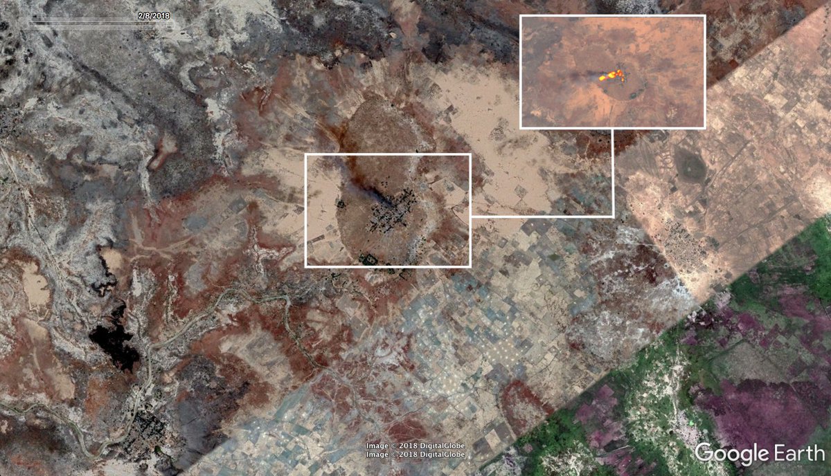
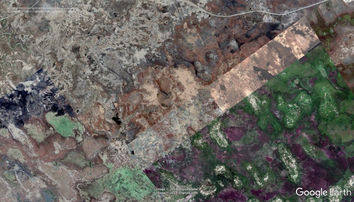
On @googleearth, the fires in the village @ 12.050973, 13.995915 on February 8, 2018, are barely noticeable - but we can easily identify this by customising the way we look at the earth. goo.gl/maps/72khpC9HN…
Using Sentinel-2 imagery through @sentinel_hub, we can see the same area located from @googleearth. There is a large repository of custom scripts that we can use to customize @sentinel_hub's view on @github: github.com/sentinel-hub/c…
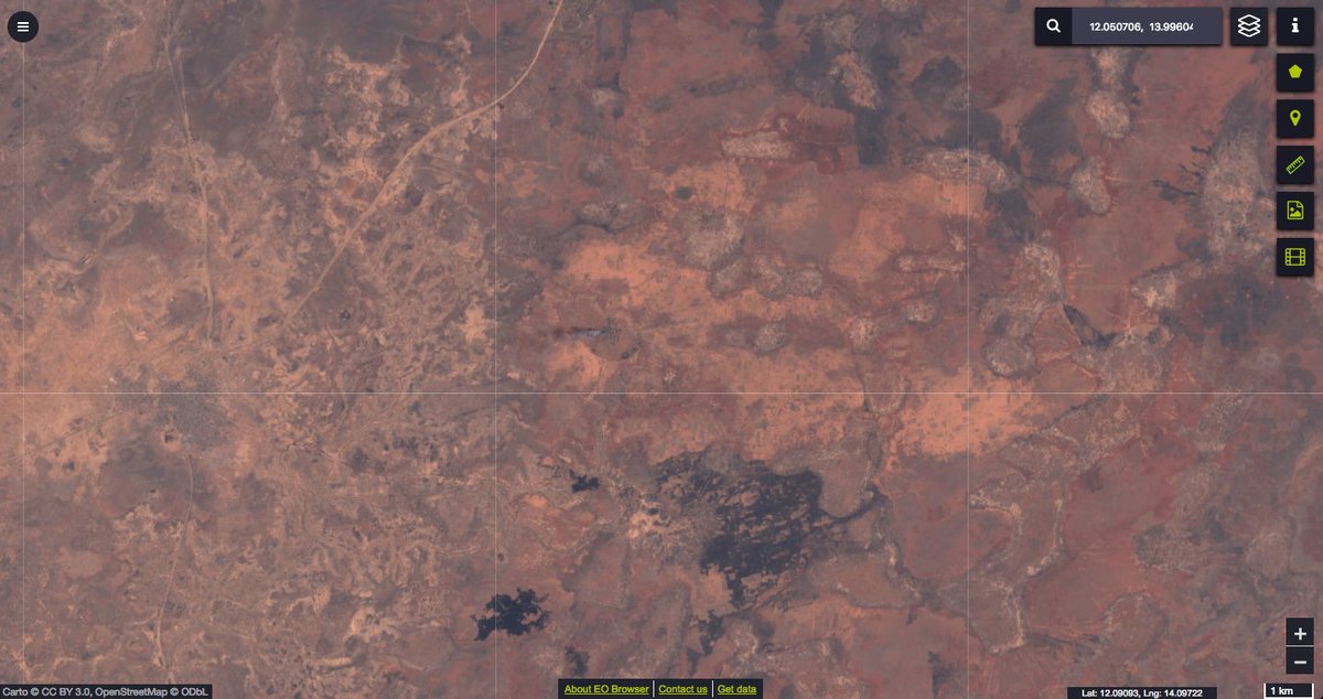
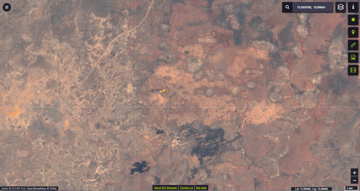
One specific script from @Pierre_Markuse provides wildfire visualization (github.com/sentinel-hub/c…) - in using this on the Nigerian village, we can see how easy it is to identify current burning buildings.
Using @github scripts in conjunction with satellite imagery may seem intimidating for some, but it is a simple 'cut and paste' (as you can see in the image). Testing and trialling different values through @sentinel_hub can also yield some amazing results.
An aspect of this work is analyzing the after-effect of fire-damaged structures in conflict areas where the cause may have been intentional. For more on this, you can view a small guide using satellite banding to identify burnt villages on @bellingcat bellingcat.com/resources/how-…
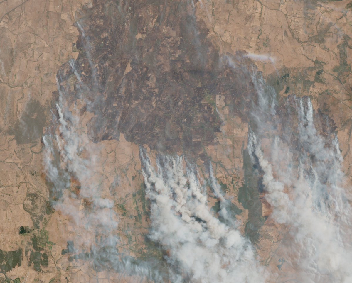
Sentinel-2 imagery from #Nigeria, east of Maiduguri, combined with custom rendering, highlights an array of fires that were burning in October. The custom script identifies the current status of the fire and the path it is taking. @sentinel_hub #geoint #remotesensing

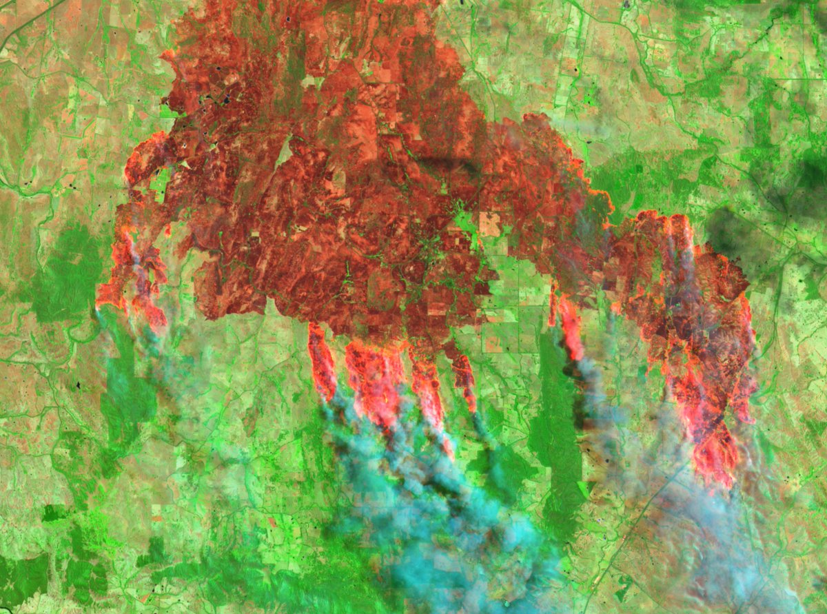
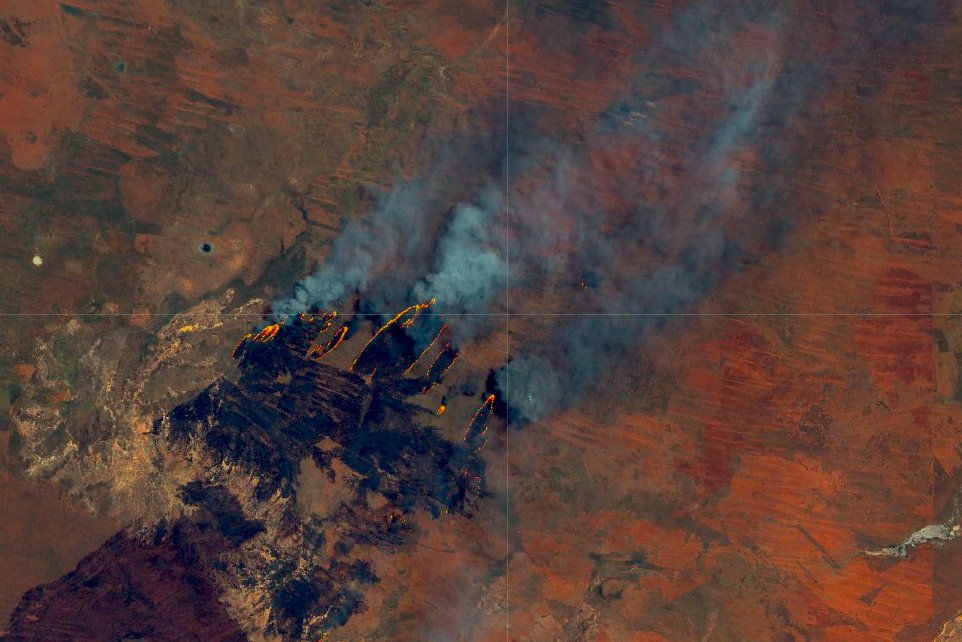
This 'gigafire' was seen on October 13 east of WA in Australia (my home). The spread of the fire in image is 20km across and resulted in the burning of 880,000 hectares. Viewed on @sentinel_hub using @Pierre_Markuse wildfire script. @wildfiretoday: wildfiretoday.com/2018/10/26/bus… #geoint
• • •
Missing some Tweet in this thread? You can try to
force a refresh