NY NJ PA Weather Profile picture
Aug 21, 2019 5 tweets 2 min read Read on X
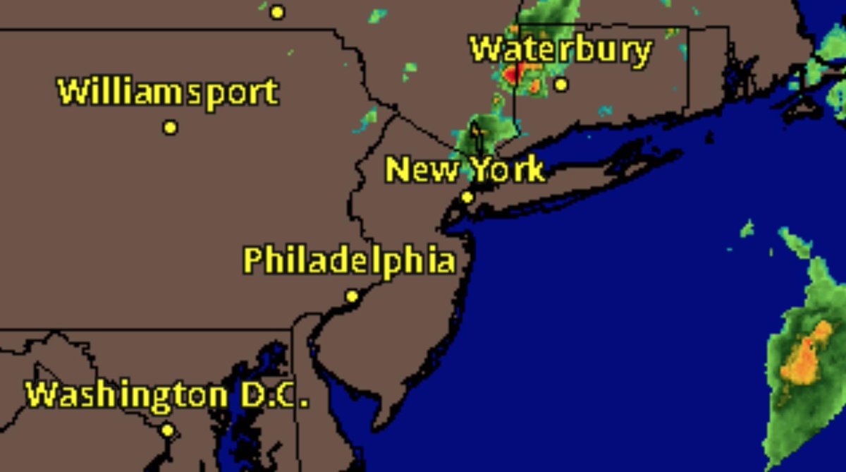
We are pretty quiet right now as you can see, but I suspect that will star to change after 2 PM.
Right now the lower levels of the atmosphere are the most unstable. If you look at this Lifted Index observation map, you might wonder why we aren't see thunderstorms pop up all over the place right now.
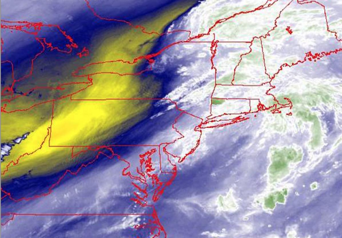
The answer can be found at the mid levels of the atmosphere where the atmosphere is far more stable because the air mass is very warm and saturated on up to about 600 MB.
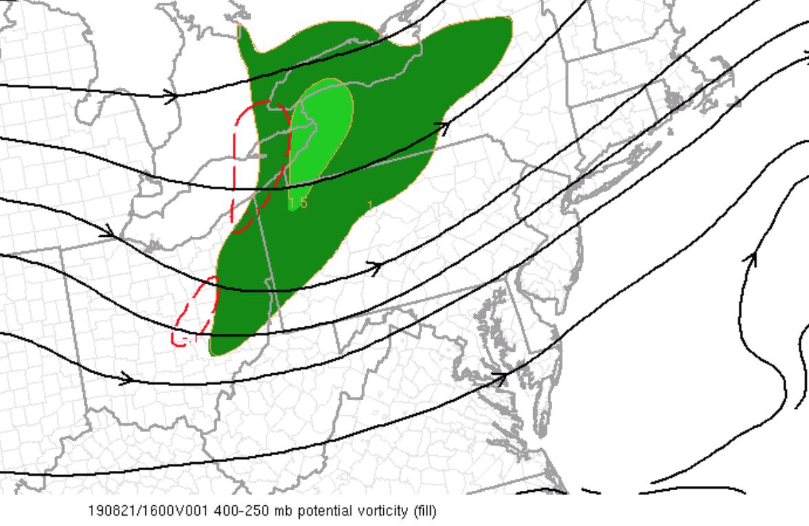
So what is needed is a trigger to enhance lifting. Well, hello trigger! We have a very strong shortwave approaching that will introduce drier air at the mid levels and destabilize the atmosphere.
Not everyone will have thunderstorms, but those that do can expect some impressive ones this evening. The primary question is where do the storms start to develop and where does the focus for low level convergence become the strongest.

• • •

Missing some Tweet in this thread? You can try to force a refresh
 

Keep Current with NY NJ PA Weather

NY NJ PA Weather Profile picture

Stay in touch and get notified when new unrolls are available from this author!

Read all threads

This Thread may be Removed Anytime!

PDF

Twitter may remove this content at anytime! Save it as PDF for later use!

Try unrolling a thread yourself!

how to unroll video
  1. Follow @ThreadReaderApp to mention us!

  2. From a Twitter thread mention us with a keyword "unroll"
@threadreaderapp unroll

Practice here first or read more on our help page!

More from @nynjpaweather

Jan 27, 2022
Okay, so now it is time to share some thoughts. These observations and ideas I’ve had up about 3 days ago for Premium Consulting Members, but at this point I think the writing is on the wall so let’s roll.
The whole forecast for this storm comes down to jet stream dynamics and how they influence upper and mid-level low-pressure development.
Basically, the models have been struggling on handling how a jet streak over the Upper-Mid West influences the development of the 500 MB trough over the Tennessee River Valley.
Read 12 tweets
Jan 31, 2021
Okay, so going to get my normal updates, client stuff done right now. Let me lay out the rules for Live Coverage so everyone is clear.
1. When you share observations please provide town and state. Also adding a #nywx #njwx #pawx etc helps the @NWS_MountHolly and @NWSNewYorkNY
2. I don't do IMBY questions in general, and especially not in a storm. That is the Premium Live Coverage, which I'll be doing starting at 5 PM until either I pass out or the storm is over. Whichever is first.
Read 4 tweets
Jan 31, 2021
Good morning everyone! HAPPY SUNDAY!!
Snow has started in southern Delaware and the Washington, D.C. metropolitan area already. Clouds are on the increase with temperatures ranging from the single digits in the Catskills to the upper 20s in Cape May, New Jersey.
Updates are on the way with the latest watches and warnings and a public update from our intern @MichaelBrownewx ! No changes to the going forecast at all. I've been pretty much locked in on this storm since Friday.
Read 6 tweets
Jan 30, 2021
Okay, so I think, while, I'm looking over the warning and watches, I just want to touch on my forecasting philosophy, specifically when models do their typical waffling as we get closer to the event.
I personally, do not change a forecast because of one model or another, even the ECMWF, unless there is a fundamental change in the overall 500 MB environment. I think this practice leads to more confusion and hurts sending out the message.
I am sure no matter your location, that you can find a model solution that is to the liking of your back yard, depending on the result you want.
Read 5 tweets
Jan 29, 2021
I think no matter what conclusion I come to this afternoon, and I have the idea in my mind but just fleshing out the details, someone will be disappointed. Can’t help that.
I have an idea of what I want to do and been developing the forecast for the past five days in the Premium Area. Now it is just down to location of lifting parameters and thermal gradient analysis on a vertical and horizontal orientation.
Here is the deal guys, I am seeing a LOT of rising air on the NW side of this storm, which means someone is going to get bombed and someone is going to be very disappointed because of sinking air and that gradient is going to be TIGHT.
Read 6 tweets
Feb 10, 2020
I want to be on record that I stand with @RogerPielkeJr and against @skepticscience, as I stand against this action of making blacklists and attacks on scientists' careers. 1/9
Look, this is for all the fellow meteorologists, climatologists, and atmospheric scientists that follow this feed. We can all disagree on climate, weather forecasts, theories, and the rest. We can disagree on whether climate projections are realistic or not. 2/9
We can debate how best to improve our ways of developing energy and what is the most realistic path from going from point A to point B. 3/9
Read 9 tweets

Did Thread Reader help you today?

Support us! We are indie developers!


This site is made by just two indie developers on a laptop doing marketing, support and development! Read more about the story.

Become a Premium Member ($3/month or $30/year) and get exclusive features!

Become Premium

Don't want to be a Premium member but still want to support us?

Make a small donation by buying us coffee ($5) or help with server cost ($10)

Donate via Paypal

Or Donate anonymously using crypto!

Ethereum

0xfe58350B80634f60Fa6Dc149a72b4DFbc17D341E copy

Bitcoin

3ATGMxNzCUFzxpMCHL5sWSt4DVtS8UqXpi copy

Thank you for your support!

Follow Us!

:(