UPDATE: Minneapolis added an additional 11 miles of Stay Healthy Streets on local streets, expanding geographic equity + complementing #openstreets along 21 miles of parkway. This includes a "super loop" linking St. Paul and MPLS on both sides of the Mississippi. #Covid19Streets
Beyond these 32 miles, sidewalk space has been expanded in front of essential services, 400+ pedestrian signals are on recall, and 20mph speed limits are being implemented citywide. In short, no other US city has taken as comprehensive a #Covid19Streets approach as Minneapolis.
With leadership from @rchonthego, many of these #Covid19Streets measures could be kept post-pandemic, as they are informed by the city's transportation action plan. Again, the opportunity for cities now is to implement safer streets in weeks/months rather than years/decades.
• • •
Missing some Tweet in this thread? You can try to
force a refresh
So, what does it take to change a New York City street? An imperfect thread about the recently completed @ParkToPark103 SIP project.
In late 2019 @StreetPlans joined up with @OpenPlans and local resident @pfrishauf to undertake a study about West 103rd Street. The goal was to improve safety and connectivity between between Central Park and Riverside Park.
@StreetPlans @OpenPlans @pfrishauf It was dubbed "Park to Park, with Douglass (NYCHA campus) at Its Heart." In early 2020 we began measuring and analyzing just a single block, West 103rd between Broadway and West End Avenue.
1/x: One year since the adoption of the 2020 #LetsRideJC Bike Master Plan, we’ve led / contributed to implementation plans for more than 7 (street) miles of protected bike lanes, with most of these miles built in or set to be installed in 2020. Here’s a quick review.
2/x: Let’s start w/ Grove St, the 1st segment built, a two-way PBL, fittingly in front of City Hall. As I tweeted Friday, the conversion of the southbound travel to outdoor dining has made this one of the best streets in JC. And Grove now connects to directional PBLs on Grand St
3/x: Washington Blvd followed in 2019, but was not finished before the City decided to repave the full street, which allowed us to learn from shortcomings in the initial design. These directional lanes extend to Marin Blvd, and will soon connect to Observer Highway in Hoboken.
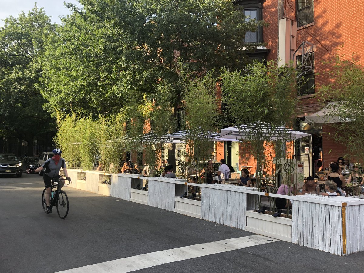
1/5: We left NYC for California to see family for a few weeks just as restaurants were allowed to convert the curbside. I took a stroll along Dekalb Avenue tonight and found my neighborhood transformed.
A number of restaurants stood out to me, including Imani Kitchen. They had the funkiest set up an diners there look like they were having the most fun.
Evelina wins on scale of intervention and greenery.
1/X: I thrive on traveling and learning/collaborating with others. The coming weeks will be a challenge in this regard, so I'm going to attempt to satisfy my wanderlust by sharing a daily image and observation from inspiring streets and public spaces I've visited globally.
2/X: Here's Angel Place (2014), a laneway in the heart of Sydney that gained international fame thanks to Artist Michael Thomas Hill's "Forgotten Songs" installation. Part of a temporary laneway activation program, the 2009 art work proved so popular it was made permanent.
3/X: Via Orologio, Palermo, Italy (2019). The humane streets of many Italian cities are as socially dynamic as they are beautiful. A reduced social life here must be particularly painful because streets like these were not designed to the lesser standard of functional mobility.
Back to NYC - thanks to @sotonobaplace for such an inspiring week exploring #tacticalurbanism, #placemaking in Japan. Here are some thoughts from my time here, with recognition that one week is hardly the time required to understand a city as complex as Tokyo.
I was utterly surprised at how little congestion there is in Tokyo. The transit system, walking, and cycling really ease the pressure on the arterial street network. Speaking of which, we felt such streets are largely overbuilt and should be given back to other uses.
The city has a 15% cycling mode share with almost zero bike infrastructure. What? I think this is largely due to the stark contrast in the city’s street network. Once off the car sewers most streets are narrow, slow, and shared. Additionally, people are allowed to sidewalk ride.