Thunderstorms on Sunday produced ominous clouds! We received many reports of a funnel cloud. But video evidence helped us determine that this was nothing more than a scary-looking cloud!
Wondering what the difference is between tornadoes, funnel clouds, and simply scary-looking clouds? Read more here from a former NWS employee! scarylookingcloudclub.org/slcs
Many clouds look like a tornado or funnel cloud but can easily fool you! Most scary-looking clouds are located at the bottom of storm clouds. Due to hills and trees blocking your field of view, they may even appear to touch the ground!
A tornado is a narrow, violently rotating column of air that extends from a thunderstorm to the ground. Is the cloud rotating? No rotation means no tornado. Can you see what's behind that hill or tree?
When relaying reports, videos are always helpful to us. It helps us identify what's really happening on the ground. Remember, pictures are worth 1000 words, but videos are worth a million! Thank you to all of you who sent in reports from yesterday's storms! #wawx
• • •
Missing some Tweet in this thread? You can try to
force a refresh
Here's a meteorological explanation of WHY it will become so warm & smoky this weekend.
1) We've got a strong ridge of high pressure in the upper levels of the atmosphere. It's deflecting any weather away from us. It's also composed of sinking air that warms as it does so.
2) But it's more than what's happening aloft. Near surface weather is hugely impactful as well. High pressure east of Cascades is pushing air toward the coast. This is called offshore flow. At the same time, warm air expands north and westward over western Oregon and Washington.
3) This causes what's known as thermally induced low pressure to form and deepen near the ground surface. As the thermal trough strengthens west of the Cascades, a surface ridge strengthens east of the mountains.
The National Tsunami Warning Center has issued a TSUNAMI ADVISORY for the Washington coast, resulting from a volcanic eruption near Tonga around 830pm Fri PST.
As you can see on the map at weather.gov excessive heat watches are now up for later this week. Here in Western WA it will be hot Thursday through Saturday (but not as hot as it was at the end of June). Here in Seattle we should see three days in the lower to mid 90s.
Here are some specifics on the temperature ranges for the bulk of the heat wave. The main caveat of course, would be the impact of upper level smoke and haze. In the next tweet, you'll see the chances of records being tied or exceeded. #wawx
Here are the chances of records being tied or broken on Friday and Saturday at a few locations. The daily record at SeaTac on the 13th is 92 (2002) and 95 on the 14th (2010). #wawx
STATE RECORD?! (1 of 3)
Multiple stations in Washington state yesterday recorded high temperatures that potentially tied or exceeded the all-time record high for the state of 118°F. #wawx
STATE RECORD?! (2 of 3)
In Western Washington this includes three stations: 118 at Sol Duc River near Forks, 118 at Mayfield Power Plant in Lewis County, and 120 near Renton. #wawx
STATE RECORD?! (3 of 3)
We will be participating in the State Climate Extremes Committee & conducting initial investigations of the sites & equipment locations. Representatives from @NWSPortland@NWSPendleton & @NWSSpokane will be doing similar investigations in their areas #wawx
Another round of morning thoughts from the forecast desk:
- A modified arctic front will lead to a few snow showers mainly north of Seattle today.
- The front will bring cold, but increasingly drier air to much of the region on Thursday.
- The weather system on Thursday will be battling this very dry air.
- Because of this dry air in place, we expect the best snowfall accumulation potential Thursday afternoon and night will be south of Tacoma.
- This won't be a "one and done" situation.
- Another weather system arrives Fri night & Saturday A.M. This one has greater snowfall potential across a larger portion of Western WA.
- There is still some considerable uncertainty on amounts.
- Saturday's system is less a question of "Will it snow?", but rather "How much?"
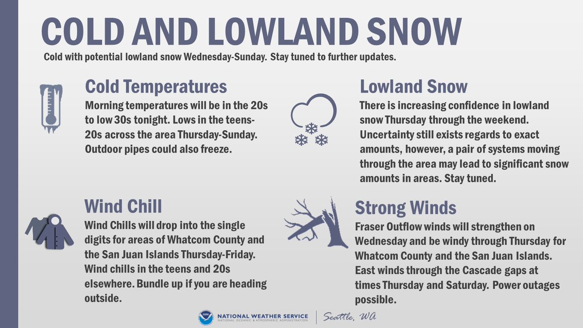
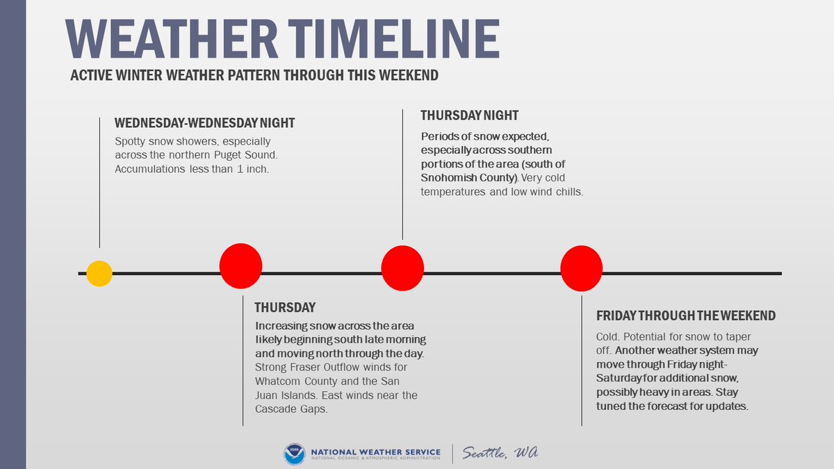
The active weather pattern is expected from Wednesday through the weekend. Spotty snow showers Wednesday, with increasing snow Thursday morning. The potential exists for another round of snow Friday night into the weekend. However, there is uncertainty in the forecast. #WAwx
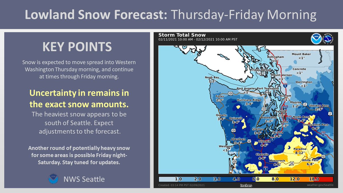
First call snow map for Thursday-Friday Morning:
Confidence is increasing in lowland snow for Thursday-Friday morning. Expect some adjustment to these snow amounts as we approach the event. Another round of snow potentially Friday night into the weekend. #WAwx