NWS Seattle Profile picture
Official Twitter account for the National Weather Service Seattle. Details: https://t.co/RXTcK1Wkwk
Oct 14, 2022 7 tweets 2 min read
Here's a meteorological explanation of WHY it will become so warm & smoky this weekend.

1) We've got a strong ridge of high pressure in the upper levels of the atmosphere. It's deflecting any weather away from us. It's also composed of sinking air that warms as it does so. 2) But it's more than what's happening aloft. Near surface weather is hugely impactful as well. High pressure east of Cascades is pushing air toward the coast. This is called offshore flow. At the same time, warm air expands north and westward over western Oregon and Washington.
Jan 15, 2022 5 tweets 1 min read
⚠TSUNAMI ADVISORY⚠

The National Tsunami Warning Center has issued a TSUNAMI ADVISORY for the Washington coast, resulting from a volcanic eruption near Tonga around 830pm Fri PST.

More information to follow. This is for the outer coast, Strait of Juan de Fuca coast, and San Juan Islands.
Aug 8, 2021 4 tweets 3 min read
As you can see on the map at weather.gov excessive heat watches are now up for later this week. Here in Western WA it will be hot Thursday through Saturday (but not as hot as it was at the end of June). Here in Seattle we should see three days in the lower to mid 90s. Here are some specifics on the temperature ranges for the bulk of the heat wave. The main caveat of course, would be the impact of upper level smoke and haze. In the next tweet, you'll see the chances of records being tied or exceeded. #wawx
Jun 29, 2021 4 tweets 3 min read
STATE RECORD?! (1 of 3)
Multiple stations in Washington state yesterday recorded high temperatures that potentially tied or exceeded the all-time record high for the state of 118°F. #wawx STATE RECORD?! (2 of 3)
In Western Washington this includes three stations: 118 at Sol Duc River near Forks, 118 at Mayfield Power Plant in Lewis County, and 120 near Renton. #wawx
Feb 10, 2021 4 tweets 1 min read
Another round of morning thoughts from the forecast desk:

- A modified arctic front will lead to a few snow showers mainly north of Seattle today.
- The front will bring cold, but increasingly drier air to much of the region on Thursday. - The weather system on Thursday will be battling this very dry air.
- Because of this dry air in place, we expect the best snowfall accumulation potential Thursday afternoon and night will be south of Tacoma.
- This won't be a "one and done" situation.
Feb 10, 2021 7 tweets 4 min read
Alright everyone, let's discuss the active weather pattern for this week. Here are the main areas of focus:

🌨️Lowland Snow
🥶Cold Temperatures & Wind Chill
🌬️Locally Strong Winds Morning temperatures will be in the 20s to low 30s tonight. The active weather pattern is expected from Wednesday through the weekend. Spotty snow showers Wednesday, with increasing snow Thursday morning. The potential exists for another round of snow Friday night into the weekend. However, there is uncertainty in the forecast. #WAwx
Feb 10, 2021 4 tweets 1 min read
Sure, it's chilly out there, but it'll get colder. Here's a hand drawn map over a satellite image taken from the NOAA 20 polar orbiting satellite today. A weak system moving south through B.C. with a give a modified arctic front a shove southward tomorrow. 
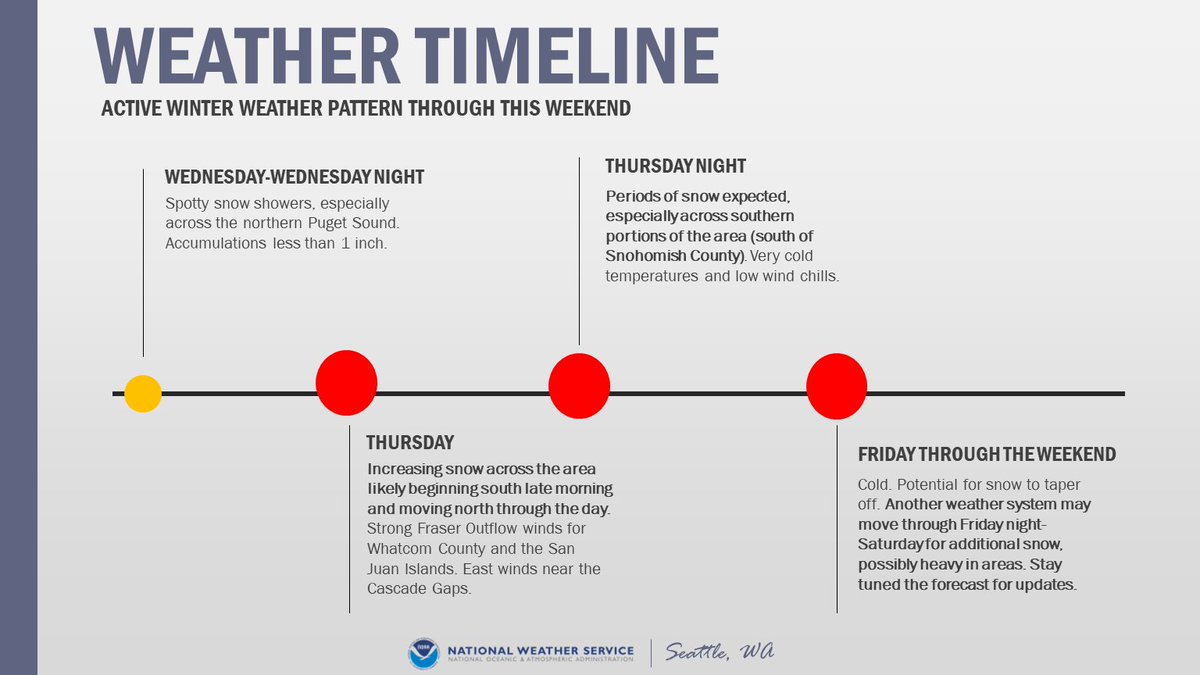
That's the precursor to more interesting weather later Thursday into Saturday. Outflow finds through the Fraser River Valley will increase substantially by Thursday - which provides Western WA with additional (and colder) air.
Feb 7, 2021 6 tweets 3 min read
[🥶THREAD] We hit on snow in a thread earlier so now let's talk COLD! Much colder air is on the way for the rest of the weekend with the coldest temperatures mid to late week. Overnight lows will likely drop below freezing, into the teens and 20s for many locations. #wawx While we're confident it'll be some of the coldest air we've seen this winter, this is still uncertainty in just how low temperatures may drop! Here's a look at the ranges we might see by Friday morning! #wawx Image
Feb 7, 2021 5 tweets 3 min read
[THREAD] First up for our afternoon forecast updates is the lowland snow potential! We'll post another thread with info on the cold later so it's easier to keep it all straight! 🥶 #wawx A convergence zone will develop this evening - tonight that has the potential to drop snow levels to 500-1000 feet (potentially slightly lower) with thin bands of heavy showers. This may bring light snow accumulations across portions of the lowlands - see graphic. #wawx Image
Jan 11, 2021 6 tweets 4 min read
We've got a lot weather-wise coming our way into Wednesday. So how about a quick thread with the details to kick off the work week? Rain, Flooding, Landslides, Snow, Wind, & Coastal Hazards - we've got it all! Keep it tuned here throughout the storm! #wawx Rain is moving onshore this morning & will continue at times thru Weds. Heaviest tonight - Tues AM & again Tues night - Weds AM. Snow levels will rise. This brings about the potential for urban, small stream, & river flooding. The threat for landslides returns as well. #wawx
Sep 21, 2020 4 tweets 3 min read
Well it looks like fall is going to waste no time making its presence known! A weather system will bring widespread rain - heavy in spots - and wind to the area Wednesday with showers continuing through at least Friday! Here's a short thread with the details! #wawx Image Wondering how much rain we'll see on Wednesday through early Thursday? Take a look at our latest forecast! Additional rain (not depicted here) expected for the end of the week with isolated thunderstorms also a possibility Thursday & Friday. #wawx Image
Sep 17, 2020 5 tweets 2 min read
Convective weather models and smoke: A Thread!

Situations involving the potential for thunderstorms and the backdrop of thick smoke are complicated for a few reasons! The first being that most convective models do not consider smoke in their initialization. #wawx So you may be looking at the latest HRRR run thinking, it looks like there could be a chance for some t-storm activity to make its way into the area! There is still a chance, but with smoke, you have to interpret the model with a grain of salt so to speak. #wawx
Jun 8, 2020 5 tweets 2 min read
Thunderstorms on Sunday produced ominous clouds! We received many reports of a funnel cloud. But video evidence helped us determine that this was nothing more than a scary-looking cloud! Wondering what the difference is between tornadoes, funnel clouds, and simply scary-looking clouds? Read more here from a former NWS employee!
scarylookingcloudclub.org/slcs
May 30, 2020 5 tweets 3 min read
THREAD: What does the rest of the day look like for us here in Western Washington? The following tweets will give you a look into our current forecast thoughts. #wawx Well this morning's storms have worked over the atmosphere here a bit. It still appears the best ingredients for strong to severe storms remains east of the Cascades this afternoon and evening. (Follow our neighbors @NWSSpokane @NWSPendleton @NWSPortland too) #wawx
May 2, 2020 5 tweets 3 min read
Good morning, Western Washington! It's shaping up to be fairly active in terms of weather, so here's a tweet thread to get your day started. Here are some of the things we've been thinking about while putting the forecast together
🌧️Rain 🍃Winds 🌩️Thunderstorms

#wawx A check of the radar this morning at 6 AM shows plenty of rain starting to fill in to our south and west.
Apr 8, 2020 7 tweets 5 min read
It’s #SafePlaceSelfie time! #SafePlaceSelfie is an initiative to identify the “safe place” in your office or residence during weather events! We will be focusing on earthquakes, tsunamis, and severe weather over the next few posts to help you locate your safe place. Image 
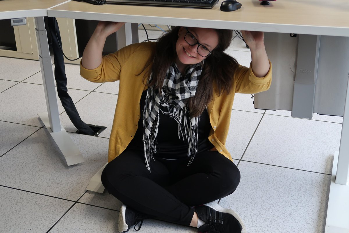
Earthquakes pose a safety risk to the Pacific Northwest. The best place to take shelter at our office is under our office table! Drop, cover, and hold on! Send us your earthquake safe place! #SafePlaceSelfie ImageImage
Jan 12, 2020 7 tweets 4 min read
THREAD: Good morning for the midnight shift crew! While you were sleeping, the forecast remained largely on track. This thread will discuss the latest details on lowland snow potential, gusty Fraser Outflow winds up north, and COLD that's coming our way! #wawx Lowland rain will transition to snow from north to south this afternoon - evening. Most places will at least see some flakes but accumulations will vary. Highest amounts expected across the north and under a possible Puget Sound Convergence Zone. #wawx