
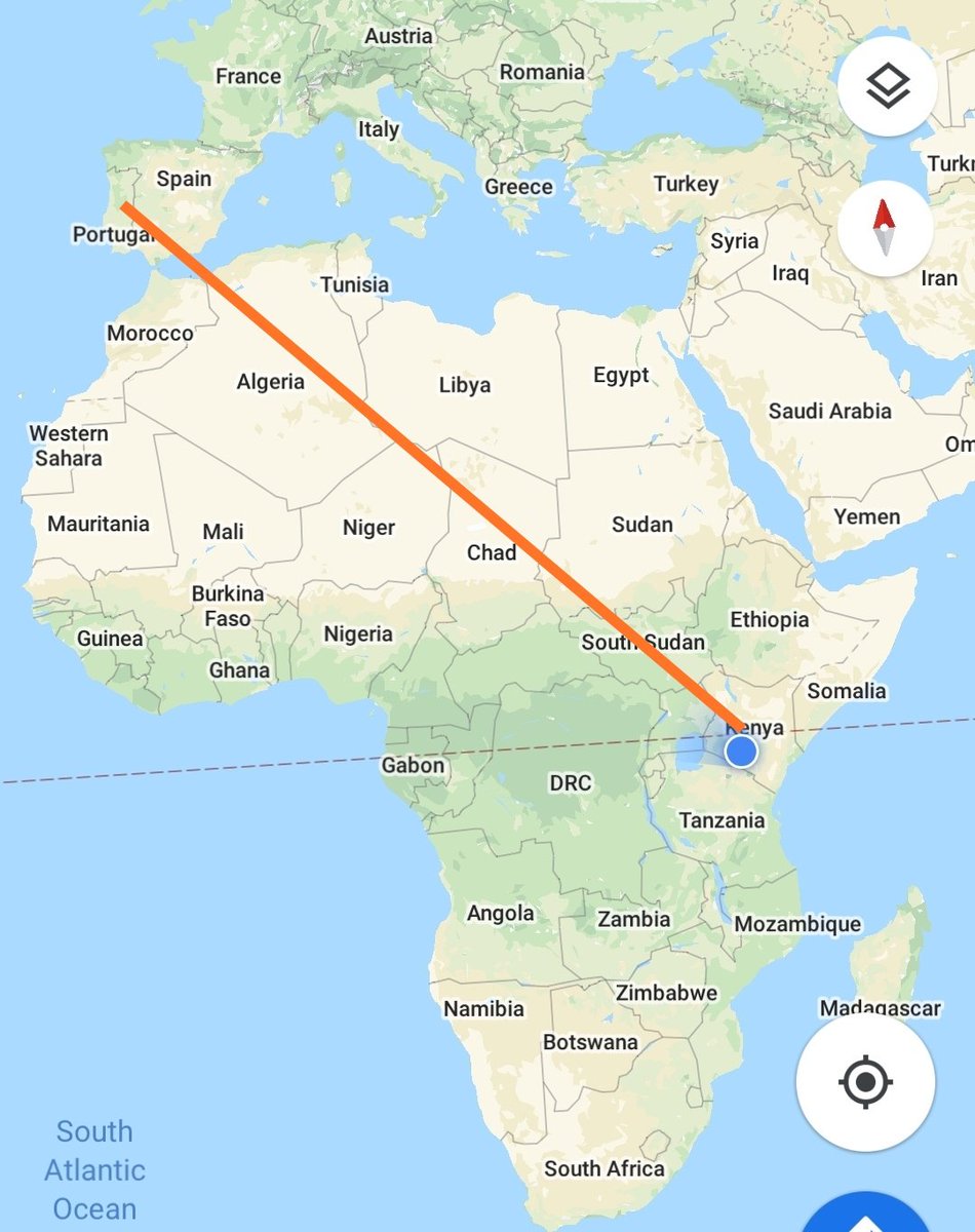
The @Space_Station flies some 400kms above earth. In this video, the ISS flies from the Iberian Peninsula to Kenya on a bright, moonlit night.
We've taken some screenshots and tried to highlight some of the cities and geographical features visible.
THREAD.
We've taken some screenshots and tried to highlight some of the cities and geographical features visible.
THREAD.
The flight starts above Spain and Portugal.
Mediterranean cities are visible due to their bright city lights including it's largest city, Barcelona as well as Northern Italy's largest city, Milan.
Europe's highest mountain, the Alps mark a dark patch North of Italy.
Mediterranean cities are visible due to their bright city lights including it's largest city, Barcelona as well as Northern Italy's largest city, Milan.
Europe's highest mountain, the Alps mark a dark patch North of Italy.

As the flight progresses, the entire Italian peninsula comes into view including it's capital, Rome.
The city of Naples is also visible as is the island of Sardinia.
The city of Naples is also visible as is the island of Sardinia.

Further along, we get to see the northern African Mediterranean coastline as well as it's capital cities, Tunis & Tripoli along the Gulf of Sidra.
The famous 'Mafia island' of Sicily is seen in close proximity to Tunisia. The Roman empire extended across both sides of the sea.
The famous 'Mafia island' of Sicily is seen in close proximity to Tunisia. The Roman empire extended across both sides of the sea.

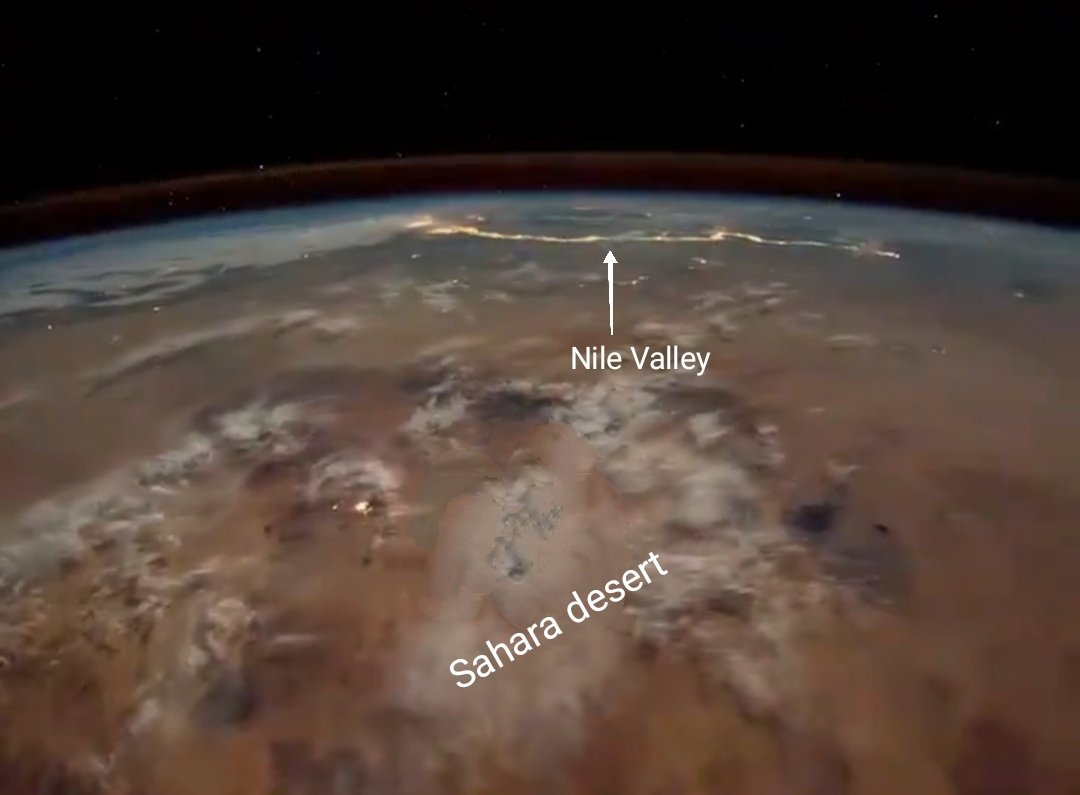
The @Space_Station then crosses above the featureless Sahara desert over Libya where the lights of the Nile valley are visible in the distance.
The Nile sustains the Egyptian population with more than 90% of Egyptians living within the river valley.
The Nile sustains the Egyptian population with more than 90% of Egyptians living within the river valley.
As the flight approaches the greater Eastern Africa region, the two branches of the Nile are marked by pockets of light along their respective valleys before converging in Khartoum.
The White Nile originates from Lake Victoria while Blue Nile starts in Lake Tana, Ethiopia.
The White Nile originates from Lake Victoria while Blue Nile starts in Lake Tana, Ethiopia.

Past Sudan, the ISS flies above North Western Kenya where Lake Turkana glistens in the moonlight.
The rift valley is marked by lakes on its floor including Lake Stephanie and Abaya in Ethiopia.
Addis Ababa stands bright above the rift valley on Ethiopia's western escarpment.
The rift valley is marked by lakes on its floor including Lake Stephanie and Abaya in Ethiopia.
Addis Ababa stands bright above the rift valley on Ethiopia's western escarpment.

We finally 'reach home' where geographical features act as landmarks due to absence of lights. Here, we can see features such as Lake Turkana, Chalbi desert, Marsabit and Lorian Swamp in Merti, Isiolo county.
Are those Nairobi city lights hiding under the clouds? 🤔
Are those Nairobi city lights hiding under the clouds? 🤔

Finally, we tried to recreate the flight path in its entirety for some perspective. End.
Video courtesy of @Space_Station.
Video courtesy of @Space_Station.
A little quiz? Can you spot the following towns in Northern Kenya?
Lodwar
Moyale
Marsabit
Wajir
Mandera
Hint..check out the small specks of lights.
Lodwar
Moyale
Marsabit
Wajir
Mandera
Hint..check out the small specks of lights.


