
Exploring Kenya's geography ▶
A showcase of the country's geographical features and how they shape lives ▶
YouTube ⬇️ https://t.co/mprpwlxP98


 The journey starts in Nairobi where the highway heads West towards Gitaru.


 Ngong river originates in Motoine forest near Dagoretti. It flows next to the Southern bypass until the Ngong road interchange where it enters the Ngong road forest.


 The southern tilt of the earth on its axis exposes the southern hemisphere to more sunlight and causes winter in the less exposed northern hemisphere.

 Mau has several forest blocks. The sections to the East, South and South West have suffered the biggest loss of forest cover since 1984.
 Access to Nguruman is via a murram road that passes over Lake Magadi.


 Nairobi has dangerously high level of toxic particles in the air. As per sensors.africa air quality tracker, Nairobi has particle levels that are 70% higher than the WHO recommended safe levels.
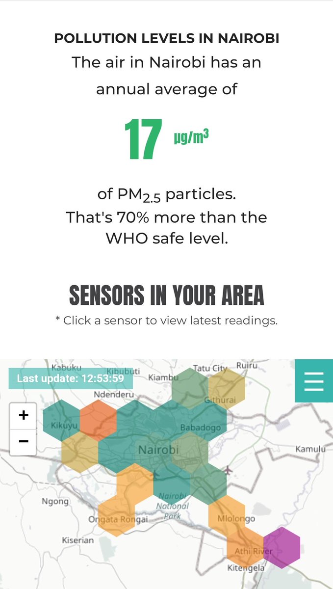
 It goes without saying that the areas with the highest average canopy height and forest coverage are the main water towers in the country (Mt. Kenya, Aberdares, Mau and Cherangany Hills).


 The trees have pods that are eaten by livestock and spread over large areas where they quickly grow. The deep tap roots of Mathenge trees ensures the trees stay evergreen once they take root.


 Lake Chala has a depth of about 90m with a further 170m from the lake surface to the crater rim. This makes for a rather deep crater of almost 300m, akin to the Mt. Longonot crater.

 The rivers of Kenya flow from three main sources: the escarpment and highlands east of rift valley (Aberdares), highlands west of the rift valley (Mau) and Mt. Kenya.


 Athi river flows right next to Yatta plateau throughout the plateau's 300km length. The flat-topped 100m high Yatta forms a natural boundary between Kitui & Makueni counties. The plateau is visible for long stretches along the Mombasa-Nairobi highway.