THREAD
Today, I released a short report into the location of Chinese & Indian forces along 3 hotspots @ Ladakh sector, using satellite imagery from May and June.
Please check it out here if you're interested. aspistrategist.org.au/satellite-imag…
All hotspots have seen a significant build up.
Today, I released a short report into the location of Chinese & Indian forces along 3 hotspots @ Ladakh sector, using satellite imagery from May and June.
Please check it out here if you're interested. aspistrategist.org.au/satellite-imag…
All hotspots have seen a significant build up.
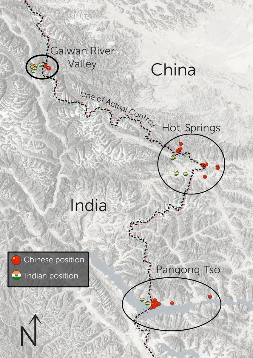
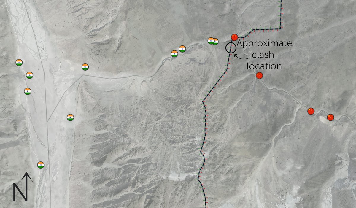
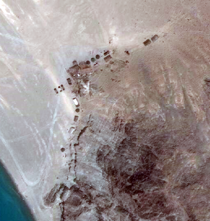
In Galwan, the site of recent deadly clashes, both Indian and Chinese forces have moved into the valley and set up significant positions, India's were about 500m back from the LAC, and China's main position was nearly 3km back, but with a small outpost ON the LAC.
Imagery released by @PlanetLabs from June 16th shows that the forward most Indian positions had been dismantled (though a casuality collection point had been set up), and some Chinese posts had been partially dismantled too. They also show ~100 trucks on the Chinese side.
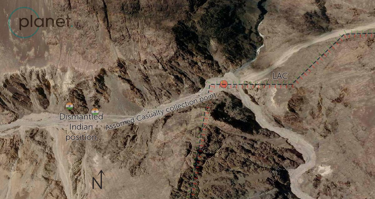
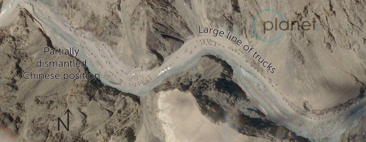
It is hard to tell if these trucks are there to help dismantle the Chinese positions further, or whether they represent a rapid injection of forces in the valley following the deadly clashes.
From positions on the ridgeline (that arent clear on satellite imagery but have been reported to be present), Chinese forces would be able to clearly see all traffic going along the newly finished DS-DBO road to Daulat Beg Oldie.
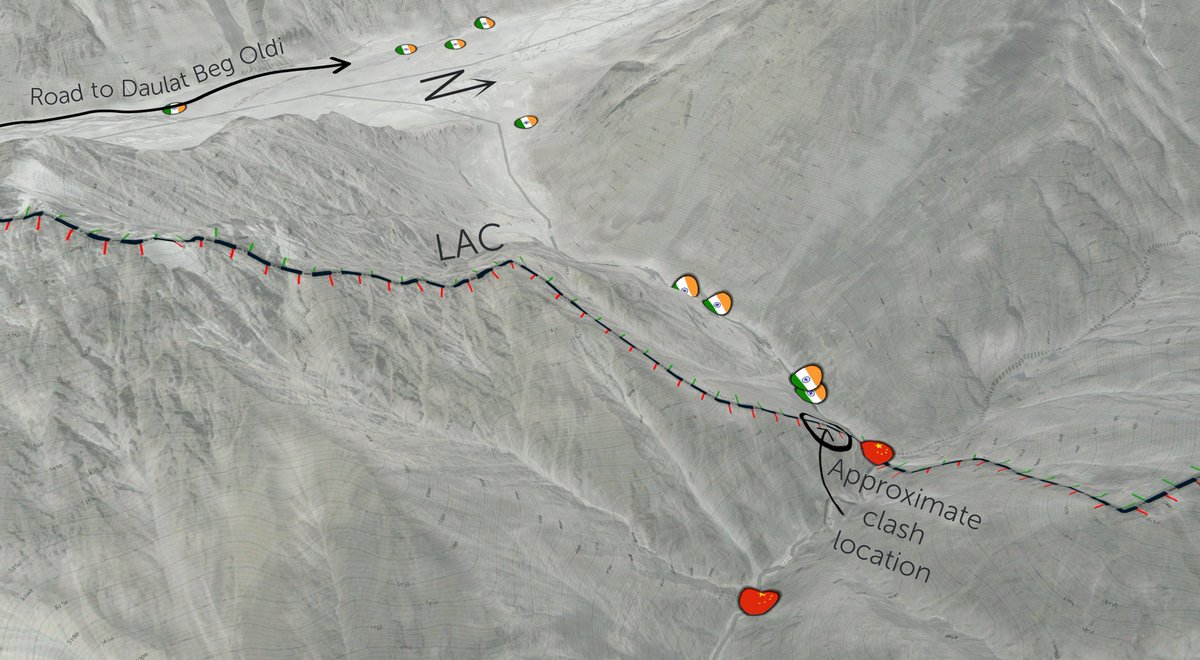

However, there is still no evidence that China has set up positions within Indian-controlled territory (in the Galwan Valley or elsewhere), their furthest most position likely houses under 40 soliders and only consisted of ~6 tents, it appears to have been dismantled.
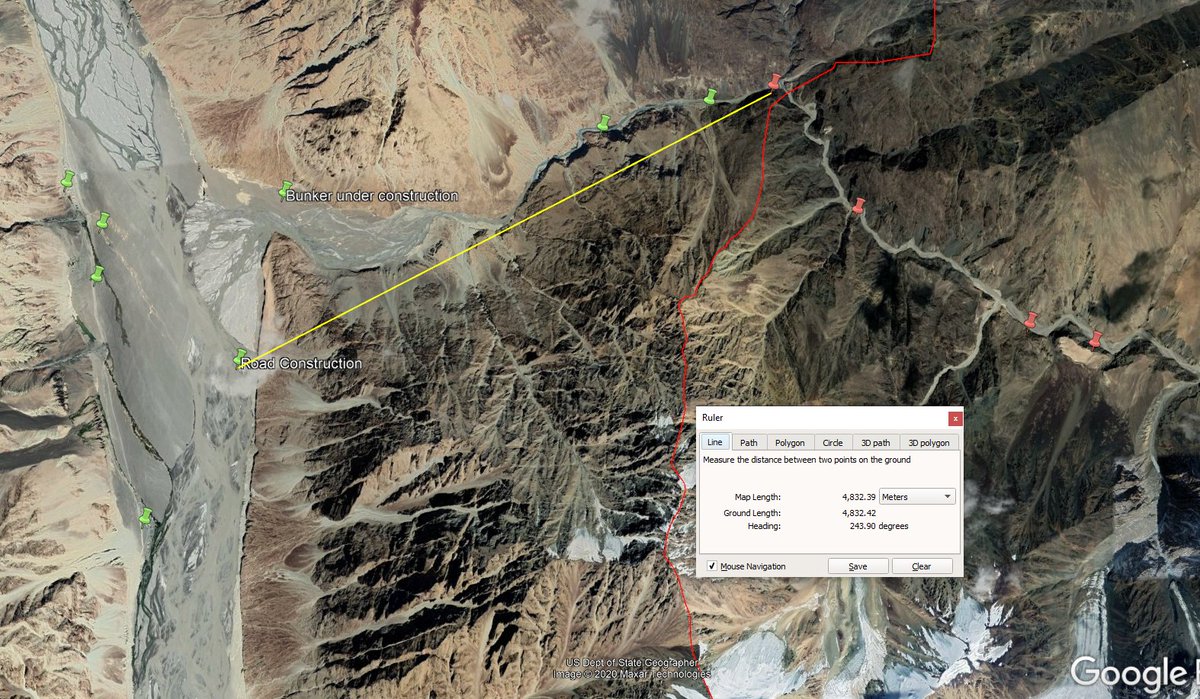
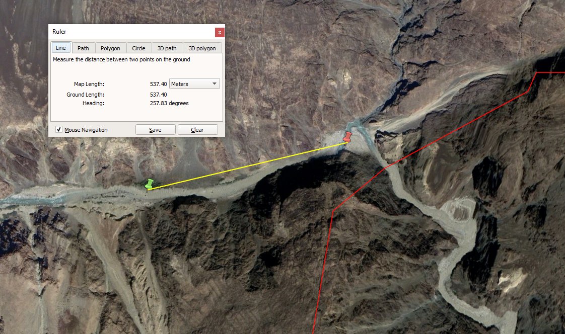
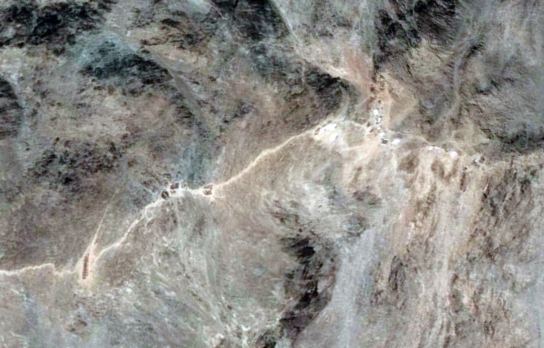
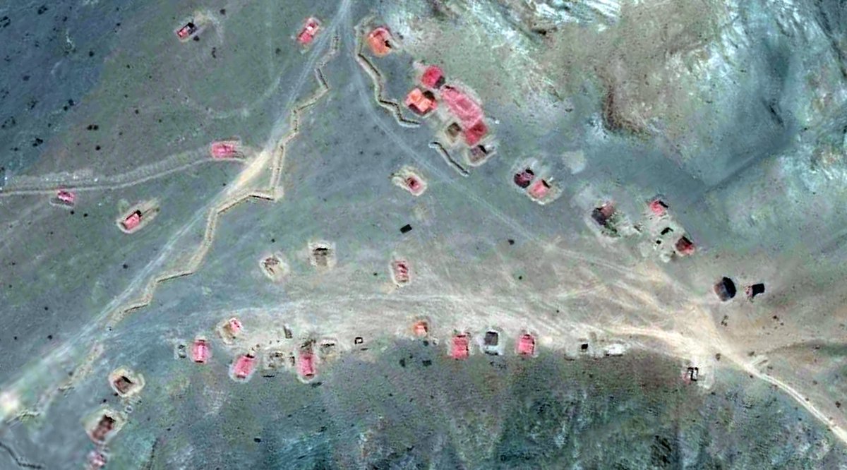
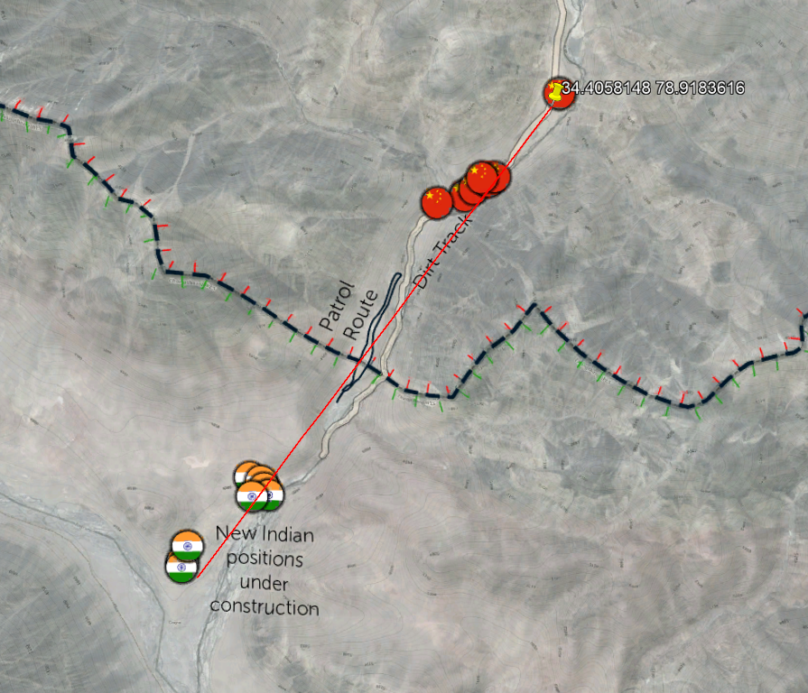
However, in the Hot Springs area, there is evidence that strongly suggests that Chinese forces had been regularly crossing into Indian territory, along a small dirt road and a compacted patrol route. Both of these cross a few hundred metres beyond the LAC.
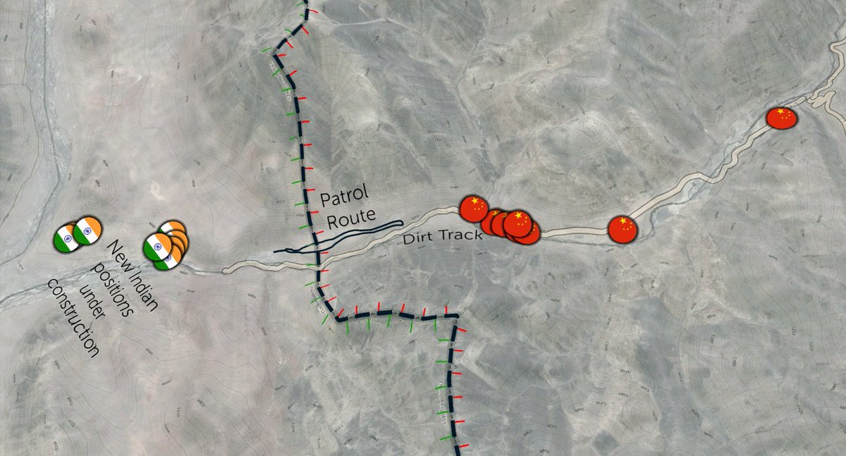
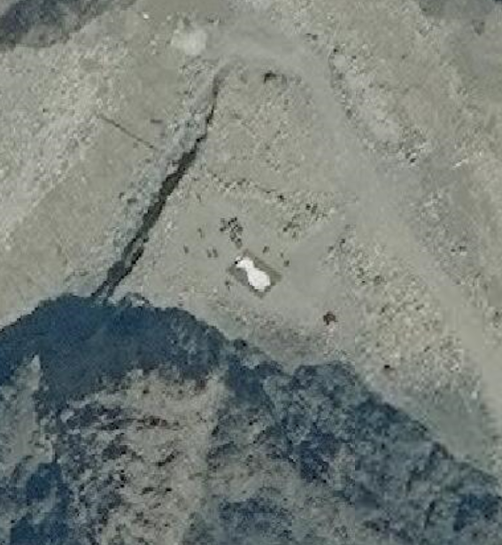
In response to these likely incursions, it appears that Indian forces have begun construction of a major permanant position overlooking that section of the LAC. This imagery from May 21st shows it under construction with significant activity from diggers.

These new positions are rougly 8km beyond the positions previously closest to this part of the LAC.
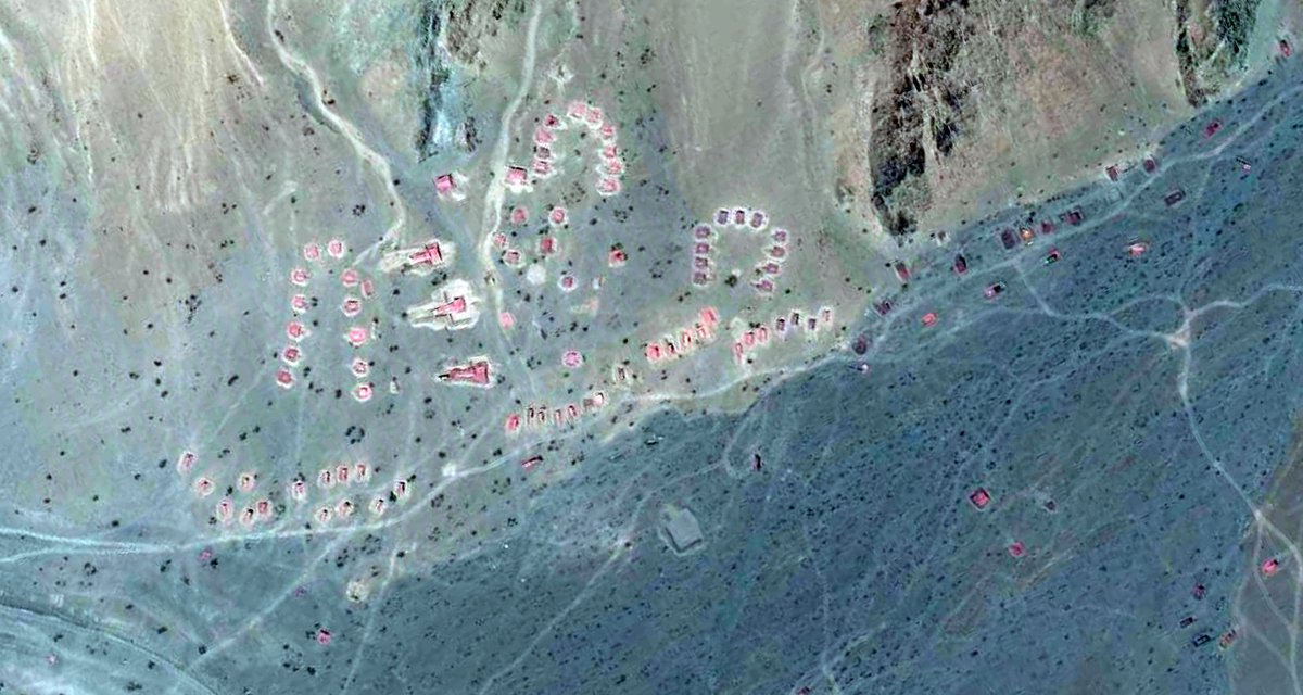
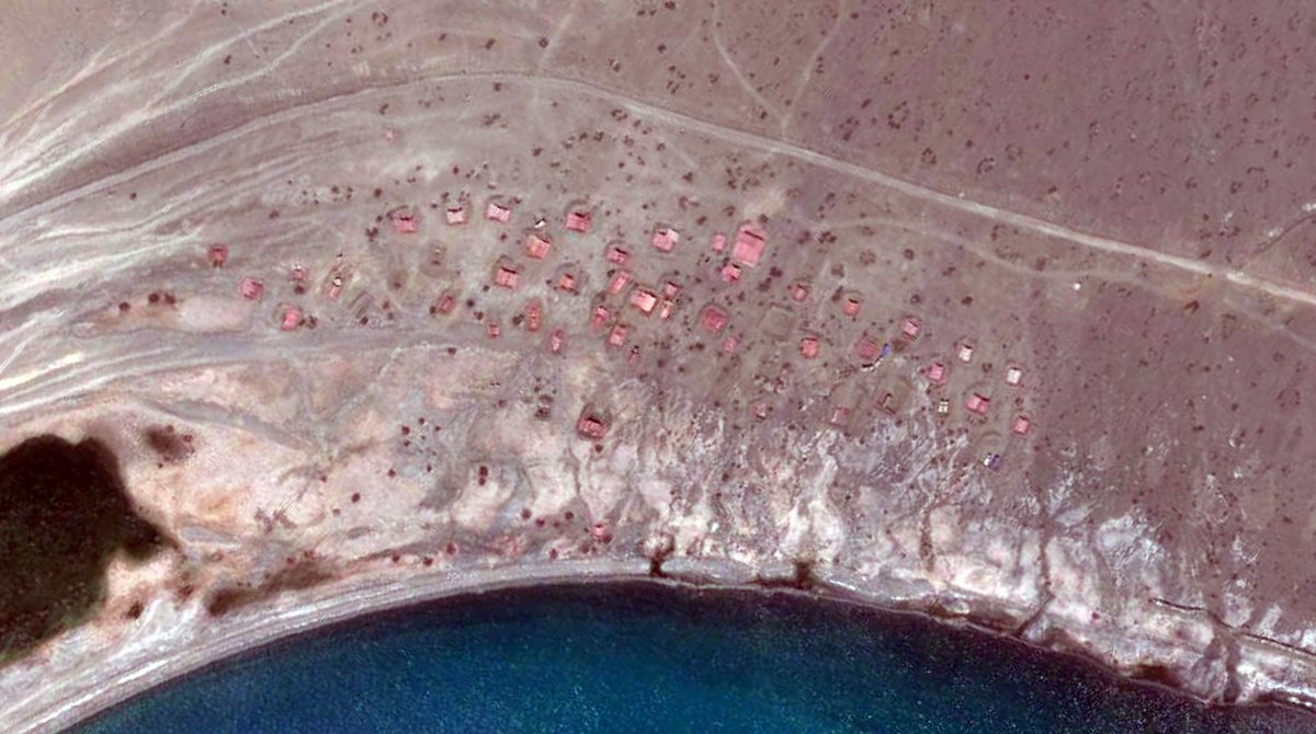
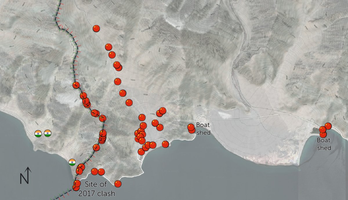
In the Pagong-tso area is where Chinese forces have been clearly their most aggressive in expanding their presence into previously unoccupied and disputed territory between the two countries.
The area between Fingers 2 and 8 is disputed between China and India (see map).
The area between Fingers 2 and 8 is disputed between China and India (see map).

India has long has a number of bases within this disputed area, however China had only used the disputed area for patrols, where they had patrolled up to Finger 4. This is the area where there was a brawl between Indian and Chinese troops in 2017.
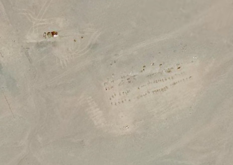
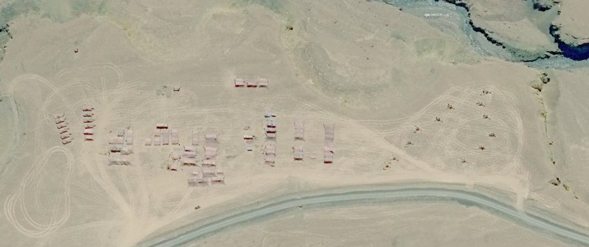
However starting in May, China began constructing positions within the disputed area (primarily between fingers 4 & 5). It's astounding how much they have built since. Hundreds of structures (I gave up counting at 250), in >50 newly constructed positions since early May.
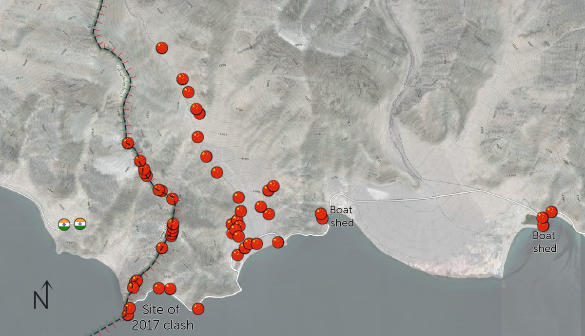
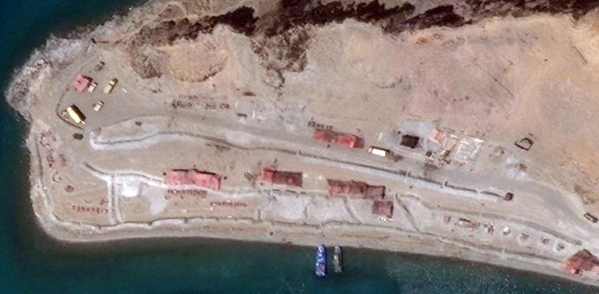
For example, the beach on which there were clashes in 2017 is now an extremely build up Chinese position, with around 10 structures that are dug in with trenches, and boats anchored at the peninsula.
The ridgeline of Finger 4 that delineates the areas to which Indian and Chinese forces patrol up to is also occupied with at least 19 ridgetop positions.
These ridgetop positions stretch at least 5km inland (after that there was cloud-cover) and include pilbox-outposts and defensive berms that have been constructed unambiguously beyond the ridgeline into Indian controlled territory.
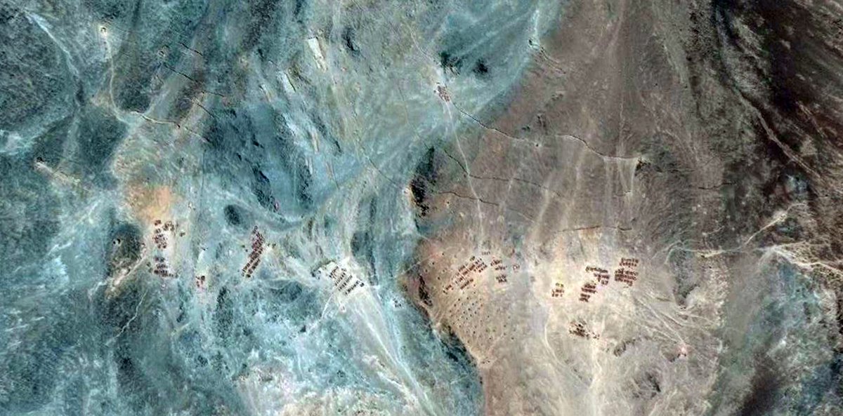
Furthern back there are numerous structures constructed on the alluvial plains feeding into the lake, these structures alone number >250 and many are dug in with trenches. More are under construction.
Overall, when there has been sporadic reports of 5-10k Chinese soldiers in Indian territory, I assume these positions are what is being referred to. However, the area where this build-up has occured in an area where the LAC is disputed between India and China by ~30km.
It's a signficant build up that has anhiliated the peaceful status quo at Pangong-tso, and needs to be addressed by Indian and international policy makers, however I would not describe them as being within Indian-controlled territory.
I'd love to flag this with @ajaishukla to see if this matches his understanding of the situtation at Pangong-tso.
Also please note that the map at the start does not show every military position within the frame, only the ones that were within the area I had recent imagery for (roughly the areas circled).
I also understand that referring to ground as Indian territory or Chinese territory is tricky given how disputed everything is. In this thread I've referred mostly to India's delineation of the LAC, and in Pangong-tso referring to the area to which both countries patrol to.
This tweet highlights why I believe some analysts are claiming that there are 1000s of PLA soldiers in Indian territory
Because India's perception of the LAC goes to finger 8, even though China regularly patrols up to finger 4 and India rarely goes past it
Because India's perception of the LAC goes to finger 8, even though China regularly patrols up to finger 4 and India rarely goes past it
Here, India Today offers the most plausible and complete timeline of the clashes that I've seen,
indiatoday.in/india/story/bl…
Satellite imagery from June 10th - 14th would be needed to ascertain whether the newly set up Chinese positions were in Indian territory or not.
indiatoday.in/india/story/bl…
Satellite imagery from June 10th - 14th would be needed to ascertain whether the newly set up Chinese positions were in Indian territory or not.
PS. Journalists,
@PlanetLabs has 80cm satellite imagery of the Galwan valley from June 12th (20200612_082312_ssc11d1_0009).
You can email them requesting it, and then DM me to analyse it.
(Or Planet, feel free to DM me with the imagery 😉)
@PlanetLabs has 80cm satellite imagery of the Galwan valley from June 12th (20200612_082312_ssc11d1_0009).
You can email them requesting it, and then DM me to analyse it.
(Or Planet, feel free to DM me with the imagery 😉)
Quick amendment,
In Pangong-tso India has also set up a new campsite within 500m of the Finger 4 ridgeline, and 500m downhill from a Chinese position.
This significantly hightens the risk of escalation having frontline forces so close to eachother
Thanks @rookie_bird_& @detresfa_
In Pangong-tso India has also set up a new campsite within 500m of the Finger 4 ridgeline, and 500m downhill from a Chinese position.
This significantly hightens the risk of escalation having frontline forces so close to eachother
Thanks @rookie_bird_& @detresfa_
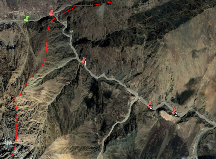
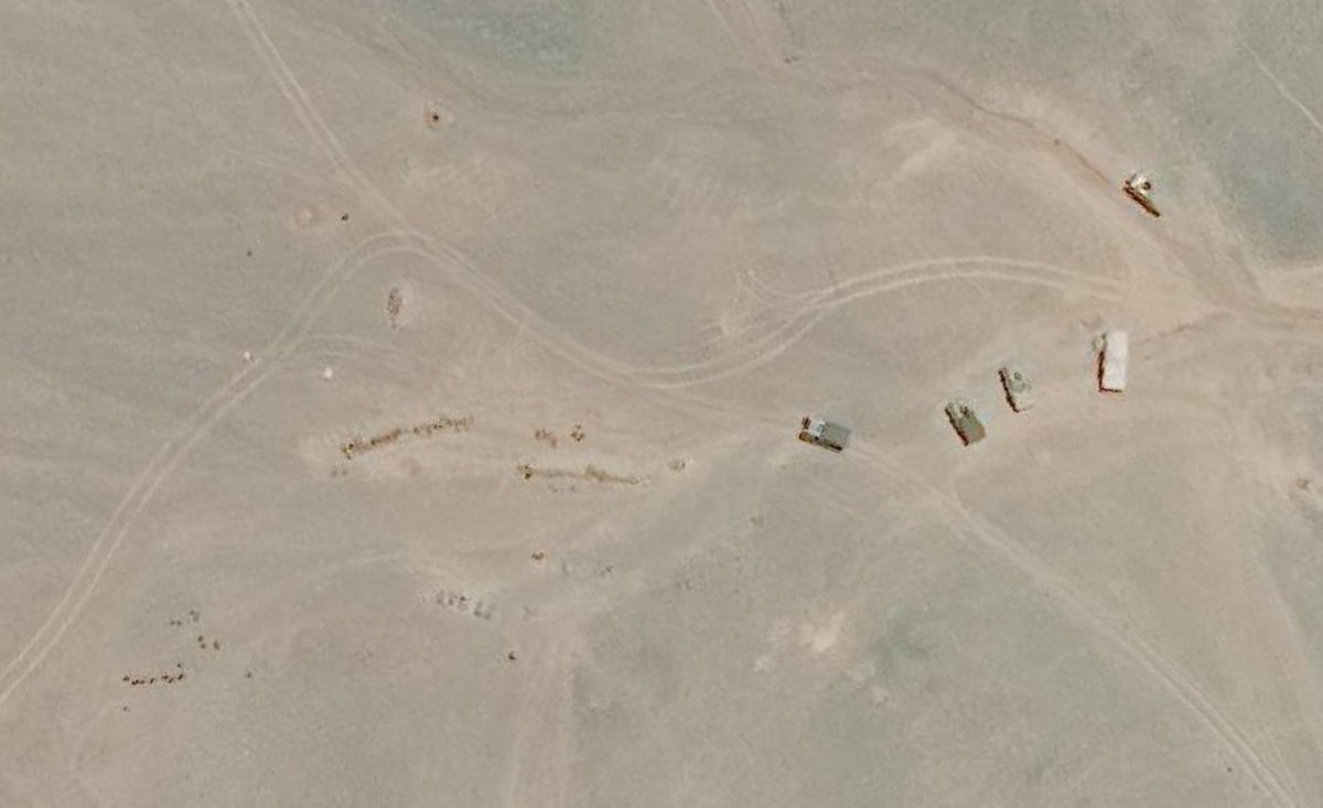
Another quick addition that I forgot to post (and thanks @detresfa_ for reminding me), is that in the Hot Springs area, about 3km from the LAC there is about 12 towed artillery pieces pointing directly at the Indian construction that's occuring (bearing 217).
Some helpful new articles from this morning, for anyone following along.
Firstly by @ShivAroor looking at Pangong-Tso, his sources say a total of 62 new Chinese positions and 300+ structures. That tracks roughly with my data too.
indiatoday.in/amp/india/stor…
Firstly by @ShivAroor looking at Pangong-Tso, his sources say a total of 62 new Chinese positions and 300+ structures. That tracks roughly with my data too.
indiatoday.in/amp/india/stor…
Next this deep dive by Reuters Graphics (@SimonScarr et al) comparing, in detail, the difference between Planet Labs imagery on June 9th to that from June 16th.
Well worth a look.
graphics.reuters.com/INDIA-CHINA/BA…
(We also need Sat imagery from June 10-15th, see above)
Well worth a look.
graphics.reuters.com/INDIA-CHINA/BA…
(We also need Sat imagery from June 10-15th, see above)