This 📷 is a map of the Roman city of Falerii Novi, near Rome, produced without lifting a trowel.
Here's an #AntiquityThread on how the archaeologists did it and the incredible discoveries they made 🧵
Here's an #AntiquityThread on how the archaeologists did it and the incredible discoveries they made 🧵

The researchers used advanced ground-penetrating radar (GPR) to do this. Like any other radar, it bounces radio waves off things and using the ‘echo’ to build a picture.
The result is a big improvement over other ways to look underground, like a magnetometer (📷)
The result is a big improvement over other ways to look underground, like a magnetometer (📷)

Recent advances in GPR technology means it is now possible to explore larger areas in higher resolution than ever before. As a result, it is now possible to study entire ancient cities with this technology.
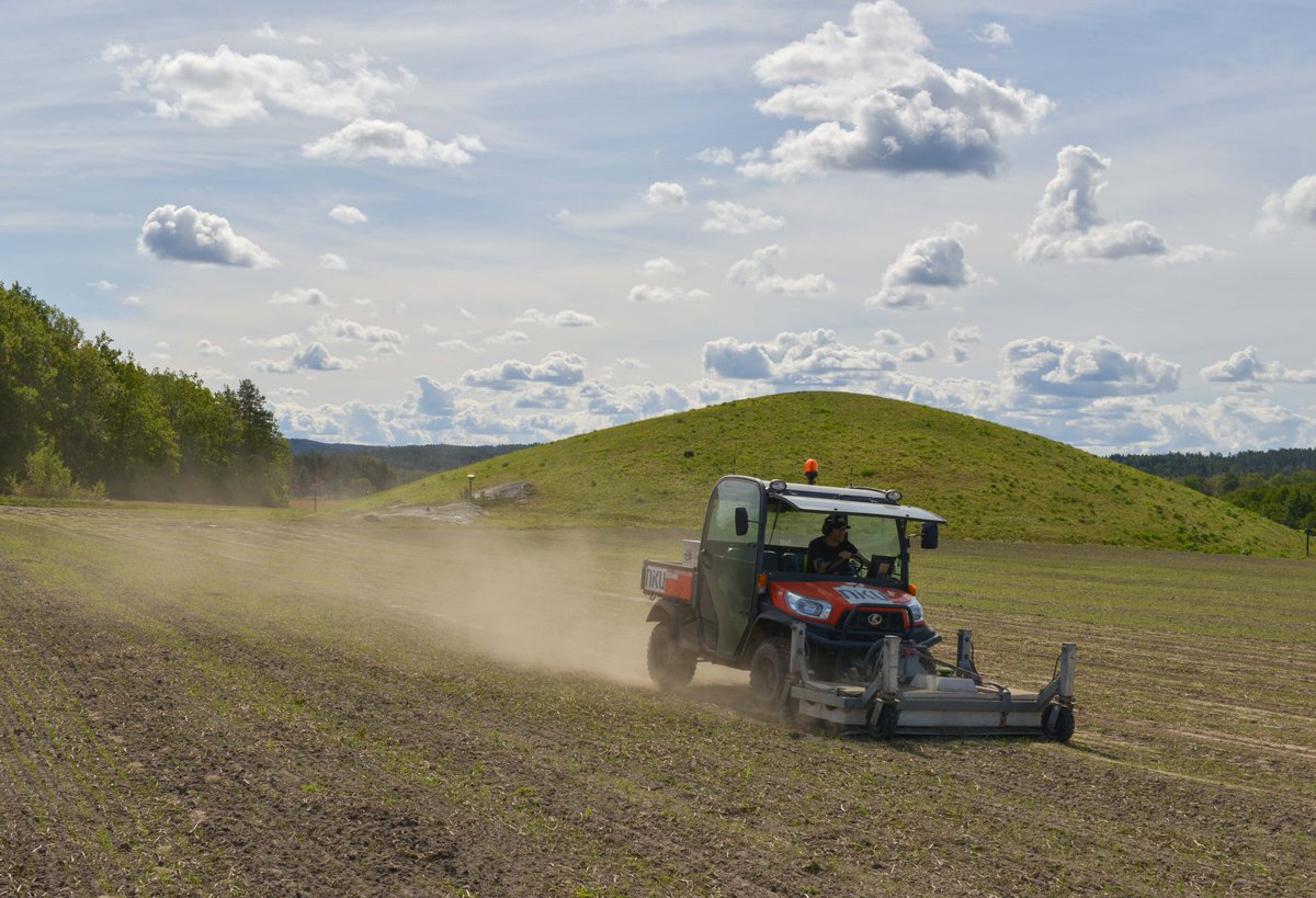
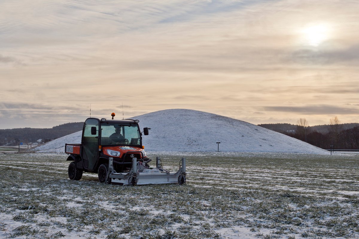
📷: GPR equipment at Falerri Novi
📷: GPR equipment at Falerri Novi

At Falerii Novi, this led to the discovery of several new buildings, including a bath complex, market, and temple—all without excavation.
📷: Temple at Falerri Novi
📷: Temple at Falerri Novi

This is important as the large size of cities, and the fact many are underneath modern structures, means it is not always viable to dig them up.
📷: Unlabelled map of Falerii Novi
📷: Unlabelled map of Falerii Novi

As GPR can be used to investigate different depths, it could also shed light on how cities built up and evolved over time.
🎥: Data from different depths at Falerii Novi
🎥: Data from different depths at Falerii Novi
Whilst this research could revolutionise our understanding of ancient cities, this technology does also create some problems: >20 billion data points were generated in this study.
As a result, it may be some time before the map of Falerii Novi is fully analysed.
As a result, it may be some time before the map of Falerii Novi is fully analysed.
Nevertheless, this research has already revealed much about the town and Roman cities in general.
Notably, it appears to be less standardised than other well-studied towns, like Pompeii, revealing the complexity in Roman urban design.
📷: Map of Pompeii by cmglee / CC BY-SA 3.0
Notably, it appears to be less standardised than other well-studied towns, like Pompeii, revealing the complexity in Roman urban design.
📷: Map of Pompeii by cmglee / CC BY-SA 3.0

“There is little doubt that this technology will fundamentally change the ways in which Roman urbanisation can be understood,” the researchers concluded.
You can read their original paper 🆓 in Antiquity: doi.org/10.15184/aqy.2…
You can read their original paper 🆓 in Antiquity: doi.org/10.15184/aqy.2…

• • •
Missing some Tweet in this thread? You can try to
force a refresh