
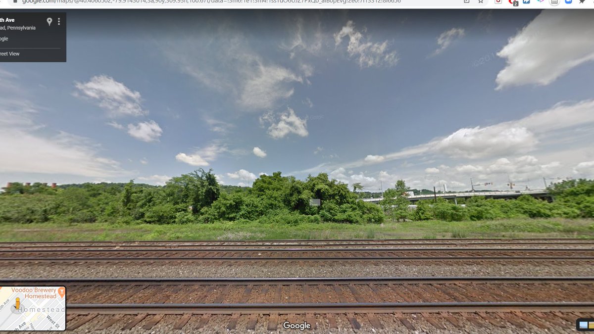
Back along the Northern Pacific in Forsyth, MT. Coal trains, almost certainly loaded with Powder River Basin Coal, below us. #SEANYC 

For those of you who are wondering, yes, this town is named after *that* Forsyth, the colonel who commanded the US Army unit involved in the Wounded Knee Massacre, where our country indiscriminately murdered 300 people. #SEANYC
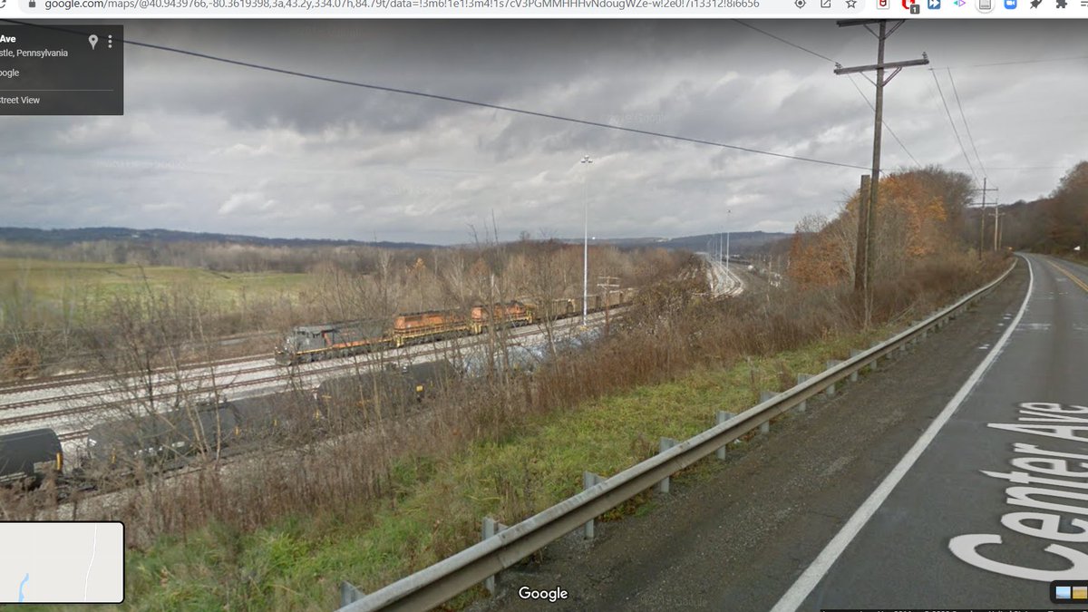
Colstrip, MT. A town where -- you guessed it -- they strip mine coal. I believe Colstrip was first settled by the Northern Pacific to provide for their steam locos. They then sold the mine (called Rosebud) to Montana Power & Light, which uses it to this day. #SEANYC

The power plant in the town is worth dwelling on. One of the more underappreciated geographical shifts of the last century has been the almost complete decoupling of energy production's spatiality from that of population, a transition facilitated by long distance power lines.

I don't just mean mine-mouth plants like this one; an entire ecosystem of transportation corridors, mines/wells and power plants has developed whereby fossil fuels produced in Wyoming is transported to a power plant in, idk, rural Missouri, burned, and then shipped to KC/STL/CHI.
As the use of fossil fuels (esp. coal) in generation declines, we're gonna be left w a bunch of marginally useful transpo infrastructure, and a ton of power lines optimized for fossil fuel energy geographies. Will be interesting to see how this (esp. the latter) evolves. #SEANYC
A final note on this: I would be remiss not to note that these energy geographies are socially charged: a lot of the resource development that has fed these changes has taken place on Native American reservation land, contributing hugely to enviro justice issues. #SEANYC
(insert plug for the book "Power Lines" here)
Anyway, here's our progress update #SEANYC


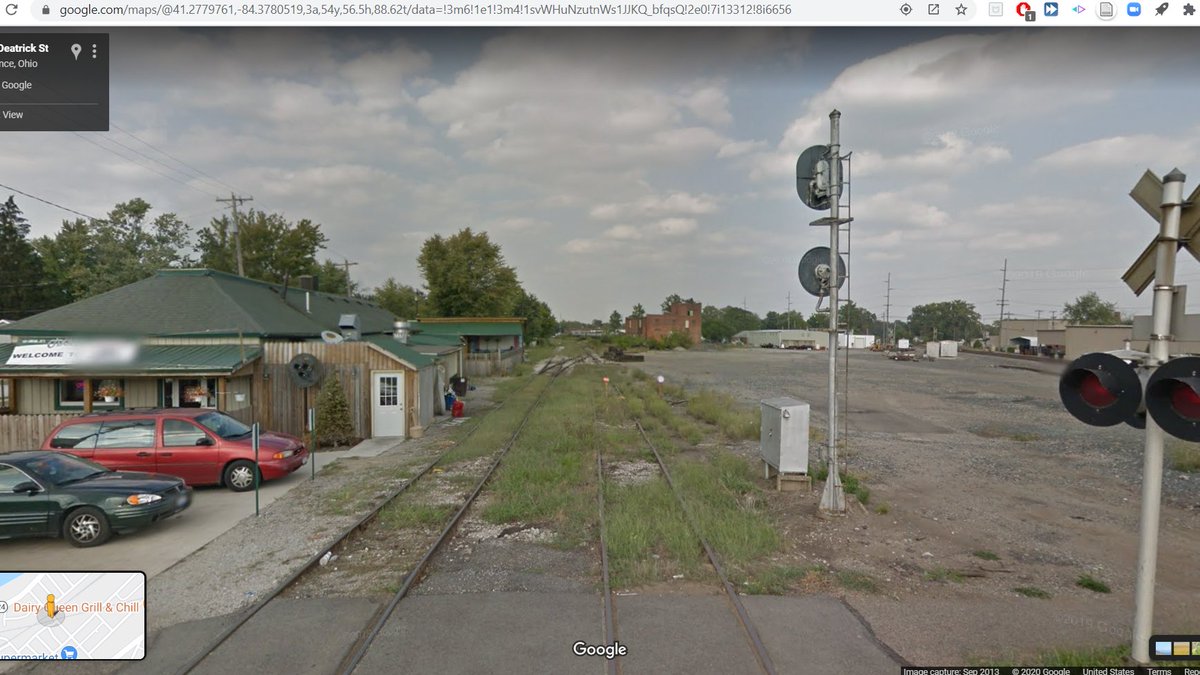
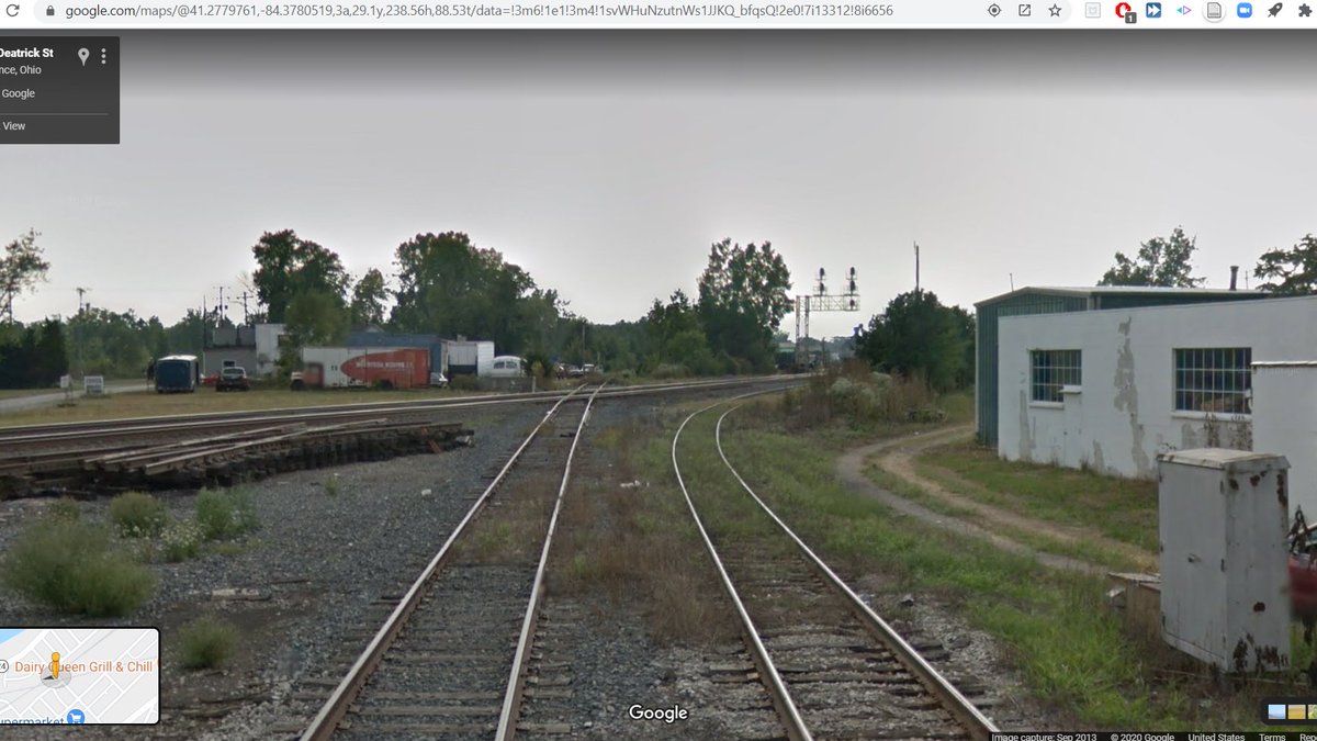
what happened to the streetview car here? #SEANYC

it's a shame the imagery on this stretch is so bad. Looks like an interesting landscape. #SEANYC

lol the streetview version of rt 212 goes through a gas station

Broke: going to the sun road
Woke: MT-59
Woke: MT-59

Wyoming! #SEANYC

Powder River Basin grasslands.... #SEANYC

Rawhide Mine #SEANYC

I'm sure I've threaded this some time in the past, but the Powder Riv. Basin's growth is a fascinating (probably?) unintended consequence of federal regulation. PRB coal is about 75% as powerful as eastern coal, but it has _very_ little sulfur. #SEANYC
...so when the Clean Air Act cracked down on SO2 emissions, all of the sudden power plants loved the stuff: it meant they didn't have to buy scrubbers. #SEANYC
Another mine mouth power plant #SEANYC

Another mine. You can just make out a coal train loading at it. Not sure this distinction is still held by the PRB, but from the 80s until recently, this was the most rail traffic dense region in North America, much of which was only built in the 1970s! #SEANYC

can sorta get a view into a mine here. strip mining _sucks_ folks. #SEANYC

Gillette WY, economic hub of the PRB. #SEANYC


more mine mouth power plants, though I _believe_ at least one unit here is now gas fired. (yes, followers, the depressing resource extraction content will stop soon) #SEANYC

entering the black hills

progress


Wyoming => SD #SEANYC

Truck in/train out in Belle Fourche, SD
This place is a big farming and (sodium) bentonite town. Roughly defines one end of the only really productive sodium bentonite mining region in the US. #SEANYC
This place is a big farming and (sodium) bentonite town. Roughly defines one end of the only really productive sodium bentonite mining region in the US. #SEANYC

The geographic center of the 50 states: #SEANYC

unironically love this landscape #SEANYC

plains driving rocks. 115 mi in 45 mins #SEANYC

really hating this purple tinge #SEANYC

SD-20/better SD-20 #SEANYC


The Missouri River, or rather, Lake Oahe. #SEANYC

The history of this irrigation project is really quite disturbing. There were two competing plans for water development in the Missouri Basin (Pick Plan and Sloan Plan) that were merged w/ few consolidations into the Pick-Sloan Plan (113 projects in each separately; 107 together)
Construction of the dams and reservoirs involved flooding massive amounts of Native American land, much of which was very productive: the river floodplain contained, for example, almost all of the forested land (as well as most wildlife) on the Standing Rock Reservation.
What's more, Native communities were barred from using the reservoir for hunting/grazing/fishing, or even from partaking in irrigation development in the area. The river floodplain ecosystem at the core of their livelihood was destroyed, and replaced with approximately nothing.
Compensation for these damages was heavily litigated: original payments were but a fraction of market value, and while a relief fund was set up in the 1990s, controversy remains.
The poverty and socioeconomic dislocation caused by these projects is relevant to current-day disputes around environmental justice and disparate impacts relative to pipeline or resource development projects; this is their legacy in too many Native communities.
I leave you for the night with this image (from 1948) of the Interior Sec signing away Native treaty rights to the Missouri Valley, while the chairman of the Fort Berthold Indian Tribal Council cries. It's one that has stuck with me for years.

in Mobridge, SD, and once again am crossing the old Milwaukee main. This part is still active under BNSF ownership.

along an old Soo Line branch in Herreid, SD #SEANYC

North Dakota! #SEANYC


Ashley ND is where that Soo branch met its parent line. Parent line is gone too now -- abandoned sometime in the 90s. #SEANYC

I genuinely never knew ND had so many of these grassy pothole type lakes. They're cool! #SEANYC

Crossing the Dakota, Missouri Valley and Western RR in Fullerton feat. a loose carload grain shipper. The DMVW operates a bunch of ex-CN locos, including some Draper Tapers! #SEANYC


The ex-OMEGA station in Lamoure, ND. Now used for some sort of submarine comms? OMEGA was the first ship positioning system w/ global coverage, which used VLF pulses to find locations. Replaced w/ GPS in the 90s. #SEANYC

A more modern grain elevator in Lamoure. #SEANYC

Just did 18 miles in 6 minutes. Who needs HSR when you have Google Streetview? #SEANYC

Maybe a year ago (but it could have been more...what even is time these days), I was at a @TransitCenter event where @christofspieler was talking about his book (I think). #SEANYC
A quote that has stuck w/ me was something to the effect of "However little some may be used, there are ~no unpaved roads in NYC. Paving is thought of as a minimum. Why is the same not true for bus shelters?" Been thinking abt that a lot on this 'drive.' #SEANYC

A windbreak in Kindred, ND. Would not be at all surprised to learn that these trees were planted by the Shelterbelt program, a New Deal initiative to reduce wind erosion on the plains. #SEANYC

OOOOH Midwestern winter streetview imagery. This is the content (or, really, the skies) I crave #SEANYC

Downtown Fargo, ND #SEANYC


New looking multifam housing in Moorhead feat. MATBUS (the Fargo-Moorhead area transit operator)

Progress update: #SEANYC


This building has big "why not both" energy (Audubon, MN) #SEANYC

This spur leads to a sand pit. Fun fact: Minnesota usually ranks among the top 5 states by construction sand/gravel production, behind TX and CA. #SEANYC

BNSF x CP in Detroit Lakes, MN. The former (the double iron) is part of BNSF's main line btwn Fargo and Minneapolis, and the latter is part of CP's route from the Twin Cities to Winnipeg #SEANYC.

As I head towards Bemidji and Duluth, it's interesting to see how the evergreen fraction of trees along the road slowly increases. #SEANYC

C O R N #SEANYC

Paul Bunyan and a blue ox in Bemidji. #SEANYC

Now driving along the Paul Bunyan Expy

~the woods~ #SEANYC

The rail line I'm 'driving' along as I head towards Hibbing is BNSF's ex-GN Lakes Subdivision, which runs from Cass Lake MN to Superior WI, as a part of the route from Grand Forks to Superior. Serves mostly bulk goods moving to lake freighters, IINM.

(for reference)

A little lumber operation #SEANYC

Arrived in Grand Rapids, MN, a papermaking town. The mill--which makes magazine paper--closed in April bc of COVID. Supposedly (and hopefully) temporary.
duluthnewstribune.com/business/54655… #SEANYC
duluthnewstribune.com/business/54655… #SEANYC

A fun tidbit: those blue striped tank cars on the train are owned by OMYA, and likely loaded with slurry which is used in papermaking. I doubt these cars are coming from VT, but there remains a huge OMYA operation there that was located to serve New England papermakers. #SEANYC
Downtown Grand Rapids #SEANYC

Above: ex-GN, still active for BNSF
Ahead: ex-DMIR, now a trail
Ahead: ex-DMIR, now a trail

Keewatin MN, a quintessential Iron Range town. Including an aerial shot to give a sense of the scale of mining ops here. #SEANYC


The iron range is an interesting early example of technological zealotry in economic development. As the region's reserves of high-grade ore were depleted in the 40s, discussions/politics/econ dev policy revolved around developing taconite as a viable blast furnace input. #SEANYC
Mining isn't what the mind goes to when one thinks of R&D, but taconite required essentially decades of work to make commercially viable.

Once developed, it became the standard for US producers, but the general trend towards surface mining and mining automation/the decline of steel in the 80s meant that its impact on Iron Range employment wasn't big and was fleeting. #SEANYC
Some have also argued that the huge investments made by US producers in taconite development in the Iron Range + in Labrador actually put them at a disadvantage to global steelmakers who were importing higher grades of ore from Brazil and Australia. #SEANYC
Though given the heavily interior geography of US steel production (a massive challenge in its own right), it's unclear to me how big of a difference that would have made outside a few plants at/near tidewater.
(If you wanna read more about steel and techno-development politics in MN, may I suggest And the Wolf Finally Came and Taconite Dreams)
Hibbing MN

Chisolm #SEANYC

Peeking into an abandoned iron mine in Mountain Iron #SEANYC
(you know you're tired when you confused coal and iron the first time you posted this)
(you know you're tired when you confused coal and iron the first time you posted this)

closest you'll probably ever get to nighttime streetview #SEANYC

Very here for this car wash ornamentation #SEANYC

Descending into Duluth, with Lake Superior in the background #SEANYC

Downtown Duluth #SEANYC


Something I'd 100% take a pic of IRL

Aside from being a major transshipment point for iron ore from the Mesabi range, Duluth handles a significant volume of grain at its docks near downtown. Great Lakes shipping is still a big business! #SEANYC

...and some ore docks. Pic is of an active set owned by CN just south of Duluth. We'll pick up tomorrow with the docks in Superior, WI which is just across the harbor from Duluth. #SEANYC

Downtown Superior #SEANYC

(insert reminder that most American cities face a set of crises quite distinct from the gentrification/housing shortage issues in metropoles like NYC and SF)
45 degree grids: the best sort of grid. Some shade on all streets all day. #SEANYC

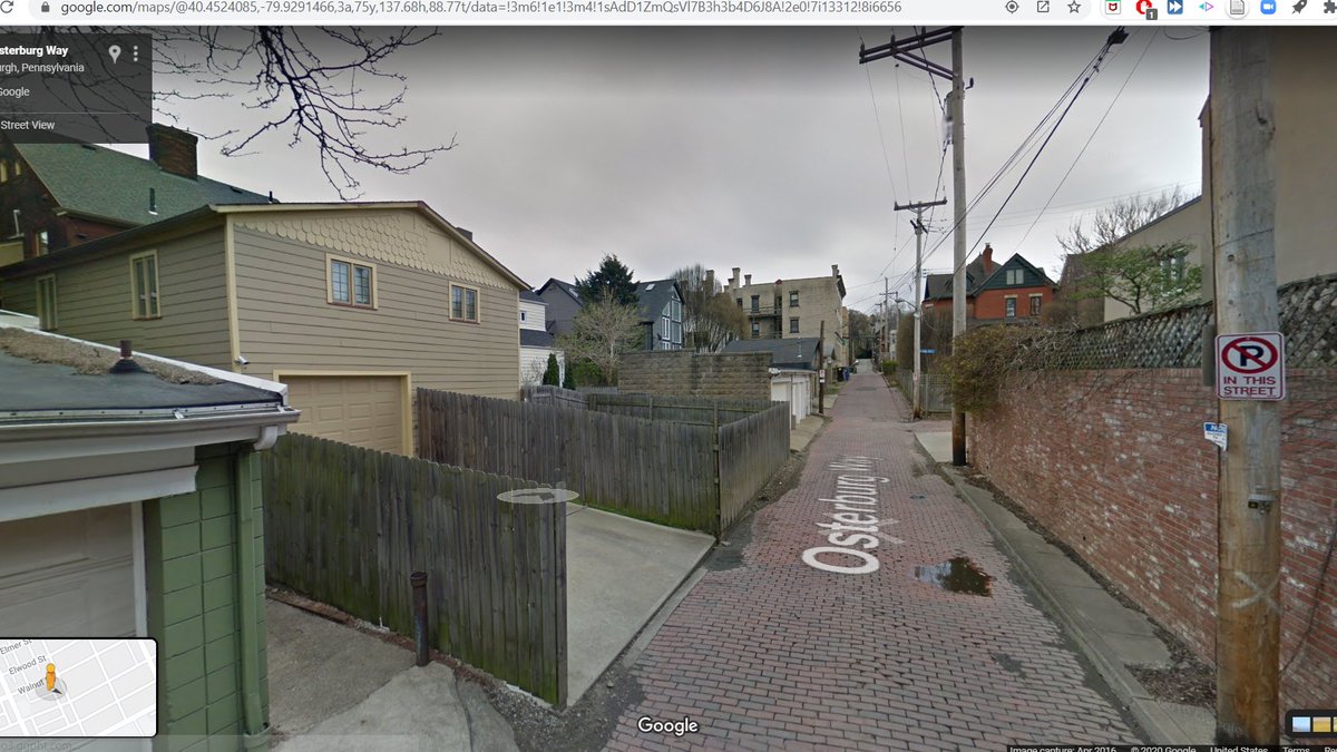
Superior has mid block alleys too! #SEANYC

Old and new ore handling infrastructure
Left: the abutment for a trestle that once carried ore cars directly to ore piers where they could be dumped into ships
Right: a conveyor belt that today brings ore from a nearby railyard #SEANYC
Left: the abutment for a trestle that once carried ore cars directly to ore piers where they could be dumped into ships
Right: a conveyor belt that today brings ore from a nearby railyard #SEANYC

Iron River WI #SEANYC

so you know how I said I thought we'd gotten as close as can be to nighttime streetview? take that back -- this is. #SEANYC

Lake Superior in Ashland, WI

Crossing the Bad River. Note the irony pigment in the water -- we still are very much in an iron-rich area. #SEANYC

Ironwood, MI -- I'm officially (albeit very briefly) in the Upper Peninsula

I've bored y'all with iron mining content already, but it's worth dwelling on the second half of that name for a moment. Michigan (incl. the UP) was almost completely deforested in the mid/late 1800s. -- something like 95% of standing board-feet in MI were cut. #SEANYC
This lumber flowed southwards in schooners to Chicago (which was the critical node in the late 19c forest products industry), where it was distributed across the fast growing Midwest. Once exhausted, this whole supply chain withered/lumber production moved west/south...
...but the fact that large swaths of the Upper Midwest are almost completely devoid of old growth forest is a fact with plenty of ecological resonances to this day. #SEANYC

they really lean into the loon population up here it seems #SEANYC


(I am very pro this, to be clear. Loons are cool!)
In the town of Minocqua, WI, which sits on a peninsula (if you consider a marsh and fill for a road "land") in a lake. Classic story of lumber town => transportation development => tourism center. #SEANYC


Fall colors #SEANYC

Crossing CN (ex-Wisconsin Central exx-SOO line) at Heafford Junction. The Milwaukee line that runs through Minocqua used to cross this line about where the road turns away from the tracks. #SEANYC

Ever since CN bought WC in 2000, rail service in this area of WI has been the subject of much debate; CN has reduced/ended service on a number of ex-WC routes. Depending on who you ask, these changes have either impacted the forestry industry, or were the product of said decline.
Progress update:

Nice view from here! #SEANYC

apropos of nothing in particular, take a look at the pedestrian accommodations at this intersection in Wausau:

The Wausau CBD seems quite employment dense for a MSA that can't be much more than 100k. Aside from forestry (paper mill pics to come), the city has a lot of insurance jobs. #SEANYC

(Note here that, thanks to the Upper Midwest's deforestation during the 1800s, the growth of the current iteration of forestry in Wausau + white collar FIRE jobs were approximate contemporaries, rather than following the blue => white collar progression)
3M's Wausau plant, where they make abrasives and roofing materials from minerals quarried north of the town. #SEANYC

Also, for those interested, the @WausauPilot did a series of interesting articles on the environmental legacy of industry in Wausau/citizens' response thereto.
wausaupilotandreview.com/2018/10/30/tox…
wausaupilotandreview.com/2018/10/30/tox…
As an aside, the regional transitions in US lumber production that made some of the sites mentioned above available are interesting. The big winner was the south, with the North (defined here as the northern tier of the country roughly west of the Mississippi) gaining little.

Behind those shifts (in no particular order): environmental regs, a really complicated game of musical chairs in the trade of softwood lumber, log cost differentials, labor cost differentials, mill age, etc. #SEANYC
A truck of snowmobiles:

Pulaski, WI. A Polish community in Wisconsin (hence the name), with a really grand catholic church. #SEANYC

Also, that table above is from here. Realize I didn't attach a link. fpl.fs.fed.us/documnts/fplrp…
Along the CNW's Green Bay to Wasau line in Pulaski, WI. Abandoned in the 80s. It's now a trail. #SEANYC flickr.com/photos/metra60…

Port of Green Bay. A decently sized bulk commodity port -- ranks in the top 20 on the lakes, IINM.

On the general transportation geography theme of this journey it's important to note that the spatiality of bulk commodity ports and those of container ports are quite different.
Most commodity ships operate point-point, are loaded at extraction points (usually not near population) and unloaded at or near industries, which aren't _necessarily_ colocated with urban areas.
Geography becomes much more about optimizing distances/minimizing handling costs by maximizing economies of scale at a given facility/finding optimal inland transport routes, if necessary. This allows smaller places (think: Green Bay or Superior or Thunder Bay) to play a big role
Procter & Gamble in Green Bay. They make toilet paper here. Would be really curious to know what their exact pulp inputs are; IINM toilet paper is usually made from a blend, including, sometimes, eucalyptus. #SEANYC

You'd be hard pressed to find a photo that more succinctly summates issues w/ US freight transpo policy: an intermodal (rail + truck) container at a *paper mill* with a rail spur. That container will produce emissions/road damage/safety problems that needn't take place. #SEANYC

Passing through the outskirts of Appleton, WI on the interstate. Appleton was a sundown town until ~1970. #SEANYC

In many urban policy discussions, sundown laws — and exclusionary policy more broadly — are associated w suburbs, but it's important to note these laws (and by extension their legacies) reach(ed) well beyond major metro areas. #SEANYC
This isn’t to excuse any party; merely think it’s important to emphasize the geographic breadth of these discriminatory measures.
(h/t to @btx91 for prompting me to reword and expound here)
(h/t to @btx91 for prompting me to reword and expound here)
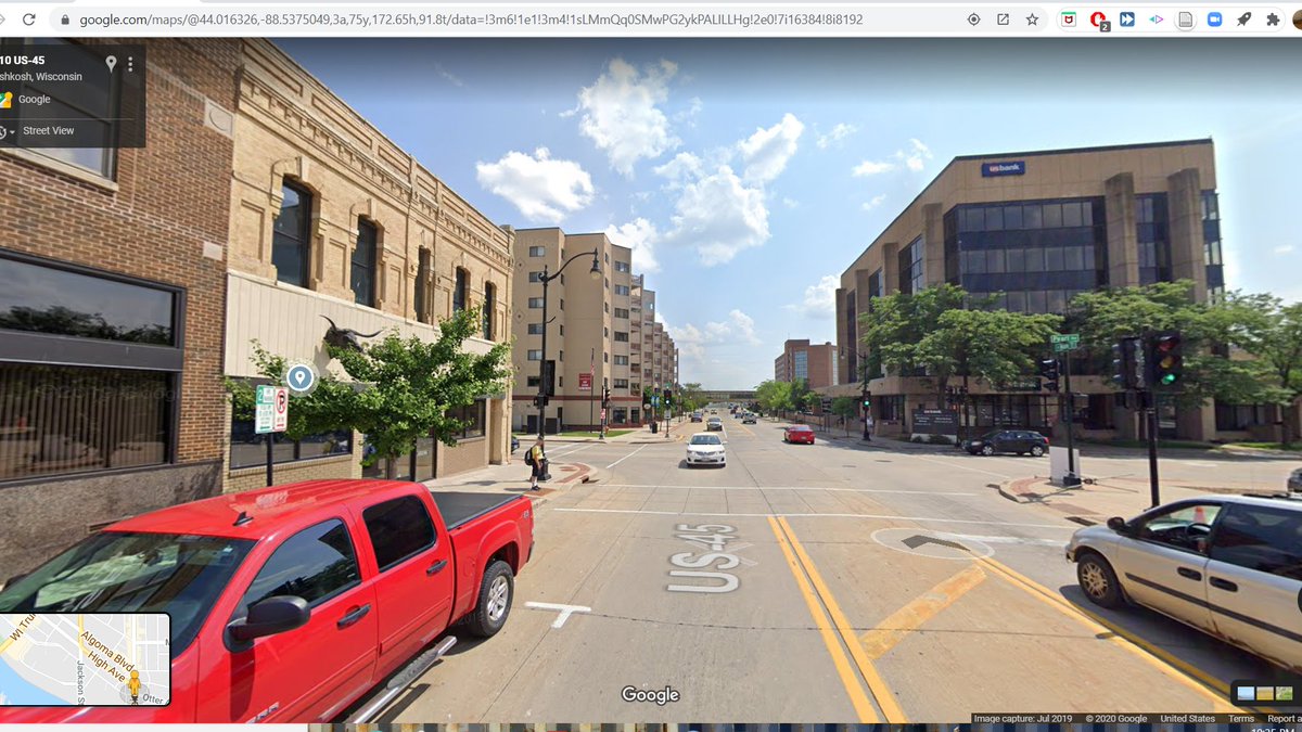
Oshkosh, WI #SEANYC


I always love it when streetview veers into a parking lot. You get a sense for where the photo car stopped along its journey. #SEANYC

You can't really see it in this pic, but it's worth remarking on car shredding machines. They completely revolutionized car recycling by making it easier to separate component materials of old cars, helping ameliorate the issue of abandoned cars in the 70s and 80s. #SEANYC

(Car abandonment itself became an issue only after the most basic air pollution regs made it illegal to burn all the icky stuff in cars to cheaply isolate the metal in the '60s. Per Junkyard Planet, something like 20m cars were abandoned across the country by 1970)
looks like google had a bit of a hard time stitching this pic together right (compare 1 vs 2; note spellings)


This hill sure doesn't look like much, but it's actually part of one of the more important lines in American resource geography: the edge of the Great Lakes watershed. #SEANYC

The Great Lakes contain 84% of the US's surface fresh water; they _are_ the motherlode. As such, many proposals over the years have been made to divert lakewater elsewhere -- including schemes as outlandish as diverting flows to the high plains to replenish aquifers.
Partially as a consequence of these proposals, states/provinces abutting the lakes formed what's known as the Great Lakes Compact, tightly regulating diversions outside the lakes' natural watershed, hence the importance of that hill.
Recommend "The Death and Life of the Great Lakes" for those interested in learning more
Entering Milwaukee #SEANYC

These densely packed single fam houses have a strong 1940s/50s Canadian/LA suburb feel to them:

This sad looking bit of track may not look like much, but is in fact the last remnant of Milwaukee's storied Beer Line, a once-bustling industrial route through the city owned by the Milwaukee RR. We'll be loosely tracking this ROW. #SEANYC

Thanks to racist land use/transportation/governmental geography policies, Milwaukee is one of the most segregated cities in America. I'm near the intersection of Locust and Humboldt on the map attached. #SEANYC


Worth noting that, among myriad other issues, Milwaukee's extreme urban-suburban divide is now exploited heavily by the state GOP in order to reduce the political power of Democrats in state government. See:
urbanmilwaukee.com/2018/06/09/the…
brennancenter.org/our-work/court…
urbanmilwaukee.com/2018/06/09/the…
brennancenter.org/our-work/court…
The Beer Line in Milwaukee got its name from the breweries it once served. Among others, Schlitz and Pabst once had large facilities just north of downtown MKE, which, with volumes of inbound grain and outbound beverages, functioned as anchor customers for the line. #SEANYC
Relatively little is left of this landscape. We're looking at the middle of the older image, next to the tracks leading off to the right #SEANYC
pinterest.com/pin/4604227618…
pinterest.com/pin/4604227618…


There certainly remains some brewing in Milwaukee, but most of the industrial-scale stuff seems to have moved away -- with the exception of Miller in the aptly named Miller Valley. For its part, the Beer Line was abandoned in 2007, after its last major customer closed. #SEANYC

Apologies to my longtime followers, but I want to belabor the importance of industrial sprawl to urban poverty. The (subsidized) suburbanization of well paying low/med skill jobs is inextricable urban economic hardships. This isn't just a story of buildings/railroads/etc. #SEANYC
scenes from downtown, feat. mixed traffic streetcar by the Amtrak station #SEANYC


I-94. West of here, WIDOT wants to spend 1 billion to widen the road, a project championed by both Scott Walker and Tony Evers--despite a lawsuit led by the NAACP, Sierra Club, local Milwaukee advocates and the ACLU to block it.
wpr.org/naacp-official…
jsonline.com/story/news/pol…
wpr.org/naacp-official…
jsonline.com/story/news/pol…

(and see usa.streetsblog.org/2015/03/24/how… for info on how they deemed the stretch unsafe)
MCTS's Purple Line, one of their high-frequency limited stop BRT-lite services. There is a Blue, Purple, Green, Gold and Red line.

Progress has been a bit slow the past few days, but that's to be expected now that we're in larger cities. #SEANYC

Former Chrysler/American Motors engine plant in Kenosha, WI. A former part of a dispersed auto parts manufacturing geography that's rapidly becoming obsolete as just-in-time manufacturing favors colocation of parts and assembly plants. #SEANYC


For those not acquainted with it, the North Shore Line (CNS&M) was an interurban railroad that ran from Chicago to Milwaukee. It was one of the longer lasted interurban operations, closing only in 1963. For more, see: american-rails.com/cnsm.html
#SEANYC
#SEANYC
Kenosha still gets rail service via Metra's UP-North line, which stops here along an ex-Chicago and Northwestern route. #SEANYC

And now, the reason I'm visiting Kenosha: its PCC trolleys. Since 1998, Kenosha has operated a loop trolley connecting the Metra station with a lakefront development. It runs a number of (mostly) ex-Toronto PCC cars. #SEANYC

This loop is (arguably) one of the first examples of modern streetcars as development-oriented transit; the genesis of this loop was the redevelopment of the town's industrial waterfront. #SEANYC
This road *is* the WI/IL border #SEANYC

An elderly coal fired power plant along the lake in Waukegan: #SEANYC

EJ&E over the ex-C&NW in North Chicago. This is the far northern end of the EJ&E, a belt railroad that circled Chicago and is now (regrettably -- could have been immensely useful as a public asset) part of CN
industrialscenery.blogspot.com/2019/01/ej-elg…
industrialscenery.blogspot.com/2019/01/ej-elg…


Glencoe, IL: one of the first towns to ever adopt a zoning ordinance (1921). Surprise surprise, it restricted development to single fam homes outside of its little downtown, and banned industrial uses.
lib.niu.edu/1987/im871205.…
#SEANYC
lib.niu.edu/1987/im871205.…
#SEANYC

The CTA is somewhat unique among rapid transit systems in that its routes still have grade crossings! Here's the far northern end of the Purple Line in Evanston. This particular portion of the CTA system was used by North Shore Line trains following their easterly route.

(image from american-rails.com/cnsm.html#gall…)
Take 2 of the images in tweet before last

'Downtown' Evanston #SEANYC

I love that street view has alleys like this. Currently crammed btwn the Metra UP-North line (ex-CNW) and some houses. #SEANYC

Howard! This station is the:
- North end of the Red Line
- South end of the Yellow Line
- South end of the Purple Line during off peak hours; a through stop during peak
- The location of a major yard
...or the Chicago equivalent of the E 180 area in NYC. A v complex operation.
- North end of the Red Line
- South end of the Yellow Line
- South end of the Purple Line during off peak hours; a through stop during peak
- The location of a major yard
...or the Chicago equivalent of the E 180 area in NYC. A v complex operation.

The saving grace for the area is the fact that Chicago (brilliantly IMO) makes the middle pair of tracks local and the outer pair express on their 4 track lines.

During the rush, Red line trains, (local south of Howard) can pull in on the middle tracks and loop around. Purple line trains (which run express south of Howard and go north on the tracks running along the sides of the loop) just stick to to the outside.
Yellows (coming from the tracks that pop up btwn the loop's sides) weave their way through; I've read they either turn on the outside tracks or use that little spur at right.
And, to top it all off, you have plenty of movements to/from the yard during rush hours. Those moves, sadly, are not grade separated, which I'm sure makes for some ~fun~ junction operation (esp given the complicated, tight and therefore somewhat slow switchwork) #SEANYC
Lots of these apartment buildings w/ mid-block service alleys here along Clark St. Would love to know the history of the design, if anyone here does. #SEANYC

Clark Junction, where CTA's Brown (right) and Red/Purple (left) lines converge at a flat interlocking. CTA is currently in the process of grade-separating the area to eliminate the conflicts caused by Brown Line trains crossing over 3 tracks to escape to Ravenswood. #SEANYC

Project details can be found here: transitchicago.com/rpm/rpb/#:~:te…. As I've discussed in the past, this project is an epitomizes the 'weakest link' investments that should be more the norm for US transit agencies; they're not as fun as a new line, but they're the highest value/dollar.
Taking a quick dip on my way to Goose Island. I really hope that streetview expands its river coverage; it's great stuff. #SEANYC

Goose Island--which once was really just a gigantic train yard--has a fun shared rail + pedestrian bridge at its north end. The rail half of its use has been out of service since 2015, sadly, and is now undergoing trail conversion.
industrialscenery.blogspot.com/2017/05/railro…
clearinghouse.isgs.illinois.edu/webdocs/ilhap/…
industrialscenery.blogspot.com/2017/05/railro…
clearinghouse.isgs.illinois.edu/webdocs/ilhap/…


The one-time site of the Cabrini-Green homes, one of the more infamous public housing projects in the US. Explaining what caused decline at the project is a subject that can (and has) filled many books, but I want to touch on a few here #SEANYC

It's first worth noting that the project's eventual function as a segregated, disinvested and socially isolated space was not by design; the original public housing plans for Chicago contained both slum replacement housing, and housing in suburbs.
The two were to work in concert, city-edge housing providing capacity to allow wholesale replacement of slum districts, in what was seen then as a progressive vision for housing. The merits of this approach can and should be debated...
...but I think it's key here to recognize the wholesale rejection of city-edge housing projects by white councilmembers using local control veto points as a critical turning point in the fate of the CHA writ large.
Ofc, location isn't everything: later events, whether that be the laser focus on unit construction costs (which led to tall bldgs w few elevators), blatant racism in tenant selection and agency budgeting, the disappearance of federal support in the 1980s, or managerial mistakes..
...on the part of agency staff and pols, were disastrous for the CHA. When combined with the generally anti-poor governmental environment of the post-Great Society era in the US they affected decline, and should be recognized for such alongside segregationary planning.
As for what has happened to Cabrini: after the Gautreaux ruling found the CHA to be intentionally segregating Black people and given the agency's chronic issues, the 90s and 00s saw a movement towards scatter-site public units and the demolition of legacy projects.
As such, Cabrini is currently being redeveloped (not without controversy about equity and inclusion in the new master plan) into a mixed income neighborhood.
A remnant of N Ogden Avenue, a diagonal Chicago street that has disappeared
forgottenchicago.com/features/the-e…
forgottenchicago.com/features/the-e…

(re: chicago public housing, I'd strongly recommend Hirsch's Making the Second Ghetto and Hunt's Blueprint for Disaster)
Last remnant of the Chicago NorthWestern/UP Navy Pier Spur, which once ran below Merchandise Mart to reach the lakefront at the Navy Pier. This was active delivering newsprint to the Sun-Times until about 2000. See: web.archive.org/web/2011072213… #SEANYC

Under: Chicago Union Station north leads, used by Milwaukee North, Milwaukee West and North Central trains.
Over: Ogilvie leads, used by Union Pacific N/NW/W. #SEANYC
Over: Ogilvie leads, used by Union Pacific N/NW/W. #SEANYC

Union Pacific-West and the Union Sta. routes cross again a bit further west at this railway operations nightmare called tower A-2 #SEANYC

Tower 18, the northwest corner of the Chicago Loop. This is among the busiest flat (ie no flyovers) interlockings anywhere. #SEANYC
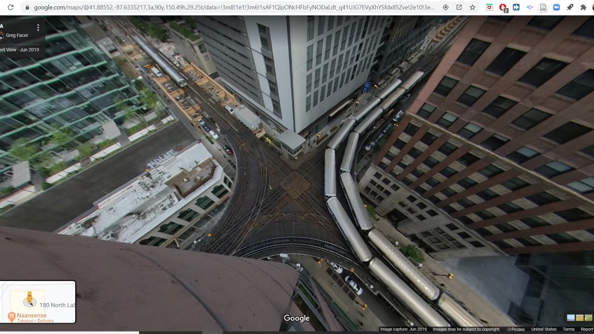
In the past (before the loop had signals), the loop handled as many as 85 (!!!!) trains per hour on one of its tracks. I'm astonished that could be made to work.

While the loop has signals today, some aspects of the operation are suitably old fashioned. Thanks to the intensity of service at tower 18 during rush hours (trains passing <<<every 60 seconds), it's deemed prudent to have an operator on site to manage things.
So, despite the industrywide trend towards centralization, this junction still has a local tower operator who, IINM, dispatches trains on sight by looking at their marker lights (colored light pairs unique to each route). Truly a blast from the past! #SEANYC
UIC-Halsted on the Blue Line. This is an important short turn point for trains coming from the busy O'Hare branch of the Blue to the relatively less busy Forest Park branch.
drive.google.com/file/d/176eBdd…
drive.google.com/file/d/176eBdd…

This stretch of track along the Eisenhower expy is also among the earliest examples of freeway median transit in the US, a typology which the CTA embraced in the 50s and 60s with lines along the Eisenhower, Dan Ryan and Kennedy expressways
chicago-l.org/operations/lin…
chicago-l.org/operations/lin…
Passing under NS's 40 St Industrial Track. This route is ex-Rock Island; I believe it made its way to Conrail (and then to NS) when the former railroad was liquidated, and now serves as a key interchange gateway between NS and BNSF/UP. #SEANYC

This area, much like the rest of Chicago, is extremely prone to congestion. The handoff process between railroads is a coordination problem that frequently goes unsolved, and things seem to get exponentially worse each time railroad traffic grows suddenly. #SEANYC
Some of that is infrastructure (LOTS of at-grade junctions), some of it is operations (coordination/crewing/handoff location issues), but either way if you're looking for the 80/20 in US transportation systems, fixing Chicago's rail network is probably it. #SEANYC
Former site of CHA's Robert Taylor Homes, part of the infamous State Street Corridor of housing projects next to the Dan Ryan on the south side. This was one of the sites chosen for PH after the rejection of suburban projects, and was only built in the early 60s. #SEANYC

Chicago's growth patterns are worth a note here. While the city's population is stagnant (and is about 25% less than its peak), the region at large still nets small population increases.

This slow growth region with no/negative growth central city pathology is common among post-industrial cities in the US, and is quite the testament to just *how* broken our incentive structures are around land use and sprawl.
Needless to say, this persistent disinvestment in central cities has really nasty side effects for regional politics, racial wealth gaps, employment opportunities and the like. #SEANYC
This is also a story of industrial sprawl, I should note. Many POC in Chicago were employed in industry, and that industry overwhelmingly decamped for the suburbs during the second half of the 20th century. #SEANYC

75 St: the worst of the worst when it comes to Chicago freight rail congestion. #SEANYC
cmap.illinois.gov/documents/1018…
cmap.illinois.gov/documents/1018…


Metra's South Chicago Branch. It once had 20 min base headways, it now runs hourly off peak. If you haven't read @sandypsj's thesis, which discusses the decline of this line in detail, you should:
itineranturbanist.files.wordpress.com/2016/05/final-…
timetable from: chicagorailfan.com/schedule.html
itineranturbanist.files.wordpress.com/2016/05/final-…
timetable from: chicagorailfan.com/schedule.html

The former site of US Steel's South Works, the westernmost major mill of the 'steel necklace' along Lake Michigan's South Shore. We're looking at the bin walls that once held inbound ore and coal for the furnaces. #SEANYC

The decline of the US steel industry is a fascinating subject; as I've previously recommended in this thread, And the Wolf Finally Came is a good read on the subject. If you want a ridiculously short version, see here:
Worth keeping in mind that if all of these mills still existed, they'd still have shed massive amounts of employment since their peaks. You simply don't need 10-20k people to run an integrated mill these days.
Another interesting trend is the shift in heavy industry commutes. Jobs-rich steel mills and their kin were once huge ridership generators for transit, and in other parts of the world, still are! But today, many of these places--even in transit rich areas--are places driven to.


E Chicago, IN #SEANYC

Steel coil cars near the Gary Works. As steel's fraction of key products (ex: automobiles) has declined, these have become less common. They are frequently high margin traffic; their loss has nontrivially hurt the profitability of carload freight networks overall. #SEANYC
Crossing the Chicago South Shore & South Bend in Gary. The only US interurban to persevere through the years carrying passengers, and currently a hugely underutilized asset:

Paired 1 way streets carrying highways through mid-sized downtowns..really suck; they encourage dangerous speeds in (actually or potentially) pedestrian-dense areas. Here we are on the eastbound half of US-20 through Gary; the downtown is mostly gone, but you get the point.

Foreground: CSS&SB line (the one we crossed earlier).
Backgrond: NS's ex-Conrail Chicago Line, their primary artery for freight traffic in and out of the region. Easily sees 60+ trains/day #SEANYC
Backgrond: NS's ex-Conrail Chicago Line, their primary artery for freight traffic in and out of the region. Easily sees 60+ trains/day #SEANYC

ArcelorMittal's Burns Harbor plant (ex-Bethlehem). This is the newest integrated mill (integrated = contains all equipment to make steel from raw iron ore vs melting from scrap) in the US, finished btwn '66-75

Today, freight ops on the CSS&SB are done by a private carrier and are diesel, but into the 80s the line was a bastion of electric freight service. #SEANYC
flickr.com/photos/2955783…
flickr.com/photos/2955783…


Michigan City scenes (note the street running segment of the CSS&SB) #SEANYC


Semi-rural highway interchange in progress, because this slip lane-d mess wasn't enough and our country seems okay with (literally) driving itself to climate emergency #SEANYC


Nice trees

A steel finishing plant in a cornfield: truly the modern industrial landscape here #SEANYC

South Bend's old Union Station. Amtrak still stops in the city, but does so at this Amshack about 1.5 miles west of downtown. Sad how a service that markets itself on downtown-downtown access has so often left downtowns through its almost 50 years. #SEANYC


South Bend's downtown is yet another example of how cars have come to dominate urban space. So much of it is just parking.

And this isn't just some urban renewal saga, either: in so many US urban business districts, decentralization trends meant that by the '30s, building owners were tearing down office space to make surface parking lots because they'd make more money that way.
Now/then. The evolution of the South Shore's route into the city reads like a history of bad transit planning: they abandoned the tracks into downtown in the 70s, cutting to the Amshack pictured above. And when it came time to 'revitalize,' they extended it...to the airport.


(pic from:
upload.wikimedia.org/wikipedia/comm…)
upload.wikimedia.org/wikipedia/comm…)
Bittersweet Road #SEANYC

Alongside Norfolk Southern's Elkhart Yard, in Elkhart IN. This (huge) facility is used to pre-sort freight moving through Chicago to western connections. As evidenced by the steel coil cars in the foreground, it also does a brisk business from Northern Indiana industries. #SEANYC

Scenes of Elkhart


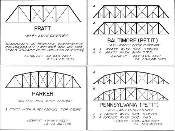
A beautiful old truss bridge in Goshen. This type of modified truss is called a Pennsylvania truss, IINM. #SEANYC

This segment of US-33 is part of the Lincoln Highway, the first transcontinental US road. Its construction was a key moment for the US's Good Roads movement, which itself gave way to the coalitions that brought us the highway and land use systems we live in today.

It's an obvious point, but I do find this road's (and automobility more broadly) youth mindboggling -- begun in 1913, it's only 15 years older than my grandfather.
something something spend on road maintenance and not endless expansion something something #SEANYC

Scenes of Fort Wayne, IN. Fort Wayne is an interesting example of an inland (and non-Mississippi) Midwestern metropolis whose growth was initially fueled by water transport; the city's first growth spurt followed the completion of the Wabash and Erie Canal in the 1840s. #SEANYC


(Last pic in the above is of the old International Harvester plant, one of the sites struck in the famous strike of 1979)
Fort Wayne's railroad geography is worth a note. It lies on two East Coast-Chicago main lines -- one owned by Norfolk Southern (ex-Nickel Plate RR) and one by a short line (Chicago Fort Wayne & Eastern, ex-CSX exx-Conrail exxx-Pennsylvania RR main).

The latter, ex-PRR line was almost abandoned by Conrail in the 1990s, which caused the Capitol Limited and Broadway Limited, both of which used to stop in Fort Wayne, to be rerouted out of town in 1994. The line ended up being kept, and was allotted to CSX in the Conrail breakup
...to be used as a secondary Chicago-Ohio main line much in the way that NS uses the Nickel Plate (as well as trackage rights over the PRR) to relieve its ex-New York Central line through northern Indiana. CSX's main line ended up holding up well, so the route was sold to the CFE
when you've crossed into Ohio but maps still thinks you're in Indiana (see top left) #SEANYC

Crossing over the Napoleon, Defiance and Western (ex-Wabash). This line is widely regarded as having among the worst track conditions of any non-spur line in the US -- look at those squiggles!

Realize I haven't done one of these in a while. Progress over the past week (give or take) has been poor, but such is life. For those interested in timeline, I'd say we're probably 14-20 days away from completion. #SEANYC

An ancient Wabash color light still stands protecting where the Napoleon, Defiance and Western crosses CSX's main line in Defiance. Old signals like this are getting much rarer with PTC (which, to be clear, I think is a good thing) forcing replacement. #SEANYC
Train was here. #SEANYC

Can't be certain absent higher res imagery, but this looks like a soy field. I've always found it interesting that US soy production is significantly more east-biased than are corn or wheat. #SEANYC


Some details on the above signal
You'd never know it, but this area of OH was once a swamp the size of CT. Though its drainage has increased arable land, the loss of its natural filtration for Lake Erie, and its water's replacement with agricultural effluent has played a huge role in Lake Erie's algae issues.


While we made progress in reducing runoff from point sources ringing the lake (think: industry) after the Clean Water Act, these sorts of non-point sources weren't rigorously regulated & are now regarded as being the biggest polluters.
(Img from: upload.wikimedia.org/wikipedia/comm…)
(Img from: upload.wikimedia.org/wikipedia/comm…)
Toledo is another one of these zero-growth sprawl metro areas. Deindustrialization hit it hard, and all sorts of...questionable planning choices only fanned the flames, for example the road below.


Dorr St once was Toledo's Black business district, but in the 70s it was deemed blighted. They elected to widen the street and clear much of the activity along it (seemingly w/o much effort to replace), yielding the above. toledoblade.com/local/2015/04/…
Wanted to leave this pithy quote from the above article for your consideration: #SEANYC

Toledo is also another example of a Midwestern city that first grew up around a port; it was the head of the Wabash and Erie and Miami and Erie Canals. A decent amount of port activity still exists; mainly coal traffic and ore to inland steel mills. #SEANYC

A nuclear station along the shores of Lake Erie. Aside from ports, nuclear power stations must be among the pieces of infrastructure most strongly correlated with proximity to large bodies of water thanks to their cooling needs. #SEANYC

The Norfolk Southern coal pier at Sandusky. This terminal (which was built by the Pennsylvania RR, but made its way to NS ownership not via Conrail, but by Norfolk & Western's acquisition of this PRR line in 1964) ships coal largely to Great Lakes steel mills, IINM. #SEANYC

One of the more deeply frustrating realities of US railroading is that, despite railroads' natural environmental advantages, they tend to be (quiet) fossil fuel proponents. Their wish to milk fossil fuel transpo assets such as this are one of the reasons why. #SEANYC
NS's Bellevue Yard. Until just a few years ago, NS was investing massive sums in expanding this facility to consolidate classification at a key network node. From 2015 to 2020, it was the second largest yard in the nation! But as of this June, most of the yard is being closed.

I'd imagine there are a number of reasons driving this (perhaps most prominently that other somewhat-nearby yards all originate lots of local traffic as well as sorting through freight), but the yard's closure is nevertheless a testament to changing freight rail ops in the US.
For shipments that not large enough to fill an entire train, moving large volumes from yard to yard and continually resorting was once the norm. Now the emphasis is on avoiding yards by combining traffic that once ran in dedicated trains w/ small shipments...
...and pre-sorting cars (allowing blocks of cars to be easily swapped at intermediate points) wherever possible. This mirrors changes in the European network, where small shipments (what they call single wagonload) is being mixed with intermodal or unit trains in mixed trains.
Some interesting ecclesiastic architecture in Huron, OH #SEANYC

Looking into US Steel's Lorain facility. Is part of their tubular products division, and has been for a long, long time. Steel is another large industry whose fate is deeply bound to the fossil fuel economy given the importance of auto/oil/gas in steel consumption. #SEANYC

It's not crazy to say that the fracking boom (and requisite ^ in pipe demand) is what saved the steel industry from total disaster during the 2008 Recession, but as of March the facility is idle; tying one's fortunes to oil/gas leads to quite the production swings. #SEANYC
Did someone say job sprawl? #SEANYC

Population sprawl -- your subdivisions depopulating central cities -- is generally the target of anti-sprawl advocates, but job sprawl is generally more damaging insofar as it is *really* difficult to build transit use in polycentric regions. #SEANYC
Piling upon Cleveland's job sprawl issues is what's happened to transit service in the city. During the Great Recession, the city lost about 35% of its transit service-miles, and has never completely got them back. #SEANYC


Some positively ancient 3-bay coal hoppers in front of Arcelor Mittal's blast furnaces in their expansive Cleveland Works (mostly ex-Republic Steel). #SEANYC

I've made this point before, but it's difficult to separate the decline of the steel industry from the fact that *so many* plants were located on these sorts of highly constrained (and urban) river valley sites.
Squeezing new processes into those plants was difficult, and just didn't make sense in many cases given the incentives to transfer operations (or cede market to) to more rural operations.
Old plants (and old companies) were also at a disadvantage given the highly adversarial nature of steel industry labor relations. Largely thanks to the huge influence Taylorism had on 20c HR practices, the US steel industry suffered hugely from mgmt-labor distrust through the 80s
It's difficult to overstate how bad this was. The legacies of lagging tech spending and sclerotic practices presented the industry with a massive collective action problem during the early 80s; to weather the recession and foreign/minimill competition they had to ^^ productivity.
(minimills being smaller steel mills fed by scrap metal that could generally produce steel at lower cost than integrated -- iron/coke in, steel out -- producers. they became important players in the lower segments of the steel market during the 1970s)
What roles labor/mgmt/gov't would play in that story would be contestatory in the best of times (esp. given the reality that some plants would have to close), but the bad faith assumptions that abounded made things oh-so-much worse...
I could go on about this for a while, but to bring us back to Cleveland, the net effect of this paralysis was that the geography of steel production that remained in the US looked radically different than it had before the 80s
Gone were many of the urban mills in PA/OH/NY; the ascendant mill typology was rural, Southern/Southwestern, and non-union. The wholesale disappearance of these types of work has a lot to do with the urban poverty we see in cities like Cleveland today.

To some extent, this shift reflected shifts in demand (ex: oil production moving south/west), but it also was the product of various sorts of arbitrage/subsidy -- on labor rules/costs, tax rates, transportation costs and otherwise. #SEANYC
Steel mills frequently use exhaust gases from 'hot' processes to fuel other parts of the plant, which leads to quite the tangle, especially at larger facilities like in Cleveland.

The age (rrs played an even larger role in steel production processes back when mills used ingot castings) and riverside site of the plant also means that its trackage is exceedingly complicated. You could catalog a _lot_ of railroad hardware just in these two photos! #SEANYC


Perhaps more important than steel in Cleveland's early development was oil. When US oil production occurred mostly in western PA, Cleveland was _the_ refining center; Standard Oil's HQ was even here until 1911! Little remains of the industry today, it would seem. #SEANYC


Cleveland's Tower City, a real estate scheme built w Cleveland's Union Station (bc TOD was the default option back then). CUS served both long distance trains and transit from the start--including the Shaker Heights route, which forms a backbone of GCRTA's network to this day.

Sadly, job densities have declined significantly in downtown CLE since then; Cleveland Clinic seems to have more jobs/sq mi than downtown at this point. #SEANYC

For ~a century, the fiercest rivalry in railroading existed between the NY Central and Pennsylvania railroads, competing for primacy in the Northeastern US.
The pride and joy of the NYC was their water level route btwn NYC and Chicago, a path which gave them a leg up on operating costs and speed vs the PRR, which had to deal with the Alleghenies.

During the 1998 Conrail split, the route east of CLE was given to CSX, and west of it NS (to be used w/ the old PRR east of CLE). These signals are where ownership changes. One can only imagine the horror NYC executives would feel at their beloved line having been split in half!

Cleveland also once had interesting elevated rail spurs

Scenes from University Circle and environs in Cleveland, that big job-dense area east of Downtown on the map from yesterday. This is where Case Western and Cleveland Clinic are. #SEANYC


(And yes folks, the Euclid Avenue you see in pic # 3 above does indeed go to _that_ Euclid, the one involved in the Supreme Court case that gave us modern American zoning.)
...and here we are in Ambler heights, a turn-of-the-century 'garden city' type development by the real estate company that sued the town of Euclid in Euclid v Ambler. This area is (ironically) now a historic district. #SEANYC

Along the Shaker Heights Rapid Transit route, the transpo instrument that facilitated the construction of the area's garden suburbs. This is a somewhat rare example of a US streetcar suburb that's kept its streetcar. #SEANYC

The wide median, curving side streets, large lots and extensive vegetation here read like a textbook of Olmstead/Howard/Downing inspired garden city planning. #SEANYC

I think this town, called Chagrin Falls, takes the cake for best place name on the trip (so far, at least). #SEANYC

Progress update #SEANYC

Apologies for the spotty posting over the past week. Have been busy. We resume our journey in Warren, OH, a steel town and a key junction point on your author's favorite fallen flag: the Erie Lackawanna #SEANYC


This sad little bit of disused trackage was once the Erie Lackawanna main through town. In part because the EL main missed important population centers west of Buffalo, and in part because the EL was shotgunned into Conrail at the last moment, Conrail tore up a lot of EL assets.

(for those of you not acquainted w/ Conrail, may I recommend american-rails.com/conrail.html)
The former site of Republic Steel's Warren Works, with an ex-NYC searchlight signal in the foreground. This mill marked the northernmost extremity of the Mahoning Valley steel district, which once contained a number of plants in/around Youngstown and Warren.

To give you a sense of just how large the industry once was, each one of those reddish areas along the river in the middle of the pic used to be a (part of a) steel mill. The area was compared to Germany's Ruhr, but now only hosts one small operation.

It's easy to decry the loss of these bits of industrial infrastructure, but the real story here is one of persistent disinvestment. I can't think of a country that's handled deindustrialization well, but...
...the US's almost completely uncoordinated response -- and its concurrence with the rise of intermunicipal competition for jobs and drastic reductions in federal level antipoverty programs -- have left deep socioeconomic scars.
These impacts have been especially felt by BIPOC workers, whose low seniority, lower physical mobility (intra and interregionally) and structural workplace disadvantages made their experience of deindustrialization especially difficult.
Pathologies of that sort create stark maps -- note here, too, that the narriative of industrial disinvestment must be overlaid with suburban flight! #SEANYC


A cool Art Deco-y building in Niles. #SEANYC

McDonald, OH, a company town built for US Steel's McDonald Works. This was a relatively late-era company town (20s-ish); note the single family housing typology, which served both as an amenity for workers and a tool to encourage stable mill employee families to settle. #SEANYC

Left turn lanes but no clearly delineated crosswalks or yield signs for pedestrians, in a city where 17% of people don't own cars (which, for reference, is more than in Staten Island). You really hate to see it. #SEANYC


A Ukrainian (?) church in Youngstown. Lots of E European immigrants ended up in steel towns in the early 20th century, before we passed a number of xenophobic immigration restrictions. #SEANYC
The ex-site of the Campbell Works, which was among the first major steel mills to close in the Midwest on what's known as Black Monday in 1977. Took only 10 years for the most others which would close to call it quits as well. #SEANYC

Quick aside before I begin tonight’s leg: I was browsing a book on the B&O today when I stumbled across this image, of a transfer freight heading to the Campbell works on 9/15/77. That’s **four days** before Black Monday. Spooky.


Goodbye Ohio and hello Pennsylvania! This will be the antipenultimate state on the trip -- we're getting there!

A B I G slip lane, because it's important that drivers can take this intersection at 60 or w/e #SEANYC

I always find it fascinating to look at small cities' demographic patterns. New Castle, PA, despite having lost about half its population and most industrial employment, still contains a well defined employment core which employs about 10% of the county's workforce. #SEANYC


These sorts of small-city downtowns were tiny enough that they could (sort of) persevere into the age of the automobile despite the geometric limits of automobility in dense settings. It's an interesting mix: an autoscape with pre-automotive employment patterns. #SEANYC

While the big integrated mills are mostly gone from the Ohio/Mahoning/Monongahela valleys, there remain a relatively healthy number of metalworking and steel finishing operations in old mill buildings/on old mill sites. #SEANYC

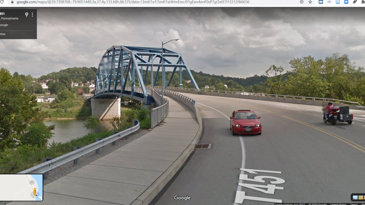
A beautiful example of a Pennsylvania Truss bridge in...Pennsylvania! #SEANYC
pahistoricpreservation.com/wp-content/upl…
pahistoricpreservation.com/wp-content/upl…


In an area once dominated by the steel industry (with an extremely healthy glass and ceramics industry alongside it), fire bricks once were a huge business. To this day, there are areas of steel mills that need to be relined about once a month. #SEANYC

CSX's New Castle Yard. This once was a somewhat important point on the B&O, staging traffic for area industries and for forwarding on trains heading towards Buffalo or Rochester via Butler. Use today is ~ the same, except the line towards BUF is owned by the Buffalo & P'burgh.

(map from upload.wikimedia.org/wikipedia/comm…)
One facet of the resource geography that made Pittsburgh such an attractive place to locate steel mills is hinted at by the presence of this cement plant: western PA is rich in high-grade limestone, which is used in steelmaking as a flux to remove impurities. #SEANYC

A less well known steel operation in the Pittsburgh solar system: Tenaris' Koppel tube plant (ex Babcock and Wilcox, which used it in part to manufacture steel components of nuclear reactors). Built in 1959, it also is among the newest mills to have existed in the region. #SEANYC

Because of its late build date, this plant has always used electric arc furnaces to make steel, EAFs being a mill technology whereby scrap is melted down and refined (in a single step) to make new steel.
This contrasts with the 2 step blast furnace => basic oxygen furnace process used to make steel from iron/coke/limestone, which was the dominant steelmaking technology before the 1970s and was, consequently, the tech of choice at most Pittsburgh mills. #SEANYC
Beaver Falls, PA #SEANYC


Scenes of New Brighton, PA. Note the alley urbanism (of which I'm a big fan!). Last pic shows the grade separated junction between Norfolk Southern's ex-Pennsylvania RR Youngstown and Ft Wayne lines. The former goes to Ashtabula via Y'town; the latter is the mainline to CHI.


Sheetz vs Wawa: the quintessential Pennsylvanian divide (I'm a NYer, but am 100% team Wawa) #SEANYC

Who needs San Francisco when you can go to PA river towns and see tons of steeply sloped streets #SEANYC

One of my lizards enjoying the heat generated by these travels

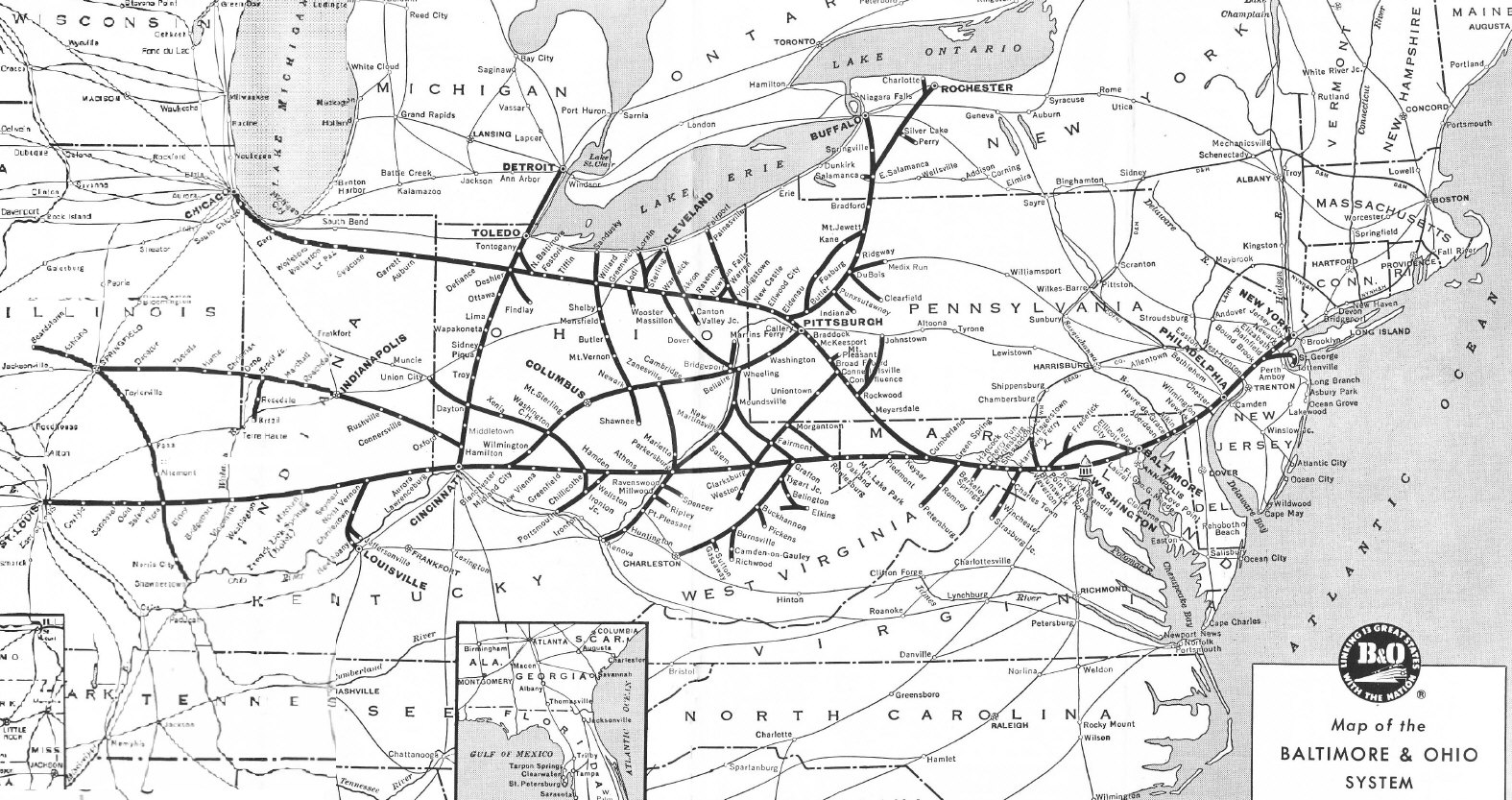
Conway! This massive ex-Pennsylvania RR facility lay at the heart of their network (as this graphic from a 1957 pamphlet shows) in the industry-rich P'burgh area, and has remained an extremely important yard for successors Penn Central, Conrail and Norfolk Southern. #SEANYC


Freight here is classified by humping cars, so pushing them up a hill, uncoupling them, and then routing them to roll down the other side of the hill into a track containing cars for a given destination. Conway used to have two humps -- one for e/b traffic, one for w/b...
...but after receiving their portion of Conrail, NS shut one of the humps and transferred some duties to other yards, including the facility at Bellevue which we covered a few weeks ago.
Ironically, Bellevue is now closed while Conway remains open; the volume of traffic that still is generated around P'burgh and its enduring network logic would suggests to me that it won't go anywhere, but I don't wanna jinx it. #SEANYC
Pamphlet: multimodalways.org/docs/railroads…
Looking north at the former site of Jones & Laughlin's Aliquippa Works. Production here ended in 1987, only six years after the first steel producing section of the plant shut. Timeline from: books.google.com/books?id=eb6Js… #SEANYC


I could bore y'all for hours talking abt the mill, but want to note what is by far its most lasting contribution to industry. In 1937, SCOTUS ruled that workers fired for unionizing at Aliquippa had to be reinstated, thus upholding the constitutionality of the Wagner Act. #SEANYC
Across the river from Aliquippa is Ambridge, a company town for the American Bridge Co. The ABC was less of a bridge company--though it did make lotsa bridges--and more of an enormous steel plate/girder fabrication outfit; they worked on skyscrapers, for example, as well. #SEANYC

yeah so progress has been a lil slow

(On the other hand, lizard has barely moved either)

Garden apartments like these have gotta be one of the most ubiquitous multifamily housing types around. You find tons of them in inner-ring suburbs in the NE/Midwest. It's good that they're multifam -- that's progress for the burbs -- but the lot sizes and FARs are very meh.

Like, the houses at right and these little apartments at left have...basically the same footprints. This probably makes it easier to get such developments by local permitting authorities, but it leaves a ton of housing capacity on the table.

Hey look, it's NYC's finest export! This is 63V, a solid train of garbage that runs from Kearny (with an additional stop at Bridgewater) to Mingo Jct, OH, where a shortline railroad takes the lovely stuff to a nearby landfill. #SEANYC

From time to time, the highway-industrial complex produces a very pretty bridge. I'm a sucker for suspension-arches. #SEANYC
Seems Pittsburgh has also caught onto the "cheap hotel construction in industrial borderlands" trend #SEANYC

Neville Island, north of Pittsburgh, once hosted a large shipyard which made barges for inland transport. It closed in 1983, and its old ramp now *seems* to be in use as a site for barge dismantling by a scrapyard. #SEANYC historicpittsburgh.org/islandora/obje…


This facility was once a coke works, where coal is baked to drive off impurities. This facility (and others like it in the PGH area, including the still-operating Clairton Coke Works) had long been the source of a massive amount of air pollution
appvoices.org/2018/06/07/hea….
appvoices.org/2018/06/07/hea….

Much as (and this is esp. true of first-wave gentrifiers) gentrifiers have a tendancy to uncomplicatedly idealize the neighborhoods/eras during which they gentrified, the narrative of industrial plenty is one that deserves some nuance. This is Donora during the smog in 1948:

The north end of Norfolk Southern's Mon Line are those two tracks that rise up here. This ex-coal/steel route has found a second life as NS's double stack cleared route through Pittsburgh, as stacks cannot fit through downtown on the Pittsburgh Line. #SEANYC

Some lovely mansard roof houses on a hill in the North Side #SEANYC

Some views of Allegheny Center, one of Pittsburgh's many urban renewal projects. From the 1940s until the '80s, Pittsburgh's government worked closely with business (largely through the (in)famous Allegheny Conference) to enact one of the more extensive renewal programs in the US


The profile of Pittsburgh's projects was unremarkable among others in the US (highways, downtown refreshes, new tower-in-a-park housing), and was equally unremarkable in its regressive impacts (ex: Lower Hill District, E. Liberty). #SEANYC
In part thanks to those urban renewal efforts, Pittsburgh retains a strong CBD. #SEANYC

The confluence of the Monongahela and Allegheny, and the beginning of the Ohio.

While Pittsburgh may go down in history as a steel and railroads city, its geography was indelibly shaped by rivers: it's no accident, for example, that all the mills located on the Mon and Ohio rather than the Allegheny; they were directly downstream of the S PA coal seams
The beginning of the Pittsburgh LRT tunnel, placed (lol) under a parking structure. Here, as in Saint Louis and Weehawken, old railroad tunnels got rebuilt to serve as grade-separated transit rights of way -- in this case, part of the old Panhandle tunnel. #SEANYC

Before this tunnel was built in the 80s, Pittsburgh's downtown had quite the network of surface rail trackage; Pittsburgh generally was an outlier in that it retained large portions of the streetcar network into the 1960s. #SEANYC transitguru.info/pgh/history/pd…
S L O P E #SEANYC

The Hill District, yet another American neighborhood scarred by racially tinged disinvestment and urban renewal policies. Also another neighborhood that has, in the span of 70 years, witnessed the construction, demolition and replacement of public housing. #SEANYC

Parking minima in action

More so than other postindustrial Midwestern cities, Pittsburgh has managed to remain a relatively important economic hub. It owes much of that success to its universities, which helped attract/retain '21st century' industries. #SEANYC

...but this prosperity has not been, by any stretch of the imagination, shared. Pittsburgh's resurgence essentially has created a class of post-industrialites who aren't much better off than in most other Rust Belt cities + a separate/prospering white collar world. #SEANYC

An entrance to Pittsburgh's East Busway which, a la Ottawa, is the trunk for a number of feeder branches. It uses two of the four former trackways along the PRR main line into PGH. This short entrance to it follows the ex-B&O main line as it exits Schenley Tunnel. #SEANYC

Shadyside #SEANYC


Switchback into the Mon Valley

Site of J&L steel's Pittsburgh Works. This side of the river housed the plant's blast furnaces; coke/ore/lime etc was made into molten pig iron here, put into torpedo cars and then was moved over the Hot Metal Bridge to the open hearth furnaces and rolling mills in the South Side


Above pic is from:
brooklineconnection.com/history/Facts/…
brooklineconnection.com/history/Facts/…
Hazlewood -- the neighborhood the old J&L works in Pittsburgh. The neighborhood is a food desert, a reality all too common in US cities, and one that only reinforces the need for high-quality (and non-radial) public transit so as to minimize the penalties of distance. #SEANYC


WJ Tower, which once controlled the east end of the Baltimore and Ohio's Glenwood Yard. #SEANYC

The trackage around the tower tells a transport story of industrial decline: the line that once went from here to Wheeling is now severed, the yard itself is now a secondary/tertiary facility, as is the original B&O main line that brought trains to it from the north. #SEANYC
Pic 1 is the former USS Homestead Works. Yes, *that* Homestead, the one of strike and Pinkerton fame. Much like the J&L Pittsburgh Works, the Homestead Works had two parts: its furnaces were across the river at Carrie Furnaces (pic 2). #SEANYC

The last integrated mill in the Mon Valley is the Edgar Thompson Works, which itself is one component of a larger complex of 4 plants -- 3 in Pittsburgh, and one north of Philly in Fairless.

The story of ET's survival is...interesting. On top of the labor relations (constricting work rules, Taylorist zealotry, adversarialism) and geographic (demand was shifting west, urban river valleys constrain expansion) factors at play in the demise of Rust Belt mills...
...was a huge lag in US producers' uptake of steelmaking technology. While the Japanese and Germans had spent the '60s and '70s installing basic oxygen furnaces and continuous casters -- labor/time saving and qual. improving techs -- US producers, despite no shortage of capital..
...had done little to move beyond open hearth furnaces and ingot casting, and indeed built greenfield integrated steel mills (ex: Bethlehem's Burns Harbor plant) without those technologies.
It's easy to armchair these sorts of qs now, but what IMO (and in the opinion of a number of researchers jstor.org/stable/2097927) is telling is that these technologies were actually adopted in the US--but only by smaller producers. Institutional conservatism is one helluva drug!
Anyway, when the 1980s rolled around and the industry was in crisis, USS knew that a) it would have to choose one or two of its Mon Valley plants to keep open/invest in and b) that everyone wanted their mill to stay.
In their eyes, ET was the most modern of their mills (despite being the oldest in the valley), but they still did a little deindustrialization arbitrage in playing the valley's many municipalities off each other for tax benefits.
They briefly considered keeping part of the Duquesne works (one town downstream & with a much ^ steelmaking capacity) open w/ hot metal shipments to the plant (a la Homestead) but the cost of doing so > benefits, so it was nixed. Et voila, ET survives. #SEANYC
That the Mon Valley was, governmentally, so fragmented is really a legacy (of steel production -- some of that was for the tax convenience of producers) that haunts the Valley to this day. It stood in the way of coordination then, and it still does now
Mckeesport is very urban renewal-y. During the '60s and '70s, the little city did legitimately try to 'improve', implementing an unsuccessful pedestrian mall, moving the B&O mainline out of downtown (the CSX train at right is on ex-P&LE rails) and building lotsa parking.

In essence, the city tried to convert its historically transit- and walking-oriented downtown (streetcars and a 10k+ strong local employer will do that) to look like one of the shopping malls around it and...it didn't work.
Given the land use/transpo/funding incentive system within which they worked, I'm honestly unsure of what they could have done *differently* -- rather than just less of. Small CBDs like this were doomed in the auto age. #SEANYC
Been noticing a lot of these brick streets in Mon Valley towns. Anyone know the history?

*inching* towards NYC #SEANYC

On one of these mountain-defying highways. Geographic aesthetics aside, road building really transformed the jobs geography of river towns: post-highways, industry/employment had an unprecedented ability to sprawl away from valley sites/routes.
Some of the stuff seen yesterday in McKeesport is just that: malls (and office/industrial parks) in the Mon Valley wouldn't have been nearly as possible if activity had been constrained to rail/water-proximate valley sites
Another good image of this topographical freedom issue. I-70 can just go over hills and soar across valleys, while the railroad has to studiously (and slowly) follow the Youghiogheny below. #SEANYC

These bridges carry the Wheeling & Lake Erie railroad towards its gigantic bridge over the Monongahela (pic 2). The left bridge goes to the lower bridge in the second pic, which descends into the river valley to serve Monessen -- another ex-steel town. #SEANYC


The W&LE has an interesting history. It was once part of the Alphabet Route -- a group of small eastern/midwestern railroads offering an alternative to the main Chicago-NYC carriers -- but ended up in the control of the Norfolk and Western. NS sold most of its lines in 1990...

...to create a new railroad called -- wait for it -- the Wheeling and Lake Erie. #SEANYC
graphic from en.wikipedia.org/wiki/Alphabet_…
graphic from en.wikipedia.org/wiki/Alphabet_…
One of the locks/dams along the Monongahela. While much less glamorous than ventures such as the Erie Canal, the damming of rivers such as the Mon was really what made inland water transport viable -- no more portages!

Monessen PA is a great example of the linear river city downtown. In terms of the forms created, I must say I really appreciate the constrained urbanism practiced in places like this. #SEANYC


The coke works in Monessen. Last active bit of the former Wheeling-Pittsburgh mill that once employed thousands here. Now operated by ArcelorMittal, the world's largest steel producer. #SEANYC

More of this in Brownsville, PA

The constraint products of riverbank development really show here. For a place that peaked at just over 8,000 people, Brownsville is quite a vertical place. It has some interesting typological peers growing along the Yangtze around the Three Gorges today. #SEANYC
(among other places, ofc)
A completed segment of the Mon-Fayette Expressway, the latest and greatest in regional economic development initiatives for the steel valley. This project is quite galling; as @liameoconnell notes, this Mon Valley has settlement/transpo structure patterns conducive to transit.


(on top of what Liam said, all these towns have once-dense cores abutting the river and RR ROWs)
To be sure, I don't think transit is much more of a 'fix' for the region's multifaceted economic woes than highways, but at least it won't contribute to the sorts of urban disinvestment that have so hurt places like McKeesport, and won't accelerate climate change. #SEANYC
lol

Southwestern PA produces a _lot_ of coal. Seams in this part of the state are generally high grade bituminous coal, making them suitable for metallurgical uses. Needless to say, this resource had everything to do with the prominence of Pittsburgh and Johnstown as steel centers.

Even today, despite only ~10% of US coal production being devoted to metal production, >40% of PA coal production is metallurgical coal. A lot of that goes to export users, flowing through coal docks in Baltimore, Norfolk and Sandusky/Toledo to Europe and Canada. #SEANYC
Southern cultural connections in SW PA really show through in the prevalence of front porches on buildings here... #SEANYC


Close enough to the mines that the bridges have these fenders to catch falling coal. #SEANYC

The railroad that owns this bit of trackage, the Cumberland Mine Railroad, is among the more obscure isolated operations in the US. Despite being in a rail-dense region, it has no connection to the national network, acting solely as a shuttle from a mine to a barge terminal.
> Puts shiny sidewalk over new bridge
> Does not connect it to anything, creating a curb cut to nowhere
networks, people. networks.
#SEANYC
> Does not connect it to anything, creating a curb cut to nowhere
networks, people. networks.
#SEANYC

The confluence of the Monongahela and Cheat Rivers in Point Marion, PA. The Cheat is one of the east's more untouched watercourses, though it did fall victim to some acid mine drainage in the '80s and '90s IIRC. #SEANYC

West Virginia! #SEANYC

(no, I don't know what happened to the I in Jim or the actual welcome sign)
IDK how to classify these (rowhouses? multiplexes?), but based on past explorations of Appalachian cities, you seemingly see a lot of this in sorta-new multifam construction in the region. #SEANYC

It's not *really* that distinct from your classic '60s-'80s courtyard or garden apartment development, just newer. I find their continuing prevalence interesting given the slow movement away from those typologies in other urban markets
Now, for this detour's real raison d'etre: the Morgantown Personal Rapid Transit system, or PRT

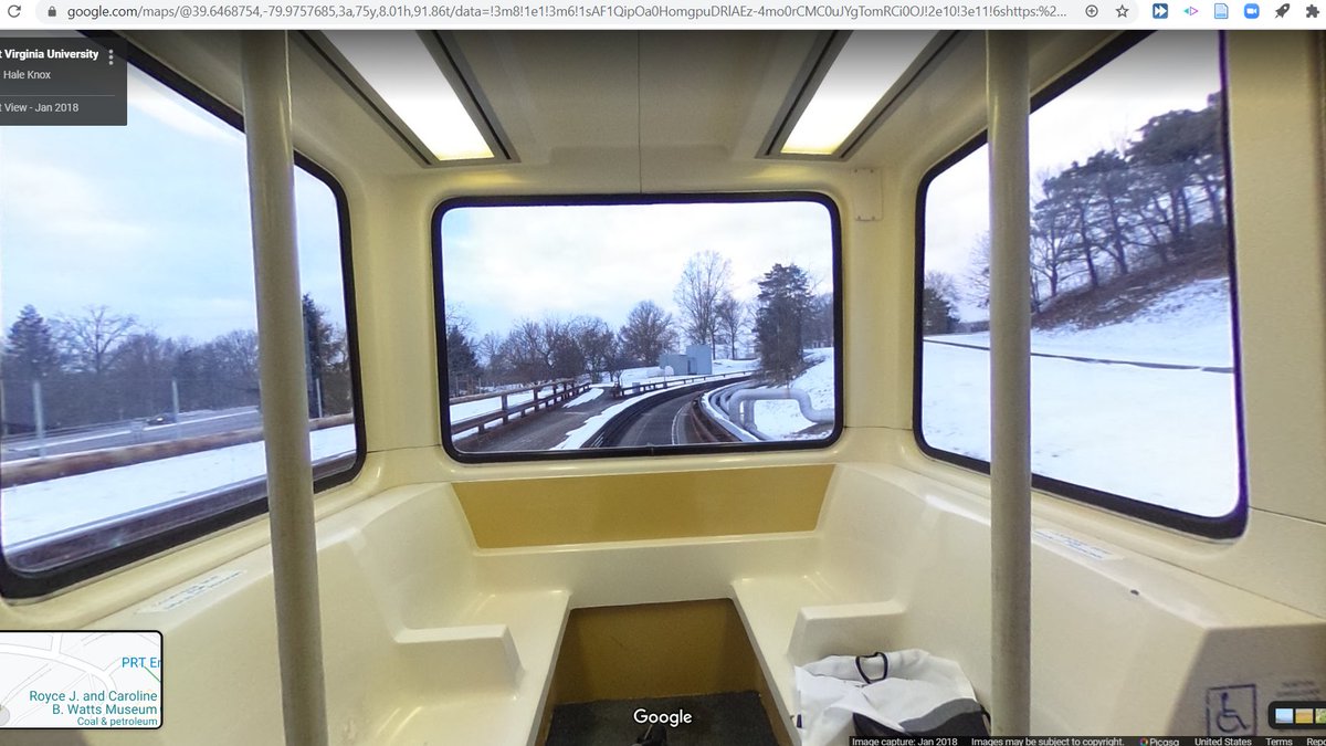

The PRT isn't really a system. It's a single rapid transit line that runs these little 15 person cars along a line that stretches from Downtown Morgantown to the WVU campus pictured in the first photo above.
As per the _personal_ rapid transit model, the system is laid out to facilitate mixed express and local operations; each station has bypass tracks. In this regard, and in this regard only, the system sorta resembles the Shinkansen 🙃 #SEANYC
As I understand it, the PRT has three operating modes. In one, it acts as true demand response, collecting riders heading to the same destination and bypassing stops without passengers. In another, cars run fixed routes on fixed intervals. In yet another, cars just make all stops
At 2800 riders/route-kilometer (about on par with a busy bus route in NYC, for example the B6), it's a successful -- albeit white elephant-y -- bit of transit infrastructure for a small city like Morgantown. #SEANYC
For the first time....ever? I will be starting my daily streetview when the clock shows an AM value (that isn't like 00:30 or smth).
Currently enjoying some sidewalk streetview in Morgantown. More of this @googlemaps!
Currently enjoying some sidewalk streetview in Morgantown. More of this @googlemaps!
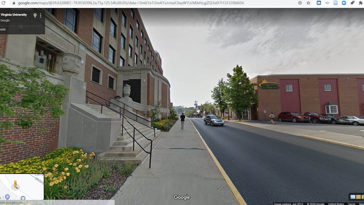
Some more Morgantown scenes. Once again am here to shill for Eastern river valley urbanism. #SEANYC


Morgantown is an interesting case of a small city that, in part thanks to WVU, has been really successful in diversifying and weathering the downturn of regional mining/industrial fortunes. It's one of the few parts of WV that's experiencing population growth. #SEANYC
En route to Terra Alta, WV #SEANYC

A lumber mill in Kingwood, WV. The forests of WV are the far northern end of the dense region of forest production that arcs south along the Appalachains to the Mississippi River -- a region which now makes up the lion's share of US forest production. #SEANYC

Maryland!

This may just look like some boring double track, but what we're looking at here is actually one of the more important bits of railroad in US history: the summit of the Baltimore and Ohio's Seventeen Mile Grade.

This segment is significant for two reasons: the first is that it was part of the B&Os original (1853) route from Baltimore, MD to Wheeling, WV -- a line which helped secure Baltimore's relevance and accelerated the development of Appalachian coal seams and the Midwest.
The second, perhaps more interesting significance is that the 17 Mile Grade's physical gradient (of 2.2%, or 116 feet/mile) became the standard for western railroads. The Pacific Railroad Act stipulated that first transcon's line profile match in quality the B&O...

...a standard which was later adopted by the CP, NP, GN, Milwaukee and others when building their mountain crossings. #SEANYC
Actually making some progress now. Just so happens that I've basically done a big loop #SEANYC


