
A short thread on China’s maps and claims in its territorial dispute with Bhutan, focusing on the area around the Sakteng wildlife sanctuary in eastern Bhutan (adjacent to India’s Arunachal Pradesh). 1/
Bottom-line up-front: Chinese maps do not show Sakteng or nearby areas in Bhutan as Chinese territory. 2/
Background: In June, China stated that Sakteng was part of “disputed areas” with Bhutan (indianexpress.com/article/world/…). Unofficial Chinese discussions note a claim to 墨拉萨丁/Merag-Sakteng (?), which would include Sakteng sanctuary and surrouding areas (web.archive.org/web/2012082202…). 3/
The (apparent) gist of China’s claim: the area was once part of Tibet, a 1715 agreement between the Tibetan local govt and Bhutan affirmed Tibet’s sovereignty but allowed Bhutanese herders to use the grasslands. In 1949, it became part of Bhutan (web.archive.org/web/2012082202…). 4/
But Sakteng and other areas in eastern Bhutan have never been raised in the many boundary talks between China and Bhutan. Per Bhutan: “at no point during the boundary discussions between Bhutan and China has it featured as a disputed area.” 5/ (indianexpress.com/article/world/…)
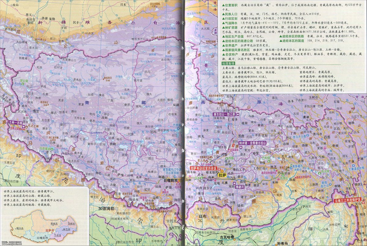
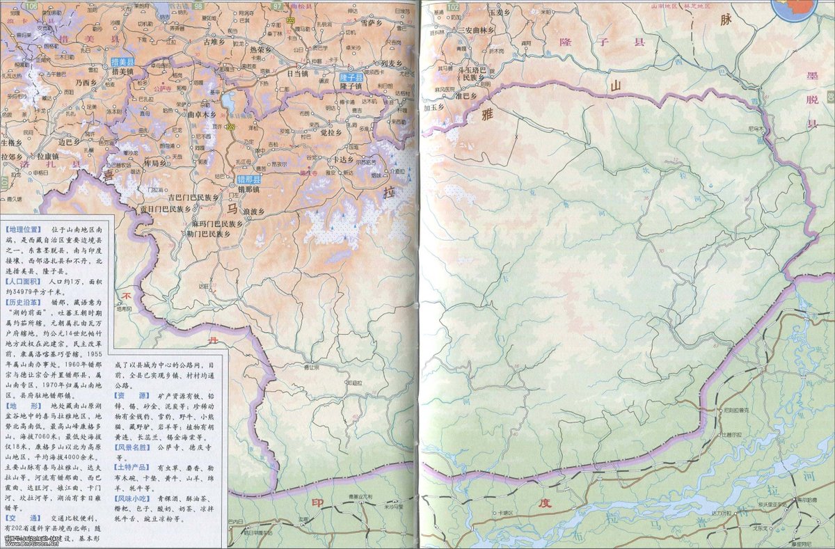
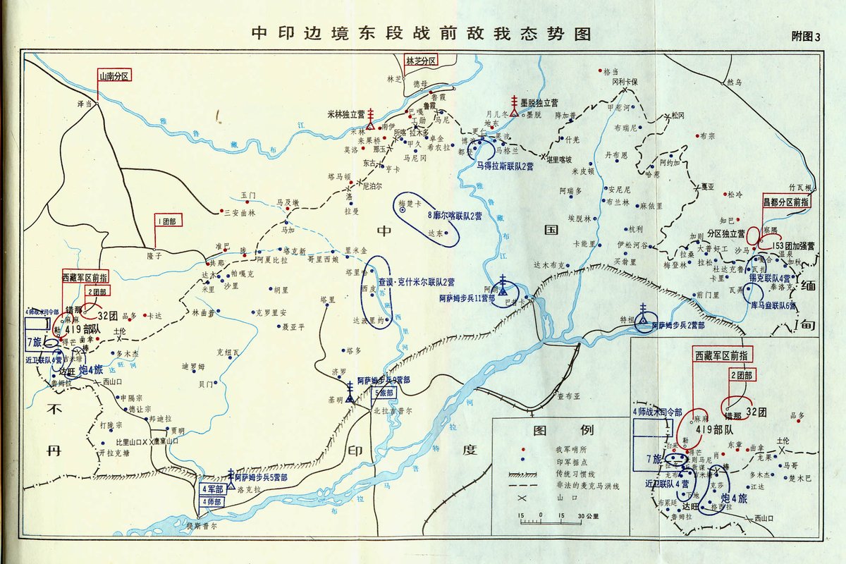
Maps: The maps below all show the area as lying within Bhutan. On the maps, Bhutan is 不丹. (Caveat: I do not know if these are official maps, but they are maps published in simplified Chinese and thus presumably in the PRC.) 6/
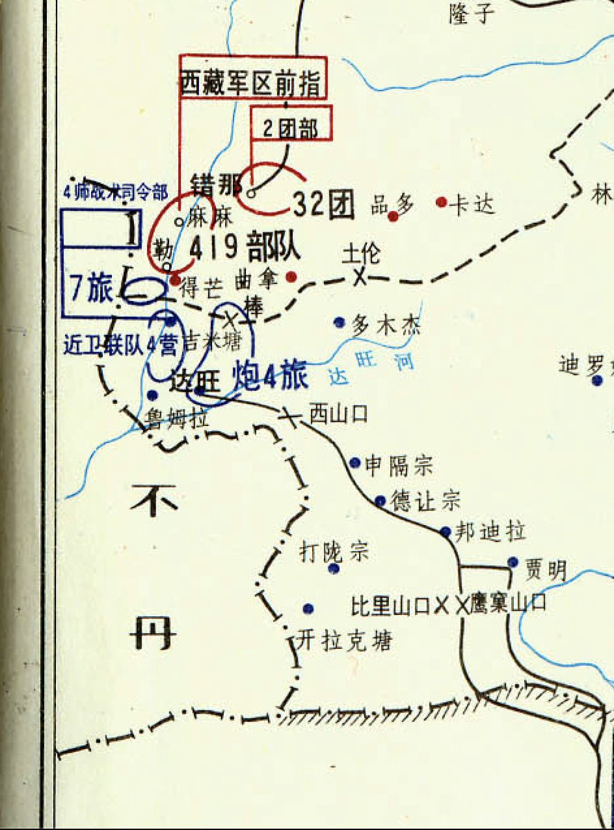
This is a map of Tibet, zooming into the area in question. 7/ 
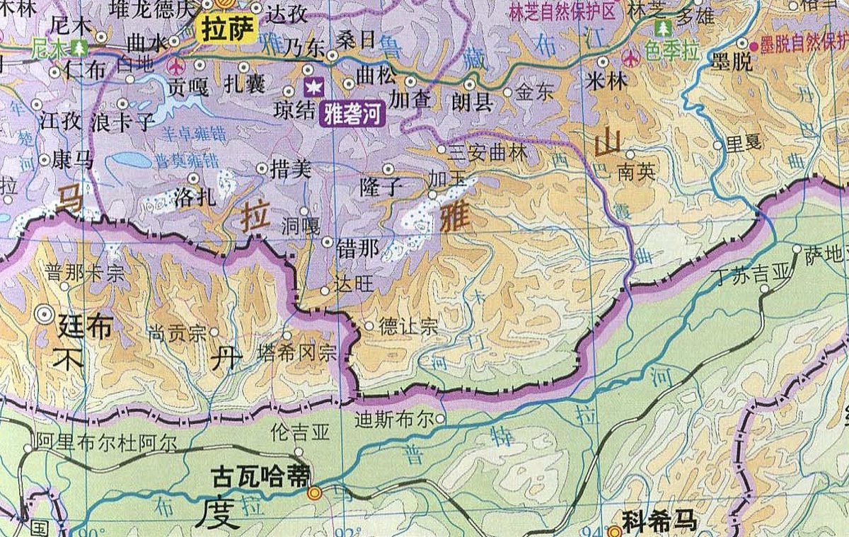
This map shows Cuona county (错那县, Cona Zong) in Tibet, which straddles the LAC in the eastern sector of the CN/IND border. It also shows Sakteng as lying inside Bhutan. This, presumably, is how China claims territory in Bhutan not adjacent to land China currently controls. 8/
This map from a Chinese history of the 1962 war with India, also showing Sakteng and surrounding areas as lying within Bhutan, also zooming into the area in question. 9/
One exception: This is the only map showing the area in question as part of China, but it is clearly annotated and the least official-looking of all maps I've seen. It also has errors wrt to China's claims in the central sector. 10/
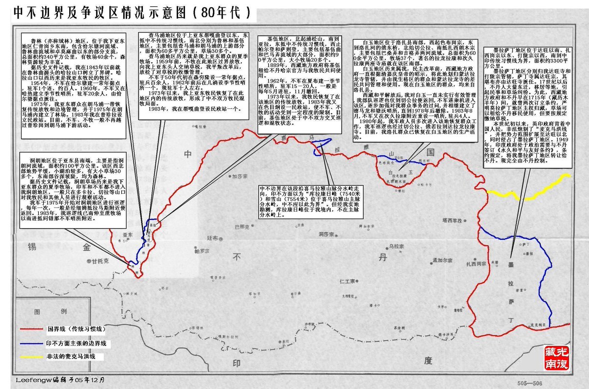
(The map depicts Chinese claims in the 1980s, which suggests one possibility: China may have previously entertained pursuing this claim, dropped it during talks with Bhutan, and now hints at reviving it. But I am speculating here.) /END

