My Authors
Read all threads
A few thoughts (thread) on the upcoming lightning event in California. All models are showing the potential for at least isolated mixed wet/dry thunderstorms in central/northern California, which is obviously not good news given the number of fires already ongoing #CAwx #CAfire
The first wave (tonight-Sunday) appears a little weak and with the upper-level ridging in place, storms are going to be near the coast and track more offshore. But the second wave (Sunday night - Monday), breaks down the ridge and strong southerly develops over California #CAwx
Here is the NSSL-WRF forecast composite reflectivity (essentially what the radar may look like) for the next 48 hours. Chance of lightning tonight and Sunday afternoon. But stronger storms and more coverage Sunday night through Monday #CAwx
And here is the HRRR solution for valid from 5pm PDT through 5 am PDT on Monday #CAwx
And the high-resolution NAM solution through 5 am PDT on Tuesday #CAwx
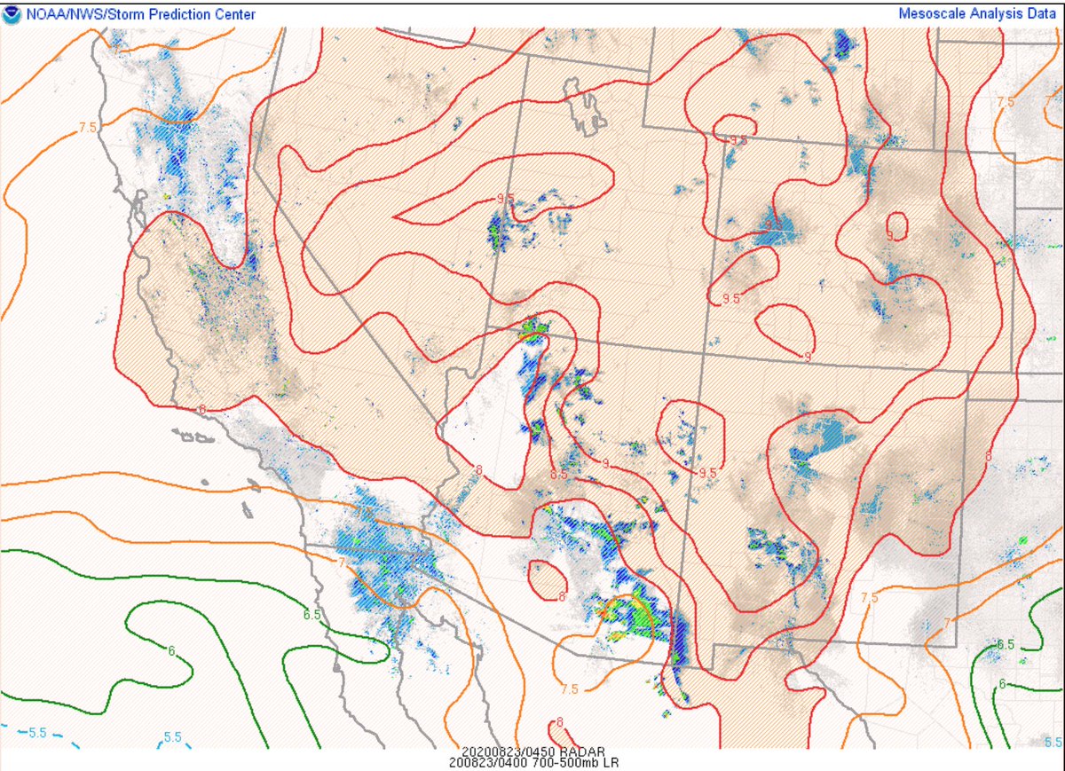
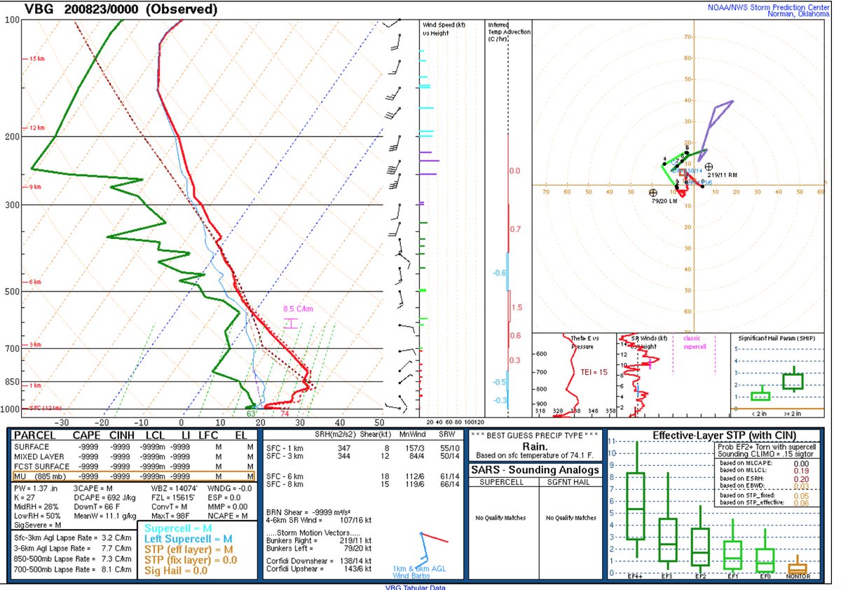
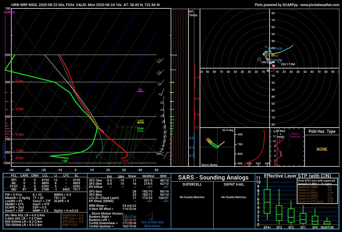
While some of the sounding profiles have skinny CAPE aloft, it is moist aloft due to Genevieve's remnants which could strengthen typically weak updrafts associated with skinny CAPE. Additionally, there are a pool of steeper mid-level lapse rates hanging out over California #Cawx
Drier lower-levels, storm motions of 25-45 mph, and any help from daytime heating and upslope flow will increase coverage/density of lightning across central and northern California over the next 72 hours. Lifting associated with the upper-level waves will help too #CAwx #CAfire
Looks like another significant lightning event is about to unfold across central and northern California. While there are possible failure modes that could bust the forecast, there is more evidence indicating scattered to widespread drier storms across the region #CA #CAfire
Hundreds of new fires are likely if this event pans out. And thunderstorm outflow winds will impact some ongoing fires which would lead to an increase of fire spread/behavior. I hope I'm wrong and this forecast busts. But for now, data points to another big event #CAwx #CAfire
Please follow the talented and dedicated folks at @NWSBayArea, @NWSSacramento, @NWSEureka, @NWSReno and listen to your local authorities
Missing some Tweet in this thread? You can try to force a refresh.

Keep Current with Nick Nauslar

Profile picture

Stay in touch and get notified when new unrolls are available from this author!

Read all threads

This Thread may be Removed Anytime!

Twitter may remove this content at anytime, convert it as a PDF, save and print for later use!

Try unrolling a thread yourself!

how to unroll video

1) Follow Thread Reader App on Twitter so you can easily mention us!

2) Go to a Twitter thread (series of Tweets by the same owner) and mention us with a keyword "unroll" @threadreaderapp unroll

You can practice here first or read more on our help page!

Follow Us on Twitter!

Did Thread Reader help you today?

Support us! We are indie developers!


This site is made by just two indie developers on a laptop doing marketing, support and development! Read more about the story.

Become a Premium Member ($3.00/month or $30.00/year) and get exclusive features!

Become Premium

Too expensive? Make a small donation by buying us coffee ($5) or help with server cost ($10)

Donate via Paypal Become our Patreon

Thank you for your support!