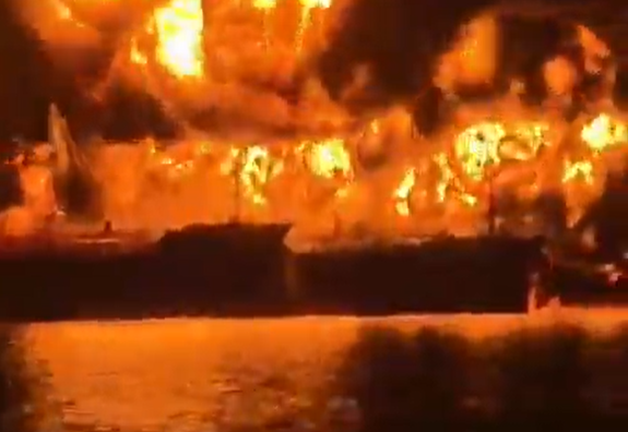
Footage from busy highway showing the extent of the Ukrainian An-26 crash.
https://twitter.com/disclosetv/status/1309561331499098122
Possible geolocation of Ukraine AF An-26 crash. Note billboard in center of 2x2 lane highway. This location is 1.25 km from the end of the airbase at Chuhuiv. 


That prognosis of 90% is not good. Awful thing to happen.
https://twitter.com/Faytuks/status/1309564783369367552?s=20
...and they've found 2 survivors so far.
Not good.
Not good.
https://twitter.com/Faytuks/status/1309567624716656642?s=20
Unfortunate. 22 people now confirmed dead in the crash. Sources say there cadets among them, which can only mean many of these were young adults in the prime of their lives. Just awful.
https://twitter.com/ThreeCalories/status/1309571546327986177?s=20
I believe I have found the identification of the An-26 airframe that went down in Ukraine. Number 76. Note yellow lettering aft, placement of the Ukrainian Air Force symbol, red on aileron tip and placement of light/dark camo paint.

Here are two screencaps from video footage of the crash. Again, note the yellow 7, placement of the Ukraine Air Force symbol, red on aileron tip and placement of light/dark camo paint.


Because Ukraine has lost so many aircraft as a result of the War in the Donbass/loss of Crimea, there are as few as 24 An-26s (now 23) in inventory. I have accounted for 16, including #76 pictured below.
But based on the other identifying marks I have confidence it is this one.
But based on the other identifying marks I have confidence it is this one.

Friends at The Aviationist have a source indicating Yellow 76 belonged to the 203rd Training Aviation Brigade which is based at Chuhuiv.
https://twitter.com/TheAviationist/status/1309608385436774401?s=20
• • •
Missing some Tweet in this thread? You can try to
force a refresh