
Confidence increases regarding a significant offshore flow event late in the weekend - not just strong winds, but the very dry airmass with it. Comparing offshore gradients SFO-WMC. (1/4)
2017 Wine Country Fires -17.8mb
2019 Kincade -16.3mb
2020 Model Fcst Sunday night -18 -20mb
2017 Wine Country Fires -17.8mb
2019 Kincade -16.3mb
2020 Model Fcst Sunday night -18 -20mb
Regarding the model forecast - I've seen this before where the models put out -20mb, but verify closer to the upper teens. That was the case 2017. Here's a look at the wind anomaly - wish there was a 925 mb layer as that is a key level for the Bay Area. (2/4) 

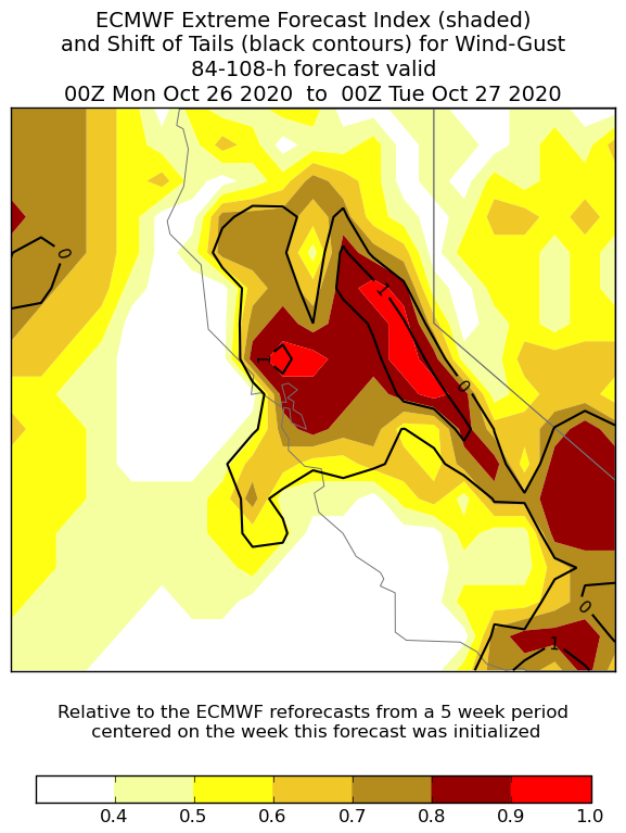
More wind info from ECMWF Extreme Forecast Index 0.5 to 0.8 is an unusual pattern and >0.8 is very unusual. In other words on the extreme end. (3/4).
Last, but not least. Even if the winds are not on the upper end of magnitude, it won't matter. The associated airmass is crispy dry and the fuels have been very receptive to fire all fire season. PWATs are on the extreme lower end. #cawx #cafire Stay fire weather aware. (4/4)

• • •
Missing some Tweet in this thread? You can try to
force a refresh


