
Alrighty, folks--it's time for Floodwall 101! We're on a very soggy walk so that you can stay dry--join us! 1/ 

We know--you think the floodwall is ugly. But it's AMAZING. On days like today 🌧️ it shines. ☀️
The floodwall was built to protect the lowest parts of Richmond and the buildings and people behind it--allowing the James River to rise, keeping floodwaters within its bounds. 2/
The floodwall was built to protect the lowest parts of Richmond and the buildings and people behind it--allowing the James River to rise, keeping floodwaters within its bounds. 2/
You may have heard that, today, parts of the floodwall are closed. A flooded James River brings higher than normal river water levels. Closing the floodwall will contain the James within this valuable and very purposeful piece of infrastructure. 3/

Let's get up close and personal! We know you love to ride, walk, skate, roll, and scoot on the @VirCapTrail, and on the beautiful Canal Walk. When you pass from one to the other, you cross through the "magic doors" where @CapitalTreesRVA's recently completed Low Line Green is. 4/

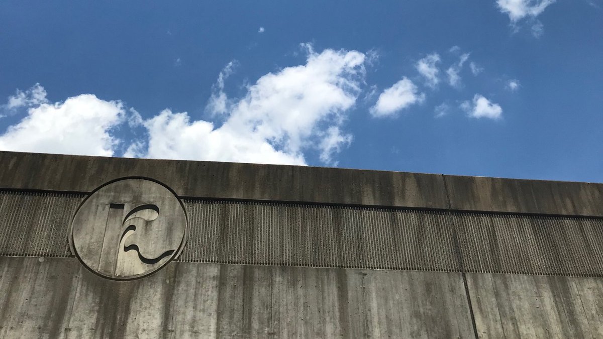
This is one of the spots along the floodwall that we've closed today. If Kanawha Canal overflows along the trail, water will stay behind the floodwall and, with the doors closed, won't flow out onto Dock Street and beyond. (Also, peep that floodwall sign on the right!) 5/

We prepare for a day like today! Here's our crew practicing closing these very doors bright and early on June 1st of this year. 6/


Honestly, we think our floodwall closure practice days each and every year are pretty darn rad--not to mention important as we prepare for the rainy season ahead. In June, our team masked up and got it done. 7/


So, just what do we practice closing, and what can we close? The floodwall has 19 closures total:
- 6 roadway closures 🏎️🛻🚚
- 6 railway closures 🚂
- 2 combined roadway and railway closures
- 1 canal closure 🛥️
- 4 pedestrian closures 🚶🚴♀️🏃♂️🛼🛹
8/
- 6 roadway closures 🏎️🛻🚚
- 6 railway closures 🚂
- 2 combined roadway and railway closures
- 1 canal closure 🛥️
- 4 pedestrian closures 🚶🚴♀️🏃♂️🛼🛹
8/
Let's look at a roadway closure! Now we're at the 17th Street closure, on Dock Street. Here's your close up view of a closed floodwall looking east, towards Great Shiplock Park and Rocketts Landing. 9/


From the other side--still that 17th Street floodwall closure on Dock Street, now looking west. 10/


Along the James, Richmond is particularly vulnerable to flows originating in the 6,760 square miles of drainage upstream in the watershed. When the James floods, the floodwall serves as piece of infrastructure that protects Manchester and Shockoe from major property damage. 11/
Still wondering why we're harping on and on about flooding and floodwater? Our friends at @RichmondOutside moved the Osprey Cam today (Maggie and Walker are away for the winter ) so you can take a gander at the James without braving the rain: wildstreaming.com 📺 12/
Let's compare flood preparation in the era before Richmond's floodwall. Scroll to the third photo in this @RTDNEWS piece from last week. richmond.com/weather/photos… 13/
So, sandbags over railroad tracks versus some easy-to-deploy, solid, tall, non-porous (and, in our opinion, really rad) infrastructure? Compared to sandbags, our upgrade is a smart investment so we can remain dynamic and prepared as we look towards a wetter, rainier future. 14/


We're also closing the Brander Street floodwall gate today, which impacts accessibility to Ancarrow's Landing and our beloved Wastewater Treatment Plant, which is at capacity today. Our crew is hard at work with all this additional stormwater in our combined sewer system! 15/
We know you're wondering this: When was the last time that both the Dock Street and Brander Street floodwall gates were closed?
1999!
Which is the same year of the Lockheed SR-71 Blackbird's last flight (find one at the @ScienceMusofVA) and that Toy Story 2 was released. 16/
1999!
Which is the same year of the Lockheed SR-71 Blackbird's last flight (find one at the @ScienceMusofVA) and that Toy Story 2 was released. 16/
So, it's been a while (21 years!) since these two gates were closed to protect Richmond from floodwaters.
The floodwall's been around for a while: it was dedicated on October 21st, 1994 (26 years and 22 days ago).
But when and why did we decide that Richmond needed one? 17/
The floodwall's been around for a while: it was dedicated on October 21st, 1994 (26 years and 22 days ago).
But when and why did we decide that Richmond needed one? 17/
In 1986, President Reagan approved the development of the floodwall, right after Hurricane Juan raised the James River's water level up to 31 feet at the City Locks, a bit shy of Hurricane Agnes' 1972 record at 36.5 feet. 18/
It's time for the most important (and always our favorite!) question and one of the most important parts. Cue @evan7257 right on time: 19/
https://twitter.com/evan7257/status/1327000277447303173
Richmond's $143 million* floodwall was built under the cost-sharing provision of the Water Resources Development Act of 1986, in partnership with the @norfolkdistrict Army Corps of Engineers and the @CityRichmondVA. We are so thankful for their foresight and investment! 20/
The floodwall cost $143 million at its dedication (October 21, 1994--again this was 26 years and 22 days ago). Though we love it beyond measure, it's now valued at approximately $153 million.
Protecting 750 flood-prone acres in Manchester and Shockoe is priceless. ✨ 21/
Protecting 750 flood-prone acres in Manchester and Shockoe is priceless. ✨ 21/
So, how does the floodwall 600 acres of Manchester? With:
- 3,566 linear feet of concrete wall up to 50 feet high
- 26,000 cubic yards of concrete
- 950 tons of reinforcing steel
- BONUS: 9,232 linear feet of levees
- EXTRA BONUS: The Floodwall Walk 22/
jamesriverpark.org/project/floodw…
- 3,566 linear feet of concrete wall up to 50 feet high
- 26,000 cubic yards of concrete
- 950 tons of reinforcing steel
- BONUS: 9,232 linear feet of levees
- EXTRA BONUS: The Floodwall Walk 22/
jamesriverpark.org/project/floodw…
The Floodwall Walk, a pedestrian walkway, is 5,655 linear feet and includes three bridges and two overlooks that we know make great spots for breathtaking photos.
Don't worry, Shockoe--there's an interesting treat on the northern floodwall for you too! 23/
Don't worry, Shockoe--there's an interesting treat on the northern floodwall for you too! 23/
How does the floodwall 150 acres of Shockoe? With:
- 3,947 linear feet of concrete wall up to 30 feet high
- 22,000 cubic yards of concrete
- 1,050 tons of reinforcing steel
- (LITTLE) BONUS: 150 linear feet of levees
- EXTRA BONUS: Unexpected art! 24/
- 3,947 linear feet of concrete wall up to 30 feet high
- 22,000 cubic yards of concrete
- 1,050 tons of reinforcing steel
- (LITTLE) BONUS: 150 linear feet of levees
- EXTRA BONUS: Unexpected art! 24/
On the northeast side of the floodwall at South 14th Street (just south of the intersection with East Byrd Street, before you're on the Mayo Bridge), there is a full-sized silhouette of a 93-foot freight boat on the floodwall. (🗺️📌 for future use ⬇️) 25/ google.com/maps/place/E+B…
The footprint of the boat is behind the silhouette, underneath the elevated 🚂 tracks. It's a look into the past--a time before floodwalls--when open-decked boats (about 14 feet across) floated up Richmond's canals with flour, iron, and tobacco (to the now-@TobaccoRowLofts) 26/
These boats moved important goods westward operated on Kanawha Canal until the 1880s.
Fast forward 140 years, and we've got the floodwall, drones, and our biggest flood in number of years on our hands. Our crews operate 24/7 for you, but today they're working extra hard. 27/
Fast forward 140 years, and we've got the floodwall, drones, and our biggest flood in number of years on our hands. Our crews operate 24/7 for you, but today they're working extra hard. 27/
Our team is treating our maximum capacity of wastewater and combined stormwater flows at the Wastewater Treatment Plant.
Our stormwater crews are clearing clogged storm drains, closing the floodwall gates, and responding to Richmond's low-lying "hot spot" flooding locations. 28/
Our stormwater crews are clearing clogged storm drains, closing the floodwall gates, and responding to Richmond's low-lying "hot spot" flooding locations. 28/
We'd bet you haven't even thought about the folks working at Richmond's Drinking Water Treatment Plant today, preparing for high water flows, because you turn on the tap and water is there and ready for you. The team provides consistent, uninterrupted service. 🥤🚿🚰 29/
Today, while so many of our DPU dream team members are working in the rain and wet, all we hope is that you stay safe.
Don't drive or walk through flooded streets.
Keep out of the James River until water levels lower.
Don't visit closed @rvaparksandrec locations. 30/
Don't drive or walk through flooded streets.
Keep out of the James River until water levels lower.
Don't visit closed @rvaparksandrec locations. 30/
Stay safe and dry.
And when you think of the floodwall--whatever you think of it aesthetically--know that is serves an important and valuable purpose protecting the businesses and people you love in Manchester and Shockoe from floodwaters and the havoc they can bring! 🌊 31/31
And when you think of the floodwall--whatever you think of it aesthetically--know that is serves an important and valuable purpose protecting the businesses and people you love in Manchester and Shockoe from floodwaters and the havoc they can bring! 🌊 31/31
@threadreaderapp unroll
• • •
Missing some Tweet in this thread? You can try to
force a refresh


