Wow!!! Lougheed’s coal policy is back in effect!

fb.watch/3xd-c0Bl4G/
@CBCFletch asking the important questions... What impact will this have on projects that received exploration permits?

No future approvals pending consultation. With respect to current exploration, it's up to the companies on how they manage their coal explorations.
This will be what we need to watch going forward. Why would you continue to explore if there is no chance of mining the area?
Also... thank-you, thank-you, thank-you Alberta!

YOU MAKE US PROUD!!

Keep using your voice and your vote to protect our prized possessions!!!
It's safe to say that we would have much rather spent this time in the mountains but all of our mad tweeting and your retweeting reached over 1,000,000 people in 28 days.

Without all of you engaging with us, this policy would have never changed. Now go enjoy our crown jewels! Image

• • •

Missing some Tweet in this thread? You can try to force a refresh
 

Keep Current with Bragg Creek-KCountry

Bragg Creek-KCountry Profile picture

Stay in touch and get notified when new unrolls are available from this author!

Read all threads

This Thread may be Removed Anytime!

PDF

Twitter may remove this content at anytime! Save it as PDF for later use!

Try unrolling a thread yourself!

how to unroll video
  1. Follow @ThreadReaderApp to mention us!

  2. From a Twitter thread mention us with a keyword "unroll"
@threadreaderapp unroll

Practice here first or read more on our help page!

More from @BCKOR

8 Feb
Sparwood, a Coal Mine Town across the BC border produced a report on its liveability,

“Liveability Study - What We Learned Report”

I hope we can learn from the shocking details in the thread below...

sparwood.civicweb.net/document/87409…
Air quality:

“visible dirty streets, decks & patios”

“lack of concern about air pollution”

“Pollution and air quality is getting bad. there is a thick layer of coal dust that sticks to the snow that makes you wonder what is in our lungs.” Image
Water Quality:

“Some noted the connection between river health and fish health, particularly with regards to selenium levels.”

“I don’t believe that the air or water is good for us.”

“Poor water, the fish have high levels of selenium” Image
Read 10 tweets
24 Jan
After the gov got caught trying to remove park’s protective status and sell off our parks, they used our tax dollars to create a website that told us we didn’t see what we saw... now they’re doing the same thing with coal mining.

Albertans are smarter than this!
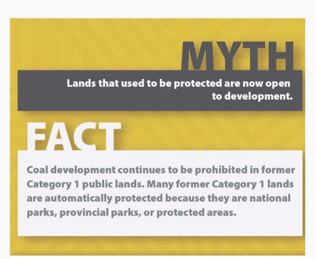
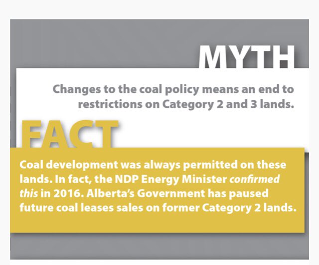
Our concern has never been with Category 1 land that has duplicate protective status. Our concern is with Category 2 land that was protected from Strip Mining under Lougheed’s Coal Policy.
Removing the Coal Policy removed a blanket ban where only limited exploration under strict control was allowed, and strip mining would not normally be considered on cat 2 land. It also banned exploration or development activities in local areas of high environmental sensitivity.
Read 15 tweets
21 Jan
Australian coal companies are investing heavily in Canadian coal.

Canadians are basically cold Aussies and Alberta is hurting for jobs, so why not sacrifice some mountains, rivers, wildlife and invite our cousins to come build coal mines??? Read on… Image
Grassy Mtn Coal Proj is 1 of many coal mines applying for approval since the gov rescinded the Coal Policy banning strip mining in the headwaters. So who owns Grassy Mtn? Benga Mines, a subsidiary of Riversdale Resources, controlled by Hancock Prospecting, owned by Gina Rinehart Image
Who is Gina Rinehart? Simply put, Rinehart is the richest person in Australia with a net worth of just under $29 Billion and one of the top 10 richest women in the world.

Alberta is broke and hurting, so why not welcome a Billionaire’s company? businessinsider.com.au/australias-ric…
Read 14 tweets
19 Jan
We want to try and address how HUGE the open-pit coal mine issue really is...

It's hard to envision how MASSIVE mines are. Here is BC's operational Teck mine (pink) next to Alberta's coal leases in the Livingstone Range (orange). They're similar but how big are they? Image
There are 5 separate mine sites along 88km of the Elk Valley. You'd have to hike 86km to walk the perimeter of the largest site and it takes up 141sq/km of the once pristine valley.

Those are some big numbers but it's still hard to visualize... how big is that? Image
To try to give you a better grasp of the size, we transplanted the mines into Kananaskis.

The mines virtually encompass the entire landscape between Kananaskis Hwy, Spray Lakes Road and the Trans Canada Highway. Image
Read 8 tweets
19 Jan
Thanks for acknowledging that you heard the thousands of people that are outraged over coal mines @sonyasavage but we weren't asking for you to cancel a fraction of the leases in Cat 2 lands... we were asking for you to reinstate Lougheed's Coal Policy that protected Cat 2 lands
If rescinding the policy was simply updating and modernizing the Coal policy without removing protections, as @JasonNixonAB has claimed, then why not make the policy clear. Instead of, virtually no open pit strip mines in Category 2 lands... just say there will be none!
Sure, there might be redundant policies that will still prevent the coal mine application from making it through the regulatory process but why let them apply?

Why will this change, "encourage substantial new investment"?

Are you just catfishing Coal companies now?
Read 4 tweets
16 Jan
By now you've seen panicked posts about Coal Mines being approved in the Rocky Mountains with no public consultation. Where? What? WHY?

Here's a short breakdown along with a great map to visualize how many leases there are in some of the most pristine and fragile environments
-44 years ago Con Premier Lougheed introduced a Coal Policy to protect AB's Rocky Mtns / Foothills. This policy categorized the land to protect the most important and fragile landscapes.
Cat 1 banned coal development.
Cat 2 banned open pit mines
Cat 3/4 were less restrictive
This amazing interactive map provided by @CBCFletch details the coal leases and category of lands.
Use the << in the top left corner to toggle options: robsonfletcher.maps.arcgis.com/apps/Embed/ind…
Read 23 tweets

Did Thread Reader help you today?

Support us! We are indie developers!


This site is made by just two indie developers on a laptop doing marketing, support and development! Read more about the story.

Become a Premium Member ($3/month or $30/year) and get exclusive features!

Become Premium

Too expensive? Make a small donation by buying us coffee ($5) or help with server cost ($10)

Donate via Paypal Become our Patreon

Thank you for your support!

Follow Us on Twitter!