
Latest map project. India’s disputed borders with China and Pakistan are a cartographers nightmare.
What I learned in the process; or a (ridiculously) brief history:
What I learned in the process; or a (ridiculously) brief history:

🇨🇳🇮🇳
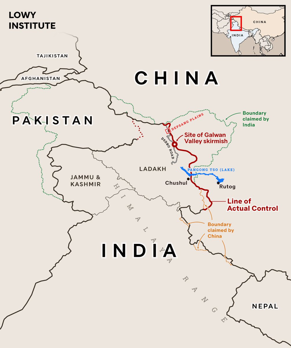
Line of control established after 1962 Sino-Indian war. Recent standoffs along the de-facto border culminated in the 2020 Galwan Valley skirmish; 20 Indian soldiers died (first deaths there since 1975). Troop disengagement announced by both sides in Feb 2021.
Line of control established after 1962 Sino-Indian war. Recent standoffs along the de-facto border culminated in the 2020 Galwan Valley skirmish; 20 Indian soldiers died (first deaths there since 1975). Troop disengagement announced by both sides in Feb 2021.
🇵🇰🇮🇳
Disputes stem from the partitioning of British India after WWII. Now, 100+ desolate, high-altitude military outposts keep watch along the disputed border. Ceasefire in place since 2003, tho many have died in avalanches. India spends ~$1M/day to maintain their position here.
Disputes stem from the partitioning of British India after WWII. Now, 100+ desolate, high-altitude military outposts keep watch along the disputed border. Ceasefire in place since 2003, tho many have died in avalanches. India spends ~$1M/day to maintain their position here.
These maps were made for a @LowyInstitute analysis, authored by @arzandc on how the Ladakh crisis will shape India's relationship with China. Read the full publication here: lowyinstitute.org/publications/c…
• • •
Missing some Tweet in this thread? You can try to
force a refresh


