Brutal heat building over the US Pacific Northwest and Western Canada right now will shatter many all-time heat records over the coming days.
The extent, intensity and longevity of this level of heat is absolutely mind-blowing.
THREAD
The extent, intensity and longevity of this level of heat is absolutely mind-blowing.
THREAD
Yes, you are reading this correctly. Glowing white hot over +40°C (104°F) widely all along the western side of North America.
This is the animation in hourly detail. Let's not forget about how hot the nights will be.
This is the animation in hourly detail. Let's not forget about how hot the nights will be.
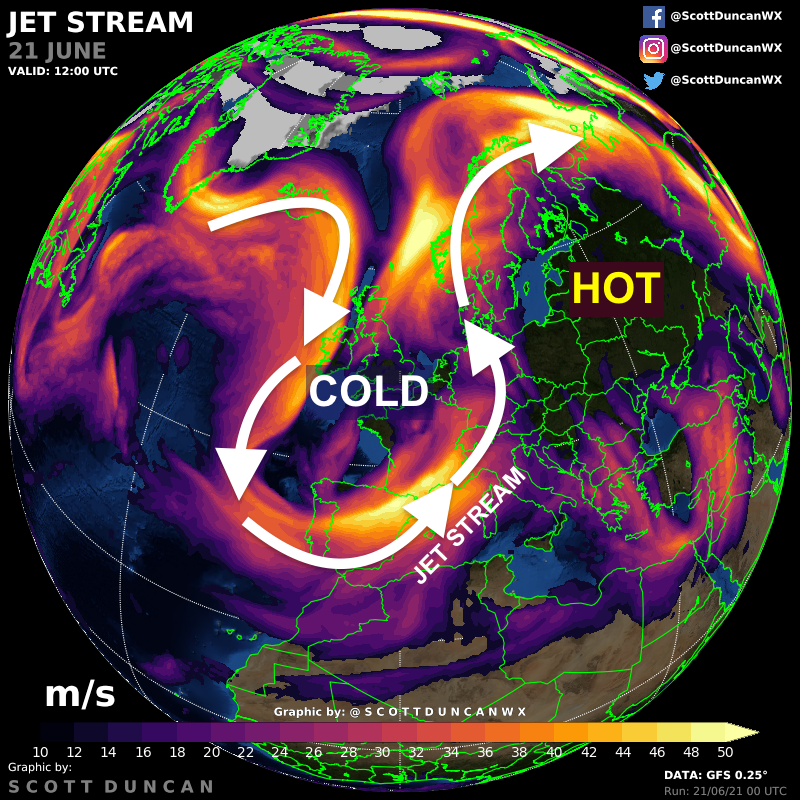
The punishing heatwave has an incredible jet stream pattern.
The dome of heat will be encircled by the polar jet and this helps lift a sub-tropical jet branch almost into the Canadian Arctic.
The dome of heat will be encircled by the polar jet and this helps lift a sub-tropical jet branch almost into the Canadian Arctic.
An 'unfathomable temperature anomaly'.
'Approaching 25°C (>40°F) above normal for B.C.'
Parts of Washington State, like Seattle also looking at unprecedented anomalies. Places that don't necessarily have the infrastructure to deal with such heat.
'Approaching 25°C (>40°F) above normal for B.C.'
Parts of Washington State, like Seattle also looking at unprecedented anomalies. Places that don't necessarily have the infrastructure to deal with such heat.
https://twitter.com/50ShadesofVan/status/1408030718966513671
The 'extreme forecast index' from @ecmwf tells us that this level of heat has never happened in their dataset.
The level of heat is off-the-scale.
The level of heat is off-the-scale.

Western Canada and US are losing glacier mass extremely quickly, one of the fastest changing environments on the planet.
More can be learnt about the change in glaciers across the globe here: wgms.ch/global-glacier…
More can be learnt about the change in glaciers across the globe here: wgms.ch/global-glacier…

The intensity of these heatwaves have the fingerprints of human-induced climate change written all over it.
This is how the average temperature of Canada 🇨🇦 and the USA 🇺🇸 have changed over the last 200 years or so.
Data via @BerkeleyEarth

This is how the average temperature of Canada 🇨🇦 and the USA 🇺🇸 have changed over the last 200 years or so.
Data via @BerkeleyEarth


We have to be careful how things are attributed. Would this level of heat be possible in our cooler previous climate?
I like this thread by @ClimateOfGavin explaining carefully how climate and extremes are connected.
I like this thread by @ClimateOfGavin explaining carefully how climate and extremes are connected.
https://twitter.com/ClimateOfGavin/status/1408416536109404165?s=19
• • •
Missing some Tweet in this thread? You can try to
force a refresh


