Tropical Storm Elsa thread for Boston area...
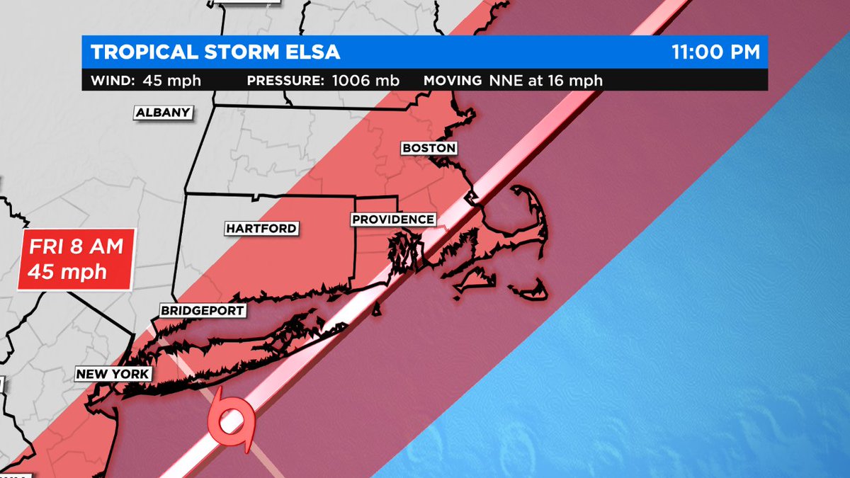
All signs point to a New England landfall for #Elsa mid/late Friday morning near Narragansett Bay, RI.
Two main threats: wind and rain. Storm surge not a widespread issue.
All signs point to a New England landfall for #Elsa mid/late Friday morning near Narragansett Bay, RI.
Two main threats: wind and rain. Storm surge not a widespread issue.

Your biggest direct impact really depends on where you compared to the track of the #Elsa.
On either side of the track to the S & E, wind is likely the biggest threat.
N & W of Boston, heavy rain + flooding is your concern.
On either side of the track to the S & E, wind is likely the biggest threat.
N & W of Boston, heavy rain + flooding is your concern.

WIND: Consistent gusts 40-60+ mph will be felt from Bristol & Plymouth County into the Cape and Islands.

While the stronger winds will be in the Cape and Islands... I think there is a unique wind damage/power outage threat for a corridor from Boston to Providence... and parts of Bristol and Plymouth County.
Many of our trees are weathered for W/NW or NE wind, not for SE wind.
Many of our trees are weathered for W/NW or NE wind, not for SE wind.

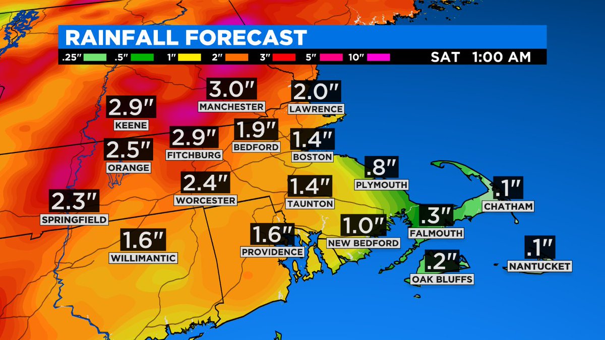
RAIN: widespread rain totals from 2-4" are likely. Higher localized totals where the rain bands set up.

Flash Flood Watch posted for nearly all of southern New England.
After a soggy start to the month, it won't take much to overwhelm our backyards. Street, poor drainage flooding likely. Check the basements too!
After a soggy start to the month, it won't take much to overwhelm our backyards. Street, poor drainage flooding likely. Check the basements too!

All the previous tweets in an easily digestible graphic.

For historical purposes... the last named storm to move up Narragansett Bay was Andrea in 2013. By the time Andrea moved off the coast of the Mid-Atlantic, it was downgraded to an extra-tropical cyclone.
Somewhat coincidentally, Andrea and Elsa have almost the exact same path.
Somewhat coincidentally, Andrea and Elsa have almost the exact same path.

The last tropical storm to make landfall within 30 nautical miles of Newport, RI was Tropical Storm Hermine in 2004.

Latest obs from #Elsa -- holding steady with 50 mph wind. Forward motion has sped up, now at 25 mph.
That's actually good news for New England. A bit quicker exit!
That's actually good news for New England. A bit quicker exit!

• • •
Missing some Tweet in this thread? You can try to
force a refresh