
- I remember having a discussion with Ravi Rikhye @Editor_Orbat on eastern Ladakh requiring a min of 4 divs & two Corps HQ. With 1 Strike Corps now earmarked most likely to south-eastern Ladakh (Demchok funnel), we're reaching this planned level.
+
theprint.in/defence/china-…
+
theprint.in/defence/china-…
@Editor_Orbat + Just for reference, overall, 1 Strike Corps has:
- 1 x Armoured Division (250-300 tanks and IFV each)
- 1 x RAPID (90-100 tanks and 100+ IFV) (Reorganized Plains Infantry Division)
- 1 x Artillery Division (Tube/Rocket/Missile)
- 6-7 Infantry/Mountain Brigades
And while the +
- 1 x Armoured Division (250-300 tanks and IFV each)
- 1 x RAPID (90-100 tanks and 100+ IFV) (Reorganized Plains Infantry Division)
- 1 x Artillery Division (Tube/Rocket/Missile)
- 6-7 Infantry/Mountain Brigades
And while the +
+ Armored Division has been earmarked as strategic reserve, don't be surprised if it makes its presence felt in Eastern Ladakh.
- And by not moving the Corps lock-stock-&-barrel to Ladakh, IA has retained the flexibility to use 1 Strike Corps for dash across IB into Pakistan.
+
- And by not moving the Corps lock-stock-&-barrel to Ladakh, IA has retained the flexibility to use 1 Strike Corps for dash across IB into Pakistan.
+
+ And while IA had done well by creating such swing formations, it is my contention that IA needs a minimum of 2 more infantry divisions for more optimal balance and for having proper reserves.
- 4 x divisions would be ideal, with two of them being preferably RAPID.
- 4 x divisions would be ideal, with two of them being preferably RAPID.
The Chinese being, well, Chinese!
Every incident is someone else's fault, not us. We're the best gift to mankind, after sliced bread, of course.
theprint.in/diplomacy/indi…
Every incident is someone else's fault, not us. We're the best gift to mankind, after sliced bread, of course.
theprint.in/diplomacy/indi…
The Vajra SPH is not even the most interesting part of this video @sparsh_amin
https://twitter.com/Lone_wolf110/status/1448159074009239559?s=20
Lot of interesting info coming from articles on NE -
1. UAVs, which were earlier with Artillery as part of SATA (Surveillance & Target Acquisition) battalions, have now been transferred to Army Aviation.
2. UAV pilots from Artillery have also been transferred.
3. Army now has +
1. UAVs, which were earlier with Artillery as part of SATA (Surveillance & Target Acquisition) battalions, have now been transferred to Army Aviation.
2. UAV pilots from Artillery have also been transferred.
3. Army now has +

+ a Independent Aviation Brigade under 4 Corps.
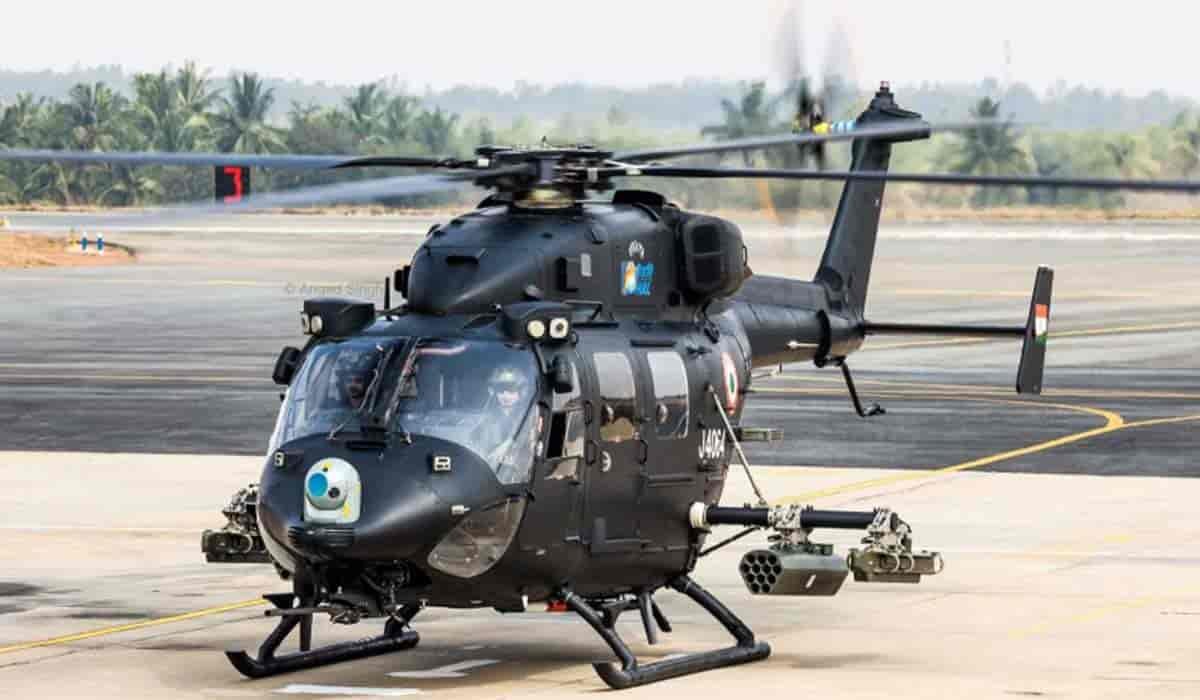
4. Equipped at present with a mix of UAVs, WSI Dhruv, and Dhruv helicopters.
5. Going by the patch below, it will have Gunship (Apache/LCH), and Light Utility Helicopter as well.
- Patch below courtesy @manishindiatv
4. Equipped at present with a mix of UAVs, WSI Dhruv, and Dhruv helicopters.
5. Going by the patch below, it will have Gunship (Apache/LCH), and Light Utility Helicopter as well.
- Patch below courtesy @manishindiatv

6. Another important point is that surveillance function has been centralized (pic: @neeraj_rajput)
7. Which means all assets will be integrated, and feed/intelligence will be shared with stakeholders in real time.
8. IMO, this will further be integrated with Air Defense assets +
7. Which means all assets will be integrated, and feed/intelligence will be shared with stakeholders in real time.
8. IMO, this will further be integrated with Air Defense assets +

+ of IA, and IAF +within the area-of-responsibility.
9. Another important point is co-location, and close coordination between IAF, and the IA.
10. While IA operates the smaller Dhruv helicopters, IAF controls the larger Mi-17, and Chinook helicopters.
11. Army and IAF need to +
9. Another important point is co-location, and close coordination between IAF, and the IA.
10. While IA operates the smaller Dhruv helicopters, IAF controls the larger Mi-17, and Chinook helicopters.
11. Army and IAF need to +


+ work closely to ensure movement of troops, and materials by these bigger helicopters to required areas.
11. Another area of collaboration will be employment of IAF held Apache gunships.
12. IA is at present using WSI Dhruv/ Rudra, and will eventually have LCH as well.
11. Another area of collaboration will be employment of IAF held Apache gunships.
12. IA is at present using WSI Dhruv/ Rudra, and will eventually have LCH as well.


Here's a fantastic report by @sneheshphilip on setting-up of aviation brigade, and higher surveillance along the McMahon Line in western Arunachal Pradesh Sector.
theprint.in/defence/armys-…
theprint.in/defence/armys-…
Another report by @ajaynewsman which gives similar, and some additional details.
tribuneindia.com/news/nation/ar…
tribuneindia.com/news/nation/ar…
Tawang/Dongzhang Stand-Off
- Couple of weeks back Indian Army had surrounded a large Chinese patrol & held them there for some hours.
- @ajaynewsman has a report with details.
- In this thread, I'll pin-point the area with maps and explain the importance
+
tribuneindia.com/news/nation/ke…
- Couple of weeks back Indian Army had surrounded a large Chinese patrol & held them there for some hours.
- @ajaynewsman has a report with details.
- In this thread, I'll pin-point the area with maps and explain the importance
+
tribuneindia.com/news/nation/ke…
- Chinese reports refer to the area as Dongzhang, and the news linked earlier calls is Yangtse.
- Map below shows the general location of the area, and its position with respect to Tawang.
- The area is ~23 km NE from Tawang (as the crow flies).
- Map below shows the general location of the area, and its position with respect to Tawang.
- The area is ~23 km NE from Tawang (as the crow flies).

- IA has two bases here and both are situated in the river valley in the area.
- A road from each base goes up the steep mountain side towards an army base & posts on the adjacent mountain ridge.
- Thang La pass is on the border dividing AP from Tibet
- A road from each base goes up the steep mountain side towards an army base & posts on the adjacent mountain ridge.
- Thang La pass is on the border dividing AP from Tibet

- Unlike our side, where the main bases are along river valleys, the Chinese base is located in a valley on the mountain itself.
- Map-01: Larger IA base towards rear.
- Map-02: Smaller forward base towards border.
Please click on the maps to read the details mentioned on them.
- Map-01: Larger IA base towards rear.
- Map-02: Smaller forward base towards border.
Please click on the maps to read the details mentioned on them.


- Map: IA base and posts on the mountain ridge.
- Thang La pass can also be seen on the map
You can make-out the road coming from Indian bases along the river valley. IA has considerable presence on the mountain ridge.
- Thang La pass can also be seen on the map
You can make-out the road coming from Indian bases along the river valley. IA has considerable presence on the mountain ridge.

- Map: View of the Chinese base when looking south towards Thang La pass from the Tibet side.
- As can be seen, there is a wide, flat valley on the mountain itself where the Chinese have been able to develop the base.
- As can be seen, there is a wide, flat valley on the mountain itself where the Chinese have been able to develop the base.

- Map: Satellite view of the road from the Tibetan side going up the mountain side towards the Chinese base.
- Probable area where the stand-off occurred, and it locations with respect to forward Indian position is also shown.
- Probable area where the stand-off occurred, and it locations with respect to forward Indian position is also shown.

- What probably happened was that a large Chinese patrol tried to ingress up the Tsa Chu river towards the forward IA post.
- And block/gain access to the road which goes-up from Indian post towards our positions on the mountain ridge, and Thang La pass.
- Chinese refer to area+
- And block/gain access to the road which goes-up from Indian post towards our positions on the mountain ridge, and Thang La pass.
- Chinese refer to area+

+ their side as Dongzhang.
- We blocked the movement of this patrol.
- And not only that, we also seem to have surrounded them in strength, and not allowed them to move forward or backward.
- Hence, the mirchi in the Chinese media.
- We blocked the movement of this patrol.
- And not only that, we also seem to have surrounded them in strength, and not allowed them to move forward or backward.
- Hence, the mirchi in the Chinese media.
- So, why is this are important? Look at the map below:
- If either side achieves success in major breakthrough in this area, then it has the potential to unhinge the defenses of either side in the entire sector.
- Tawang on our side, and Cona on Tibetan side could be the +
- If either side achieves success in major breakthrough in this area, then it has the potential to unhinge the defenses of either side in the entire sector.
- Tawang on our side, and Cona on Tibetan side could be the +

+ potential gains.
- But such grand success aside, its the Chinese who've a bigger problem.
- Even a minor success here by India could mean that we cut their lateral connectivity.
- And threaten the flank of their defenses across Bum La, or rear areas towards east.
- But such grand success aside, its the Chinese who've a bigger problem.
- Even a minor success here by India could mean that we cut their lateral connectivity.
- And threaten the flank of their defenses across Bum La, or rear areas towards east.

Impact of India-China stand-off on Indian troop levels.
- There is a perception that Ladakh stand-off has stretched Indian Army in terms of deployment.
- In this thread, I'll examine how relevant is this argument.
- And what's the impact of this deployment on the Chinese.
+
- There is a perception that Ladakh stand-off has stretched Indian Army in terms of deployment.
- In this thread, I'll examine how relevant is this argument.
- And what's the impact of this deployment on the Chinese.
+

- Lets start with North-East.
- From Sikkim to Arunachal Pradesh, Indian Army's Eastern Command has four Corps.
- These are 33 Corps (Sikkim), 4 Corps (Tezpur), 3 Corps ( Dimapur), and 17 Mountain Strike Corps (Panagarh).
- While 17 MSC has 2 x divisions under it, all other +
- From Sikkim to Arunachal Pradesh, Indian Army's Eastern Command has four Corps.
- These are 33 Corps (Sikkim), 4 Corps (Tezpur), 3 Corps ( Dimapur), and 17 Mountain Strike Corps (Panagarh).
- While 17 MSC has 2 x divisions under it, all other +
+ Corps have 3 x divisions each.
- There was a time when 3 Corps has only ONE division.
- But sometime in last decade, IA raised 2 x Mountain Divisions and rationalized the Area of Responsibility (AOR) between 4 Corps, and 3 Corps.
- So, 4 Corps gave 1 x Mountain Divisions to+
- There was a time when 3 Corps has only ONE division.
- But sometime in last decade, IA raised 2 x Mountain Divisions and rationalized the Area of Responsibility (AOR) between 4 Corps, and 3 Corps.
- So, 4 Corps gave 1 x Mountain Divisions to+
+ 3 Corps, and gained a new Mountain Division.
- The other new Mountain Division went to 3 Corps, and both 4 & 3 Corps got 3 x divisions each.
- On top of this, we added a new division under 17 MSC.
- The second division which has been given to 17 MSC already existed.
+
- The other new Mountain Division went to 3 Corps, and both 4 & 3 Corps got 3 x divisions each.
- On top of this, we added a new division under 17 MSC.
- The second division which has been given to 17 MSC already existed.
+
+
- And even without 17 MSC, was dual tasked between eastern and western theaters.
- So, we've in all 3+3+3+2 = 11 Divisions for offense/defense in north-east.
- But what about the Chinese?
- Has anyone questioned/asked what troops do they have?
+
- And even without 17 MSC, was dual tasked between eastern and western theaters.
- So, we've in all 3+3+3+2 = 11 Divisions for offense/defense in north-east.
- But what about the Chinese?
- Has anyone questioned/asked what troops do they have?
+
+
- The map below gives the geographical spread of PLA's 13 Group Armies.
- Plus, the assets under Xinjiang Military Region, and Tibet Military Region.
- To elaborate, the main fighting force of the Western Theater Command reside OUTSIDE of the Tibetan plateau.
- Troops +
- The map below gives the geographical spread of PLA's 13 Group Armies.
- Plus, the assets under Xinjiang Military Region, and Tibet Military Region.
- To elaborate, the main fighting force of the Western Theater Command reside OUTSIDE of the Tibetan plateau.
- Troops +

+ under TMR include:
- 1 x Mountain Bde
- 1 x Light Combined Arms Bde
- 1 x Medium Combined Arms Bde
- 1 each of Aviation Bde, Artillery Bde, and a SOF bde.
- If a shooting match happens, PLA will have to get both 76 and 77 Group Armies to Tibet.
+
- 1 x Mountain Bde
- 1 x Light Combined Arms Bde
- 1 x Medium Combined Arms Bde
- 1 each of Aviation Bde, Artillery Bde, and a SOF bde.
- If a shooting match happens, PLA will have to get both 76 and 77 Group Armies to Tibet.
+
+
- Between these two Group Armies, they have 12 x Combined Arms Bdes, their main fighting components.
- Arty, Aviation and AD Bdes are in addition to them.
- Compared to this, 11 x Indian Divisions will have a minimum of 33 brigades between them!
- And here's one more +
- Between these two Group Armies, they have 12 x Combined Arms Bdes, their main fighting components.
- Arty, Aviation and AD Bdes are in addition to them.
- Compared to this, 11 x Indian Divisions will have a minimum of 33 brigades between them!
- And here's one more +
+ point: Indian Army is kitted to fight in the mountains from ground-up.
- While the Chinese Group Armies are basically mechanized formations. How will they fare in the mountainous terrain along the McMahon Line?
- Yes, the Chinese can create hyper-local superiority in +
- While the Chinese Group Armies are basically mechanized formations. How will they fare in the mountainous terrain along the McMahon Line?
- Yes, the Chinese can create hyper-local superiority in +
+ using better geography on their side, but then, two can play this game.
- To go the whole hog against India, China will have to induct more Group Armies against India from other theaters.
- And this applies equally to Ladakh theater as well.
[To be continued]
- To go the whole hog against India, China will have to induct more Group Armies against India from other theaters.
- And this applies equally to Ladakh theater as well.
[To be continued]
Map below gives a view towards east of Tawang. India-China border primarily runs along the continuous snow-capped peaks that you see on the map. Now, ask yourself this - where is the terrain to deploy the fantastic, mechanized Combined Arms Brigades of the PLA?

- Typical Chinese propaganda.
- 1st, video shows PHL-03, and not PHL-16.
- 2nd, firing a 370mm rocket to 350km range? Sure!
- What the Chinese do have are two types of ballistic missiles which can be fired from PHL-16 platform.
- Details in next tweet.
+
- 1st, video shows PHL-03, and not PHL-16.
- 2nd, firing a 370mm rocket to 350km range? Sure!
- What the Chinese do have are two types of ballistic missiles which can be fired from PHL-16 platform.
- Details in next tweet.
+
https://twitter.com/louischeung_hk/status/1456938003490738183?s=20
+
- King Dragon 300: 610mm, ~300km range.
- Fire Dragon 480 (bigger missile): 750mm, 480kg warhead, CEP 30 meters, ~300km range.
- So, its a good, modular system but it will not exactly rain guided rockets on India to 300+ km.
- King Dragon 300: 610mm, ~300km range.
- Fire Dragon 480 (bigger missile): 750mm, 480kg warhead, CEP 30 meters, ~300km range.
- So, its a good, modular system but it will not exactly rain guided rockets on India to 300+ km.

This🧵analysis evaluates some assertions make by @VishnuNDTV regarding dual-use villages constructed by the Chinese close to LAC.
- We start with village constructed on Indian claimed territory in the Upper Subansiri region.
- What is the ground situation in this area?
+
- We start with village constructed on Indian claimed territory in the Upper Subansiri region.
- What is the ground situation in this area?
+

+
(1) Ground situation is as per the given map.
(2) Migyitun/Tsari is in Tibet while Longju is on our side of McMahon Line (ML).
(3) ML most probably runs approximately midway between Longju to south, and Migyitun to north (yellow flag)
(4) Longju was last under Indian +
(1) Ground situation is as per the given map.
(2) Migyitun/Tsari is in Tibet while Longju is on our side of McMahon Line (ML).
(3) ML most probably runs approximately midway between Longju to south, and Migyitun to north (yellow flag)
(4) Longju was last under Indian +

+ control in 1959.
(5) On 25th August 1959, 200 PLA troops attacked a forward picket of 12 men, killing one soldier and capturing others.
(6) On 26th August 1959, they attacked and captured Longju.
(7) So, area south of Indian claim line/McMahon Line has been under the Chinese +
(5) On 25th August 1959, 200 PLA troops attacked a forward picket of 12 men, killing one soldier and capturing others.
(6) On 26th August 1959, they attacked and captured Longju.
(7) So, area south of Indian claim line/McMahon Line has been under the Chinese +

+ control since 1959.
(8) Now, lets come to PLA Border Post-1.
(9) Satellite images are available from 2010 and show that this post was operational before December 2010. Click on the image for details.
(10) So, the Chinese have been here for last 11 years minimum.
+
(8) Now, lets come to PLA Border Post-1.
(9) Satellite images are available from 2010 and show that this post was operational before December 2010. Click on the image for details.
(10) So, the Chinese have been here for last 11 years minimum.
+

(11) And the Chinese village which @VishnuNDTV has highlighted came BEHIND a Chinese post (which has existed for 11 years that we know of) over last couple of years.
- But this does not end here.
+
- But this does not end here.
+

+
(12) Chinese created a forward post ahead of their PLA Border Post-1 (marked as Chinese Border Post-2).
(13) Going by historic satellite imagery available, this forward post has also existed AT LEAST since 2013 (images in next tweet)
+
(12) Chinese created a forward post ahead of their PLA Border Post-1 (marked as Chinese Border Post-2).
(13) Going by historic satellite imagery available, this forward post has also existed AT LEAST since 2013 (images in next tweet)
+

+
(14) Satellite images showing presence of Chinese border outpost-2 since 2013 at least.
(15) So, what are Indian options here?
(16) Unless your recipe is that we go all guns blazing, take out the PLA posts, and retake Indian territory till Longju, only option is diplomatic +
(14) Satellite images showing presence of Chinese border outpost-2 since 2013 at least.
(15) So, what are Indian options here?
(16) Unless your recipe is that we go all guns blazing, take out the PLA posts, and retake Indian territory till Longju, only option is diplomatic +

+ and raising ruckus over these developments.
(17) And contrary to what people will have you believe, these villages do not in any way cement the Chinese claims to the area.
(18) The salami slicing term that many are fond to use has actually happened in Eastern Ladakh.
+
(17) And contrary to what people will have you believe, these villages do not in any way cement the Chinese claims to the area.
(18) The salami slicing term that many are fond to use has actually happened in Eastern Ladakh.
+
(19) Here, the Chinese used to send Tibetan nomads and herders into Indian claimed area (but not physically held by any party), then send foot patrols behind them, gradually compact the earth, and one fine day black-top the road.
(20) This is what has happened in the +
(20) This is what has happened in the +
+ Demchok area.
(21) And something similar happened in Depsang Plains. Here, there were no herders but Chinese foot patrols, then trails, then compacted road, and finally, black-topped road. All on the Indian side of LAC.
(22) To claim that Chinese villages on area which they+
(21) And something similar happened in Depsang Plains. Here, there were no herders but Chinese foot patrols, then trails, then compacted road, and finally, black-topped road. All on the Indian side of LAC.
(22) To claim that Chinese villages on area which they+
+ have controlled since 1959 alters status quo, is similar to say that any development by Pakistan in Pakistan Occupied Kashmir and Gilgit Baltistan alter their status quo. And the Pakistanis have done much more than simply build villages!
Clarification:
- The PLA Border Post-1 has been there since at least 2000.
- And not 2010 as I've mentioned.
- Pardon the error.
- So, the Chinese have been here for past 21 years AT LEAST.
- The PLA Border Post-1 has been there since at least 2000.
- And not 2010 as I've mentioned.
- Pardon the error.
- So, the Chinese have been here for past 21 years AT LEAST.

- Funny thing is, those who oppose/question any military action against Pakistan, are the same set of people who want India to go to war with China.
- And there's a reason for it.
- They question the former because they know it gets votes for Modi.
- In case of China +
- And there's a reason for it.
- They question the former because they know it gets votes for Modi.
- In case of China +
+ they want to create these sensational news items because this allows them to portray that Modi government is weak against China.
- And they hope that it cuts votes way from the government.
- And they hope that it cuts votes way from the government.
• • •
Missing some Tweet in this thread? You can try to
force a refresh


