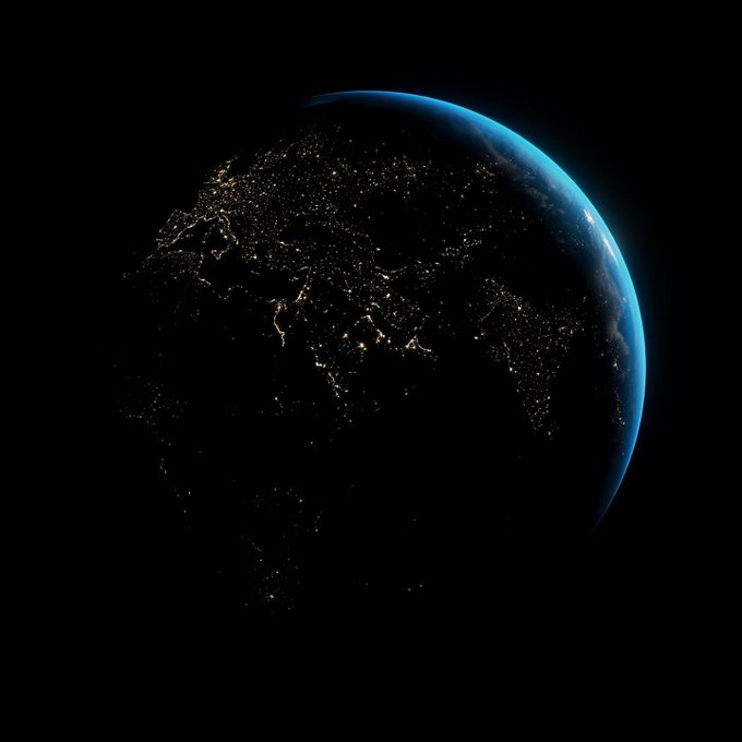
Ever wondered why North is at the top of our maps?
If you're assuming there are logical, scientific, Nature-driven reasons for it - yeah, I did too.
In fact, they're whimsical, arbitrary or just plain ridiculous.
Hold onto your hat. This may turn your world upside-down.
(1/)
If you're assuming there are logical, scientific, Nature-driven reasons for it - yeah, I did too.
In fact, they're whimsical, arbitrary or just plain ridiculous.
Hold onto your hat. This may turn your world upside-down.
(1/)

We start in 1154 AD. Arab geographer Muhammad al-Idrisi is about to publish a very special book. A book describing the entire known world.
It's as heavy on calculations as it is on narrative.
And thanks to a map made of solid silver, just plain *heavy*.
(2/)
It's as heavy on calculations as it is on narrative.
And thanks to a map made of solid silver, just plain *heavy*.
(2/)

This map was astoundingly accurate for its time.
Al-Idrisi calculated the circumference of the world to be 37,000 km (22,900 mi). That’s less than 10% short of the correct figure.
Parts of the book were still considered authoritative at the turn of the 20th Century.
(3/)
Al-Idrisi calculated the circumference of the world to be 37,000 km (22,900 mi). That’s less than 10% short of the correct figure.
Parts of the book were still considered authoritative at the turn of the 20th Century.
(3/)
It took al-Idrisi 15 years to put it together, with the gorgeous title of نزهة المشتاق في اختراق الآفاق - "The Excursion of One Who is Eager to Traverse the Regions of the World."
It's like a note to travel writers from 1,000 years ago: "try harder with your book titles."
(4/)
It's like a note to travel writers from 1,000 years ago: "try harder with your book titles."
(4/)

200 years later, Ibn Battuta would create تحفة النظار في غرائب الأمصار وعجائب الأسفار - "A Gift to Those Who Contemplate the Wonders of Cities and the Marvels of Travelling."
Don't make 'em like that anymore. (For practical reasons. Nobody's typing *that* out in a Search.)
(5/)
Don't make 'em like that anymore. (For practical reasons. Nobody's typing *that* out in a Search.)
(5/)
Al-Idrisi's work is now called the Tabula Rogeriana - which sounds great until it's put into English ("The Map Of Roger") where it becomes a bit Monty Python. Stick with the original Arabic.
Here's a 1929 copy of the map. Feel free to take a moment.
Yep. It's upside-down.
(6/)
Here's a 1929 copy of the map. Feel free to take a moment.
Yep. It's upside-down.
(6/)

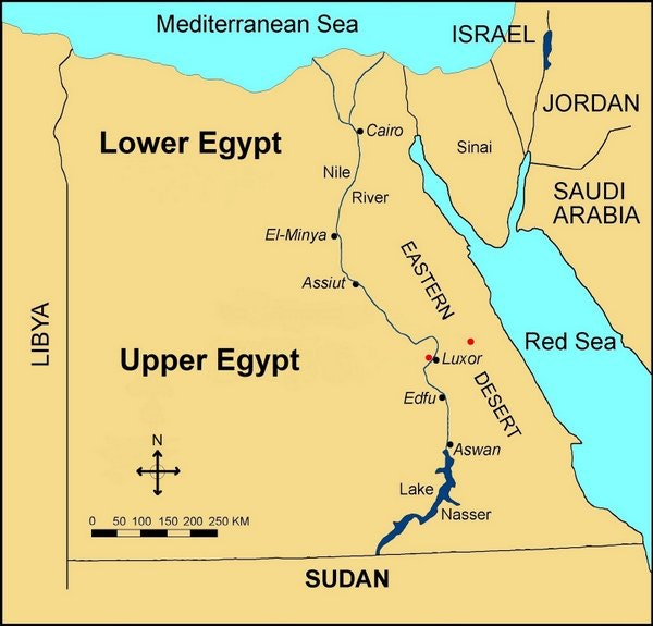
Ancient Egyptians saw things the same way.
Their south-facing preference is still visible on modern maps: “Upper Egypt” is down, & “Lower Egypt” is where the Nile empties into the Mediterranean.
It's logical. Surely the “upper” part of a river is where it flows *from*?
(7/)
Their south-facing preference is still visible on modern maps: “Upper Egypt” is down, & “Lower Egypt” is where the Nile empties into the Mediterranean.
It's logical. Surely the “upper” part of a river is where it flows *from*?
(7/)
It's a global cartographic free-for-all.
Take the number of early European medieval maps where East was depicted as upwards. (Reason: it put the Holy Land at the top.)
And because some explorers drew charts pointing in the direction they were *going*...
Yeah.
(8/)
Take the number of early European medieval maps where East was depicted as upwards. (Reason: it put the Holy Land at the top.)
And because some explorers drew charts pointing in the direction they were *going*...
Yeah.
(8/)

Okay. You can read more about the history here: everythingisamazing.substack.com/p/why-all-our-…
But - back to scientific, Nature-points-the-way explanations.
Don't compasses always point North? Isn't that a fact nobody can argue with?
(9/)
But - back to scientific, Nature-points-the-way explanations.
Don't compasses always point North? Isn't that a fact nobody can argue with?
(9/)

Here's a lodestone compass from China's Han Dynasty period (206 BC - 220 AD).
Its name translates as the South-Pointing Spoon: hakaimagazine.com/article-short/…
It points *south.*
How?
(10/)
Its name translates as the South-Pointing Spoon: hakaimagazine.com/article-short/…
It points *south.*
How?
(10/)
Compasses don't really point south. All they do is align themselves with the Earth's magnetic field.
It's *humans* that decide which end is the pointy one. It could go either way.
And in this case, Chinese scholars chose the *other* end.
(11/)
It's *humans* that decide which end is the pointy one. It could go either way.
And in this case, Chinese scholars chose the *other* end.
(11/)

But ancient Chinese maps tended to point the same way ours do - with North at the top.
That's *despite* their compasses apparently pointing South.
Why?
(12/)
That's *despite* their compasses apparently pointing South.
Why?
(12/)

Thread resumes shortly. (I had to go shopping).
#ArtvsRealLife
#ArtvsRealLife
Thread resumes! (Powered by a rucksack of groceries & 2 Scotch Eggs.)
The reason ancient Chinese maps pointed north?
Correct!
"...you are in a position of subjection to the Emperor, so you look up to him." - historian J. Brotton.
(13/)
The reason ancient Chinese maps pointed north?
https://twitter.com/zimkatir/status/1419288798559567876
Correct!
"...you are in a position of subjection to the Emperor, so you look up to him." - historian J. Brotton.
(13/)
Presumably if he had been based in the south of China, the reverse would have become true - & then, any medieval Europeans copying Chinese navigation techniques would have learned to orient their maps with south at the top?
It's *that* arbitrary?
everythingisamazing.substack.com/p/why-all-our-…
(14/)
It's *that* arbitrary?
everythingisamazing.substack.com/p/why-all-our-…
(14/)
If all this seems upsettingly random, here's a glimmer of empirical hope to cling to.
The North Star. Fixed, *nailed* in place in our skies. Known to be used by ancient navigators. Reliable as hell.
Is that our unchanging North?
Uh....
(15/)
The North Star. Fixed, *nailed* in place in our skies. Known to be used by ancient navigators. Reliable as hell.
Is that our unchanging North?
Uh....
(15/)

Polaris (ie. the North Star) is incredibly easy to find.
Look up on a cloudless night and find the seven stars of the Plough or The Big Dipper - the constellation that’s shaped like a pan, or perhaps a spoon. Draw a line from the two...
Wait.
A *spoon*, you say?
(16/)
Look up on a cloudless night and find the seven stars of the Plough or The Big Dipper - the constellation that’s shaped like a pan, or perhaps a spoon. Draw a line from the two...
Wait.
A *spoon*, you say?
(16/)

Were Han-Dynasty navigators also relying on Polaris in some way? Maybe! Nobody knows for sure.
And is the North Star fixed in a direction we could ALL agree on, no matter where & when we are?
What a sensibly-designed world that would be!
Sorry. We don't live in it.
(17/)
And is the North Star fixed in a direction we could ALL agree on, no matter where & when we are?
What a sensibly-designed world that would be!
Sorry. We don't live in it.
(17/)

Because of something called precession (due to a wobble in the Earth's rotational axis), Polaris hasn’t always been in the same place for us.
It’s only been exactly North since the 12th Century AD.
And in 2,000 more years, it'll again wander off the mark again.
(18/)
It’s only been exactly North since the 12th Century AD.
And in 2,000 more years, it'll again wander off the mark again.
(18/)

In 320 BC, the Greek navigator Pytheas of Massalia - modern-day Marseilles - described the celestial pole as being empty of stars.
(Fascinating chap, Pytheas. Absurdly well-voyaged. Discovered Britain for the Greeks! You should read about him: en.wikipedia.org/wiki/Pytheas)
(19/)
(Fascinating chap, Pytheas. Absurdly well-voyaged. Discovered Britain for the Greeks! You should read about him: en.wikipedia.org/wiki/Pytheas)
(19/)
In fact, human history has featured *many* pole stars - most near, not exactly on, each pole.
Our current South Star is Polaris Australis - rather dimmer than its northern counterpart & a little off South. But perfectly usable!
Pic: reddit.com/r/spaceporn/co…
(20/)
Our current South Star is Polaris Australis - rather dimmer than its northern counterpart & a little off South. But perfectly usable!
Pic: reddit.com/r/spaceporn/co…
(20/)

Reluctantly, we have to abandon Nature as an explanation for the direction our maps point.
Ready for the *real* reason our maps face North?
It's because some people are really, really AWFUL.
That's the reason. Tell your friends.
Here are the details:
(21/)
Ready for the *real* reason our maps face North?
It's because some people are really, really AWFUL.
That's the reason. Tell your friends.
Here are the details:
(21/)
This is América Invertida, a sketch by Uruguayan artist Joaquín Torres García in 1943.
"We now turn the map upside down & then we have a true idea of our position, and not as the rest of the world wishes."
A tiny act of rebellion against the tyranny of north-facing maps.
(22/)
"We now turn the map upside down & then we have a true idea of our position, and not as the rest of the world wishes."
A tiny act of rebellion against the tyranny of north-facing maps.
(22/)

Like the Han Dynasty Chinese, we have a tendency to put “important” people (ie. ourselves) at the top of maps. The industrialised, wealthy folk are the ones who "look down."
(It also seems we’re biased to see places up our maps as 'higher'.)
america.aljazeera.com/opinions/2014/…
(23/)
(It also seems we’re biased to see places up our maps as 'higher'.)
america.aljazeera.com/opinions/2014/…
(23/)
Because of the recent global dominance of north-facing maps, this top-of-the-map bias is baked into us.
It’s unthinkingly normal for us Westerners to say “up north” and “down south” (& “out west” and “back east” in the U.S.) - and make social assumptions based on each.
(24/)
It’s unthinkingly normal for us Westerners to say “up north” and “down south” (& “out west” and “back east” in the U.S.) - and make social assumptions based on each.
(24/)
And when Billy Joel sings 'Uptown Girl,' you instantly understand that she’s from a nicer part of town, right?
Of course you did. It's right there in the name of the song.
(25/)
Of course you did. It's right there in the name of the song.
(25/)
Reality contradicts this frequently. In the UK, we Northerners are seen as relatively muck-spattered unsophisticates. And I remember staying in downtown Toronto - *north* of the city.
But since when did humanity let reality get in the way of a good irrational prejudice?
(26/)
But since when did humanity let reality get in the way of a good irrational prejudice?
(26/)

You could say North-up maps are sponsoring a privileged world view - one that subtly descriminates against other places, thrusting them down the map towards assumed irrelevance, squalor and perdition.
The bloke who made *this* map would DEFINITELY say that.
(27/)
The bloke who made *this* map would DEFINITELY say that.
(27/)

Melbourne Uni student Stuart McArthur made this map, which launched on Australia Day in 1979.
It's now sold over 350,000 copies - presumably mainly to the 12% of the world population that lives south of the equator.
Take THAT, Northern hemisphere oppressors.
(28/)
It's now sold over 350,000 copies - presumably mainly to the 12% of the world population that lives south of the equator.
Take THAT, Northern hemisphere oppressors.
(28/)

I'll finish with a videogame.
It's called Neocolonialism (store.steampowered.com/app/333540/Neo…).
You take over countries & then liquidate them for cash. Get rich, & to hell with everything else.
(Perhaps a better name: "Sociopathic Billionaire Simulator.")
Look at the map...
(29/)
It's called Neocolonialism (store.steampowered.com/app/333540/Neo…).
You take over countries & then liquidate them for cash. Get rich, & to hell with everything else.
(Perhaps a better name: "Sociopathic Billionaire Simulator.")
Look at the map...
(29/)

Not only is it south-up, it's also (I think?) using a Gall-Peters Projection, sacrificing the correct shapes for countries to accurately show how big they are compared to each other.
Where are on on this map?
This game wants to make you *squirm.*
(30/)
Where are on on this map?
This game wants to make you *squirm.*
(30/)

For more on all this, plus a (ridiculous?) suggestion for fixing our Western world 'north-is-upwards' mapping prejudice, please read my @SubstackInc newsletter on it:
everythingisamazing.substack.com/p/why-all-our-…
Thanks for reading this megathread! I will now finally unpack my groceries. Ta.
everythingisamazing.substack.com/p/why-all-our-…
Thanks for reading this megathread! I will now finally unpack my groceries. Ta.
And as so often before, thank you to the generous, talented photographers of Unsplash for making their work usable by folk like me in a thread like this.
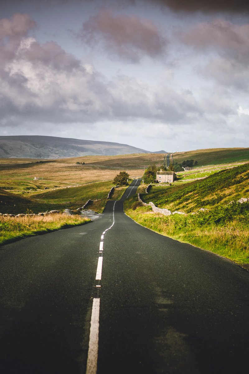
For example, this delightful view of the Yorkshire Dales National Park by Illija Vjestica : unsplash.com/photos/Noc6j53…
For example, this delightful view of the Yorkshire Dales National Park by Illija Vjestica : unsplash.com/photos/Noc6j53…
Update:
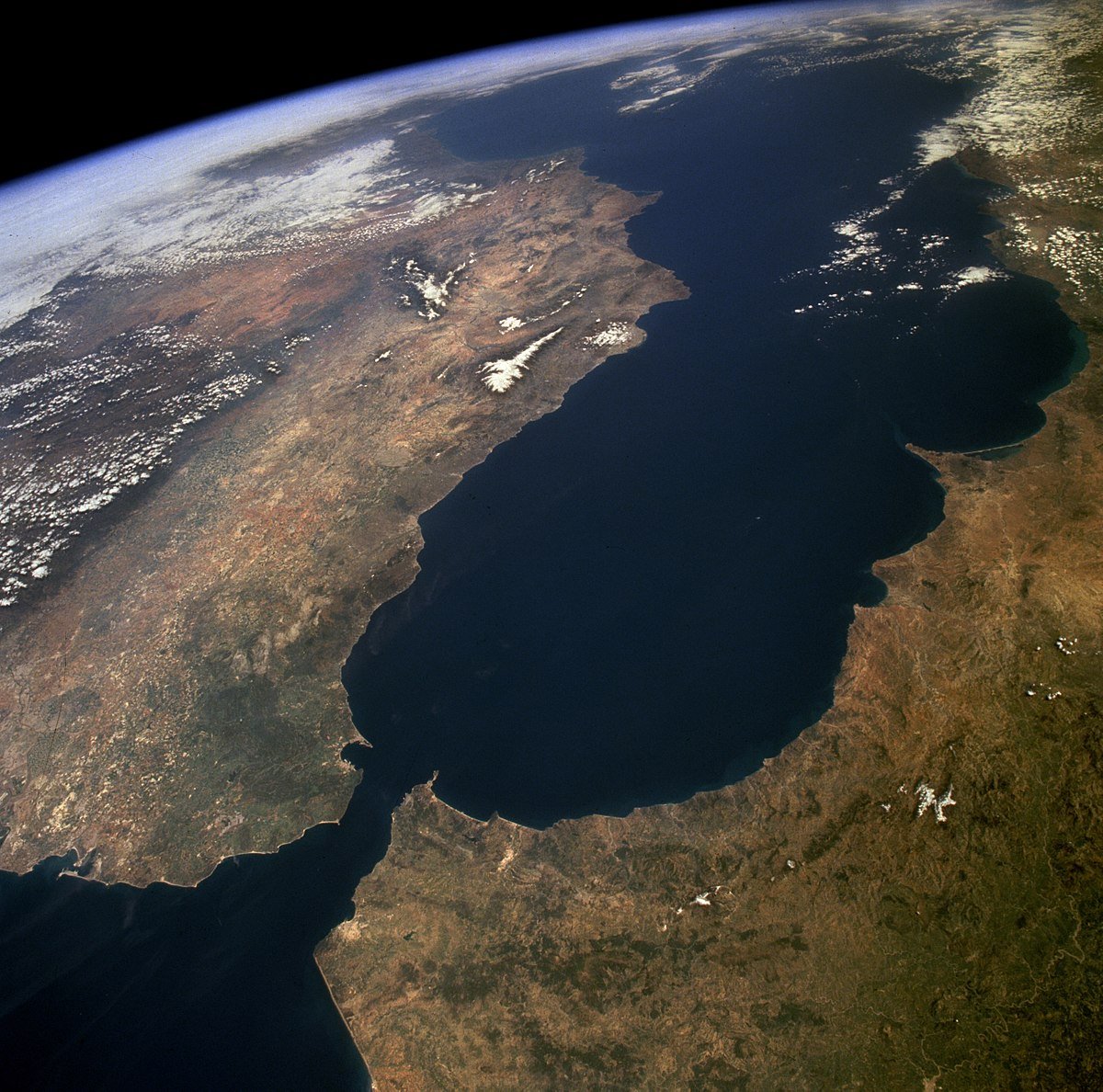
Here's a very different, slightly Westeros-feeling take on the Mediterranean:
Here's a very different, slightly Westeros-feeling take on the Mediterranean:
https://twitter.com/simongerman600/status/1484936411015000069(via the reliably interesting @simongerman600)
• • •
Missing some Tweet in this thread? You can try to
force a refresh