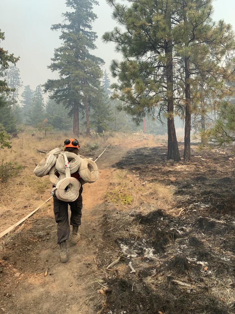
If conditions on site are favourable this morning the #BCWildfire Service will be conducting aerial planned ignitions on the Flat Lake wildfire (C41602), approximately 27 kilometres southwest of #100MileHouse.
Smoke is anticipated to be visible from 70 Mile House, #BCHWY97 and the surrounding communities.
This planned ignition operation is being considered for the southwest corner of the fire perimeter in the area between Meadow Lake Road, Dog Creek Road and the Gustafson East FSR.
The purpose of the planned ignition is to remove unburnt fuels between the fire perimeter and pre-determined control lines (roads and machine guards) and will cover approximately 800 hectares.
This will build off of yesterday's successful planned ignition and will allow us to bring the southwest corner of the fire perimeter to more easily accessible locations where ground crews can safely work and deliver water directly to the fire’s edge.
Planned ignitions are an essential and effective tactic that the BC Wildfire Service uses to help contain very large wildfires. Conditions will be monitored closely and operations will be halted if conditions change. Aviation support will be utilized throughout the day.
For more information on this wildfires and other current Wildfires of Note, visit: ow.ly/s0tR50Fn6aR
• • •
Missing some Tweet in this thread? You can try to
force a refresh
As new technology emerges, the #BCWildfire Service is reminding the public to understand their best uses. Although online fire detection tools, such as MODIS, can be helpful to gather information about wildfires in your area, they can also cause a lot of confusion and anxiety.
MODIS uses satellite sensors to record the intensity of electromagnetic radiation from Earth in various spectral wavelengths or channels. This means heat signatures are picked up by the satellite and the map is populated with pixels.
The satellite can flag smoke, or large open areas such as cut blocks, as a heat signature. It will also pick up a heat signature if the ground around a fire is cooler than the fire itself, for example in the morning.
This morning, July 31, 2021, areas of the Fraser Zone in the Coastal Fire Centre received multiple lightning strikes resulting in reports of two wildfires on the northern half of Harrison Lake, northeast of #Chilliwack. #BCWildfire
No fires have been reported on the southern portion of the lake. The lightning moved across Harrison Lake in a northeastern direction. Resources have been dispatched and are now attending these fires.
Currently there are two confirmed with more expected to be discovered as the day progresses.
North End Long Island (V12262) – this fire is currently .5 hectares in size and aerial resources including air tankers are on site.
If conditions on site are favourable later this morning the #BCWildfire Service will be conducting small scale planned ignitions on the Flat Lake wildfire (C41602) approximately 27 kilometres southwest of #100MileHouse.
Smoke is anticipated to be visible from #70MileHouse, HWY 97 and the surrounding communities.
This planned ignition operation is being considered for the south edge of the fire perimeter in the area between Alberta Lake, McKinley Lake and the 3900 road.
The purpose of the planned ignition is to remove unburnt fuels between the fire perimeter and pre-determined control lines (roads and machine guards) and will cover approximately 200 hectares.
There have been 787 wildfires in British Columbia so far this season, 330 of those fires started within the last week. The #BCWildfire Service would like to acknowledge all personnel responding to the ongoing wildfire situation.
The #BCWildfire Service is a multifaceted organization consisting of positions both on and off the fireline that are vital to wildfire management. With heightened activity, the passion and resiliency of our staff members becomes evident.
Firefighters, pilots and support staff have been working around the clock to manage this recent surge in wildfire activity. Additionally, we are grateful for the incoming support received from partner agencies.
Campfire and open burning prohibitions are currently in place across B.C. The #BCWildfire Service (BCWS) continues to monitor conditions and will take further action to protect public safety if necessary. At this time, the BCWS has not implemented any backcountry closures.
All trails and backroads that are not affected by Area Restriction Orders, Evacuation Orders, or are otherwise under municipal jurisdiction, remain open for public use. Members of the public must remain vigilant and act responsibly when recreating in the backcountry.
Know before you go: check the local fire danger rating, download the BC Wildfire Service app and stay up to date with location-specific wildfire information.
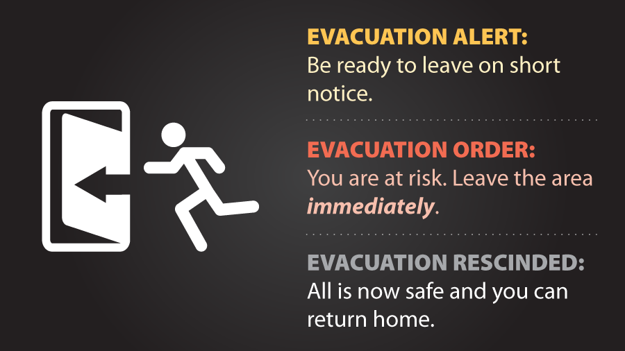
The #BCWildfire Service would like to remind the public that preparing in advance for a potential Evacuation Alert or Evacuation Order is important during times of heightened wildfire risk and activity.
Evacuation Alerts and Orders are put into place by local governments.
Any information about evacuations will come from a band office, municipality, regional district or local authority. Once an Evacuation Alert or Order is place, the information is reflected on the BC Wildfire Service Dashboard and through the BC Wildfire service mobile app.
The BC Wildfire Service provides updates as required and as situations continue to develop. Any changes to an evacuation status are made through the local authority and Emergency Management BC.