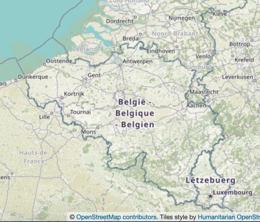
2/ The Kingdom of Belgium has 3 official languages: Dutch, French, German. The country's linguistic diversity leads to a complex internal organization
en.wikipedia.org/wiki/Communiti… and many places have multiple names
en.wikipedia.org/wiki/Communiti… and many places have multiple names

3/ The capital of Belgium 🇧🇪 is Brussels - Bruxelles (fr), Brussel (nl), Brüssel (de), and it is also the administrative center of the European Union 🇪🇺, and thus is often referred to as the “the capital of the EU” 


4/ So far so good, but what makes Belgium “geoweird"? First of all, it has Baarle-Hertog, an enclave in the Netherlands 🇳🇱 (as covered in our thread about enclaves and exclaves)
https://twitter.com/OpenCage/status/1400778179653124096
5/ Next, Belgium has a province named Luxembourg like the neighbouring country Luxembourg 🇱🇺 and a province named Limburg, just like the province Limburg in neighbouring Netherlands 🇳🇱 


6/ We also need to talk about the 🇧🇪 Belgian / 🇩🇪 German border. Over the years and many wars the border has been adapted many times, leading to the strange case of tiny strip of Belgian land (once a railway, now a cycle path) that goes through Germany
en.wikipedia.org/wiki/Vennbahn
en.wikipedia.org/wiki/Vennbahn

7/ From 1816 until 1920 there was a tiny (3,5 km²), wedge-shaped, neutral territory between Belgium and Germany known as Neutral Moresnet, and there was an attempt to make it the world's first Esperanto‑speaking state
en.wikipedia.org/wiki/Neutral_M…
en.wikipedia.org/wiki/Neutral_M…
8/ These days border changes are a more friendly affair. A few years ago Belgium gave the Netherlands a chunk of land to simplify the border
theguardian.com/world/2016/nov…
theguardian.com/world/2016/nov…
9/ The Belgian border is still sometimes “in flux” - recently a farmer mistakenly moved a boundary stone thus slightly enlarging the country
theguardian.com/world/2021/may…
theguardian.com/world/2021/may…
10/ Final bit of 🇧🇪 Belgian geo oddness is that the Belgian province of Liège looks like a smaller version of the country itself 

11/ We hope you enjoyed our look at 🇧🇪Belgium’s geoweirdness. We have more about border disputes, exclaves, geocoding, etc listed on our blog: blog.opencagedata.com/post/geothread… More countries and regions in the coming weeks and months 

12/ Bonus tweet - The Belgian OpenStreetMap community is very active. Learn more by following @osm_be and in our interview with community members from a few years ago: blog.opencagedata.com/post/144645475… 

• • •
Missing some Tweet in this thread? You can try to
force a refresh


