Tomas Pueyo Profile picture
Aug 30, 2021 14 tweets 4 min read Read on X
Have you ever heard northern Europeans telling southern Europeans they're lazy?

It's false.
So why are northerners richer?

Small thread 🧵
1. Northerners work substantially LESS than southerners
2. Northerners make substantially MORE money
Here's GDP per capita PPS, indexed at 100=EU average
Which mean Northern Europeans are substantially more productive.

Why? If you ask a Northerner, he might tell you it's because they're better educated, have better institutions, the protestant work ethic, it's colder so ppl work harder...

Suspicious.
Alternative: geography.
This is Europe's topography map.

Look at it and try to figure out the biggest patterns.
Do you see any?

The biggest one: the north is made up of the gigantic Northern European Plain, while the south is mostly mountains.

Why?
Because the African tectonic plate hits the Eurasian plate.
Looking at the details, you can see the formation of Southern Europe due to these tectonic plates.
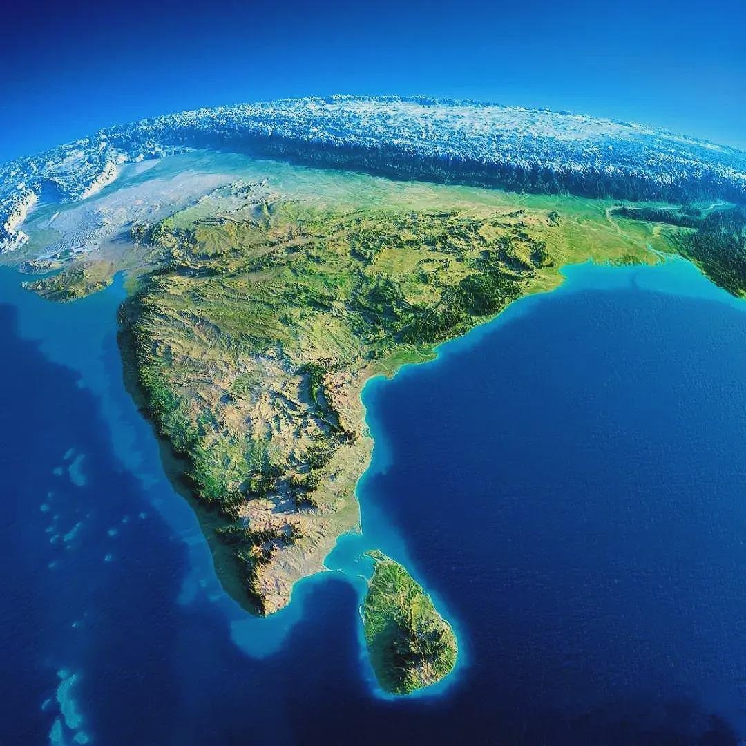
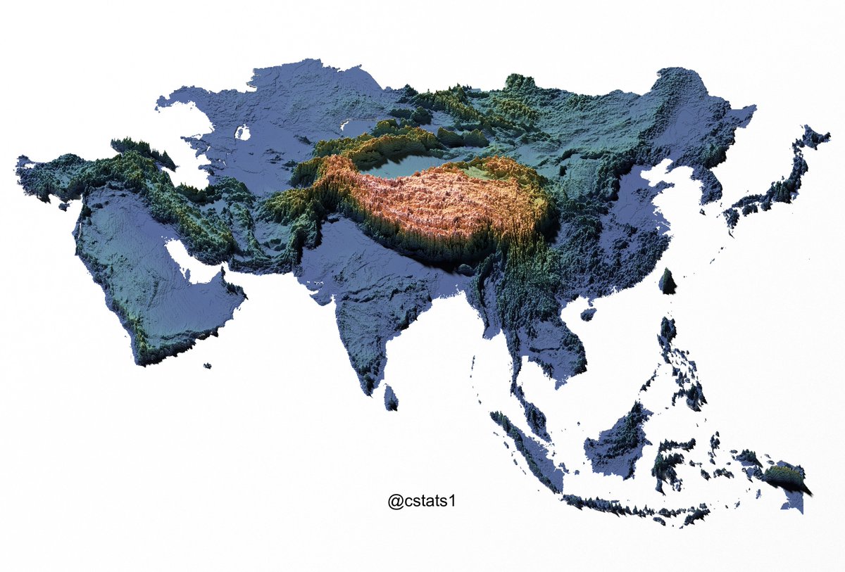
A bit like the Indian plate forms the Himalayas hitting the Eurasian Plate
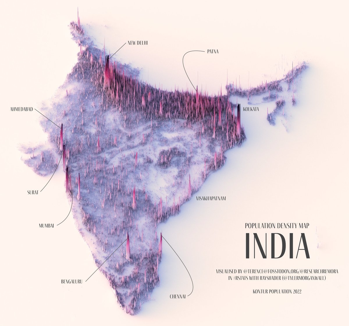
But mountains don't create wealth. Plains do. Wherever there's a plain that is well irrigated, there's ppl. Where there's ppl there's wealth.

Why?
Flat :
➡️ you can irrigate. Water doesn't run away.
➡️ build up of sediments from rivers, so +fertile
➡️ Rivers are slower, easier to control. +irrigation
➡️ easy to trade (walk, roads, navigable rivers)
➡️building is much cheaper
Now look back at the map of Europe, this time with navigable rivers. What do you notice?
1. So many mountains in the south, you can't develop agriculture as well, grow a big pop, create much wealth. And everything is + expensive
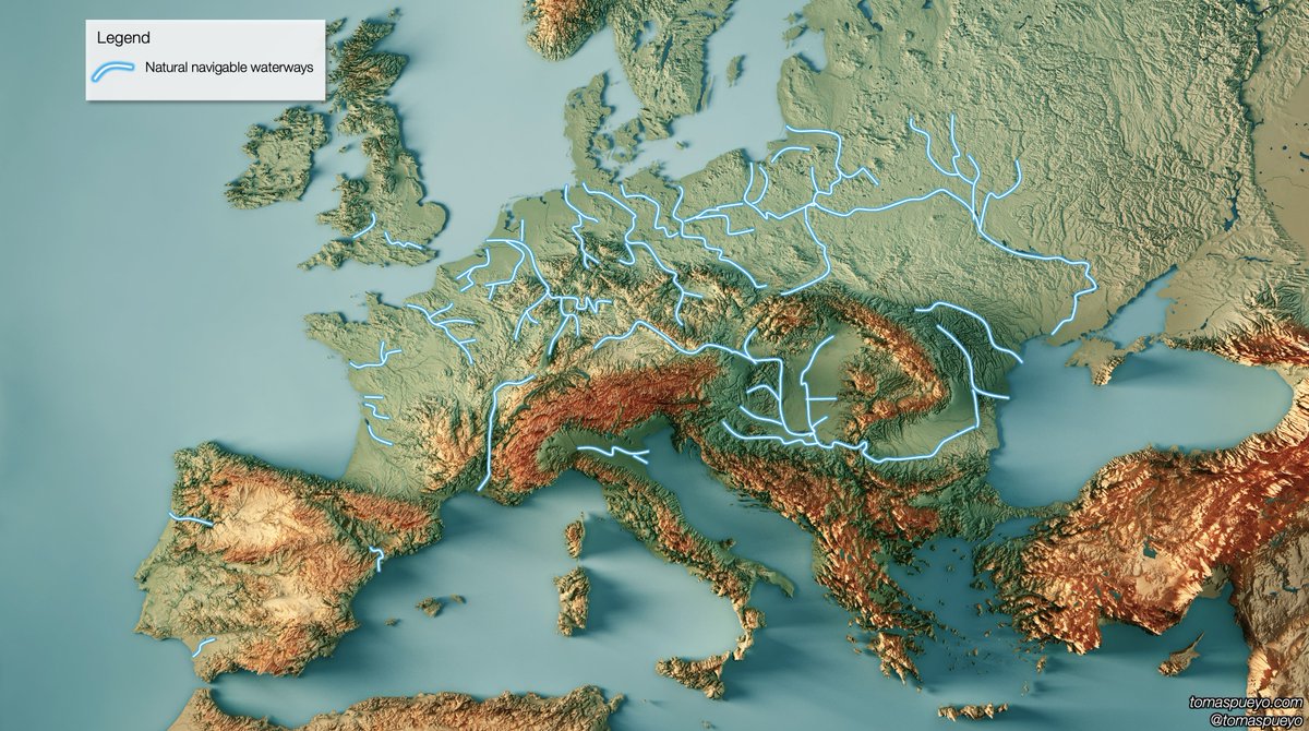
2. The mountains stop the water from the clouds, which falls quickly into the mediterranean in the south (mountains), but very slowly in the Northern European Plain, creating lots of navigable rivers, amazing for irrigation and trade.
Remember all of this when you hear northern Europeans calling the southern neighbors "lazy".

Many details in my series of articles on geohistory. Eg:
unchartedterritories.tomaspueyo.com/p/geography-is…
unchartedterritories.tomaspueyo.com/p/world-chessb…
unchartedterritories.tomaspueyo.com/p/a-space-craf…
To clarify: I’m not saying geography is the only cause. I’m arguing it’s a big one

• • •

Missing some Tweet in this thread? You can try to force a refresh
 

Keep Current with Tomas Pueyo

Tomas Pueyo Profile picture

Stay in touch and get notified when new unrolls are available from this author!

Read all threads

This Thread may be Removed Anytime!

PDF

Twitter may remove this content at anytime! Save it as PDF for later use!

Try unrolling a thread yourself!

how to unroll video
  1. Follow @ThreadReaderApp to mention us!

  2. From a Twitter thread mention us with a keyword "unroll"
@threadreaderapp unroll

Practice here first or read more on our help page!

More from @tomaspueyo

Sep 8
Never bet against the US:
Ppl think its biggest strength is its institutions, the dollar, entrepreneurship... But one of its biggest assets is its geography 🧵
1. Size
The US is the 4th largest country. It spans an entire continent, reaches two oceans, and is big enough to be a geographic heavyweight in the world Image
2. The Mississippi Basin
It's the 4th largest drainage basin in the world and occupies 40% of the contiguous 48 US states, touching 32 of the US’s 50 states. 11 US states directly take their name from it. Image
Read 17 tweets
Sep 4
Climate caused the US Civil War, because:
1. Slavery was the main cause of the war
2. Different crops were the main cause of slavery
3. Climate caused different crops in the North vs South

This is terribly important to understand the US today and how to heal it
🧵
1. Slavery was the main cause of the war: the Abolitionist North & the Slavery South were competing to expand westward to increase their political influence

But the North grew & expanded faster, to a point where it could force abolition on the South, which then seceded
In 1790, the Free & Slave states had the same population, and there were many more Slave States (8 vs 5), so Slave States controlled the Senate.

By the eve of the war in 1860, the North had 50% more population and 4 more states, giving them control of both the House & Senate Image
Read 18 tweets
Aug 14
Moscow is one of the weirdest capitals:
• Biggest European city
• Extremely cold
• Little farmland
• To Russia's extreme west
• Not on a coast or main river

How did it create the biggest country on Earth?

It involves horse archers, human harvesting & tiny animals 🧵
The first shocking fact is that Russia is so far north it's at the edge of arable land. How can you create a capital with so little food? Why not in the middle of the most fertile area on Earth? Image
This far north is extremely cold
Moscow is the 3rd coldest capital in the world and by far the biggest: with 20M ppl, its metro population is 8x bigger than the 2nd biggest cold capital, Stockholm!Image
Read 20 tweets
Jul 28
This map tells you how a seemingly innocent difference, like wheat vs rice eating, can have dramatic political, economic, and cultural ramifications:
🧵 Image
The areas that harvest wheat vs rice are different. Why?
Because of climate
Rice needs heat and lots of water. Ideally, flooding the fields to also kill weeds. Rice dies with frost.

Wheat resists it well, prefers cooler temperatures, but dies when it's flooded Image
Read 12 tweets
Jul 7
Did you know the West's trade deficits to China are not recent, but started 2000 years ago? This is the story of how silk, porcelain, tea, opium, and silver have determined the history of the world 🧵
The Romans already complained about deficits to China! Mainly because of silk Image
Back then the Chinese already preferred manufacturing and selling products than consuming foreign products. Chronicler Solinus ~200 AD: The Chinese "prefer only to sell their products, but do not like to buy our goods."Image
Read 12 tweets
Jun 25
Why did 🇮🇱Israel strike 🇮🇷Iran now, and not months or years ago or in the future?

A unique combination of a dozen factors converged to make the moment unique for 🇮🇱Israel: 🧵
1. No Hamas to its southwest
2. No Hezbollah to its north
3. No Assad threat to the northeast
4... Image
4. No more Syrian army to attack 🇮🇱Israel's planes: As the new forces of HTS took over Syria, Israel bombed all the existing Syrian military. No more fighter jets or surface-to-air missiles to threaten 🇮🇱Israel Image
5. Ability to fly over Syria to refuel
This is critical, because 🇮🇷Iran is ~600-1000 miles away from 🇮🇱Israel, so 1200-2000 miles round trip

The range of Israel’s stealth F35 is only about 1,350 mi
To operate inside 🇮🇷Iran, 🇮🇱Israel needed refueling over Syria Image
Image
Read 7 tweets

Did Thread Reader help you today?

Support us! We are indie developers!


This site is made by just two indie developers on a laptop doing marketing, support and development! Read more about the story.

Become a Premium Member ($3/month or $30/year) and get exclusive features!

Become Premium

Don't want to be a Premium member but still want to support us?

Make a small donation by buying us coffee ($5) or help with server cost ($10)

Donate via Paypal

Or Donate anonymously using crypto!

Ethereum

0xfe58350B80634f60Fa6Dc149a72b4DFbc17D341E copy

Bitcoin

3ATGMxNzCUFzxpMCHL5sWSt4DVtS8UqXpi copy

Thank you for your support!

Follow Us!

:(