
Last week, I got seriously obsessed with what, at first glance, looks like a really daft question:
What does the Internet actually *look* like?
All the ways to answer this are fascinating and full of surprises. Here are some in a thread:
1/
What does the Internet actually *look* like?
All the ways to answer this are fascinating and full of surprises. Here are some in a thread:
1/

Here is the simplest, most straightforward and wrongest answer.
It looks like the box in the corner of your room that you sit in front of every day, "enjoying" its contents.
Devoid of context, that's what my senses tell me. But obviously this is absurd. Let's move on.
2/
It looks like the box in the corner of your room that you sit in front of every day, "enjoying" its contents.
Devoid of context, that's what my senses tell me. But obviously this is absurd. Let's move on.
2/

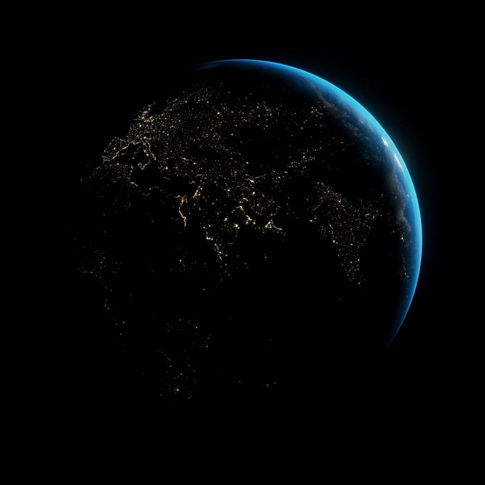
If "the Internet" is the signal, all that data flying around, then in a sense it looks like this.
99%+ all international data races along sea floors at around 16 mill. times the force of a home Internet connection, through cables roughly the width of a can of Coke.
3/
99%+ all international data races along sea floors at around 16 mill. times the force of a home Internet connection, through cables roughly the width of a can of Coke.
3/

Incredibly, the first colossal undersea cable was laid back in 1858, when two steam-powered (!) battleships met mid-Atlantic to connect together two pieces of a telegraph cable running for over *2,500 miles*.
Alas, it only worked for 3 weeks: spectrum.ieee.org/the-first-tran…
4/
Alas, it only worked for 3 weeks: spectrum.ieee.org/the-first-tran…
4/

Or maybe the Internet is where data *stops* moving, in the data centres and other machine-holding architecture.
Photographer Dave Greer got curious about this, with oddly beautiful results (in a Simon Stålenhag sort of way): qz.com/770849/these-b…
5/
Photographer Dave Greer got curious about this, with oddly beautiful results (in a Simon Stålenhag sort of way): qz.com/770849/these-b…
5/
Or maybe our best way to see "the Internet" is indirectly, to trace its passing - like this mesmerising datavis of geotagged tweets using the hashtag #sunrise one day in 2014, showing a spluttering blaze of yellow marking dawn:
cartodb.s3.amazonaws.com/static_vizz/su…
6/
cartodb.s3.amazonaws.com/static_vizz/su…
6/

Or this from opte.org, looking like a colourful explosion of dandelion clocks:
It shows the Internet knitting itself together, network by network. It looks *alive*.
(This may creep you out a bit.)
7/
It shows the Internet knitting itself together, network by network. It looks *alive*.
(This may creep you out a bit.)
7/
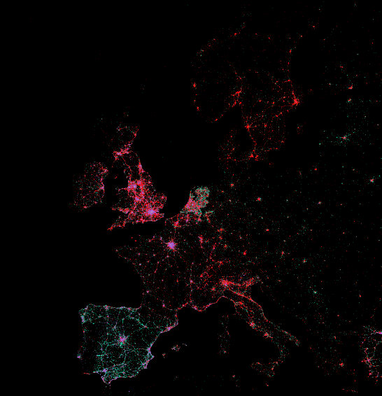
Or this, mapping tweets from mobile phones:
labs.mapbox.com/labs/twitter-g…
(Red means iPhone. As a European Android-user, I had *no idea what a minority I was in. At least on Twitter, anyway. Eeesh.)
8/
labs.mapbox.com/labs/twitter-g…
(Red means iPhone. As a European Android-user, I had *no idea what a minority I was in. At least on Twitter, anyway. Eeesh.)
8/
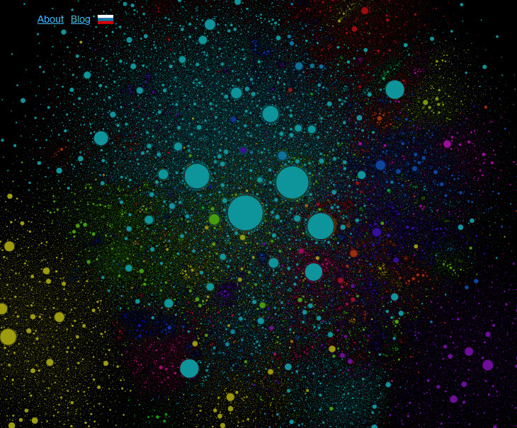
This zoomable "star map" of websites from 2012 is engrossing and more than a bit bonkers in scale:
internet-map.net
(I can find my old blog on it. It's tiny but it's there. Had a website for more than a decade? Go searching. I bet you'll find it.)
9/
internet-map.net
(I can find my old blog on it. It's tiny but it's there. Had a website for more than a decade? Go searching. I bet you'll find it.)
9/
But maybe the only maps that fit here are abstract, subjective and virtual. Maybe you have to be *inside* to map it properly.
Kevin Kelly's Internet Mapping Project asked people to draw what they thought the Internet looked & felt like: kk.org/ct2/the-intern…
10/
Kevin Kelly's Internet Mapping Project asked people to draw what they thought the Internet looked & felt like: kk.org/ct2/the-intern…
10/

"The internet is intangible, like spirits and angels. The web is an immense ghost land of disembodied places....Yet everyday we navigate through this ethereal realm for hours on end and return alive. We must have some map in our head." - Kevin Kelly (brainpickings.org/2009/06/08/int…)
11/
11/

I'm writing more about all this soon, first for paying subscribers & later for everyone, in my @SubstackInc newsletter, Everything Is Amazing:
everythingisamazing.substack.com/about
Sign up if you're curious.
But before I end this thread, my current fave map of them all...
12/
everythingisamazing.substack.com/about
Sign up if you're curious.
But before I end this thread, my current fave map of them all...
12/
After a year of work, designer Martin Vargic has completed a modern-day Mappa Mundi of the online world:
trendland.com/the-world-map-…
The detail here is just *staggering*. The research alone must have been...I just can't.
13/
trendland.com/the-world-map-…
The detail here is just *staggering*. The research alone must have been...I just can't.
13/
Just barmy.
Click for the Hi-Res version here to lose the next hour of your life:
…mp-ed30a86b8c4ca887773594c2.wixmp.com/f/13ad2603-668…
14/
Click for the Hi-Res version here to lose the next hour of your life:
…mp-ed30a86b8c4ca887773594c2.wixmp.com/f/13ad2603-668…
14/

And if all that has left you feeling a overwhelmed and a bit lost, don't worry! Here's the end of the Internet, so you at least know where one of the edges or corners is:
endoftheinternet.com
Thanks for reading.
endoftheinternet.com
Thanks for reading.

• • •
Missing some Tweet in this thread? You can try to
force a refresh


